




Rainsville, Alabama
Rainsville is a city of 5,702 people in DeKalb County, Alabama, founded in 1956.
Why visit Rainsville
Townapedia lists 1 park or trail, 9 places to eat and 1 place to stay in and around town.
July is the warmest month, with average highs of 91°F; January lows average 32°F.
Weather in Rainsville
Forecast from the National Weather Service. Full forecast
About Rainsville
Rainsville is a city in DeKalb County, Alabama, United States. As of the 2020 census, Rainsville had a population of 5,505. Rainsville is located on top of Sand Mountain, a southern extension of the Cumberland Plateau.
From the Wikipedia article Rainsville, Alabama (this version), under CC BY-SA 4.0.
Parks, trails and playgrounds1

Restaurants and cafes9

Toki Sushi Steak House
Restaurant · Japanese, Sushi, Steak House · 1.2 mi
648 Main Street West, Rainsville
Katy's Katfish
Restaurant · Fish, Seafood, Burger · 0.9 mi
1382 Main Street East, Rainsville
Toros Cantina & Grill
Restaurant · Mexican · 0.4 mi
462 Main Street East, Rainsville

McDonald's
Fast food · Burger · 0.6 mi
32 Main Street West
Mo-Th 05:00-23:00; Fr-Sa 05:00-24:00; Su 06:00-23:00
Sonic
Fast food · Burger · 0.5 mi
208 Main Street East, Rainsville
Mo-Th 06:00-22:30; Fr 06:00-24:00; Sa 06:00-23:00; Su 08:00-22:30
Where to stay1

Churches and places of worship19

7 more on the map.
History
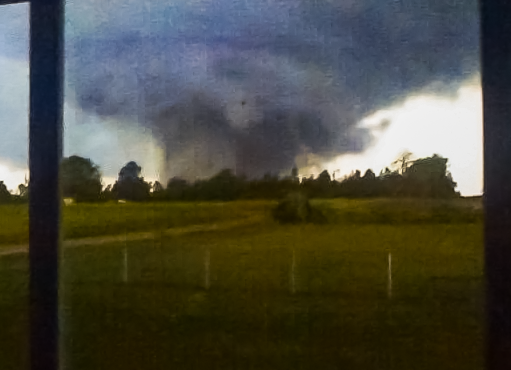
An EF5 tornado struck the city on April 27, 2011, leaving 25 fatalities. It initially touched down 10 miles (16 km) to the southwest in Lakeview, causing structural damage to small buildings and snapping trees. It grew in intensity, and the path width increased from around fifty yards to a half a mile, as the rotation entered the Rainsville and Sylvania communities. Damage included houses that were completely removed from foundations and debris scattered for about one mile, trees debarked, and a few mobile homes were destroyed with debris strewn for about a mile downstream. In Sylvania, some of these houses removed from foundations contained anchor bolts and foundation straps.
From the History section of Rainsville, Alabama on Wikipedia, under CC BY-SA 4.0.
Shopping2
Gas and EV charging3
Schools, colleges and libraries8
Healthcare1
Map of Rainsville
44 places. The map loads OpenStreetMap tiles when you open it.
Climate by month
Monthly table
| Month | High | Low | Rain |
|---|---|---|---|
| Jan | 52°F | 32°F | 5.3 in |
| Feb | 57°F | 36°F | 5.4 in |
| Mar | 65°F | 42°F | 5.3 in |
| Apr | 74°F | 50°F | 5.1 in |
| May | 81°F | 58°F | 5.0 in |
| Jun | 88°F | 67°F | 4.6 in |
| Jul | 91°F | 70°F | 5.4 in |
| Aug | 90°F | 69°F | 3.9 in |
| Sep | 86°F | 64°F | 4.4 in |
| Oct | 76°F | 52°F | 3.6 in |
| Nov | 64°F | 41°F | 4.5 in |
| Dec | 55°F | 35°F | 5.6 in |
U.S. Climate Normals 1991-2020 for Ft Payne (7 mi away), NOAA NCEI.
People and cost of living
American Community Survey 5-year estimates, 2020-2024, U.S. Census Bureau. Estimates have margins of error, larger for small towns.
Disaster history
DeKalb County has had 21 federal disaster declarations since 2000, most often for severe storms.
- 2024-09-26: Hurricane Helene (Hurricane)
- 2020-09-14: Hurricane Sally (Hurricane)
- 2020-07-10: Severe Thunderstorms (Severe Storm)
- 2020-03-29: Covid-19 Pandemic (Biological)
- 2020-03-13: Covid-19 (Biological)
- 2019-04-17: Severe Storms, Straight-Line Winds, Tornadoes, And Flooding (Severe Storm)
OpenFEMA disaster declarations summaries.
Getting there and nearby towns
Northeast Alabama Regional Airport (GAD) is the nearest airport with scheduled flights listed in OpenStreetMap, 39 miles away.
- Fyffe 5 mi southwest, about 8 min by car
- Fort Payne 9 mi east, about 14 min by car
- Henagar 11 mi northeast, about 18 min by car
- Scottsboro 16 mi northwest, about 26 min by car
- Collinsville 16 mi south, about 25 min by car
- Crossville 17 mi southwest, about 28 min by car
- Guntersville 25 mi west, about 41 min by car
- Centre 25 mi south, about 41 min by car
- Albertville 27 mi southwest, about 43 min by car
- Boaz 27 mi southwest, about 44 min by car
Drive times are estimates from straight-line distance, not routes.
Local news
Headlines from INDB, the NEMICO news database.
Reviews, tips and questions
Loading what members have shared...
Sources and licences
- NCES EDGE (Public domain): public schools
- NOAA NCEI U.S. Climate Normals 1991-2020 (Public domain): climate by month
- OpenFEMA (Public domain): disaster declarations
- OpenStreetMap contributors (ODbL 1.0): places, airports, map data
- U.S. Census Bureau (Public domain): population, income, housing, education, commute
- Wikidata (CC0 1.0): elevation, founding date, time zone, website
- Wikimedia Commons (see each image): photos
- Wikipedia (CC BY-SA 4.0): overview and history text
Photo credits
- USPS - Rainsville, Alabama 35986, Shannon from New York, CC BY-SA 2.0
- Rainsville Tornado Dana Dobbins, Dana Dobbins, CC BY-SA 2.0
- EF5 damage to a home along Skaggs Rd, National Oceanic and Atmospheric Administration, Public domain
- ISS065-E-348037 - View of Earth, Earth Science and Remote Sensing Unit , Lyndon B. Johnson Space Center, Public domain
- ISS053-E-170396 - View of Earth, Earth Science and Remote Sensing Unit , Lyndon B. Johnson Space Center, Public domain
- ISS042-E-312447 - View of Earth, Earth Science and Remote Sensing Unit , Lyndon B. Johnson Space Center, Public domain
- ISS042-E-121922 - View of Earth, Earth Science and Remote Sensing Unit , Lyndon B. Johnson Space Center, Public domain
- ISS031-E-57295 - View of Earth, Earth Science and Remote Sensing Unit , Lyndon B. Johnson Space Center, Public domain
- ISS065-E-220276 - View of Earth, Earth Science and Remote Sensing Unit , Lyndon B. Johnson Space Center, Public domain
- ISS042-E-124922 - View of Earth, Earth Science and Remote Sensing Unit , Lyndon B. Johnson Space Center, Public domain
- ISS065-E-220275 - View of Earth, Earth Science and Remote Sensing Unit , Lyndon B. Johnson Space Center, Public domain
- ISS042-E-316747 - View of Earth, Earth Science and Remote Sensing Unit , Lyndon B. Johnson Space Center, Public domain
- ISS042-E-121921 - View of Earth, Earth Science and Remote Sensing Unit , Lyndon B. Johnson Space Center, Public domain
- ISS042-E-312448 - View of Earth, Earth Science and Remote Sensing Unit , Lyndon B. Johnson Space Center, Public domain
- ISS042-E-124923 - View of Earth, Earth Science and Remote Sensing Unit , Lyndon B. Johnson Space Center, Public domain
- ISS053-E-170397 - View of Earth, Earth Science and Remote Sensing Unit , Lyndon B. Johnson Space Center, Public domain
- ISS031-E-52791 - View of Earth, Earth Science and Remote Sensing Unit , Lyndon B. Johnson Space Center, Public domain
- ISS065-E-220277 - View of Earth, Earth Science and Remote Sensing Unit , Lyndon B. Johnson Space Center, Public domain
- ISS042-E-316748 - View of Earth, Earth Science and Remote Sensing Unit , Lyndon B. Johnson Space Center, Public domain
- ISS067-E-107384 - View of Earth, Earth Science and Remote Sensing Unit , Lyndon B. Johnson Space Center, Public domain
- ISS053-E-7114 - View of Earth, Earth Science and Remote Sensing Unit , Lyndon B. Johnson Space Center, Public domain
- ISS042-E-121920 - View of Earth, Earth Science and Remote Sensing Unit , Lyndon B. Johnson Space Center, Public domain
- ISS042-E-121919 - View of Earth, Earth Science and Remote Sensing Unit , Lyndon B. Johnson Space Center, Public domain
- ISS065-E-220274 - View of Earth, Earth Science and Remote Sensing Unit , Lyndon B. Johnson Space Center, Public domain
- ISS002-E-6193 - View of Tennessee, Earth Science and Remote Sensing Unit , Lyndon B. Johnson Space Center, Public domain
- ISS031-E-57294 - View of Earth, Earth Science and Remote Sensing Unit , Lyndon B. Johnson Space Center, Public domain
- ISS042-E-124920 - View of Earth, Earth Science and Remote Sensing Unit , Lyndon B. Johnson Space Center, Public domain
- ISS031-E-52790 - View of Earth, Earth Science and Remote Sensing Unit , Lyndon B. Johnson Space Center, Public domain
- ISS053-E-7115 - View of Earth, Earth Science and Remote Sensing Unit , Lyndon B. Johnson Space Center, Public domain
- ISS065-E-348036 - View of Earth, Earth Science and Remote Sensing Unit , Lyndon B. Johnson Space Center, Public domain
- ISS042-E-124921 - View of Earth, Earth Science and Remote Sensing Unit , Lyndon B. Johnson Space Center, Public domain


Page built October 30, 2026. Spotted a mistake? Tell us or suggest a place.