

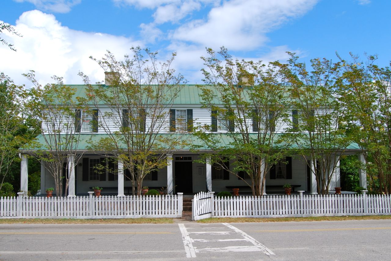


Red Bank, South Carolina
Red Bank is a community of 11,314 people in Lexington County, South Carolina.
Why visit Red Bank
Townapedia lists 15 museums and landmarks, 4 parks and trails, 44 places to eat, 1 place to stay and 1 attraction in and around town.
Highlights include Bank of Western Carolina, C.E. Corley House and Red Bank Sports Complex.
July is the warmest month, with average highs of 93°F; January lows average 35°F.
Weather in Red Bank
Forecast from the National Weather Service. Full forecast
About Red Bank
Red Bank is an unincorporated community and census-designated place (CDP) in Lexington County, South Carolina, United States. The population was 9,617 at the 2010 census, up from 8,811 at the 2000 census. It is part of the Columbia, South Carolina Metropolitan Statistical Area.
From the Wikipedia article Red Bank, South Carolina (this version), under CC BY-SA 4.0.
Things to do1

Museums and landmarks15

Bank of Western Carolina
Monument and historic site · National Register of Historic Places · 3.6 mi
Bank building in Lexington, South Carolina

C.E. Corley House
Monument and historic site · National Register of Historic Places · 2.5 mi
Historic house in South Carolina, United States

Charlton Rauch House
Monument and historic site · National Register of Historic Places · 3.8 mi
Historic house in South Carolina, United States

David Rawl House
Monument and historic site · National Register of Historic Places · 3.7 mi
Historic house in South Carolina, United States

Ernest L. Hazelius House
Monument and historic site · National Register of Historic Places · 4.0 mi
Historic house in South Carolina, United States
Fox House
Monument and historic site · National Register of Historic Places · 4.0 mi
Listed on the NRHP in Lexington County, South Carolina

Home National Bank
Monument and historic site · National Register of Historic Places · 3.5 mi
Bank building in Lexington, South Carolina

James Harman Building
Monument and historic site · National Register of Historic Places · 3.6 mi
Historic building in Lexington, South Carolina, USA

Lemuel Boozer House
Monument and historic site · National Register of Historic Places · 3.9 mi
Historic house in South Carolina, United States

Lexington County Courthouse
Monument and historic site · National Register of Historic Places · 3.6 mi
Courthouse in Lexington, South Carolina, U.S.A.
Maj. Henry A. Meetze House
Monument and historic site · National Register of Historic Places · 2.7 mi
Historic home located near Lexington, Lexington County, South Carolina


Simmons-Harth House
Monument and historic site · National Register of Historic Places · 3.6 mi
Lexington, SC, listed on the NRHP in South Carolina
3 more on the map.
Parks, trails and playgrounds4

Restaurants and cafes44




32 more on the map.
Where to stay1
Churches and places of worship10
New Bethel AME Church
Church · African Methodist Episcopal · 3.2 mi
500 South Lake Drive, Lexington
Northside Baptist West Campus
Church · Baptist · 2.5 mi
742 Kitti Wake Drive, West Columbia
Red Bank United Methodist Church
Church · United Methodist · 0.4 mi
2909 Old Barnwell Road, Lexington
St James Lutheran Church
Church · Lutheran · 0.7 mi
1358 South Lake Drive, Lexington
White Knoll Church
Church · Church Of Christ · 0.9 mi
675 Old Orangeburg Road, Lexington
Shopping6
Gas and EV charging16
Schools, colleges and libraries28
American Leadership Academy South Carolina-Lexington Campu
School · 2.4 mi
109 Innovation Drive, Lexington
Healthcare5
Map of Red Bank
130 places. The map loads OpenStreetMap tiles when you open it.
Climate by month
Monthly table
| Month | High | Low | Rain | Snow |
|---|---|---|---|---|
| Jan | 57°F | 35°F | 3.5 in | 0.6 in |
| Feb | 61°F | 37°F | 3.4 in | 0.4 in |
| Mar | 68°F | 44°F | 3.6 in | 0.1 in |
| Apr | 77°F | 52°F | 2.8 in | 0.0 in |
| May | 84°F | 60°F | 3.5 in | 0.0 in |
| Jun | 90°F | 69°F | 5.0 in | 0.0 in |
| Jul | 93°F | 72°F | 5.3 in | 0.0 in |
| Aug | 91°F | 71°F | 4.7 in | 0.0 in |
| Sep | 86°F | 65°F | 3.9 in | 0.0 in |
| Oct | 76°F | 53°F | 3.1 in | 0.0 in |
| Nov | 66°F | 42°F | 2.8 in | 0.0 in |
| Dec | 59°F | 36°F | 3.7 in | 0.1 in |
U.S. Climate Normals 1991-2020 for Columbia 72310 (7 mi away), NOAA NCEI.
People and cost of living
American Community Survey 5-year estimates, 2020-2024, U.S. Census Bureau. Estimates have margins of error, larger for small towns.
Disaster history
Lexington County has had 22 federal disaster declarations since 2000, most often for hurricanes.
- 2026-01-23: Severe Winter Storm (Winter Storm)
- 2024-09-29: Hurricane Helene (Hurricane)
- 2024-09-26: Hurricane Helene (Tropical Storm)
- 2024-08-05: Hurricane Debby (Tropical Storm)
- 2023-08-31: Hurricane Idalia (Hurricane)
- 2022-11-21: Hurricane Ian (Hurricane)
OpenFEMA disaster declarations summaries.
Getting there and nearby towns
Columbia Metropolitan Airport (CAE) is the nearest airport with scheduled flights listed in OpenStreetMap, 6 miles away.
- White Knoll 3 mi south, about 4 min by car
- Oak Grove 6 mi northeast, about 9 min by car
- Seven Oaks 10 mi northeast, about 15 min by car
- Cayce 11 mi east, about 18 min by car
- Irmo 12 mi north, about 19 min by car
- Forest Acres 16 mi northeast, about 26 min by car
- Dentsville 19 mi northeast, about 30 min by car
- Columbia 21 mi east, about 33 min by car
- Newberry 32 mi northwest, about 52 min by car
- Orangeburg 37 mi southeast, about 59 min by car
Drive times are estimates from straight-line distance, not routes.
Local news
Headlines from INDB, the NEMICO news database.
Reviews, tips and questions
Loading what members have shared...
Sources and licences
- NCES EDGE (Public domain): public schools
- NOAA NCEI U.S. Climate Normals 1991-2020 (Public domain): climate by month
- OpenFEMA (Public domain): disaster declarations
- OpenStreetMap contributors (ODbL 1.0): places, airports, map data
- U.S. Census Bureau (Public domain): population, income, housing, education, commute
- Wikidata (CC0 1.0): elevation, founding date, time zone, website, landmarks and historic places
- Wikimedia Commons (see each image): photos
- Wikipedia (CC BY-SA 4.0): overview and history text
Photo credits
- Extra lanes for S Lake Dr in Red Bank - panoramio, Fee Fi Foe Fum, CC BY 3.0
- John Fox House, Lexington, SC, Vrc84, CC BY-SA 3.0
- David Rawl House, Bill Fitzpatrick, CC BY-SA 3.0
- Lexington County Courthouse, Lexington, South Carolina, Ralph Hightower, CC BY-SA 3.0
- Lemuel Boozer House, Bill Fitzpatrick, CC BY-SA 3.0
- Simmons-Harth House, Bill Fitzpatrick, CC BY-SA 3.0
- WQM Berly House, Bill Fitzpatrick, CC BY-SA 3.0
- Home National Bank, Bill Fitzpatrick, CC BY-SA 3.0
- James Harman Building, Bill Fitzpatrick, CC BY-SA 3.0
- Ernest L Hazelius House, Bill Fitzpatrick, CC BY-SA 3.0
- Bank of Western Carolina, Bill Fitzpatrick, CC BY-SA 3.0
- William Berly House, Bill Fitzpatrick, CC BY-SA 3.0
- Charlton Rauch House, Bill Fitzpatrick, CC BY-SA 3.0
- Piggly Wiggly (8558340538), Mike Prosser from Austin, TX, USA, CC BY-SA 2.0
- Zoey Diamond Color Splash, Babygirafffe, CC BY-SA 4.0
- Zoey Diamond Outdoor Photoshoot, Babygirafffe, CC BY-SA 4.0
- Zoey Diamond Sky Photoshoot, Babygirafffe, CC BY-SA 4.0
- CE Corley House, Bill Fitzpatrick, CC BY-SA 3.0
- C.E. Corley House - Lexington, Upstateherd, CC BY-SA 4.0
- Maj. Henry A. Meetze House - Lexington, Upstateherd, CC BY-SA 4.0
- Maj Henry A Meetze House, Bill Fitzpatrick, CC BY-SA 3.0
- ISS013-E-26319 - View of South Carolina, Earth Science and Remote Sensing Unit , Lyndon B. Johnson Space Center, Public domain
- Ficus pumila 446499917, Raven Dandridge, CC BY 4.0
- Ficus pumila 446499899, Raven Dandridge, CC BY 4.0
- Ficus pumila 446499879, Raven Dandridge, CC BY 4.0
- Half Our Ills-are Catarrhal in Nature, Article posted by Samuel Hartman, MD in The Lexington Dispatch. Author of drawing unknown. Image provided by the University of South Carolina., Public domain
- The Reserve at Mill Landing - panoramio, Fee Fi Foe Fum, CC BY 3.0


Page built October 30, 2026. Spotted a mistake? Tell us or suggest a place.