
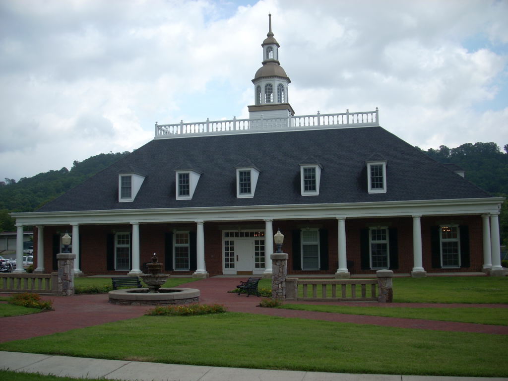


Ringgold, Georgia
Ringgold is a city of 3,435 people in Catoosa County, Georgia, founded in 1846.
Why visit Ringgold
Townapedia lists 5 museums and landmarks, 6 parks and trails, 28 places to eat, 7 places to stay and 2 attractions in and around town.
Highlights include Ringgold Depot and Catoosa County Courthouse.
July is the warmest month, with average highs of 89°F; January lows average 29°F.
Weather in Ringgold
Forecast from the National Weather Service. Full forecast
About Ringgold
Ringgold is a city in and the county seat of Catoosa County, Georgia, United States. Its population was 3,414 at the 2020 census. It is part of the Chattanooga metropolitan area.
From the Wikipedia article Ringgold, Georgia (this version), under CC BY-SA 4.0.
Things to do2


Museums and landmarks5

Ringgold Depot
Monument and historic site · National Register of Historic Places · 0.7 mi
Railway station in Ringgold, Georgia
155 Depot Street, Ringgold

Catoosa County Courthouse
Monument and historic site · National Register of Historic Places · 0.6 mi
Courthouse in Georgia, US

Ringgold Commercial Historic District
Monument and historic site · National Register of Historic Places · 0.7 mi
Historic district in Ringgold, Georgia, USA


Ringgold Gap Battlefield
Monument and historic site · National Register of Historic Places · 1.4 mi
US Civil War battlefield

Parks, trails and playgrounds6

Restaurants and cafes28


Spencer B's BBQ
Restaurant · Barbecue · 0.7 mi
6581 US-41, Ringgold
Mo-Fr 10:45- 20:00, Sa 10:45- 16:00

Caffeine Addicts
Cafe · Coffee Shop, Milkshake · 0.7 mi
7819 Nashville Street, Ringgold
Home Plate Grill
Restaurant · Burger, Regional · 0.7 mi
7807 Nashville Street, Ringgold
Pepper's Fresh Mexican Restaurant
Restaurant · Mexican · 0.7 mi
7859 Nashville Street, Ringgold
Rafael's Pizzeria & Italian Restaurant
Restaurant · Italian · 0.6 mi
126 Remco Shops Ln, Ringgold
16 more on the map.
History
Ringgold was founded in 1846 and incorporated as a city in 1847. It was named after Samuel Ringgold, a hero of the Battle of Palo Alto in the Mexican–American War.
Ringgold is where The General locomotive stopped during the Great Locomotive Chase on April 12, 1862. Ringgold is also home to the historic Ringgold Depot, which still contains bullet marks from the Civil War.
The Battle of Ringgold Gap took place on November 27, 1863. Confederate Major General Patrick Cleburne with 4,100 men used the mountain pass known as the Ringgold Gap to stall the advance of Union Major General Joseph Hooker and his troops. Hooker's troops were over 12,000 strong. It was a Confederate victory because it allowed Confederate artillery and wagon trains to move safely through the Ringgold Gap unharmed while inflicting high Union casualties.
The Whitman-Anderson House located in Ringgold is listed in the National Register of Historic Places (NRHP). From their house, the Whitman family watched the Battle of Ringgold Gap, during which William Whitman's general store was destroyed. After the Confederates evacuated Ringgold, General Grant requisitioned the Whitman's house as his headquarters. After General Grant moved on, General Sherman ordered the burning of the town of Ringgold, but spared the Whitman house, which remained in the Whitman family until 1902.
From the History section of Ringgold, Georgia on Wikipedia, under CC BY-SA 4.0.
Where to stay7
SpringHill Suites Chattanooga South/Ringgold, GA
Motel and hotel · 1.9 mi
155 General Lee Drive, Ringgold
HomeTown Inn Ringgold
Motel and hotel · 1.9 mi
22 Gateway Business Park Dr, Ringgold
Churches and places of worship13
Kingdom Hall of Jehovah’s Witnesses
Place of worship · Jehovahs Witness · 0.9 mi
8129 US 41, Ringgold
Shopping10
Cottage Treasures Tea Room & GiftShop
Shop · 0.4 mi
170 Cleveland Street, Ringgold
Gas and EV charging9
Schools, colleges and libraries10
Tiger Creek Elementary School
School · 2.8 mi
134 Rhea Mcclanahan Dr, Tunnel Hill
Healthcare2
Map of Ringgold
92 places. The map loads OpenStreetMap tiles when you open it.
Climate by month
Monthly table
| Month | High | Low | Rain | Snow |
|---|---|---|---|---|
| Jan | 51°F | 29°F | 5.6 in | 0.2 in |
| Feb | 56°F | 32°F | 5.1 in | 0.2 in |
| Mar | 64°F | 37°F | 5.0 in | 0.0 in |
| Apr | 73°F | 45°F | 4.7 in | 0.0 in |
| May | 80°F | 54°F | 4.6 in | 0.0 in |
| Jun | 86°F | 63°F | 4.2 in | 0.0 in |
| Jul | 89°F | 66°F | 5.1 in | 0.0 in |
| Aug | 89°F | 66°F | 4.5 in | 0.0 in |
| Sep | 84°F | 59°F | 4.2 in | 0.0 in |
| Oct | 75°F | 47°F | 3.6 in | 0.0 in |
| Nov | 62°F | 35°F | 4.4 in | 0.0 in |
| Dec | 53°F | 31°F | 5.4 in | 0.3 in |
U.S. Climate Normals 1991-2020 for Chickamauga Pk Larc (9 mi away), NOAA NCEI.
People and cost of living
American Community Survey 5-year estimates, 2020-2024, U.S. Census Bureau. Estimates have margins of error, larger for small towns.
Disaster history
Catoosa County has had 12 federal disaster declarations since 2000, most often for hurricanes.
- 2026-10-09: Hurricane Isaias (Tropical Storm)
- 2026-01-24: Severe Winter Storm (Winter Storm)
- 2024-09-26: Hurricane Helene (Tropical Storm)
- 2020-03-29: Covid-19 Pandemic (Biological)
- 2020-03-13: Covid-19 (Biological)
- 2017-09-15: Hurricane Irma (Hurricane)
OpenFEMA disaster declarations summaries.
Getting there and nearby towns
Chattanooga Metropolitan Airport (CHA) is the nearest airport with scheduled flights listed in OpenStreetMap, 9 miles away.
- Indian Springs 4 mi northwest, about 6 min by car
- Fort Oglethorpe 7 mi west, about 12 min by car
- East Ridge 8 mi northwest, about 14 min by car
- Lakeview 9 mi northwest, about 14 min by car
- Fairview 10 mi west, about 16 min by car
- Chickamauga 10 mi west, about 16 min by car
- Collegedale 11 mi northeast, about 17 min by car
- Chattanooga 13 mi northwest, about 21 min by car
- Dalton 13 mi southeast, about 21 min by car
- Chattanooga Valley 13 mi west, about 20 min by car
Drive times are estimates from straight-line distance, not routes.
Local news
Headlines from INDB, the NEMICO news database.
Reviews, tips and questions
Loading what members have shared...
Sources and licences
- NCES EDGE (Public domain): public schools
- NOAA NCEI U.S. Climate Normals 1991-2020 (Public domain): climate by month
- OpenFEMA (Public domain): disaster declarations
- OpenStreetMap contributors (ODbL 1.0): places, airports, map data
- U.S. Census Bureau (Public domain): population, income, housing, education, commute
- Wikidata (CC0 1.0): elevation, founding date, time zone, website, landmarks and historic places
- Wikimedia Commons (see each image): photos
- Wikipedia (CC BY-SA 4.0): overview and history text
Photo credits
- Ringgold City Hall, Ringgold (Catoosa County, Georgia), KudzuVine, Public domain
- Confederate Hospitals historical marker in Ringgold, Nyttend, Public domain
- Wedding chapel in Ringgold, Nyttend, Public domain
- Ringgold, GA 30736, USA - panoramio (2), Evan Nichols (Virtua…, CC BY 3.0
- Ringgold Exit, James Pressley, CC BY-SA 4.0
- John Ross House, near Ringgold, Ga., 1864 (4152940699), The U.S. National Archives, Public domain
- Camp at Ringgold, Ga., 1864 (4152991739), The U.S. National Archives, Public domain
- Battle of Ringgold Gap, Hal Jespersen, CC BY 4.0
- Ringgold, GA 30736, USA - panoramio (1), Evan Nichols (Virtua…, CC BY 3.0
- Ringgold, GA 30736, USA - panoramio, Evan Nichols (Virtua…, CC BY 3.0
- Ringgold Depot, Ringgold (Catoosa County, Georgia), KudzuVine, Public domain
- New York Ringgold Monument, Greenmachine18 at en.wikipedia, Public domain
- Catoosa County Courthouse, Ringgold, Georgia, KudzuVine, Public domain
- Commercial historic district, Ringgold (Catoosa County, Georgia), KudzuVine, Public domain
- ISS043-E-240835 - View of Earth, Earth Science and Remote Sensing Unit , Lyndon B. Johnson Space Center, Public domain
- ISS062-E-144258 - View of Earth, Earth Science and Remote Sensing Unit, NASA Johnson Space Center, Public domain
- ISS043-E-240833 - View of Earth, Earth Science and Remote Sensing Unit , Lyndon B. Johnson Space Center, Public domain
- ISS062-E-144257 - View of Earth, Earth Science and Remote Sensing Unit, NASA Johnson Space Center, Public domain
- ISS065-E-15448 - View of Earth, Earth Science and Remote Sensing Unit , Lyndon B. Johnson Space Center, Public domain
- ISS043-E-240836 - View of Earth, Earth Science and Remote Sensing Unit , Lyndon B. Johnson Space Center, Public domain
- ISS062-E-144255 - View of Earth, Earth Science and Remote Sensing Unit, NASA Johnson Space Center, Public domain
- ISS062-E-142367 - View of Earth, Earth Science and Remote Sensing Unit, NASA Johnson Space Center, Public domain
- ISS043-E-240834 - View of Earth, Earth Science and Remote Sensing Unit , Lyndon B. Johnson Space Center, Public domain
- ISS062-E-144256 - View of Earth, Earth Science and Remote Sensing Unit, NASA Johnson Space Center, Public domain
- 138th Chemical Company conducts DAGRS training for wartime mission (5554343233), Georgia National Guard from United States, CC BY 2.0
- The end of the Great Locomotive Chase, American Highlander, CC BY-SA 4.0


Page built October 30, 2026. Spotted a mistake? Tell us or suggest a place.