


Why visit Rio
Townapedia lists 37 museums and landmarks, 9 parks and trails, 54 places to eat, 8 places to stay and 4 attractions in and around town.
Highlights include International Residential College, Market Street Park, Abell-Gleason House and Albemarle County Courthouse Historic District.
July is the warmest month, with average highs of 90°F; January lows average 30°F.
Weather in Rio
Forecast from the National Weather Service. Full forecast
About Rio
Rio is an unincorporated community and census-designated place in Albemarle County, Virginia, United States. It is directly northeast of Charlottesville. As of the 2020 census, Rio had a population of 2,076.
From the Wikipedia article Rio, Virginia (this version), under CC BY-SA 4.0.
Things to do4

International Residential College
School · 3.4 mi
Residential college at the University of Virginia

Market Street Park
Monument and historic site · 3.4 mi
Park in Charlottesville, Virginia, United States
University of Virginia Center for Politics
School · 3.2 mi
Nonpartisan organization based in Charlottesville, Virginia

Museums and landmarks37

Abell-Gleason House
Monument and historic site · National Register of Historic Places · 3.2 mi
Historic home located at Charlottesville, Virginia, United States

Albemarle County Courthouse Historic District
Monument and historic site · National Register of Historic Places · 3.4 mi
United States historic place

Armstrong Knitting Factory
Monument and historic site · National Register of Historic Places · 3.2 mi
United States historic place

Bentivar
Monument and historic site · National Register of Historic Places · 2.1 mi
Historic house in Virginia, United States

Carr's Hill
Monument and historic site · National Register of Historic Places · 3.4 mi
Historic house in Virginia, United States
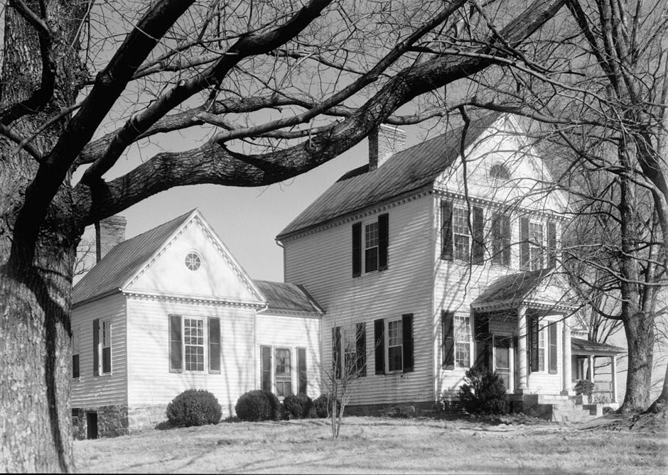
Carrsbrook
Monument and historic site · National Register of Historic Places · 1.3 mi
Building in Virginia, United States

Charles B. Holt House
Monument and historic site · National Register of Historic Places · 2.9 mi
Charlottesville, Virginia, NRHP-listed

Charlottesville and Albemarle County Courthouse Historic District
Monument and historic site · National Register of Historic Places · 3.3 mi
Historic district in Charlottesville, Virginia

Charlottesville Coca-Cola Bottling Works
Monument and historic site · National Register of Historic Places · 3.2 mi
Historic Coca-Cola bottling plant located at Charlottesville, Virginia

Dabney-Thompson House
Monument and historic site · National Register of Historic Places · 3.2 mi
Historic home in Charlottesville, Virginia, United States

Enderly
Monument and historic site · National Register of Historic Places · 2.7 mi
Historic house in Virginia, United States


Equestrian statue of Stonewall Jackson
Monument and historic site · National Register of Historic Places · 3.4 mi
Former public statue in Charlottesville, Virginia
25 more on the map.
Parks, trails and playgrounds9


Restaurants and cafes54

Mexico Viejo Grill
Restaurant · Mexican · 0.6 mi
Welcome to Mexico Viejo Grill, a vibrant Mexican restaurant nestled in the heart of Charlottesville, VA, that has been serving up a...
571 Branchlands Boulevard, Charlottesville
Fr-Su 11:00-23:00, Mo-Th 11:00-22:00
Akira Level Sushi & Ramen
Restaurant · Sushi · 1.2 mi
3912 Lenox Avenue
Mo,We-Th 11:00-21:00; Tu off; Fr-Sa 11:00-22:00; Su 11:30-21:00

Burton's Grill and Bar of Charlottesville
Restaurant · American, Burger · 1.5 mi
2010 Bond Street
Mo-Th 11:30-21:30; Fr-Sa 11:30-22:30; Su 11:30-21:00
El Tizon Rotisserie Chicken
Restaurant · Mexican · 0.5 mi
1875 Seminole Trail, Charlottesville
Mo-Su 11:00-21:00
Guadalajara Mexican Restaurant
Restaurant · Mexican · 1.0 mi
395 Greenbrier Drive
Mo-Fr 11:00-23:00; Sa 11:30-22:00; Su 11:30-21:00
M Sushi
Restaurant · Sushi · 1.2 mi
171 Seminole Court, Charlottesville
Mo-Th 11:00-15:00,17:00-21:30; Fr 11:00-15:00,17:00-22:30; Sa...
Matchbox
Restaurant · Pizza · 1.5 mi
2055 Bond Street, Charlottesville
Mo-Th 11:30-21:00; Fr-Sa 11:00-22:00; Su 11:00-21:00
Mission BBQ
Restaurant · American, Barbecue · 1.2 mi
3912 Lenox Avenue
Mo-Sa 11:00-21:00; Su 11:30-20:00
Noodles & Company
Restaurant · Pasta · 1.5 mi
2035 Bond Street
Mo-We,Su 11:00-21:00; Th-Sa 11:00-22:00
42 more on the map.
Where to stay8
Fairfield Inn & Suites Charlottesville North
Motel and hotel · 0.7 mi
577 Branchlands Boulevard, Charlottesville
Homewood Suites by Hilton Charlottesville, VA
Motel and hotel · 1.5 mi
2036 India Road, Charlottesville
Churches and places of worship13
Church of the Incarnation
Church · Catholic · 0.5 mi
1465 Incarnation Drive, Charlottesville
Episcopal Church of Our Savior
Church · Episcopal · 0.8 mi
1165 East Rio Road, Charlottesville
The Church of Jesus Christ of Latter-day Saints
Church · Mormon · 1.0 mi
1618 Earlysville Road
Union Ridge Baptist Church
Church · Baptist · 1.0 mi
2980 Hydraulic Road, Charlottesville
Center Church Charlottesville
Church · 0.9 mi
475 Westfield Road, Charlottesville
Church of the Incarnation Stone Chapel
Church · 0.6 mi
1455 Incarnation Drive, Charlottesville
Shopping21
C'ville Oriental Market
Grocery · Asian · 1.0 mi
1195 Seminole Trail, Charlottesville
Gas and EV charging12
Market Street Cafe Rio Road
Gas station · 1.0 mi
1111 Rio Road East, Charlottesville
Schools, colleges and libraries35
Blue Ridge Juvenile Detention Home
School · 5.3 mi
195 Peregory Ln., Charlottesville
Healthcare6
Passport Health Charlottesville Travel Clinic
Clinic and pharmacy · 0.8 mi
3315 Berkmar Drive, Charlottesville
Planned Parenthood
Clinic and pharmacy · 1.0 mi
2964 Hydraulic Road, Charlottesville
Map of Rio
199 places. The map loads OpenStreetMap tiles when you open it.
Climate by month
Monthly table
| Month | High | Low | Rain |
|---|---|---|---|
| Jan | 47°F | 30°F | 3.0 in |
| Feb | 51°F | 31°F | 2.4 in |
| Mar | 60°F | 38°F | 3.5 in |
| Apr | 70°F | 47°F | 3.2 in |
| May | 78°F | 56°F | 4.2 in |
| Jun | 86°F | 64°F | 4.4 in |
| Jul | 90°F | 68°F | 3.4 in |
| Aug | 87°F | 66°F | 3.9 in |
| Sep | 81°F | 60°F | 4.1 in |
| Oct | 71°F | 48°F | 3.3 in |
| Nov | 60°F | 38°F | 3.4 in |
| Dec | 51°F | 32°F | 3.0 in |
U.S. Climate Normals 1991-2020 for Charlottesville Ap (4 mi away), NOAA NCEI.
People and cost of living
American Community Survey 5-year estimates, 2020-2024, U.S. Census Bureau. Estimates have margins of error, larger for small towns.
Disaster history
Albemarle County has had 16 federal disaster declarations since 2000, most often for hurricanes.
- 2026-01-23: Severe Winter Storm (Winter Storm)
- 2024-10-01: Tropical Storm Helene (Tropical Storm)
- 2022-03-11: Severe Winter Storm And Snowstorm (Severe Storm)
- 2020-04-02: Covid-19 Pandemic (Biological)
- 2020-03-13: Covid-19 (Biological)
- 2018-09-11: Hurricane Florence (Hurricane)
OpenFEMA disaster declarations summaries.
Getting there and nearby towns
Charlottesville-Albemarle Airport (CHO) is the nearest airport with scheduled flights listed in OpenStreetMap, 4 miles away.
- Charlottesville 3 mi south, about 5 min by car
- Pantops 4 mi southeast, about 6 min by car
- Earlysville 5 mi north, about 8 min by car
- Piney Mountain 7 mi northeast, about 11 min by car
- Lake Monticello 14 mi southeast, about 22 min by car
- Gordonsville 16 mi east, about 26 min by car
- Dooms 21 mi west, about 33 min by car
- Crimora 21 mi west, about 34 min by car
- Waynesboro 23 mi west, about 38 min by car
- Orange 23 mi northeast, about 37 min by car
Drive times are estimates from straight-line distance, not routes.
Local news
Headlines from INDB, the NEMICO news database.
Reviews, tips and questions
Loading what members have shared...
Sources and licences
- NCES EDGE (Public domain): public schools
- NOAA NCEI U.S. Climate Normals 1991-2020 (Public domain): climate by month
- OpenFEMA (Public domain): disaster declarations
- OpenStreetMap contributors (ODbL 1.0): places, airports, map data
- U.S. Census Bureau (Public domain): population, income, housing, education, commute
- Wikidata (CC0 1.0): elevation, founding date, time zone, website, landmarks and historic places
- Wikimedia Commons (see each image): photos
- Wikipedia (CC BY-SA 4.0): overview and history text
Photo credits
- 2019-08-08 17 13 02 View north along U.S. Route 29 (Seminole Trail) from the overpass for Virginia State Route 631 (Rio Road) in Woodbrook, Albemarle County, Virginia, Famartin, CC BY-SA 4.0
- 2019-08-08 17 09 14 View south along U.S. Route 29 (Seminole Trail) from the overpass for Virginia State Route 631 (Rio Road) in Berkeley, Albemarle County, Virginia, Famartin, CC BY-SA 4.0
- 2019-08-08 14 23 24 View north along U.S. Route 29 (Seminole Trail) at the exit for Virginia State Route 631 (Rio Road) in Berkeley, Albemarle County, Virginia, Famartin, CC BY-SA 4.0
- 2019-08-08 08 58 04 View south along U.S. Route 29 (Seminole Trail) at the exit for Virginia State Route 631 (Rio Road, Charlottesville) in Woodbrook, Albemarle County, Virginia, Famartin, CC BY-SA 4.0
- Boletus patrioticus T.J. Baroni, Bessette & Roody 912996, This image was created by user dario.z (dario13) at Mushroom Observer , a source for mycological images. You can contact this user here ., CC BY-SA 3.0
- Sunnyside in Charlottesville, through trees, Nyttend, Public domain
- William McGuffey School, Nickmorgan2, CC BY-SA 3.0
- Court Square, Jhb 10s ( talk ), Public domain
- Locust Grove, Nickmorgan2, CC BY-SA 3.0
- Jackson Sculpture, Nickmorgan2, CC BY-SA 3.0
- Woodlands near Charlottesville, Nyttend, Public domain
- Four Acres house, Charlottesville, Nyttend, Public domain
- UVA house for ΧΦ, Nyttend, Public domain
- Carrsbrook, South Fork River vicinity, Charlottesville vicinity (Albemarle County, Virginia), Unknown author Unknown author, Public domain
- Lee Park, Charlottesville, VA, Cville dog, Public domain
- Charles B Holt House, Nickmorgan2, CC BY-SA 3.0
- Turner-LaRowe House, Nyttend, Public domain
- Faulkner House, Rwhaley, CC BY-SA 3.0
- Bentivar entrance, Nyttend, Public domain
- Judge William J. Robertson House, Nyttend, Public domain
- Enderly, Nickmorgan2, CC BY-SA 3.0
- Red Hills entrance from Polo Grounds Road, Nyttend, Public domain
- Hard Bargain, Nickmorgan2, CC BY-SA 3.0
- McConnell-Neve House site, Charlottesville, Nyttend, Public domain
- Martha Jefferson HD, Nickmorgan2, CC BY-SA 3.0
- The Aviator statue outside Clemons Library, Semclaughlin, Public domain
- Jefferson School Charlottesville, Nickmorgan2, CC BY-SA 3.0
- King Lumber, Nickmorgan2, CC BY-SA 3.0
- Court Square - panoramio, birchstudio, CC BY-SA 3.0
- Stonefield in Charlottesville, through trees, Nyttend, Public domain
- Carrs hill, Rwhaley, CC BY-SA 3.0
- Armstrong Knitting, Nickmorgan2, CC BY-SA 3.0
- Wynhurst Charlottesviille VA, Strawser, CC BY-SA 3.0
- Abell Gleason, Nickmorgan2, CC BY-SA 3.0
- Dabney Thompson, Nickmorgan2, CC BY-SA 3.0
- Cocacola Works, Nickmorgan2, CC BY-SA 3.0
- Marshall Rucker Smith, Nickmorgan2, CC BY-SA 3.0
- Amenity Strip retail Rt 29 outside cville (4904755607), Brett VA, CC BY 2.0
- Neighborhood services Rt 29 outside cville (4904754725), Brett VA, CC BY 2.0
- Fitnes center Rt 29 outside cville (4905342396), Brett VA, CC BY 2.0


Page built October 30, 2026. Spotted a mistake? Tell us or suggest a place.