

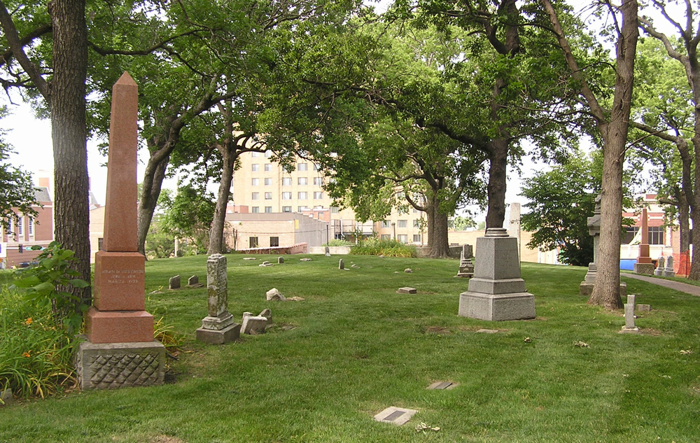


Riverside, Missouri
Riverside is a city of 4,276 people in Platte County, Missouri, founded in 1951.
Why visit Riverside
Townapedia lists 20 museums and landmarks, 14 parks and trails, 17 places to eat, 6 places to stay and 8 attractions in and around town.
Highlights include Lewis and Clark Viaduct, Park University, A. Porter Davis Residence and Armour Theatre Building.
July is the warmest month, with average highs of 90°F; January lows average 22°F.
Weather in Riverside
Forecast from the National Weather Service. Full forecast
About Riverside
Riverside is a city in Platte County, Missouri, United States, that is part of the Kansas City metropolitan area. The population was 4,013 at the 2020 census.
From the Wikipedia article Riverside, Missouri (this version), under CC BY-SA 4.0.
Things to do8

Lewis and Clark Viaduct
Bridge · 4.2 mi
Viaducts over the Kansas River in Kansas and Missouri, United States

Park University
School · 2.8 mi
Private university in Parkville, Missouri
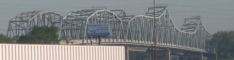
Platte Purchase Bridge
Bridge · 1.2 mi
Bridge in United States of America

Union Pacific Bridge
Bridge · 4.1 mi
Bridge in United States of America

US 69 Missouri River Bridge
Bridge · 1.2 mi
Bridge in Missouri to Kansas City, Kansas

Western University
School · 2.1 mi
Former historically Black college in Kansas

Morton Amphitheater
Cinema and theater · 1.3 mi
6150 Northwest Music Boulevard, Riverside

Museums and landmarks20

A. Porter Davis Residence
Monument and historic site · National Register of Historic Places · 3.5 mi
Building in Kansas, United States

Armour Theatre Building
Monument and historic site · National Register of Historic Places · 3.6 mi
Movie theater in Kansas City, Missouri

Benjamin Banneker School
Monument and historic site · National Register of Historic Places · 3.2 mi
Building in Missouri, United States

Charles Smith Scott Memorial Observatory
Monument and historic site · National Register of Historic Places · 2.8 mi
Building in Missouri, United States
Huron Cemetery
Monument and historic site · National Register of Historic Places · 4.0 mi
Native American cemetery

Kansas City, Kansas City Hall and Fire Headquarters
Monument and historic site · National Register of Historic Places · 3.9 mi
Historic buildings in Kansas City, Kansas, United States

Mackay Building
Monument and historic site · National Register of Historic Places · 2.8 mi
Building in Missouri, United States

Memorial Hall
Monument and historic site · National Register of Historic Places · 4.1 mi
Auditorium in Kansas City, Kansas, United States

Quindaro Townsite
Monument and historic site · National Register of Historic Places · 2.0 mi
Historical site in Kansas City, Kansas, United States
Renner Village Archeological Site
Monument and historic site · National Register of Historic Places · 1.0 mi
Archaeological site in Missouri, United States of America

Scottish Rite Temple
Monument and historic site · National Register of Historic Places · 4.0 mi
Masonic temple in Kansas City, Kansas
Sears, Roebuck and Company Warehouse Building
Monument and historic site · National Register of Historic Places · 3.9 mi
Building in Missouri, United States
8 more on the map.
Parks, trails and playgrounds14



E. H. Young Riverfront Park
Park · 1.1 mi
1001 Northwest Argosy Parkway, Riverside
Mo-Fr 05:00-22:00

Green Hills of Platte Wildlife Preserve
Hiking and trails · 1.1 mi
4730 North Green Hills Road, Parkville

2 more on the map.
Restaurants and cafes17

Philly Time
Restaurant · Cheesesteak, Sandwich · 1.8 mi
4111 North Mulberry Drive, Kansas City
Mo-Fr 10:30-19:00; Sa,Su 10:30-16:00

La Tacita de Café
Cafe · Coffee Shop, Tea · 1.4 mi
2304 Northwest Vivion Road, Riverside
Mo-Sa 07:00-15:30
Taqueria Mexico Lindo
Restaurant · Mexican · 1.3 mi
2532 Northwest Vivion Road, Northmoor
Su 10:00-18:00; Mo-Th 10:00-22:00; Fr-Sa 10:00-21:00
LC's Hamburgers
Restaurant · Burger · 1.3 mi
2424 Northwest Vivion Road, Northmoor
Mo-Sa 11:00-21:00
Tree Hugger
Restaurant · Burger · 1.7 mi
1841 Northwest Vivion Road, Riverside
Mo-Su 11:00-20:00; Tu off; We off

Taquitos El Nopal
Restaurant · Mexican · 1.3 mi
2502 Northwest Vivion Road, Northmoor
Briarcliff Barrio
Restaurant · Mexican · 1.9 mi
4125 North Mulberry Drive, Kansas City
5 more on the map.
History
Riverside lies on the edge of the Missouri River and was formally incorporated in 1951.
For many years, the town was known for its Riverside Race Track. The Riverside Park Jockey Club operated from 1928 to 1937 and was popularly called Pendergast Track after its patron, the city boss of Kansas City, Tom Pendergast, although he was not officially on its organization papers. The horse racing track was on the site of a former dog racing track. The track operated under a questionable legal basis. The site was supplanted by an automobile race track, which closed in the 1990s.
The Riverside Red X store was founded as a gas station in 1948 by Edward Young. He and local business owners Ferd Filger and Dr. Thomas M. Eagle led the incorporation of Riverside in 1951, after both Parkville and Kansas City expressed interest in annexing the area. As of 2015, the store was still owned by the Young family.
The Renner Village Archeological Site was listed on the National Register of Historic Places in 1969.
From the History section of Riverside, Missouri on Wikipedia, under CC BY-SA 4.0.
Where to stay6
TownePlace Suites Kansas City at Briarcliff
Motel and hotel · 2.1 mi
3950 North Mulberry Drive, Kansas City
Riverside Motel
Motel and hotel · 1.2 mi
4717 Northwest Gateway Avenue, Riverside
Churches and places of worship5
Washington Chapel C.M.E. Church
Church · National Register of Historic Places · 3.3 mi
Heartland Church of Christ
Church · Church Of Christ · 2.3 mi
6120 Northwest Prairie View Road, Kansas City
Saint Matthews Evangelical Lutheran
Church · Lutheran · 1.4 mi
5047 Northwest Gateway Avenue, Riverside
Allen Chapel AME Church
Church · African Methodist Episcopal · 2.3 mi
3421 North 29th Street, Kansas City
Shopping2
Gas and EV charging3
Schools, colleges and libraries48
Park Hill South High School
School · 0.4 mi
4500 Northwest River Park Drive, Riverside
Map of Riverside
123 places. The map loads OpenStreetMap tiles when you open it.
Climate by month
Monthly table
| Month | High | Low | Rain | Snow |
|---|---|---|---|---|
| Jan | 40°F | 22°F | 1.0 in | 3.4 in |
| Feb | 45°F | 26°F | 1.5 in | 3.2 in |
| Mar | 57°F | 36°F | 2.1 in | 0.4 in |
| Apr | 67°F | 46°F | 3.9 in | 0.1 in |
| May | 76°F | 57°F | 5.1 in | 0.0 in |
| Jun | 86°F | 67°F | 5.3 in | 0.0 in |
| Jul | 90°F | 72°F | 4.4 in | 0.0 in |
| Aug | 89°F | 70°F | 4.7 in | 0.0 in |
| Sep | 80°F | 61°F | 3.8 in | 0.0 in |
| Oct | 68°F | 49°F | 3.2 in | 0.3 in |
| Nov | 54°F | 36°F | 1.8 in | 0.1 in |
| Dec | 44°F | 27°F | 1.3 in | 3.5 in |
U.S. Climate Normals 1991-2020 for Kansas City Downtown Ap (4 mi away), NOAA NCEI.
People and cost of living
American Community Survey 5-year estimates, 2020-2024, U.S. Census Bureau. Estimates have margins of error, larger for small towns.
Disaster history
Platte County has had 17 federal disaster declarations since 2000, most often for severe storms.
- 2020-03-26: Covid-19 Pandemic (Biological)
- 2020-03-13: Covid-19 (Biological)
- 2019-07-09: Severe Storms, Tornadoes, And Flooding (Severe Storm)
- 2019-05-20: Severe Storms, Straight-Line Winds, And Flooding (Flood)
- 2015-08-07: Severe Storms, Tornadoes, Straight-Line Winds, And Flooding (Severe Storm)
- 2011-08-12: Flooding (Flood)
OpenFEMA disaster declarations summaries.
Getting there and nearby towns
Charles B. Wheeler Downtown Airport (MKC) is the nearest airport with scheduled flights listed in OpenStreetMap, 4 miles away.
- North Kansas City 4 mi southeast, about 7 min by car
- Lake Waukomis 4 mi north, about 7 min by car
- Kansas City 5 mi southeast, about 9 min by car
- Gladstone 5 mi northeast, about 8 min by car
- Parkville 5 mi northwest, about 8 min by car
- Weatherby Lake 5 mi northwest, about 9 min by car
- Kansas City 7 mi southwest, about 11 min by car
- Claycomo 8 mi east, about 14 min by car
- Pleasant Valley 9 mi east, about 14 min by car
- Roeland Park 9 mi south, about 15 min by car
Drive times are estimates from straight-line distance, not routes.
Local news
Headlines from INDB, the NEMICO news database.
Reviews, tips and questions
Loading what members have shared...
Sources and licences
- NCES EDGE (Public domain): public schools
- NOAA NCEI U.S. Climate Normals 1991-2020 (Public domain): climate by month
- OpenFEMA (Public domain): disaster declarations
- OpenStreetMap contributors (ODbL 1.0): places, airports, map data
- U.S. Census Bureau (Public domain): population, income, housing, education, commute
- Wikidata (CC0 1.0): elevation, founding date, time zone, website, landmarks and historic places
- Wikimedia Commons (see each image): photos
- Wikipedia (CC BY-SA 4.0): overview and history text
Photo credits
- Wyandotte County Kansas courthouse, Ichabod, CC BY-SA 3.0
- 073 Huron cemetery, Mark Michalovic, CC BY-SA 3.0
- Castle Rock, Kansas City, KS, 25or6to4, CC BY-SA 4.0
- Soldiers and Sailors Memorial Building (front), Nja1985, CC BY-SA 3.0
- Washington Chapel CME Church, Parkville, MO, 25or6to4, CC BY-SA 4.0
- Waddell "A" Truss Bridge, Spanning Lin Branch Creek, Missouri cropped, Image taken by unknown photographer, Public domain
- Wheeling Corrugating Company Building KCMO, Bartokie, CC BY-SA 4.0
- Banneker School, Parkville, MO, 25or6to4, CC BY-SA 4.0
- Scottish rite temple, Reddi at en.wikipedia, CC BY-SA 3.0
- Mckay-hall-parkville, The original uploader was Americasroof at English Wikipedia ., CC BY-SA 3.0
- Wyandotte High School front, User:KarateLady (DeBarra Mayo Shaw), Public domain
- Armour Theatre Building 2012-09-18 00-58-50, ovivas, CC BY-SA 3.0
- Scott Memorial Observatory, Parkville, MO, 25or6to4, CC BY-SA 4.0
- Town House Hotel, Nja1985, CC BY-SA 3.0
- Kansas City Hall, Nja1985, CC BY-SA 3.0
- Kansas High School Gymnasium and Laboratory, Nja1985, CC BY-SA 3.0
- Western University historic lankmark, America Beautiful Patton, CC BY-SA 4.0
- NewUS69bridge, SamuelNelsonGISP, CC0
- Platte-purchase-fairfax-bridges-from-south, No machine-readable author provided. Bhugh assumed (based on copyright claims)., Public domain
- Quality-i70, Unknown author, CC BY-SA 2.5
- Canada Geese on the Missouri River. PHOTO WALK ENGLISH LANDING PARK (41624903745), Laura Gilchrist from Kansas City, United States, CC BY 2.0


Page built October 30, 2026. Spotted a mistake? Tell us or suggest a place.