



Roanoke, Virginia
Roanoke is a city of 98,355 people in Roanoke city, Virginia, founded in 1852.
Why visit Roanoke
Townapedia lists 92 museums and landmarks, 63 parks and trails, 186 places to eat, 22 places to stay and 14 attractions in and around town.
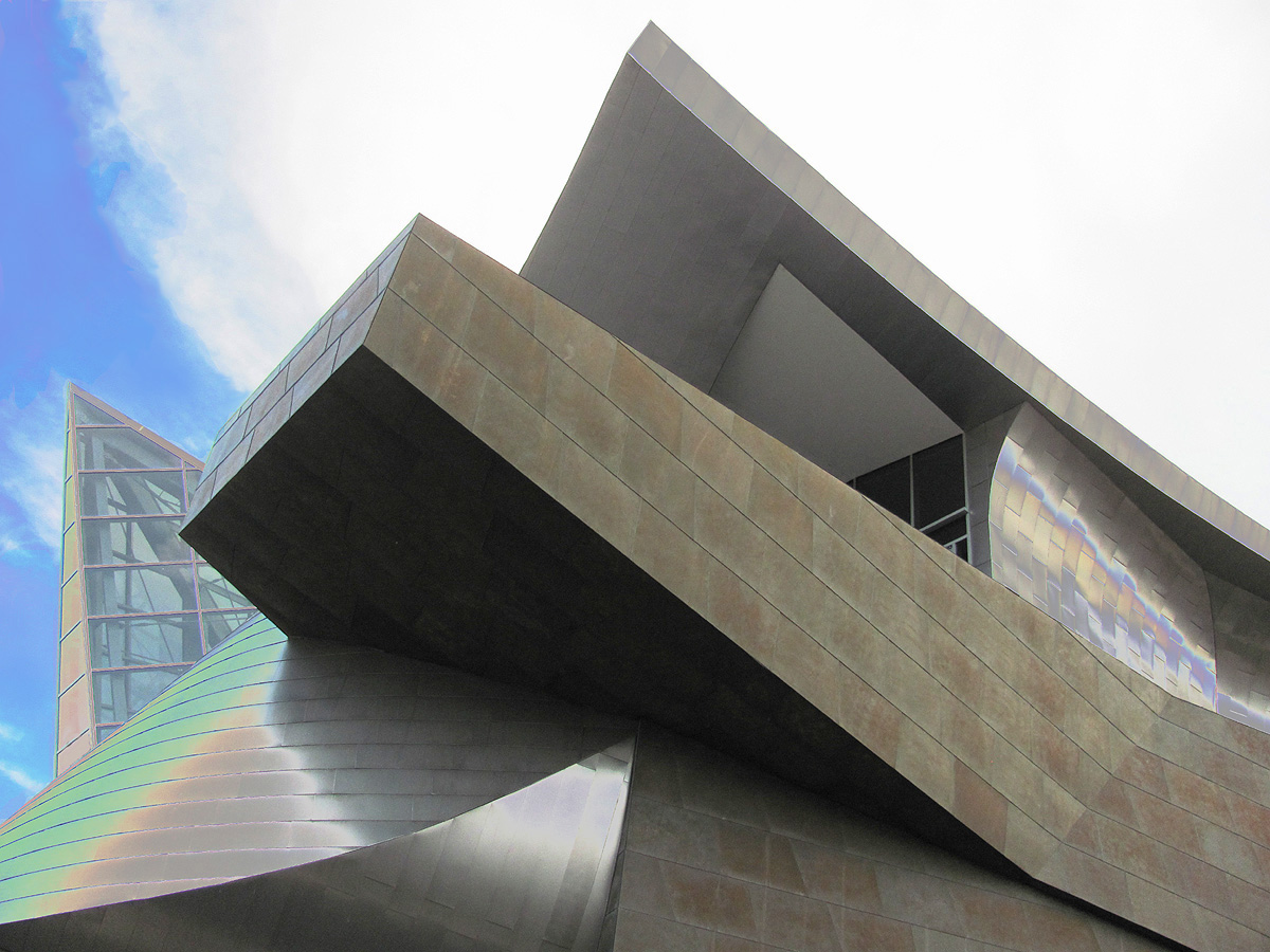
Highlights include Lakeside Amusement Park, Memorial Bridge, Taubman Museum of Art and Roanoke Star.
July is the warmest month, with average highs of 88°F; January lows average 29°F.
Weather in Roanoke
Forecast from the National Weather Service. Full forecast
About Roanoke
Roanoke is an independent city in Virginia, United States. It lies in Southwest Virginia along the Roanoke River, within the Blue Ridge range of the greater Appalachian Mountains. Roanoke is about 50 miles (80 km) north of the Virginia–North Carolina border and 250 miles (400 km) southwest of Washington, D.C., along Interstate 81. At the 2020 census, Roanoke's population was 100,011, making it the most populous city in Virginia west of the state capital, Richmond.
From the Wikipedia article Roanoke, Virginia (this version), under CC BY-SA 4.0.
Things to do14

Lakeside Amusement Park
Monument and historic site · 4.1 mi
Former amusement park in Salem, Virginia

Memorial Bridge
Bridge · 0.9 mi
Bridge spanning the Roanoke River along U.S. Route 11 (Memorial Avenue) in Roanoke, Virginia

Mill Mountain Theatre
Cinema and theater · 1.1 mi
Theater in Roanoke, Virginia, United States

Berglund Performing Arts Theater
Cinema and theater · 1.2 mi
710 Williamson Road Northeast, Roanoke
2 more on the map.
Museums and landmarks92

Roanoke Star
Monument and historic site · National Register of Historic Places · 2.4 mi
Man-made illuminated star in Roanoke, Virginia, United States
Roanoke Warehouse Historic District
Monument and historic site · National Register of Historic Places · 0.9 mi
Human settlement in Roanoke, Virginia, United States of America

Academy Street School
Monument and historic site · National Register of Historic Places · 5.8 mi
Historic school complex located at Salem, Virginia

Apartment Building on Windsor Avenue and Brunswick St.
Monument and historic site · National Register of Historic Places · 1.6 mi
United States historic place

Belle Aire
Monument and historic site · National Register of Historic Places · 3.5 mi
Mansion in Virginia, United States


Belmont Historic District
Monument and historic site · National Register of Historic Places · 1.7 mi
Historic district in Roanoke, Virginia, US
Belmont Methodist-Episcopal Church
Monument and historic site · National Register of Historic Places · 1.7 mi
Church building in Roanoke, United States of America
Black Horse Tavern-Bellvue Hotel and Office
Monument and historic site · National Register of Historic Places · 5.2 mi
Historic commercial building in Virginia, United States
Blair Apartments
Monument and historic site · National Register of Historic Places · 5.8 mi
Historic residential building in Virginia, United States
Boxley Building
Monument and historic site · National Register of Historic Places · 1.1 mi
Historic commercial building in Virginia, United States
Boxley-Sprinkle House
Monument and historic site · National Register of Historic Places · 2.4 mi
Historic house in Virginia, United States
80 more on the map.
Parks, trails and playgrounds63

Mill Mountain Park
Park · 2.6 mi
2198 Mill Mountain Spur, Roanoke
Mo-Su 06:00-23:00
51 more on the map.
Restaurants and cafes186

Sakura Asian Fusion
Restaurant · Asian · 0.7 mi
551 Marshall Avenue Southwest, Roanoke
Su 11:00-21:30; Mo-Th 10:30-21:30; Fr 10:30-22:00; Sa 11:00-22:00
Cedars Lebanese Restaurant
Restaurant · Lebanese, Mediterranean · 1.2 mi
112 Campbell Avenue Southeast
Mo-Su 10:30-21:30
El Cielito Lindo
Restaurant · Mexican · 1.5 mi
683 Brandon Avenue Southwest, Roanoke
Mo-Sa 09:30-20:30; Su 10:30-17:30
IHOP
Restaurant · Breakfast, Pancake · 1.7 mi
4764 Valley View Boulevard Northwest, Roanoke
Mo-Th,Su 07:00-22:00; Fr,Sa 07:00-24:00
PortaBella Pizza
Restaurant · Pizza, Italian · 0.4 mi
1132 Salem Avenue Southwest, Roanoke
Mo-Th 10:00-21:00, Fr-Sa 10:00-22:00, Su 10:00-21:00
Pueblo Chico
Restaurant · Mexican · 1.9 mi
2626 Broadway Avenue Southwest
Mo-Th 11:00-21:00; Fr-Sa 11:00-22:00; Su 11:00-21:00

Starbucks
Cafe · Coffee Shop · 2.6 mi
1309 Hershberger Road Northwest, Roanoke
Mo-Fr 05:00-21:30; Sa-Su 05:30-21:30
Taaza Indian Cuisine
Restaurant · Indian · 1.3 mi
1910 Memorial Avenue Southwest, Roanoke
Mo off; Tu-Fr 11:00-14:00,16:00-22:00; Sa-Su 12:00-15:00,16:00-22:00
Viet Sub Banh Mi
Restaurant · Sandwich, Vietnamese · 1.5 mi
1403 Williamson Road Northeast, Roanoke
Mo-Sa 11:00-19:00

174 more on the map.
Where to stay22
BEST WESTERN PLUS Inn at Valley View
Motel and hotel · 2.2 mi
5050 Valley View Boulevard Northwest, Roanoke
Hampton Inn & Suites Roanoke Airport
Motel and hotel · 2.1 mi
5033 Valley View Boulevard North, Roanoke
Home2 Suites by Hilton Roanoke
Motel and hotel · 1.9 mi
4830 Valley View Boulevard Northwest, Roanoke
Hyatt Place Roanoke Airport/Valley View Mall
Motel and hotel · 2.2 mi
5040 Valley View Boulevard Northwest, Roanoke
Churches and places of worship127
Salem Presbyterian Church (Salem, Virginia)
Church · National Register of Historic Places · 5.5 mi
Holy Trinity Greek Orthodox Church
Church · Greek Orthodox · 1.9 mi
30 Huntington Boulevard Northeast, Roanoke
Saint Johns Episcopal Church
Church · Episcopal · 1.2 mi
1 Mountain Avenue Southwest, Roanoke
Calvary Baptist Church
Church · Baptist · 0.6 mi
608 Campbell Avenue Southwest, Roanoke
First Christian Church
Church · Disciples Of Christ · 2.8 mi
302 6th Street, Vinton
First Christian Church
Church · Disciples Of Christ · 0.8 mi
344 Church Avenue Southwest, Roanoke
Shopping52
Gas and EV charging23
Schools, colleges and libraries89
Belmont Branch Roanoke City Public Library
Library · 2.0 mi
1101 Morningside Street Southeast, Roanoke
Raleigh Court Branch Roanoke City Public Library
Library · 2.1 mi
2112 Grandin Road Southwest, Roanoke
Healthcare27
Carilion Clinic Outpatient Therapy
Clinic and pharmacy · 1.9 mi
2331 Franklin Road Southwest, Roanoke
Map of Roanoke
250 places. The map loads OpenStreetMap tiles when you open it.
Climate by month
Monthly table
| Month | High | Low | Rain | Snow |
|---|---|---|---|---|
| Jan | 47°F | 29°F | 3.2 in | 4.3 in |
| Feb | 51°F | 31°F | 2.9 in | 4.8 in |
| Mar | 59°F | 38°F | 3.5 in | 2.3 in |
| Apr | 70°F | 46°F | 3.5 in | 0.1 in |
| May | 77°F | 55°F | 4.3 in | 0.0 in |
| Jun | 84°F | 63°F | 4.7 in | 0.0 in |
| Jul | 88°F | 67°F | 4.3 in | 0.0 in |
| Aug | 86°F | 66°F | 3.4 in | 0.0 in |
| Sep | 80°F | 59°F | 4.1 in | 0.0 in |
| Oct | 70°F | 48°F | 3.0 in | 0.0 in |
| Nov | 59°F | 38°F | 3.0 in | 0.1 in |
| Dec | 50°F | 32°F | 3.1 in | 3.2 in |
U.S. Climate Normals 1991-2020 for Roanoke Rgnl Ap 72411 (3 mi away), NOAA NCEI.
People and cost of living
American Community Survey 5-year estimates, 2020-2024, U.S. Census Bureau. Estimates have margins of error, larger for small towns.
Disaster history
Roanoke city has had 12 federal disaster declarations since 2000, most often for hurricanes.
- 2026-01-23: Severe Winter Storm (Winter Storm)
- 2024-10-01: Tropical Storm Helene (Tropical Storm)
- 2020-04-02: Covid-19 Pandemic (Biological)
- 2020-03-13: Covid-19 (Biological)
- 2018-10-15: Hurricane Florence (Hurricane)
- 2018-09-11: Hurricane Florence (Hurricane)
OpenFEMA disaster declarations summaries.
Getting there and nearby towns
Roanoke-Blacksburg Regional Airport (ROA) is the nearest airport with scheduled flights listed in OpenStreetMap, 3 miles away.
- Cave Spring 5 mi southwest, about 7 min by car
- Hollins 5 mi north, about 7 min by car
- Blacksburg 26 mi west, about 42 min by car
- Christiansburg 26 mi west, about 42 min by car
- Radford 35 mi west, about 56 min by car
- Forest 38 mi east, about 1 h by car
- Martinsville 41 mi south, about 1 h by car
- Lynchburg 43 mi east, about 1 h 15 min by car
- Madison Heights 48 mi east, about 1 h 15 min by car
- Eden 55 mi south, about 1 h 30 min by car
Drive times are estimates from straight-line distance, not routes.
Local news
Headlines from INDB, the NEMICO news database.
Reviews, tips and questions
Loading what members have shared...
Sources and licences
- NCES EDGE (Public domain): public schools
- NOAA NCEI U.S. Climate Normals 1991-2020 (Public domain): climate by month
- OpenFEMA (Public domain): disaster declarations
- OpenStreetMap contributors (ODbL 1.0): places, airports, map data
- U.S. Census Bureau (Public domain): population, income, housing, education, commute
- Wikidata (CC0 1.0): elevation, founding date, time zone, website, landmarks and historic places
- Wikimedia Commons (see each image): photos
- Wikipedia (CC BY-SA 4.0): overview and history text
Photo credits
- Roanoke City (Virginia) from Mill Mountain Star at Dusk, Joe Ravi, CC BY-SA 3.0
- Roanoke Salvation Army Citadel, Nyttend, Public domain
- Roanoke City Health Center, Nyttend, Public domain
- Part of the Rail Yard behind the Virginia Museum of Transportation in Downtown Roanoke, Virginia, Donnie Nunley from Boones Mill, Virginia, CC BY 2.0
- Taubman Museum of Art, O Palsson, CC BY 2.0
- Roanoke star, Ben Schumin, CC BY-SA 3.0
- Keepers Cottage front, DrOrinScrivello, CC BY-SA 4.0
- Stewart near Eighth in Belmont, Nyttend, Public domain
- APARTMENT BUILDING ON WINDSOR AVENUE AND BRUNSWICK ST. ROANOKE CITY, Jerrye & Roy Klotz, MD, CC BY-SA 4.0
- GAINSBORO HISTORIC DISTRICT, ROANOKE CITY, Jerrye & Roy Klotz, MD, CC BY-SA 4.0
- Colony House - Roanoke 01, Farragutful, CC BY-SA 4.0
- BELLE AIRE, ROANOKE CITY, VA, JERRYE & ROY KLOTZ. M.D., CC BY-SA 4.0
- Administration Snow (8474594858), roanokecollege, CC BY 2.0
- Roanoke VA Hospital HABS VA1, unknown HABS photographer, Public domain
- MONTEREY, ROANOKE CITY, Jerrye & Roy Klotz, MD, CC BY-SA 4.0
- BUENA VISTA ROANOKE CITY, Jerrye & Roy Klotz, MD, CC BY-SA 4.0
- HUNTINGDON, ROANOKE CITY, Jerrye & Roy Klotz, MD, CC BY-SA 4.0
- Gainsboro Branch Library 01, Farragutful, CC BY-SA 4.0
- Salem VA downtown, Mojo Hand, CC BY-SA 3.0
- MOUNT MORIAH BAPTIST CHURCH AND CEMETERY, ROANOKE CITY, Jerrye & Roy Klotz, MD, CC BY-SA 4.0
- SalemPresbyterian, Cdenas, CC BY-SA 3.0
- AcademyStSchool, Cdenas, CC BY-SA 3.0
- MELROSE-RUGBY HISTORIC DISTRICT, ROANOKE CITY, Jerrye & Roy Klotz, MD, CC BY-SA 4.0
- McVittyHouse, Molly Cardenas, CC BY-SA 3.0
- SalemPresbParsonage, Molly Cardenas, CC BY-SA 3.0
- Valley RR Bridge 2008 facing south, Xhancock, CC BY-SA 4.0
- WilliamsBrownHouse, Molly Cardenas, CC BY-SA 3.0
- ROANOKE CITY FIREHOUSE NO. 6 ROANOKE CITY, Jerrye & Roy Klotz, MD, CC BY-SA 4.0
- OldSalemPostOffice, Molly Cardenas, CC BY-SA 3.0
- Salem Camp Meeting, Nyttend, Public domain
- OldRoanokeCtyCourt, Cdenas, CC BY-SA 3.0
- William Byrd HS in Vinton, former, Nyttend, Public domain
- Ringing the elevator alarm, Dieselducy, Andrew R, CC BY-SA 3.0
- Gainsboro St. Paul's Methodist, Nyttend, Public domain
- View of the sky under an umbrella, Saturae, CC BY-SA 4.0
- The Engineer S Morning, Donnie Nunley, CC BY 3.0
- Norfolk and Western Railway No. 1776 - October 2011, Chris Lawrence, CC BY-SA 2.0
- 1218, Donnie Nunley, CC BY 3.0
- Ticket Please, Donnie Nunley, CC BY 3.0
- Signal, Donnie Nunley, CC BY 3.0


Page built October 30, 2026. Spotted a mistake? Tell us or suggest a place.