
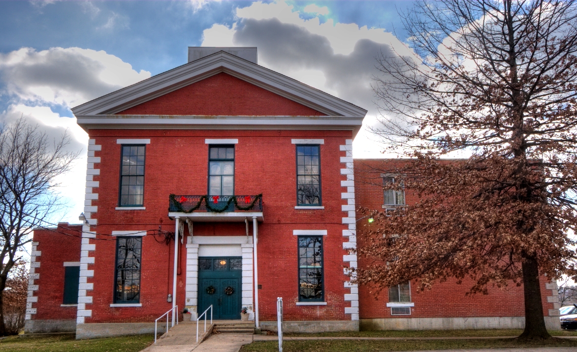


Rolla, Missouri
Rolla is a city of 20,287 people in Phelps County, Missouri, founded in 1844.
Why visit Rolla
Townapedia lists 11 museums and landmarks, 23 parks and trails, 63 places to eat, 15 places to stay and 3 attractions in and around town.
Highlights include Forum Four Cinema, Leach Theatre, National Bank of Rolla Building and Phelps County Courthouse.
July is the warmest month, with average highs of 89°F; January lows average 22°F.
Weather in Rolla
Forecast from the National Weather Service. Full forecast
About Rolla
Rolla is a city in and the county seat of Phelps County, Missouri, United States. Its population in the 2020 United States Census was 19,943. It is approximately midway between St. Louis and Springfield along I-44. Its micropolitan statistical area consists of all of Phelps County.
From the Wikipedia article Rolla, Missouri (this version), under CC BY-SA 4.0.
Things to do3

Museums and landmarks11

National Bank of Rolla Building
Monument and historic site · National Register of Historic Places · 0.6 mi
Building in Missouri, United States

Phelps County Courthouse
Monument and historic site · National Register of Historic Places · 0.6 mi
Courthouse in Missouri, United States
Phelps County Jail
Monument and historic site · National Register of Historic Places · 0.7 mi
Prison in Missouri, United States of America


Rolla Ranger Station Historic District
Monument and historic site · National Register of Historic Places · 1.6 mi
Historic district in Missouri, United States
Rt 66 Museum of Phelps Co., - Mule Trading Post
Monument and historic site · 3.0 mi
11160 North Outer Dillon Road, Rolla
Missouri S&T Stonehenge
Monument and historic site · 1.1 mi
North Bishop Avenue, Rolla

Parks, trails and playgrounds23


Allgood-Bailey Stadium
Sports field and stadium · 1.1 mi
705 West 10th Street, Rolla

11 more on the map.
Restaurants and cafes63

Pryor's Pizza
Restaurant · Pizza · 1.1 mi
Hometown handcrafted pizza in business in Rolla since 1962
1505 North Bishop Avenue, Rolla
Su-Th 11:00-20:30; Fr-Sa 11:00-21:30
Alex's Pizza Palace
Restaurant · Pizza · 0.6 mi
122 West 8th Street, Rolla
Su-Th 11:00-21:00, Fr,Sa 11:00-10:00
Colton's Steak House & Grill
Restaurant · Steak House, Steak · 1.1 mi
1675 North Bishop Avenue, Rolla
11:00-21:00
NaCl + H2O
Restaurant · Seafood · 0.6 mi
817 North Pine Street, Rolla
Mo-Sa 16:00-21:00; We 11:00-21:00

Ole Mule Axes N Fun LLC
Bar and pub · 3.1 mi
Welcome to the Rt 66 Museum of Phelps Co. - Mule Trading Post, a unique bar located in Rolla, MO. Established in 2024, we specialize in...
11160 North Outer Dillon Road, Rolla
Mo-Tu 11:00-20:00, Th 11:00-22:00, Fr 11:00-24:30, Sa 08:00-24:30,...
Pancheros Mexican Grill
Restaurant · Mexican · 1.0 mi
1303 North Bishop Avenue, Rolla
Mo-Su 11:00-21:00

Spoon Me
Ice cream · Frozen Yogurt, Ice Cream · 1.0 mi
1051 North Bishop Avenue, Rolla
11:00-21:00; Fr-Sa 11:00-22:00
The Locker Room Sports Bar & Grill
Restaurant · Bar And Grill · 0.7 mi
609 North Rolla Street, Rolla
Mo-Sa 11:00-01:30
Buffalo Wild Wings
Restaurant · Wings · 1.0 mi
1811 North Bishop Avenue, Rolla
Mo-Th 11:00-24:00; Fr-Sa 11:00-01:00; Su 11:00-23:00
IHOP
Restaurant · Breakfast, Pancake · 1.1 mi
1735 North Bishop Avenue, Rolla
Mo-Th 06:00-22:00; Fr 06:00-24:00; Sa 00:00-24:00; Su 00:00-22:00
51 more on the map.
History
The first European-American settlers in Phelps County arrived in the early 19th century, working as farmers and iron workers along the local rivers, such as the Meramec, the Gasconade, and the
Little Piney. In 1842, John Webber built the first house in what became the City of Rolla. Nine years later, railroad contractor Edmund Ward Bishop, considered to be the founder of Rolla, settled in the area. The state officially established Rolla as a town in 1858.
Three stories account for how Rolla was named. One story, widely regarded as a folk legend, and acknowledged as such by the Phelps County Historical Society, arises from the competition between Rolla and neighboring Dillon, Missouri, to be designated the county seat. When Rolla was made the county seat in 1861, the residents of Dillon, having lost a round, were allowed to choose the name of the new city and named it Rolla, after a good-for-nothing hunting dog.
Another story came from a citizens' meeting about naming the town. Webber was said to prefer the name Hardscrabble (which was used to describe the soils in the region) and Bishop pushed for the name Phelps Center. George Coppedge, representing new settlers from North Carolina, wanted to name the community after Raleigh. Bishop broke the three-way tie by agreeing with Coppedge as long as the name was spelled properly for the region, Rolla.
From the History section of Rolla, Missouri on Wikipedia, under CC BY-SA 4.0.
Where to stay15
Holiday Inn Express & Suites Rolla - Univ of Missouri S&T
Motel and hotel · 2.0 mi
1610 Old Wire Outer Road, Rolla
Churches and places of worship17
Shopping17
Gas and EV charging13
Schools, colleges and libraries30
Rolla Seventh-day Adventist Elementary School
School · Seventh Day Adventist · 1.2 mi
814 Highway O, Rolla
Healthcare7
Map of Rolla
199 places. The map loads OpenStreetMap tiles when you open it.
Climate by month
Monthly table
| Month | High | Low | Rain | Snow |
|---|---|---|---|---|
| Jan | 41°F | 22°F | 2.7 in | 5.6 in |
| Feb | 46°F | 26°F | 2.5 in | 4.1 in |
| Mar | 56°F | 35°F | 4.1 in | 2.6 in |
| Apr | 67°F | 45°F | 4.9 in | 0.2 in |
| May | 76°F | 56°F | 5.5 in | 0.0 in |
| Jun | 84°F | 65°F | 4.4 in | 0.0 in |
| Jul | 89°F | 69°F | 4.7 in | 0.0 in |
| Aug | 88°F | 67°F | 4.5 in | 0.0 in |
| Sep | 80°F | 59°F | 4.0 in | 0.0 in |
| Oct | 69°F | 47°F | 3.3 in | 0.1 in |
| Nov | 56°F | 36°F | 3.9 in | 1.3 in |
| Dec | 45°F | 27°F | 2.8 in | 3.4 in |
U.S. Climate Normals 1991-2020 for Rolla Missouri S&T Hcn (1 mi away), NOAA NCEI.
People and cost of living
American Community Survey 5-year estimates, 2020-2024, U.S. Census Bureau. Estimates have margins of error, larger for small towns.
Disaster history
Phelps County has had 21 federal disaster declarations since 2000, most often for severe storms.
- 2025-05-21: Severe Storms, Straight-Line Winds, Tornadoes, And Wildfires (Severe Storm)
- 2025-01-01: Severe Storms, Tornadoes, Straight-Line Winds, And Flooding (Severe Storm)
- 2020-03-26: Covid-19 Pandemic (Biological)
- 2020-03-13: Covid-19 (Biological)
- 2017-06-02: Severe Storms, Tornadoes, Straight-Line Winds And Flooding (Flood)
- 2016-01-21: Severe Storms, Tornadoes, Straight-Line Winds, And Flooding (Flood)
OpenFEMA disaster declarations summaries.
Getting there and nearby towns
Rolla National Airport (VIH) is the nearest airport with scheduled flights listed in OpenStreetMap, 12 miles away.
- Doolittle 7 mi west, about 11 min by car
- Newburg 8 mi west, about 13 min by car
- St. James 9 mi northeast, about 14 min by car
- Dixon 19 mi west, about 30 min by car
- Indian Lake 20 mi northeast, about 32 min by car
- Vienna 20 mi northwest, about 32 min by car
- Cuba 21 mi northeast, about 34 min by car
- Fort Leonard Wood 24 mi southwest, about 39 min by car
- Jefferson City 48 mi northwest, about 1 h 15 min by car
- Lebanon 53 mi west, about 1 h 30 min by car
Drive times are estimates from straight-line distance, not routes.
Local news
Headlines from INDB, the NEMICO news database.
Reviews, tips and questions
Loading what members have shared...
Sources and licences
- NCES EDGE (Public domain): public schools
- NOAA NCEI U.S. Climate Normals 1991-2020 (Public domain): climate by month
- OpenFEMA (Public domain): disaster declarations
- OpenStreetMap contributors (ODbL 1.0): places, airports, map data
- U.S. Census Bureau (Public domain): population, income, housing, education, commute
- Wikidata (CC0 1.0): elevation, founding date, time zone, website, landmarks and historic places
- Wikimedia Commons (see each image): photos
- Wikipedia (CC BY-SA 4.0): overview and history text
Photo credits
- Old Phelps County Courthouse, Robert Lawton, CC BY-SA 2.5
- Hope Lutheran Rolla, MO - side, Unifadenfisch, CC BY-SA 4.0
- Hope Lutheran Rolla, MO - front, Unifadenfisch, CC BY-SA 4.0
- Phelps County Jail, Robert Lawton, CC BY-SA 2.5
- Ranger's office, Rolla Ranger Station HD, TheCatalyst31, CC0
- National Bank of Rolla Building, John Phelps, Public domain
- Happy TI-84 (5678429301), Sterling Coffey from Rolla, MO, USA, CC BY 2.0
- Phelps County new courthouse 20150715-8302, Kbh3rd, CC BY 4.0
- Norwood Hall at Missouri S&T, Adavidb, CC BY-SA 3.0
- MSTR, Scetoaux, CC BY-SA 3.0
- Mstleachtheatre, Nebraska Puffer Fish, CC BY-SA 4.0
- Frosty the Trash Can Wearing Snowman (5678989532), Sterling Coffey from Rolla, MO, USA, CC BY 2.0
- Clean Side (5675385223), Sterling Coffey from Rolla, MO, USA, CC BY 2.0
- The Dark Side (5675977954), Sterling Coffey from Rolla, MO, USA, CC BY 2.0
- Work Bench (7046915817), Sterling Coffey from Rolla, MO, USA, CC BY 2.0
- Box from Heil!!! (6924648597), Sterling Coffey from Rolla, MO, USA, CC BY 2.0
- QSL cards since 1940 (6900820748), Sterling Coffey from Rolla, MO, USA, CC BY 2.0
- Coffee Corner (7046915395), Sterling Coffey from Rolla, MO, USA, CC BY 2.0
- Posters and Signs (7046915763), Sterling Coffey from Rolla, MO, USA, CC BY 2.0
- QST Magazine Rack (6900820678), Sterling Coffey from Rolla, MO, USA, CC BY 2.0
- Heathkit SB-220 (6900820848), Sterling Coffey from Rolla, MO, USA, CC BY 2.0
- View from Outside (7046916135), Sterling Coffey from Rolla, MO, USA, CC BY 2.0
- Our Antenna Farm (7046915685), Sterling Coffey from Rolla, MO, USA, CC BY 2.0
- The Heil PR40 (6778530940), Sterling Coffey from Rolla, MO, USA, CC BY 2.0
- Left Side Operating Station (7046915385), Sterling Coffey from Rolla, MO, USA, CC BY 2.0
- Storage Shelf (6900820626), Sterling Coffey from Rolla, MO, USA, CC BY 2.0
- View from Door (7046915315), Sterling Coffey from Rolla, MO, USA, CC BY 2.0
- View in Door (7046915699), Sterling Coffey from Rolla, MO, USA, CC BY 2.0
- Outdoor Bulletin Board (6900820488), Sterling Coffey from Rolla, MO, USA, CC BY 2.0
- View from Hall (6900820446), Sterling Coffey from Rolla, MO, USA, CC BY 2.0
- WIRES! (7046915595), Sterling Coffey from Rolla, MO, USA, CC BY 2.0
- IEEE Storage Room (7046915547), Sterling Coffey from Rolla, MO, USA, CC BY 2.0
- Files (7046915929), Sterling Coffey from Rolla, MO, USA, CC BY 2.0
- Shelf (6900820206), Sterling Coffey from Rolla, MO, USA, CC BY 2.0
- The Couch (6900820834), Sterling Coffey from Rolla, MO, USA, CC BY 2.0
- Window and Lamp (6900820922), Sterling Coffey from Rolla, MO, USA, CC BY 2.0
- Right side Station Console (7046915359), Sterling Coffey from Rolla, MO, USA, CC BY 2.0
- Vintage Rigs (7046915459), Sterling Coffey from Rolla, MO, USA, CC BY 2.0
- W0EEE Shack in Contest Mode (6589188555), Sterling Coffey from Rolla, MO, USA, CC BY 2.0
- Logs since 1942 (7046915995), Sterling Coffey from Rolla, MO, USA, CC BY 2.0


Page built October 30, 2026. Spotted a mistake? Tell us or suggest a place.