
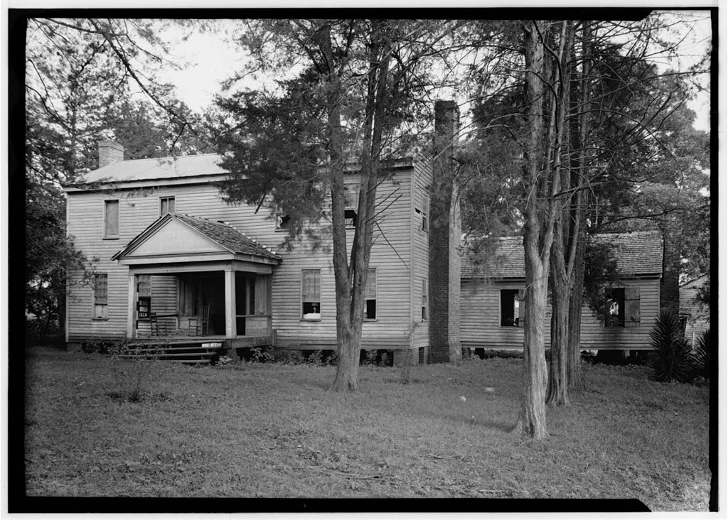


San Augustine, Texas
San Augustine is a city of 2,054 people in San Augustine County, Texas.
Why visit San Augustine
Townapedia lists 35 museums and landmarks, 3 places to eat and 2 places to stay in and around town.
Highlights include Ezekiel W. Cullen House and Mission Dolores State Historic Site.
August is the warmest month, with average highs of 94°F; January lows average 35°F.
Weather in San Augustine
Forecast from the National Weather Service. Full forecast
About San Augustine
San Augustine is the county seat of San Augustine County in East Texas, United States. Its population was 1,920 at the 2020 census.
From the Wikipedia article San Augustine, Texas (this version), under CC BY-SA 4.0.
Museums and landmarks35

Ezekiel W. Cullen House
Monument and historic site · National Register of Historic Places
Building in San Augustine, San Augustine County, Texas


Mission Dolores State Historic Site
Museum · National Register of Historic Places · 0.5 mi
701 South Broadway Street, San Augustine
Tu-Su 08:00-17:00

San Augustine County Courthouse and Jail
Monument and historic site · National Register of Historic Places
Historic place in San Augustine, San Augustine County, Texas
William Garrett Plantation
Monument and historic site · National Register of Historic Places · 1.8 mi
Historic place in San Augustine, San Augustine County, Texas
23 more on the map.
Restaurants and cafes3

Tasha's Country Kitchen
Restaurant · 1.0 mi
806 North El Camino, San Augustine

Subway
Fast food · Sandwich · 0.9 mi
201 North El Camino, San Augustine
Where to stay2

Budget Inn
Motel and hotel · 0.9 mi
103 South El Camino, San Augustine
Churches and places of worship3

Faith Alive Church
Church · Protestant · 1.0 mi
1013 FM 1277, San Augustine
Greater Mount Olive Baptist Church
Church · Baptist · 0.4 mi
613 Columbia Street, San Augustine
History
The first European settlement in the area began in 1717 with the establishment of Mission Nuestra Señora de los Dolores de los Ais by Spanish missionaries. The mission was abandoned and re-established in 1721. It lasted until 1773 and is now preserved as Mission Dolores State Historic Site.
Before the establishment of the town, a small number of residents lived in the Ayish Bayou area. They had briefly fled during the Fredonian Rebellion in 1822 to escape Mexican forces. The town was established in 1832 under alcalde William McFarland by the site of the mission, then owned by Thomas S. McFarland. The town was named after the Presidio de San Agustín de Ahumada, which had been named in honor of the (1755–1761) Viceroy of New Spain, Don Agustín de Ahumada y Villalón. McFarland laid out a grid of 356 plots, making it the first town laid out in the Anglo-American style rather than the Spanish one.
From the History section of San Augustine, Texas on Wikipedia, under CC BY-SA 4.0.
Shopping1
Gas and EV charging7
Schools, colleges and libraries5
Healthcare2
CHI St. Luke’s Health Memorial San Augustine
Hospital · 0.5 mi
511 East Hospital Street, San Augustine
Brookshire Brothers Pharmacy
Clinic and pharmacy · 0.5 mi
705 West Columbia Street, San Augustine
Map of San Augustine
58 places. The map loads OpenStreetMap tiles when you open it.
Climate by month
Monthly table
| Month | High | Low | Rain | Snow |
|---|---|---|---|---|
| Jan | 60°F | 35°F | 5.0 in | 0.1 in |
| Feb | 63°F | 39°F | 5.1 in | 0.1 in |
| Mar | 70°F | 45°F | 5.2 in | 0.0 in |
| Apr | 77°F | 52°F | 4.7 in | 0.0 in |
| May | 84°F | 61°F | 4.3 in | 0.0 in |
| Jun | 90°F | 68°F | 4.8 in | 0.0 in |
| Jul | 94°F | 70°F | 3.2 in | 0.0 in |
| Aug | 94°F | 70°F | 4.3 in | 0.0 in |
| Sep | 88°F | 64°F | 4.2 in | 0.0 in |
| Oct | 80°F | 53°F | 4.8 in | 0.0 in |
| Nov | 70°F | 44°F | 4.7 in | 0.0 in |
| Dec | 61°F | 36°F | 5.4 in | 0.0 in |
U.S. Climate Normals 1991-2020 for San Augustine (1 mi away), NOAA NCEI.
People and cost of living
American Community Survey 5-year estimates, 2020-2024, U.S. Census Bureau. Estimates have margins of error, larger for small towns.
Disaster history
San Augustine County has had 21 federal disaster declarations since 2000, most often for hurricanes.
- 2024-07-09: Hurricane Beryl (Hurricane)
- 2024-05-17: Severe Storms, Straight-Line Winds, Tornadoes, And Flooding (Flood)
- 2021-02-19: Severe Winter Storms (Severe Ice Storm)
- 2021-02-14: Severe Winter Storm (Severe Ice Storm)
- 2020-08-24: Tropical Storms Marco And Laura (Hurricane)
- 2020-03-25: Covid-19 Pandemic (Biological)
OpenFEMA disaster declarations summaries.
Getting there and nearby towns
A L Mangham Junior Regional Airport (OCH) is the nearest airport with scheduled flights listed in OpenStreetMap, 35 miles away.
- Hemphill 20 mi southeast, about 32 min by car
- Milam 20 mi east, about 32 min by car
- Zwolle 29 mi east, about 46 min by car
- Garrison 30 mi northwest, about 49 min by car
- Nacogdoches 32 mi west, about 52 min by car
- Huntington 32 mi southwest, about 52 min by car
- Logansport 32 mi north, about 51 min by car
- Many 37 mi east, about 1 h by car
- Lufkin 39 mi west, about 1 h by car
- Mansfield 42 mi northeast, about 1 h 15 min by car
Drive times are estimates from straight-line distance, not routes.
Local news
Headlines from INDB, the NEMICO news database.
Reviews, tips and questions
Loading what members have shared...
Sources and licences
- NCES EDGE (Public domain): public schools
- NOAA NCEI U.S. Climate Normals 1991-2020 (Public domain): climate by month
- OpenFEMA (Public domain): disaster declarations
- OpenStreetMap contributors (ODbL 1.0): places, airports, map data
- U.S. Census Bureau (Public domain): population, income, housing, education, commute
- Wikidata (CC0 1.0): elevation, founding date, time zone, website, landmarks and historic places
- Wikimedia Commons (see each image): photos
- Wikipedia (CC BY-SA 4.0): overview and history text
Photo credits
- Hail Blount House, San Augustine, Texas, Harry L. Starnes, Public domain
- San augustine county tx former jail, Larry D. Moore, CC BY 4.0
- San Augustine County Courthouse, San Augustine, Texas 1709101414 (37087464951), Patrick Feller from Humble, Texas, USA, CC BY 2.0
- Gazebo, San Augustine County Courthouse, Texas 1709101403 (36415732993), Patrick Feller from Humble, Texas, USA, CC BY 2.0
- San Augustine County Courthouse, San Augustine, Texas 1709101406 (37087478651), Patrick Feller from Humble, Texas, USA, CC BY 2.0
- San Augustine County Courthouse, San Augustine, Texas 1709101426 (36832379980), Patrick Feller from Humble, Texas, USA, CC BY 2.0
- San augustine county tx courthouse 2015, Larry D. Moore, CC BY 4.0
- Ezekiel Cullen House, San Augustine, Texas, Harry L. Starnes, Public domain
- Mission Nuestra Senora de los Dolores de los Ais Site (1 of 1), Renelibrary, CC BY-SA 4.0
- Gary Brewer's Deck House from North Broadway, Embyarby, CC0
- Gary Brewer's Deck House from West Main, Embyarby, CC0
- Fannie Ratchford 1970 101 1296, Texas State Archives, No restrictions
- The Mission Dolores Covered Walkway, Kpalmer2021, CC BY-SA 4.0
- The Mission Dolores Footbridge, Kpalmer2021, CC BY-SA 4.0
- The Mission Dolores Museum, Kpalmer2021, CC BY-SA 4.0
- ISS055-E-33589 - View of Earth, Earth Science and Remote Sensing Unit, NASA Johnson Space Center, Public domain
- ISS015-E-24991 - View of Earth, Earth Science and Remote Sensing Unit , Lyndon B. Johnson Space Center, Public domain
- ISS048-E-72011 - View of Earth, Earth Science and Remote Sensing Unit , Lyndon B. Johnson Space Center, Public domain


Page built October 30, 2026. Spotted a mistake? Tell us or suggest a place.