


Sandy Hook, Connecticut
Sandy Hook is a community of 9,863 people in Connecticut, founded in 1711.
Why visit Sandy Hook
Townapedia lists 24 museums and landmarks, 51 parks and trails, 37 places to eat, 1 place to stay and 11 attractions in and around town.
Highlights include Stevenson Dam Bridge, Cedar Hill, Russian Village Historic District and Aaron Bronson House.
Weather in Sandy Hook
Forecast from the National Weather Service. Full forecast
About Sandy Hook
Sandy Hook is a village in the town of Newtown, Connecticut, United States, founded in 1711. It was listed as a census-designated place prior to the 2020 census. According to the United States Census Bureau in 2021, it has a population of 9,114.
From the Wikipedia article Sandy Hook, Connecticut (this version), under CC BY-SA 4.0.
Things to do11

Stevenson Dam Bridge
Bridge · 4.1 mi
Bridge in United States of America


Museums and landmarks24

Russian Village Historic District
Monument and historic site · National Register of Historic Places · 2.8 mi
Listed on the National Register of Historic Places in Connecticut

Aaron Bronson House
Monument and historic site · National Register of Historic Places · 5.3 mi
Historic house at 846 Southford Road in Southbury, Connecticut

Caleb Baldwin Tavern
Monument and historic site · National Register of Historic Places · 3.4 mi
Building in Connecticut, United States
Camps Nos. 10 and 41 of Rochambeau's Army
Monument and historic site · National Register of Historic Places · 3.1 mi
Archaeological site in Newtown, Connecticut

Daniel Basset House
Monument and historic site · National Register of Historic Places · 4.7 mi
Historic house in Connecticut, United States

Glover House
Monument and historic site · National Register of Historic Places · 3.5 mi
Known also as Budd House, NRHP-listed in Fairfield County
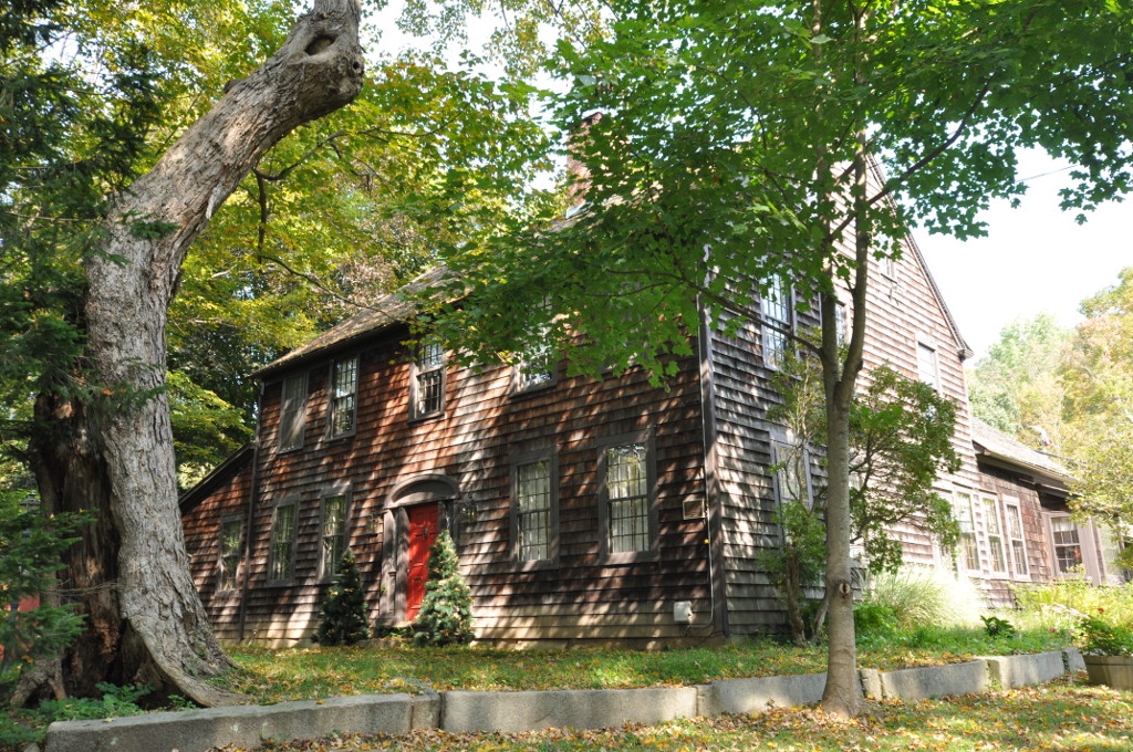
John Glover House
Monument and historic site · National Register of Historic Places · 4.3 mi
Newtown, Connecticut, NRHP-listed
Nathan B. Lattin Farm
Monument and historic site · National Register of Historic Places · 3.2 mi
Building in Connecticut, United States
Newtown Borough Historic District
Monument and historic site · National Register of Historic Places · 3.4 mi
Historic district in Newtown, Connecticut

Plaster House
Monument and historic site · National Register of Historic Places · 4.8 mi
House in Southbury, Connecticut

Quaker Farms Historic District
Monument and historic site · National Register of Historic Places · 4.6 mi
Historic district in Connecticut, United States
Sanford Road Historic District
Monument and historic site · National Register of Historic Places · 4.7 mi
Historic district in Southbury, Connecticut
12 more on the map.
Parks, trails and playgrounds51



Webb Mountain Park
Park · 4.7 mi
Park in Connecticut, United States of America, United States of America

Town Open Space (Cedar Hill Road)
Hiking and trails · 3.1 mi
Municipal, Open To Public Without Fee
Town Open Space (High Rock Road)
Hiking and trails · 1.5 mi
Municipal, Open To Public Without Fee
Bagburn Estates Tract
Hiking and trails · 3.1 mi
Municipal, Open To Public Without Fee

Halfway River Acquistion
Hiking and trails · 2.9 mi
Municipal, Open To Public Without Fee
39 more on the map.
Restaurants and cafes37


Cosmic Cafe + Smoothie Bar
Cafe · Coffee Shop · 3.3 mi
282 South Main Street
Mo-Fr 06:30-16:30; Sa,Su 07:30-16:30
Maggie McFly's
Restaurant · 3.5 mi
971 Main Street South, Southbury
Mo-Th 11:30-01:00; Fr,Sa 11:30-02:00; Su 10:00-01:00
Burrito Shack
Restaurant · Mexican · 3.5 mi
314 South Main Street, Newtown
Mo-Fr 11:00-20:00; Sa,Su 12:00-19:00
Jewel Of Himalaya
Restaurant · Indian, Asian, Nepalese, Tibetan, Himalayan · 3.2 mi
266 South Main Street, Newtown
Newtown Deli
Restaurant · Deli · 2.8 mi
79 South Main Street, Newtown
06:00-21:00

Burgerritoville
Diner · American · 2.9 mi
Tu 11:00-20:00, We 11:00-21:00, Th 11:00-24:00, Fr 11:00-23:00, Sa...
25 more on the map.
History
Sandy Hook was founded in 1711 when several proprietors with land in the area relocated together to reduce isolation. Within a year of the settlement of Newtown, some of its proprietors began moving away from the central village to some of their larger parcels. Colonists found that the Pootatuck River at Sandy Hook allowed for saw and gristmills, leading to it becoming one of the first outlying areas to be settled.
In 1839, the chemist and engineer Charles Goodyear accidentally invented the process of vulcanization while living on Glen Road, to the north of Sandy Hook center. This led to the creation and prosperity of the Goodyear Rubber Packing factory in the following 15 years, and hugely impacted the manufacturing industry in the following decades.
The Sandy Hook neighborhood did not grow dramatically until the mid-19th century post-industrialization, due to innovation and economic growth caused by businesses such as the Goodyear Rubber Packing Factory.
From the History section of Sandy Hook, Connecticut on Wikipedia, under CC BY-SA 4.0.
Where to stay1
Churches and places of worship5
Saint Rose of Lima Roman Catholic Church
Church · Roman Catholic · 2.9 mi
46 Church Hill Road, Newtown
Shopping7
Gas and EV charging6
Schools, colleges and libraries20
Healthcare3
Map of Sandy Hook
165 places. The map loads OpenStreetMap tiles when you open it.
People and cost of living
American Community Survey 5-year estimates, 2020-2024, U.S. Census Bureau. Estimates have margins of error, larger for small towns.
Disaster history
The county has had 25 federal disaster declarations since 2000, most often for hurricanes.
- 2024-09-20: Severe Storm, Flooding, Landslides, And Mudslides (Severe Storm)
- 2024-08-21: Severe Storms, Flooding, Landslides, And Mudslides (Severe Storm)
- 2021-10-30: Remnants Of Hurricane Ida (Hurricane)
- 2021-08-22: Hurricane Henri (Hurricane)
- 2021-01-12: Tropical Storm Isaias (Hurricane)
- 2020-08-06: Tropical Storm Isaias (Hurricane)
OpenFEMA disaster declarations summaries.
Getting there and nearby towns
Waterbury-Oxford Airport (OXC) is the nearest airport with scheduled flights listed in OpenStreetMap, 7 miles away.
- Newtown 4 mi west, about 6 min by car
- East Village 4 mi southeast, about 7 min by car
- Heritage Village 5 mi north, about 9 min by car
- Stepney 6 mi south, about 10 min by car
- Shelton 9 mi southeast, about 14 min by car
- Bethel 9 mi west, about 15 min by car
- Daniels Farm 9 mi south, about 15 min by car
- Tashua 9 mi south, about 15 min by car
- Ansonia 10 mi southeast, about 16 min by car
- Derby 10 mi southeast, about 16 min by car
Drive times are estimates from straight-line distance, not routes.
Local news
Headlines from INDB, the NEMICO news database.
Reviews, tips and questions
Loading what members have shared...
Sources and licences
- NCES EDGE (Public domain): public schools
- OpenFEMA (Public domain): disaster declarations
- OpenStreetMap contributors (ODbL 1.0): places, airports, map data
- U.S. Census Bureau (Public domain): population, income, housing, education, commute
- Wikidata (CC0 1.0): elevation, founding date, time zone, website, landmarks and historic places
- Wikimedia Commons (see each image): photos
- Wikipedia (CC BY-SA 4.0): overview and history text
Photo credits
- SanfordRoad, LisaHendricks, CC BY-SA 3.0
- NewtownCT HawleySchool RochambeauCampMarker, User:Magicpiano, CC BY-SA 4.0
- Lenore H. Davidson Building at the Southbury Training School, Johnhirschauer, CC0
- NEWTOWNEDMONDTOWNHALL01, The original uploader was Polaron at English Wikipedia ., CC BY 2.5
- SouthburyCT WilliamHurdHouse, Magicpiano, CC BY-SA 4.0
- 50 Main Street, Newtown CT, John Phelan, CC BY-SA 3.0
- SouthburyCT AaronBronsonHouse, Magicpiano, CC BY-SA 4.0
- NewtownCT JohnGloverHouse, Magicpiano, CC BY-SA 4.0
- MonroeCT DanielBassetHouse, Magicpiano, CC BY-SA 4.0
- OxfordCT QuakerFarmsHD2, Magicpiano, CC BY-SA 4.0
- PlasterHouse, LisaHendricks, CC BY-SA 3.0
- 32 Main Street, Newtown CT, John Phelan, CC BY-SA 3.0
- Paugussett Trail footbridge over Round Hill Brook in Webb Mountain Park Monroe CT IMG 5015, Morrowlong, CC BY-SA 4.0
- Newtown Tornado Damage 2, Runningonbrains, Public domain
- Newtown tornado damage, Unknown author, Public domain
- State Boat Launch - panoramio, Csouthard, CC BY-SA 3.0
- NewtownCT ThurberHouse, Magicpiano, CC BY-SA 4.0
- Lake Zoar - panoramio, Csouthard, CC BY-SA 3.0
- BBHTZoarTrailPryddenFalls1, H. Morrow Long, CC BY-SA 3.0
- Kettletown State Park Miller Trail Lake Zoar Overloop, Morrowlong, CC BY-SA 4.0
- BBHTKettletownMillerTrail, H. Morrow Long, CC BY-SA 3.0
- BBHTZoarTrailPryddenFalls2, H. Morrow Long, CC BY-SA 3.0
- Bacon (4905053979), Peter Galvin, CC BY 2.0
- Lake Zoar old bridge 105, Pedro Xing, CC0
- ISS019-E-20372 - View of Earth, Earth Science and Remote Sensing Unit , Lyndon B. Johnson Space Center, Public domain
- ISS030-E-64730 - View of Earth, Earth Science and Remote Sensing Unit , Lyndon B. Johnson Space Center, Public domain
- ISS030-E-106230 - View of Earth, Earth Science and Remote Sensing Unit , Lyndon B. Johnson Space Center, Public domain
- ISS038-E-31263 - View of Earth, Earth Science and Remote Sensing Unit , Lyndon B. Johnson Space Center, Public domain
- ISS027-E-9277 - View of Earth, Earth Science and Remote Sensing Unit , Lyndon B. Johnson Space Center, Public domain
- Glen Road bridge 104, Pedro Xing, CC0
- Lake Zoar 106, Pedro Xing, CC0
- NewtownCT NewYorkBeltingAndPackingCompany, Magicpiano, CC BY-SA 4.0
- Tricholoma saponaceum 105820528, Kristof Zyskowski, CC BY 4.0
- Tricholoma saponaceum 105820526, Kristof Zyskowski, CC BY 4.0
- Kettletown-Crest-Trail-Housatonic, Morrowlong, CC BY-SA 4.0
- Lake Zoar September 2010 - panoramio, Csouthard, CC BY-SA 3.0
- Lake Zoar - panoramio (1), Csouthard, CC BY-SA 3.0
- Looking Southeast from Jackson's Cove - panoramio, Csouthard, CC BY-SA 3.0
- SouthburyCT RussianVillage 3, Magicpiano, CC BY-SA 4.0
- SouthburyCT RussianVillage 1, Magicpiano, CC BY-SA 4.0


Page built October 30, 2026. Spotted a mistake? Tell us or suggest a place.