

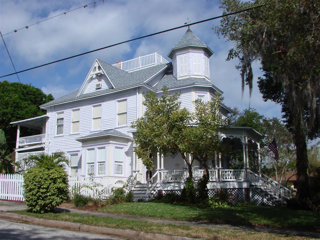


Satellite Beach, Florida
Satellite Beach is a city of 11,313 people in Brevard County, Florida.
Why visit Satellite Beach
Townapedia lists 4 museums and landmarks, 11 parks and trails, 10 places to eat and 2 attractions in and around town.
Highlights include Eau Gallie Causeway, Mathers Bridge, William H. Gleason House and Foosaner Art Museum.
July is the warmest month, with average highs of 91°F; January lows average 50°F.
Weather in Satellite Beach
Forecast from the National Weather Service. Full forecast
About Satellite Beach
Satellite Beach is a coastal city in Brevard County, Florida, U.S. The population was 11,226 at the 2020 United States census, up from 10,109 at the 2010 census, and it is located with the Atlantic Ocean to the east and the Banana River to the west. Satellite Beach is part of the Palm Bay–Melbourne–Titusville, Florida Metropolitan Statistical Area.
From the Wikipedia article Satellite Beach, Florida (this version), under CC BY-SA 4.0.
Things to do2

Eau Gallie Causeway
Bridge · 3.4 mi
Bridge in United States of America

Museums and landmarks4
William H. Gleason House
Monument and historic site · National Register of Historic Places · 3.6 mi
Building in Florida, United States



Candy Cane Lane
Monument and historic site · 1.0 mi
In December only, residents of Verbenia Court put up their lights, and they go all-out. Stop by and drive or walk down this charming...
Dec 01-Jan 01
Parks, trails and playgrounds11




Restaurants and cafes10

Da Kine Diego's
Restaurant · Burrito, Tacos · 0.6 mi
1360 Florida A1A, Satellite Beach
Mo-Sa 11:00-21:00; Su 12:00-20:00
Pizza Hut
Restaurant · Pizza · 0.6 mi
1024 Highway A1A, Satellite Beach
Su-Th 10:00-24:00; Fr-Sa 10:00-01:00

Taco Bell
Fast food · Tex-Mex · 0.6 mi
1004 Highway A1A, Satellite Beach
Mo-Fr 00:00-01:00,09:00-22:00,09:00-24:00; Sa-Su...
History
Satellite Beach became incorporated in 1957 by Percy L. Hedgecock and his brothers, B. D. (Shine) and Herbert (Hub) Hedgecock, along with cousins Jimmy Caudle and Dumont Smith. Hedgecock also served as the town's first mayor from 1957 until 1973.
In 2010, the city began planning for a rise in sea level resulting from climate change.
As of 2011, volunteers have provided more than 10,000 hours each year to youth and public service programs.
In 2011, the city became one of the first areas in the United States to install solar panels on municipal buildings.
In 2013, the city announced that it would undertake $36 million worth of work to restore beach areas and dunes along the coast, battered by hurricanes in 2004. The project was underwritten by Brevard County and the Florida Department of Environmental Protection.
As of 2013, the only traditional Jewish synagogue, Chabad of the Space & Treasure Coasts, along the Brevard County coastline is in the city.
On December 4, 2013, there was a parade in celebration of the Jewish holiday of Hanukkah. There were one hundred Menorah-topped vehicles, a Menorah lighting, free food (including traditional Latkes), and live entertainment.
As of 2013, the annual Ocean, Reef, and Beach Festival is organized by the Surfrider Foundation, Pure Ocean TV Productions and Anglers for Conservation.
From the History section of Satellite Beach, Florida on Wikipedia, under CC BY-SA 4.0.
Churches and places of worship5
Calvary Chapel Surfside
Church · Nondenominational · 0.5 mi
505 Cinnamon Drive, Satellite Beach
Oceanside Community Church
Church · Southern Baptist · 0.5 mi
305 Cassia Boulevard, Satellite Beach
Shopping2
Schools, colleges and libraries23
Ocean Breeze Elementary School
School · 2.0 mi
1101 Cheyenne Dr, Indian Harbour Beach
Healthcare1
Map of Satellite Beach
58 places. The map loads OpenStreetMap tiles when you open it.
Climate by month
Monthly table
| Month | High | Low | Rain | Snow |
|---|---|---|---|---|
| Jan | 72°F | 50°F | 2.8 in | 0.0 in |
| Feb | 75°F | 53°F | 2.3 in | 0.0 in |
| Mar | 78°F | 56°F | 2.9 in | 0.0 in |
| Apr | 82°F | 61°F | 2.5 in | 0.0 in |
| May | 86°F | 67°F | 3.8 in | 0.0 in |
| Jun | 89°F | 72°F | 7.5 in | 0.0 in |
| Jul | 91°F | 73°F | 6.8 in | 0.0 in |
| Aug | 91°F | 73°F | 7.5 in | 0.0 in |
| Sep | 89°F | 73°F | 8.6 in | 0.0 in |
| Oct | 84°F | 68°F | 5.3 in | 0.0 in |
| Nov | 78°F | 60°F | 2.6 in | 0.0 in |
| Dec | 74°F | 54°F | 2.7 in | 0.0 in |
U.S. Climate Normals 1991-2020 for Melbourne Wfo (6 mi away), NOAA NCEI.
People and cost of living
American Community Survey 5-year estimates, 2020-2024, U.S. Census Bureau. Estimates have margins of error, larger for small towns.
Disaster history
Brevard County has had 31 federal disaster declarations since 2000, most often for hurricanes.
- 2024-10-11: Hurricane Milton (Hurricane)
- 2024-10-07: Hurricane Milton (Hurricane)
- 2024-08-10: Hurricane Debby (Tropical Storm)
- 2024-08-03: Tropical Storm Debby (Tropical Storm)
- 2023-08-31: Hurricane Idalia (Hurricane)
- 2023-08-28: Tropical Storm Idalia (Tropical Storm)
OpenFEMA disaster declarations summaries.
Getting there and nearby towns
Patrick Space Force Base (COF) is the nearest airport with scheduled flights listed in OpenStreetMap, 4 miles away.
- Melbourne 6 mi southwest, about 10 min by car
- Merritt Island 10 mi northwest, about 16 min by car
- Cocoa Beach 11 mi north, about 17 min by car
- Rockledge 13 mi northwest, about 21 min by car
- Cape Canaveral 15 mi north, about 24 min by car
- Palm Bay 16 mi south, about 26 min by car
- Cocoa 17 mi northwest, about 27 min by car
- Port St. John 24 mi northwest, about 39 min by car
- St. Cloud 42 mi west, about 1 h by car
- Alafaya 43 mi northwest, about 1 h 15 min by car
Drive times are estimates from straight-line distance, not routes.
Local news
Headlines from INDB, the NEMICO news database.
Reviews, tips and questions
Loading what members have shared...
Sources and licences
- NCES EDGE (Public domain): public schools
- NOAA NCEI U.S. Climate Normals 1991-2020 (Public domain): climate by month
- OpenFEMA (Public domain): disaster declarations
- OpenStreetMap contributors (ODbL 1.0): places, airports, map data
- U.S. Census Bureau (Public domain): population, income, housing, education, commute
- Wikidata (CC0 1.0): elevation, founding date, time zone, website, landmarks and historic places
- Wikimedia Commons (see each image): photos
- Wikipedia (CC BY-SA 4.0): overview and history text
Photo credits
- Bridge at Merritt Island, Florida, Jason Ralston from Ormond Beach, United states of AMERICA, CC BY 2.0
- Williamhgleasonhouse, Fl295 at English Wikipedia, Public domain
- Foosaner Art Museum 001, Leonard J. DeFrancisci, CC BY-SA 3.0
- Eau Gallie Causeway 1, Leonard J. DeFrancisci, CC BY-SA 3.0
- FL513fnRoadAerial-May2014, formulanone, CC BY-SA 2.0
- TropicalTrailHomes-Docks, formulanone, CC BY-SA 2.0
- ISS030-E-50515 - View of Earth, Earth Science and Remote Sensing Unit , Lyndon B. Johnson Space Center, Public domain
- ISS051-E-38732 - View of Earth, Earth Science and Remote Sensing Unit , Lyndon B. Johnson Space Center, Public domain
- ISS047-E-84375 - View of Earth, Earth Science and Remote Sensing Unit , Lyndon B. Johnson Space Center, Public domain
- Merritt Island, FL, USA - panoramio, starscream1211, CC BY-SA 3.0


Page built October 30, 2026. Spotted a mistake? Tell us or suggest a place.