


Why visit Seagoville
Townapedia lists 3 museums and landmarks, 5 parks and trails, 15 places to eat and 2 places to stay in and around town.
August is the warmest month, with average highs of 96°F; January lows average 36°F.
Weather in Seagoville
Forecast from the National Weather Service. Full forecast
About Seagoville
Seagoville is a city in Dallas County, Texas, United States, and a suburb of Dallas. A small portion of Seagoville extends into Kaufman County. Its population was 18,446 at the 2020 census. The city is located along U.S.
From the Wikipedia article Seagoville, Texas (this version), under CC BY-SA 4.0.
Museums and landmarks3

Parks, trails and playgrounds5

Post Oak Preserve
Park · 1.5 mi
335 acre preserve managed by Dallas Independent School District as a part of the Environmental Education center located across the street

Restaurants and cafes15




Papa John's
Fast food · Pizza
208 Hall Road, Seagoville
Mo-Th 11:00-21:00; Fr-Sa 11:00-22:00; Su 11:30-21:00
Sonic
Fast food · Burger
202 Hall Road, Seagoville
Mo-Th 06:00-23:00; Fr 06:00-24:00; Sa 07:00-24:00; Su 07:00-23:00
Taco Bell
Fast food · Tex-Mex · 0.8 mi
550 East Malloy Bridge Road, Seagoville
Mo-Th 09:00-02:00; Fr-Sa 09:00-03:00; Su 09:00-02:00
Wendy's
Fast food · Burger · 0.8 mi
605 East Malloy Bridge Road, Seagoville
Mo-Sa 07:00-22:00; Su 08:00-22:00
3 more on the map.
Where to stay2

History
Seagoville was originally called Seago, and under this name was laid out in 1876 by T. K. Seago (1836–1904), and named after him. The United States Post Office changed the town's name to "Seagoville" in 1910 to prevent confusion with another city in Texas called Sego.
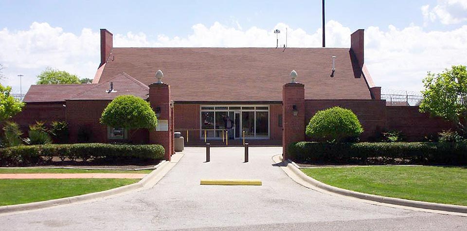
During World War II, the Federal Reformatory for Women in Seagoville was the site of an Immigration and Naturalization Service detention camp for Japanese, German, and Italian Americans classified as "enemy aliens" and women of Japanese and German ancestry deported from Latin America. Internees at Seagoville published a German-language newsletter called the Sägedorfer Fliegende Blätter. The camp housed up to 647 people, and was closed in June 1945, after the internees were either "repatriated" to Japan or Germany, or transferred to Crystal City, Texas.
From the History section of Seagoville, Texas on Wikipedia, under CC BY-SA 4.0.
Churches and places of worship21
Methodist Church of Seagoville
Church · Methodist · 1.0 mi
101 South Kaufman Street, Seagoville
Seagoville Church of Christ
Church · Church Of Christ · 0.8 mi
510 North Kaufman Street, Seagoville
Shopping3
Gas and EV charging13
Schools, colleges and libraries36
Healthcare2
Map of Seagoville
100 places. The map loads OpenStreetMap tiles when you open it.
Climate by month
Monthly table
| Month | High | Low | Rain |
|---|---|---|---|
| Jan | 58°F | 36°F | 3.0 in |
| Feb | 62°F | 39°F | 3.1 in |
| Mar | 69°F | 45°F | 4.0 in |
| Apr | 77°F | 53°F | 3.9 in |
| May | 84°F | 63°F | 4.3 in |
| Jun | 92°F | 71°F | 4.0 in |
| Jul | 96°F | 74°F | 2.0 in |
| Aug | 96°F | 73°F | 2.8 in |
| Sep | 90°F | 66°F | 2.7 in |
| Oct | 80°F | 55°F | 4.9 in |
| Nov | 67°F | 45°F | 2.8 in |
| Dec | 59°F | 37°F | 3.5 in |
U.S. Climate Normals 1991-2020 for Ferris (11 mi away), NOAA NCEI.
People and cost of living
American Community Survey 5-year estimates, 2020-2024, U.S. Census Bureau. Estimates have margins of error, larger for small towns.
Disaster history
Dallas County has had 18 federal disaster declarations since 2000, most often for hurricanes.
- 2024-05-17: Severe Storms, Straight-Line Winds, Tornadoes, And Flooding (Flood)
- 2021-02-19: Severe Winter Storms (Severe Ice Storm)
- 2021-02-14: Severe Winter Storm (Severe Ice Storm)
- 2020-08-24: Tropical Storms Marco And Laura (Hurricane)
- 2020-03-25: Covid-19 Pandemic (Biological)
- 2020-03-13: Covid-19 (Biological)
OpenFEMA disaster declarations summaries.
Getting there and nearby towns
Terrell Municipal Airport (TRL) is the nearest airport with scheduled flights listed in OpenStreetMap, 17 miles away.
- Balch Springs 6 mi northwest, about 10 min by car
- Heartland 6 mi east, about 9 min by car
- Mesquite 8 mi north, about 12 min by car
- Forney 8 mi northeast, about 13 min by car
- Lancaster 14 mi west, about 22 min by car
- Heath 15 mi north, about 24 min by car
- Dallas 16 mi northwest, about 26 min by car
- Red Oak 17 mi southwest, about 27 min by car
- Garland 18 mi north, about 30 min by car
- Rowlett 18 mi north, about 29 min by car
Drive times are estimates from straight-line distance, not routes.
Local news
Headlines from INDB, the NEMICO news database.
Reviews, tips and questions
Loading what members have shared...
Sources and licences
- NCES EDGE (Public domain): public schools
- NOAA NCEI U.S. Climate Normals 1991-2020 (Public domain): climate by month
- OpenFEMA (Public domain): disaster declarations
- OpenStreetMap contributors (ODbL 1.0): places, airports, map data
- U.S. Census Bureau (Public domain): population, income, housing, education, commute
- Wikidata (CC0 1.0): elevation, founding date, time zone, website
- Wikimedia Commons (see each image): photos
- Wikipedia (CC BY-SA 4.0): overview and history text
Photo credits
- SeaggovilleFCIlarge, Federal Bureau of Prisons, Public domain
- Favolus brasiliensis 25242498, Annika Lindqvist, CC BY 4.0
- Favolus brasiliensis 25242496, Annika Lindqvist, CC BY 4.0
- Favolus brasiliensis 25242500, Annika Lindqvist, CC BY 4.0
- Favolus brasiliensis 25242501, Annika Lindqvist, CC BY 4.0
- Crepis zacintha 364324021, Annika Lindqvist, CC BY 4.0
- Euphorbia humistrata, Annika Lindqvist, CC BY 4.0

Page built October 30, 2026. Spotted a mistake? Tell us or suggest a place.