


Selma, Alabama
Selma is a city of 17,057 people in Dallas County, Alabama, founded in 1815.
Why visit Selma
Townapedia lists 29 museums and landmarks, 11 parks and trails, 26 places to eat, 5 places to stay and 4 attractions in and around town.
Highlights include Walton Theater Selma, The National Voting Rights Museum & Institute II, Edmund Pettus Bridge and Selma Country Club.
July is the warmest month, with average highs of 93°F; January lows average 36°F.
Weather in Selma
Forecast from the National Weather Service. Full forecast
About Selma
Selma is a city in and the county seat of Dallas County, in the Black Belt region of south central Alabama and extending to the west. Located on the banks of the Alabama River, the city has a population of 17,971 as of the 2020 census. About 80% of the population is African-American.
From the Wikipedia article Selma, Alabama (this version), under CC BY-SA 4.0.
Things to do4


Museums and landmarks29

The National Voting Rights Museum & Institute II
Museum · 1.5 mi
6 US Highway 80 East, Selma
Mo-Th 10:00-16:00; Fr-Su "By appointment only"

Edmund Pettus Bridge
Monument and historic site · National Register of Historic Places · 1.3 mi
Historic bridge in Selma, Alabama, United States

Icehouse Historic District
Monument and historic site · National Register of Historic Places · 0.5 mi
Historic district in Alabama, United States

Old Town Historic District
Monument and historic site · National Register of Historic Places · 0.8 mi
Historic district in Selma, Alabama, USA

Riverview Historic District
Monument and historic site · National Register of Historic Places · 1.0 mi
Historic district in Selma, Alabama
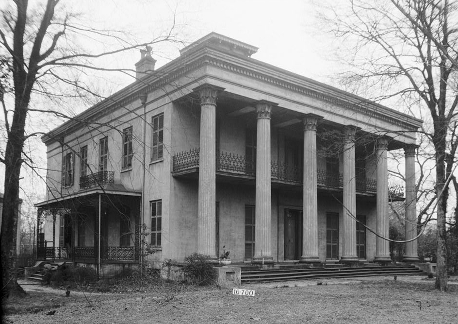
Sturdivant Hall
Monument and historic site · National Register of Historic Places · 0.5 mi
Building in Alabama, United States
713 Mabry Street, Selma
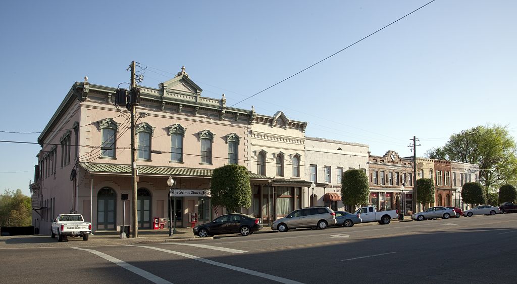
Water Avenue Historic District
Monument and historic site · National Register of Historic Places · 1.3 mi
Historic district in Alabama, United States

John Tyler Morgan House
Monument and historic site · National Register of Historic Places · 0.5 mi
Historic house in Alabama, United States

Joseph T. Smitherman Historic Building
Monument and historic site · National Register of Historic Places · 1.0 mi
County courthouse and former hospital in Selma, Alabama

Marcus Meyer Skinner House
Monument and historic site · National Register of Historic Places · 1.5 mi
Historic house in Alabama, United States

Marshall's Grove
Monument and historic site · National Register of Historic Places · 3.8 mi
Human settlement in Alabama, United States of America

Sullivan and Richie Jean Jackson House
Monument and historic site · National Register of Historic Places
Civil Rights Heritage Site
17 more on the map.
Parks, trails and playgrounds11






Restaurants and cafes26



Captain D's
Fast food · Seafood · 1.2 mi
1516 West Highland Avenue, Selma
Mo-Th 10:30-22:00; Fr-Sa 10:30-23:00; Su 10:30-22:00
Domino's
Fast food · Pizza · 0.9 mi
2225 Summerfield Road, Selma
Mo-Th 10:30-24:00; Fr-Sa 10:30-01:00; Su 10:30-24:00
14 more on the map.
History
Before discovery and settlement by Europeans, the area of present-day Selma had been inhabited for thousands of years by various warring tribes of Native Americans. The Europeans encountered the historic Native American people known as the Muscogee (also known as the Creek), who had been in the area for hundreds of years.
French explorers and colonists were the first Europeans to explore this area. In 1732, they recorded the site of present-day Selma as Écor Bienville. Later Anglo-Americans called it the Moore's Bluff settlement. Selma was incorporated in 1820. The city was planned and named as Selma by William R. King, a politician and planter from North Carolina who was a future vice president of the United States. The name, meaning 'high seat' or 'throne', came from the Ossianic poem The Songs of Selma by Scottish poet James Macpherson.
From the History section of Selma, Alabama on Wikipedia, under CC BY-SA 4.0.
Where to stay5
Churches and places of worship55
Tabernacle Baptist Church
Church · Baptist · National Register of Historic Places · 0.7 mi
Brown Chapel A.M.E. Church
Church · National Register of Historic Places · 1.2 mi
First Baptist Church
Church · National Register of Historic Places · 1.1 mi
St. Paul's Episcopal Church
Church · National Register of Historic Places · 1.0 mi
Valley Creek Presbyterian Church
Church · National Register of Historic Places · 3.8 mi
Brown Chapel AME Church;Brown Chapel African Methodist Episcopal Church
Church · African Methodist Episcopal · 1.2 mi
Shopping6
Gas and EV charging8
Schools, colleges and libraries36
Bruce K Craig Elementary School
School · 4.8 mi
Building 108 Craig Ind Park, Selma
Healthcare5
Map of Selma
185 places. The map loads OpenStreetMap tiles when you open it.
Climate by month
Monthly table
| Month | High | Low | Rain | Snow |
|---|---|---|---|---|
| Jan | 59°F | 36°F | 5.1 in | 0.2 in |
| Feb | 63°F | 39°F | 5.3 in | 0.0 in |
| Mar | 71°F | 46°F | 5.3 in | 0.2 in |
| Apr | 78°F | 52°F | 4.6 in | 0.0 in |
| May | 85°F | 61°F | 4.1 in | 0.0 in |
| Jun | 91°F | 69°F | 4.3 in | 0.0 in |
| Jul | 93°F | 72°F | 5.1 in | 0.0 in |
| Aug | 93°F | 71°F | 4.9 in | 0.0 in |
| Sep | 89°F | 67°F | 3.8 in | 0.0 in |
| Oct | 80°F | 55°F | 2.7 in | 0.0 in |
| Nov | 69°F | 43°F | 4.1 in | 0.0 in |
| Dec | 61°F | 38°F | 5.2 in | 0.0 in |
U.S. Climate Normals 1991-2020 for Selma Hcn (1 mi away), NOAA NCEI.
People and cost of living
American Community Survey 5-year estimates, 2020-2024, U.S. Census Bureau. Estimates have margins of error, larger for small towns.
Disaster history
Dallas County has had 19 federal disaster declarations since 2000, most often for hurricanes.
- 2024-09-26: Hurricane Helene (Hurricane)
- 2023-01-15: Severe Storms, Straight-Line Winds, And Tornadoes (Severe Storm)
- 2020-12-10: Hurricane Zeta (Hurricane)
- 2020-09-14: Hurricane Sally (Hurricane)
- 2020-05-21: Severe Storms And Flooding (Severe Storm)
- 2020-03-29: Covid-19 Pandemic (Biological)
OpenFEMA disaster declarations summaries.
Getting there and nearby towns
Craig Field (SEM) is the nearest airport with scheduled flights listed in OpenStreetMap, 6 miles away.
- Selmont-West Selmont 3 mi southeast, about 5 min by car
- Valley Grande 5 mi north, about 8 min by car
- White Hall 20 mi southeast, about 33 min by car
- Marion 22 mi northwest, about 36 min by car
- Autaugaville 22 mi east, about 35 min by car
- Prattville 34 mi east, about 54 min by car
- Millbrook 39 mi east, about 1 h by car
- Montgomery 45 mi east, about 1 h 15 min by car
- Calera 52 mi north, about 1 h 30 min by car
- Pike Road 54 mi east, about 1 h 30 min by car
Drive times are estimates from straight-line distance, not routes.
Local news
Headlines from INDB, the NEMICO news database.
Reviews, tips and questions
Loading what members have shared...
Sources and licences
- NCES EDGE (Public domain): public schools
- NOAA NCEI U.S. Climate Normals 1991-2020 (Public domain): climate by month
- OpenFEMA (Public domain): disaster declarations
- OpenStreetMap contributors (ODbL 1.0): places, airports, map data
- U.S. Census Bureau (Public domain): population, income, housing, education, commute
- Wikidata (CC0 1.0): elevation, founding date, time zone, website, landmarks and historic places
- Wikimedia Commons (see each image): photos
- Wikipedia (CC BY-SA 4.0): overview and history text
Photo credits
- Selma Reformed Presbyterian Church, Ralph Joseph, Public domain
- Sturdivant Hall historical marker, Selma, Nyttend, Public domain
- EF2 damage in Selma, National Oceanic and Atmospheric Administration, Public domain
- Tabernacle Baptist Selma, Nyttend, Public domain
- Wesley Plattenburg House at Selma, AL, RuralSWAlabama, CC BY-SA 3.0
- Representatives Ellison, Walz and McCollum in Selma, Alabama for the 2007 Faith and Politics Civil Rights Pilgrimage (770029912), Keith Ellison from Minneapolis, USA, CC BY 2.0
- First Baptist Church, Selma AL 20160713 1, DXR, CC BY-SA 4.0
- Selma December 2018 25 (Joseph T. Smitherman Historic Building - Vaughan-Smitherman Museum), Michael Barera, CC BY-SA 4.0
- Selma December 2018 20 (Broad Street), Michael Barera, CC BY-SA 4.0
- Selma December 2018 19 (Selma-Dallas County Public Library), Michael Barera, CC BY-SA 4.0
- Selma December 2018 18 (Selma-Dallas County Public Library), Michael Barera, CC BY-SA 4.0
- Selma December 2018 17 (Selma-Dallas County Public Library), Michael Barera, CC BY-SA 4.0
- Selma December 2018 24 (United States Post Office Building), Michael Barera, CC BY-SA 4.0
- "Dinkins Memorial Chapel, Alabama Colored University, Selma, Ala." (NBY 6999), Unknown author Unknown author, Public domain
- Water Avenue Selma Highsmith 01, Carol M. Highsmith, Public domain
- Riverview Historic District Selma Alabama 003, Altairisfar (Jeffrey Reed), CC BY-SA 3.0
- Edmund Pettus Bridge 03, Carol M. Highsmith, Public domain
- Icehouse Historic District Selma Alabama 002, Altairisfar (Jeffrey Reed), CC BY-SA 3.0
- First Baptist Church of Selma, Emmett Tullos from Jackson AL, United States, CC BY 2.0
- Sturdivant Hall 01, W. N. Manning, Public domain
- First Baptist Church of Selma, Alabama, Richard apple, CC BY-SA 3.0
- Marcus Meyer Skinner House 002, Altairisfar (Jeffrey Reed), CC BY-SA 3.0
- St. Paul's Episcopal Church Selma, Emmett Tullos from Jackson AL, United States, CC BY 2.0
- Valley Creek Presbyterian Church, Bjwetherbee, CC BY-SA 3.0
- Marshall's Grove, Mthunter58, CC BY-SA 3.0
- Summerfield Methodist Church, Bjwetherbee, CC BY-SA 3.0
- Federal Building Selma, Carol M. Highsmith, Public domain
- Brown Chapel A.M.E. Church 410 Martin Luther King St, Selma (AL) March 2019 (47980895673), Ron Cogswell from Arlington, Virginia, USA, CC BY 2.0
- Smitherman Building Selma, Altairisfar, Public domain
- John Tyler Morgan House 02, Altairisfar, CC BY-SA 3.0
- Selma December 2018 01 (National Voting Rights Museum and Institute), Michael Barera, CC BY-SA 4.0
- S. and R.J. Jackson House, Nyttend, Public domain
- SturdivantHall, AlabamaSouthern, Public domain
- SturdivantHallPanoramic, AlabamaSouthern, Public domain
- SturdivantHallFront, AlabamaSouthern, Public domain
- SturdivantHallRightSide, AlabamaSouthern, Public domain
- SturdivantHallRightSide2, AlabamaSouthern, Public domain
- John Tyler Morgan House, Alex Bush, Public domain
- WarrenDunn, AlabamaSouthern, Public domain
- WarrenDunn2, AlabamaSouthern, Public domain


Page built October 30, 2026. Spotted a mistake? Tell us or suggest a place.