


Social Circle, Georgia
Social Circle is a city of 5,217 people in Newton County, Georgia.
Why visit Social Circle
Townapedia lists 5 museums and landmarks, 6 parks and trails and 7 places to eat in and around town.
Highlights include Social Circle Historic District and Brick Store.
July is the warmest month, with average highs of 89°F; January lows average 34°F.
Weather in Social Circle
Forecast from the National Weather Service. Full forecast
About Social Circle
Social Circle is a city in southern Walton County, extending into Newton County, in the U.S. state of Georgia, 45 miles (72 km) east of Atlanta. As of the 2020 census, Social Circle had a population of 4,974.
From the Wikipedia article Social Circle, Georgia (this version), under CC BY-SA 4.0.
Museums and landmarks5

Social Circle Historic District
Monument and historic site · National Register of Historic Places · 0.7 mi
Historic districrt in Social Circle, Walton County, Georgia, USA
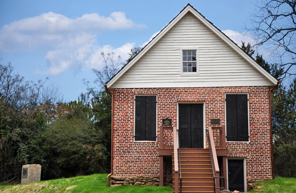
Brick Store
Monument and historic site · National Register of Historic Places · 3.6 mi
On the NRHP in Georgia

Social Circle Welcome Center
Museum · 0.7 mi
129 East Hightower Trail, Social Circle
Mo-Fr 10:00-16:00
Parks, trails and playgrounds6


Restaurants and cafes7

Bread and Butter Bakery
Cafe · Coffee Shop, Coffee · 0.8 mi
109 South Cherokee Road, Social Circle
Mo-Su 07:00-21:00

Tin Plate
Restaurant · Burger, American, Sandwich · 0.6 mi
198 East Sycamore Street, Social Circle
Mo-Th 11:30-22:00; Fr 11:30-22:30; Sa 11:30-23:00; Su 11:30-16:00
Willy's Mex Mex Grill
Restaurant · Mexican · 0.8 mi
123 South Cherokee Road, Social Circle
Mo-Fr 11:00-22:30; Su 12:00-22:00; Sa 12:00-22:30
Grill'n Station
Restaurant · Barbecue · 0.7 mi
151 East Hightower Trail, Social Circle
Tu-Sa 11:00-20:00
Hong Kong Garden
Restaurant · Chinese · 0.7 mi
157 South Cherokee Road, Social Circle
Mo-Sa 11:00-22:00
Hot Rods Diner
Restaurant · 0.9 mi
294 North Cherokee Road, Social Circle

Churches and places of worship8

First Baptist Church
Church · Baptist · 0.9 mi
195 North Cherokee Road, Social Circle
Mars Hill Missionary Baptist Church
Church · Southern Baptist · 1.1 mi
387 West Hightower Trail, Social Circle

History
It is unclear why the name "Social Circle" was applied to this place. According to tradition, Social Circle was named from an incident in which a group of people living in the settlement offered water to a weary traveler, whose response was "This certainly is a social circle". The city also officially notes that a citizen of another village community which was already known by the name of Social Circle joined the settlement in its early days.
Social Circle was incorporated as a town in 1869, and as a city in 1904. The city includes a 132 acre historic district.
In 2026, Immigration and Customs Enforcement (ICE) acquired a one-million square foot warehouse in the city. According to city officials, ICE plans to use the structure as an immigrant detention center holding "anywhere from 7,500 to 10,000 detainees". The city shut off and padlocked the water meter to the proposed site until "ICE indicates how water and sewer will be served without exceeding our limited infrastructure capacity". Later, plans were scrapped, yet the warehouse is still there.
From the History section of Social Circle, Georgia on Wikipedia, under CC BY-SA 4.0.
Shopping2
Gas and EV charging5
Schools, colleges and libraries5
Social Circle Elementary School
School · 0.9 mi
240A W Hightower Trl, Social Circle
Social Circle Primary School
School · 0.9 mi
439 Annie P Henderson Dr, Social Circle
Map of Social Circle
38 places. The map loads OpenStreetMap tiles when you open it.
Climate by month
Monthly table
| Month | High | Low | Rain | Snow |
|---|---|---|---|---|
| Jan | 52°F | 34°F | 4.5 in | 0.7 in |
| Feb | 57°F | 37°F | 5.1 in | 0.3 in |
| Mar | 65°F | 42°F | 5.1 in | 0.0 in |
| Apr | 74°F | 50°F | 3.4 in | 0.0 in |
| May | 81°F | 58°F | 2.9 in | 0.0 in |
| Jun | 87°F | 67°F | 4.6 in | 0.0 in |
| Jul | 89°F | 70°F | 4.5 in | 0.0 in |
| Aug | 88°F | 70°F | 4.2 in | 0.0 in |
| Sep | 84°F | 64°F | 3.8 in | 0.0 in |
| Oct | 74°F | 53°F | 3.2 in | 0.0 in |
| Nov | 63°F | 41°F | 4.2 in | 0.0 in |
| Dec | 56°F | 36°F | 4.9 in | 0.3 in |
U.S. Climate Normals 1991-2020 for Covington Hcn (8 mi away), NOAA NCEI.
People and cost of living
American Community Survey 5-year estimates, 2020-2024, U.S. Census Bureau. Estimates have margins of error, larger for small towns.
Disaster history
Newton County has had 16 federal disaster declarations since 2000, most often for severe storms.
- 2026-10-09: Hurricane Isaias (Tropical Storm)
- 2026-01-24: Severe Winter Storm (Winter Storm)
- 2024-09-30: Hurricane Helene (Hurricane)
- 2024-09-26: Hurricane Helene (Tropical Storm)
- 2023-01-16: Severe Storms, Straight-Line Winds, And Tornadoes (Severe Storm)
- 2020-03-29: Covid-19 Pandemic (Biological)
OpenFEMA disaster declarations summaries.
Getting there and nearby towns
Barrow County Airport (WDR) is the nearest airport with scheduled flights listed in OpenStreetMap, 24 miles away.
- Covington 8 mi west, about 13 min by car
- Oxford 9 mi west, about 15 min by car
- Monroe 11 mi north, about 17 min by car
- Porterdale 12 mi southwest, about 19 min by car
- Madison 14 mi east, about 23 min by car
- Conyers 16 mi west, about 25 min by car
- Loganville 16 mi northwest, about 26 min by car
- Lakeview Estates 19 mi west, about 31 min by car
- Snellville 22 mi northwest, about 36 min by car
- Stonecrest 25 mi west, about 40 min by car
Drive times are estimates from straight-line distance, not routes.
Local news
Headlines from INDB, the NEMICO news database.
Reviews, tips and questions
Loading what members have shared...
Sources and licences
- NCES EDGE (Public domain): public schools
- NOAA NCEI U.S. Climate Normals 1991-2020 (Public domain): climate by month
- OpenFEMA (Public domain): disaster declarations
- OpenStreetMap contributors (ODbL 1.0): places, airports, map data
- U.S. Census Bureau (Public domain): population, income, housing, education, commute
- Wikidata (CC0 1.0): elevation, founding date, time zone, website, landmarks and historic places
- Wikimedia Commons (see each image): photos
- Wikipedia (CC BY-SA 4.0): overview and history text
Photo credits
- Brick Store, Mailsmc, CC BY-SA 3.0
- ISS065-E-327488 - View of Earth, Earth Science and Remote Sensing Unit , Lyndon B. Johnson Space Center, Public domain
- ISS065-E-327487 - View of Earth, Earth Science and Remote Sensing Unit , Lyndon B. Johnson Space Center, Public domain
- ISS047-E-147127 - View of Earth, Earth Science and Remote Sensing Unit , Lyndon B. Johnson Space Center, Public domain
- ISS013-E-44947 - View of South Carolina, Earth Science and Remote Sensing Unit , Lyndon B. Johnson Space Center, Public domain
Page built October 30, 2026. Spotted a mistake? Tell us or suggest a place.