

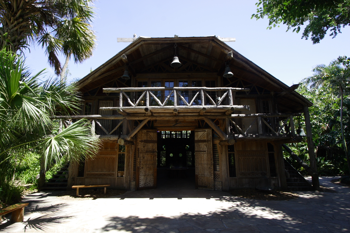


South Beach, Florida
South Beach is a community of 3,063 people in Indian River County, Florida.
Why visit South Beach
Townapedia lists 2 museums and landmarks and 3 parks and trails in and around town.
Highlights include Hallstrom House, McKee Botanical Garden and Round Island Riverside Park.
July is the warmest month, with average highs of 90°F; January lows average 51°F.
Weather in South Beach
Forecast from the National Weather Service. Full forecast
About South Beach
South Beach is a census-designated place (CDP) on North Hutchinson Island in Indian River County, Florida, United States. As of the 2020 census, South Beach had a population of 3,703. It is ranked tenth in Florida locations by per capita income as of 2010.
From the Wikipedia article South Beach, Florida (this version), under CC BY-SA 4.0.
Museums and landmarks2

Hallstrom House
Monument and historic site · National Register of Historic Places · 2.6 mi
Historic house in Florida, United States
McKee Botanical Garden
Monument and historic site · National Register of Historic Places · 3.6 mi
Non-profit organization in the USA
Parks, trails and playgrounds3

Schools, colleges and libraries11



Map of South Beach
16 places. The map loads OpenStreetMap tiles when you open it.
Climate by month
Monthly table
| Month | High | Low | Rain |
|---|---|---|---|
| Jan | 73°F | 51°F | 2.8 in |
| Feb | 76°F | 54°F | 2.2 in |
| Mar | 78°F | 56°F | 2.9 in |
| Apr | 82°F | 61°F | 3.0 in |
| May | 86°F | 67°F | 3.9 in |
| Jun | 88°F | 71°F | 6.7 in |
| Jul | 90°F | 73°F | 5.8 in |
| Aug | 90°F | 73°F | 6.9 in |
| Sep | 88°F | 73°F | 6.3 in |
| Oct | 84°F | 68°F | 5.2 in |
| Nov | 79°F | 61°F | 3.0 in |
| Dec | 75°F | 56°F | 2.3 in |
U.S. Climate Normals 1991-2020 for Ft Pierce St Lucie Co Intl Ap (6 mi away), NOAA NCEI.
People and cost of living
American Community Survey 5-year estimates, 2020-2024, U.S. Census Bureau. Estimates have margins of error, larger for small towns.
Disaster history
Indian River County has had 25 federal disaster declarations since 2000, most often for hurricanes.
- 2024-10-11: Hurricane Milton (Hurricane)
- 2024-10-07: Hurricane Milton (Hurricane)
- 2022-12-13: Hurricane Nicole (Hurricane)
- 2022-11-08: Tropical Storm Nicole (Tropical Storm)
- 2022-09-29: Hurricane Ian (Hurricane)
- 2022-09-24: Tropical Storm Ian (Hurricane)
OpenFEMA disaster declarations summaries.
Getting there and nearby towns
Treasure Coast International Airport (FPR) is the nearest airport with scheduled flights listed in OpenStreetMap, 6 miles away.
- Florida Ridge 3 mi west, about 5 min by car
- Lakewood Park 4 mi southwest, about 7 min by car
- Vero Beach South 6 mi northwest, about 9 min by car
- Vero Beach 6 mi northwest, about 10 min by car
- Fort Pierce North 7 mi south, about 12 min by car
- Gifford 9 mi northwest, about 14 min by car
- West Vero Corridor 10 mi northwest, about 16 min by car
- Indian River Shores 10 mi north, about 16 min by car
- Fort Pierce 11 mi south, about 17 min by car
- Fort Pierce South 12 mi south, about 19 min by car
Drive times are estimates from straight-line distance, not routes.
Local news
Headlines from INDB, the NEMICO news database.
Reviews, tips and questions
Loading what members have shared...
Sources and licences
- NCES EDGE (Public domain): public schools
- NOAA NCEI U.S. Climate Normals 1991-2020 (Public domain): climate by month
- OpenFEMA (Public domain): disaster declarations
- OpenStreetMap contributors (ODbL 1.0): places, airports, map data
- U.S. Census Bureau (Public domain): population, income, housing, education, commute
- Wikidata (CC0 1.0): elevation, founding date, time zone, website, landmarks and historic places
- Wikimedia Commons (see each image): photos
- Wikipedia (CC BY-SA 4.0): overview and history text
Photo credits
- HallstromHouse, SebasTorrente, CC BY-SA 3.0
- The Hall of Giants, Robert Lawton, CC BY 2.5
- Agama picticauda 177459615, Roseanna Denton, CC0
- FCYC January 2016 (102) (24186377593), Isles Yacht Club, CC BY 2.0
- FCYC January 2016 (104) (24186377453), Isles Yacht Club, CC BY 2.0
- FCYC January 2016 (103) (24695388782), Isles Yacht Club, CC BY 2.0
- FCYC January 2016 (98) (24695387292), Isles Yacht Club, CC BY 2.0
- FCYC January 2016 (100) (24786971736), Isles Yacht Club, CC BY 2.0
- FCYC January 2016 (101) (24186377653), Isles Yacht Club, CC BY 2.0
- Imani Milele Choir at Saint Edwards School (2022) 02, Kiran891, CC BY-SA 4.0
- Imani Milele Choir at Saint Edwards School (2022) 01, Kiran891, CC BY-SA 4.0
- Imani Milele Choir at Saint Edwards School (2022) 09, Kiran891, CC BY-SA 4.0
- Imani Milele Choir at Saint Edwards School (2022) 08, Kiran891, CC BY-SA 4.0
- Imani Milele Choir at Saint Edwards School (2022) 07, Kiran891, CC BY-SA 4.0
- Imani Milele Choir at Saint Edwards School (2022) 06, Kiran891, CC BY-SA 4.0
- Imani Milele Choir at Saint Edwards School (2022) 03, Kiran891, CC BY-SA 4.0
- Imani Milele Choir at Saint Edwards School (2022) 05, Kiran891, CC BY-SA 4.0
- Imani Milele Choir at Saint Edwards School (2022) 04, Kiran891, CC BY-SA 4.0
- C-Change Conversations presentation in April 2023 in Florida 02, Kiran891, CC BY-SA 4.0
- C-Change Conversations presentation in April 2023 in Florida 04, Kiran891, CC BY-SA 4.0
- C-Change Conversations presentation in April 2023 in Florida 03, Kiran891, CC BY-SA 4.0
- Bill Posey presents Congressional Award at Saint Edward's School Vero Beach, Florida in April 2023 wide, Kiran891, CC BY-SA 4.0
- Bill Posey presents Congressional Award at Saint Edward's School Vero Beach, Florida in April 2023, Kiran891, CC BY-SA 4.0
- Bill Posey in April 2023 at Saint Edward's School Vero Beach, Florida 03, Kiran891, CC BY-SA 4.0
- C-Change Conversations presentation in April 2023 in Florida (Sea level rise by temp increase), Kiran891, CC BY-SA 4.0
- C-Change Conversations presentation in April 2023 in Florida 06, Kiran891, CC BY-SA 4.0
- Bill Posey in April 2023 at Saint Edward's School Vero Beach, Florida 01, Kiran891, CC BY-SA 4.0
- Bill Posey in April 2023 at Saint Edward's School Vero Beach, Florida 02, Kiran891, CC BY-SA 4.0
- C-Change Conversations presentation in April 2023 in Florida 01, Kiran891, CC BY-SA 4.0
- Samantha Arsenault Livingstone at Saint Edward's School in February 2024 info on screen, Kiran891, CC BY-SA 4.0
- Samantha Arsenault Livingstone at Saint Edward's School in February 2024, Kiran891, CC BY-SA 4.0
- Samantha Arsenault Livingstone at Saint Edward's School in February 2024 zoom out, Kiran891, CC BY-SA 4.0
- Doctoral gown shows five-inch velvet panel down the front and three velvet bars on each sleeve, with university pins (zoomed-in), Kiran891, CC BY-SA 4.0
- Doctoral gown shows five-inch velvet panel down the front and three velvet bars on each sleeve, with university pins, Kiran891, CC BY-SA 4.0
- K9 unit Indian River County Sheriff 03, Kiran891, CC BY-SA 4.0
- K9 unit Indian River County Sheriff 01, Kiran891, CC BY-SA 4.0
- Indian River County Sheriff's Deputies 20230310 103021, Kiran891, CC BY-SA 4.0
- Wabasso School at Saint Edward's School (Pals Day) 20230310 102627, Kiran891, CC BY-SA 4.0


Page built October 30, 2026. Spotted a mistake? Tell us or suggest a place.