


South Milwaukee, Wisconsin
South Milwaukee is a city of 20,442 people in Milwaukee County, Wisconsin.
Why visit South Milwaukee
Townapedia lists 6 museums and landmarks, 20 parks and trails, 30 places to eat and 1 attraction in and around town.
Highlights include South Milwaukee Performing Arts Center, South Milwaukee Post Office, Cudahy Chicago and North Western Railway Depot and Grant Park.
July is the warmest month, with average highs of 80°F; January lows average 16°F.
Weather in South Milwaukee
Forecast from the National Weather Service. Full forecast
About South Milwaukee
South Milwaukee is a city in Milwaukee County, Wisconsin, United States. The population was 20,795 at the 2020 census. Situated on the western shore of Lake Michigan, South Milwaukee developed as a streetcar suburb located 5 miles (8.0 km) south of Milwaukee.
From the Wikipedia article South Milwaukee, Wisconsin (this version), under CC BY-SA 4.0.
Things to do1

Museums and landmarks6

South Milwaukee Post Office
Monument and historic site · National Register of Historic Places
Post office in Wisconsin, United States of America
2210 10th Avenue, South Milwaukee

Cudahy Chicago and North Western Railway Depot
Monument and historic site · National Register of Historic Places · 3.3 mi
Historic railroad station built in 1893 by the Chicago and Northwestern Railway in Cudahy, Wisconsin

Lawson Airplane Company-Continental Faience and Tile Company
Monument and historic site · National Register of Historic Places · 0.5 mi
Factory in South Milwaukee, Wisconsin, United States

New Coeln House
Monument and historic site · National Register of Historic Places · 3.0 mi
Historical inn located in Wisconsin

South Milwaukee Passenger Station
Monument and historic site · National Register of Historic Places
Railway station in South Milwaukee, the United States of America
Parks, trails and playgrounds20

Grant Park
Park · 1.0 mi
Park in Milwaukee County, Wisconsin, United States of America
100 Hawthorne Avenue, South Milwaukee
Oak Creek Parkway
Park · National Register of Historic Places · 0.6 mi
Parkway in Milwaukee County, Wisconsin
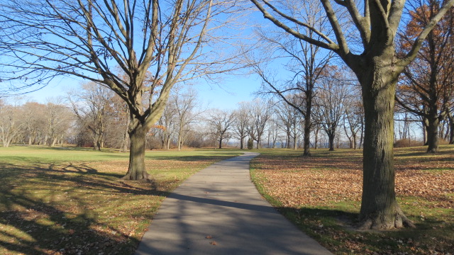


Sheridan Park
Park · 3.3 mi
Municipal park in Cudahy, Wisconsin, United States


Rawson Park
Hiking and trails · 0.5 mi
1400 East Rawson Avenue, South Milwaukee
8 more on the map.
Restaurants and cafes30

Barbiere's Italian Inn
Restaurant · Italian
1021;1021 1/2 Milwaukee Avenue, South Milwaukee
Su-Sa 13:00-20:00


Moran's Pub
Bar and pub · Grill
912 Milwaukee Avenue
Tu-Th 16:00-23:30; Fr 16:00-02:30; Sa 08:30-02:30; Su 10:00-19:00
Pat's Oak Manor
Restaurant · American, Mexican, Seafood · 0.5 mi
1804 15th Avenue, South Milwaukee
Tu-Sa 16:00-21:00, Su 11:00-18:00 || Tu-Sa 15:00-00:00 open "Bar...

Paisano's Italian Restaurant
Restaurant · American, Italian · 1.2 mi
Su-Th 11:00-21:00; Fr-Sa 11:00-22:00

Avenue Coffeehouse
Cafe · Coffee Shop
911 Milwaukee Avenue, South Milwaukee
Mo off; Tu-Fr 07:00-15:00; Sa-Su 08:00-13:00
Better Together Cafe
Ice cream · 0.4 mi
1301 North Chicago Avenue, South Milwaukee
Mo-Fr 07:00-19:00; Sa 09:00-19:00; Su off

Castillo's Family Restaurant
Restaurant · American, Mexican · 1.9 mi
5656 South Packard Avenue, Cudahy
Sa-Su 07:00-14:00, Tu-Th 08:00-16:00, Fr 08:00-20:00
De Rango's Pizzeria
Restaurant · Pizza, Seafood, Wings, Sandwich, Burger, Italian, Pasta, Salad, Mexican, Tacos · 0.4 mi
1215 North Chicago Avenue, South Milwaukee
18 more on the map.
History
South Milwaukee was laid out in 1891 by the South Milwaukee company within the Town of Oak Creek, with the purpose of serving as a rival industrial suburb of the City of Milwaukee, and was named from its location south of Milwaukee. South Milwaukee was incorporated as a village in 1892, then as a city in 1897. South Milwaukee has a rich immigrant history, as immigrants from England and Germany made up a large portion of the population in the early 1900s.
From the History section of South Milwaukee, Wisconsin on Wikipedia, under CC BY-SA 4.0.
Churches and places of worship4
Zion Evangelical Lutheran Church
Church · Wisconsin Evangelical Lutheran Synod (Wels)
900 Michigan Avenue, South Milwaukee
Masjid al-Huda South Milwaukee
Place of worship · 0.6 mi
1800 16th Avenue, South Milwaukee
St. Lukes United Church of Christ
Church · 0.9 mi
2200 18th Avenue, South Milwaukee
Shopping4
Gas and EV charging8
Schools, colleges and libraries54
South Milwaukee High School
School · 0.7 mi
801 15th Avenue, South Milwaukee
Zion Evangelical Lutheran Church, School, and Early Learning Center
School · Lutheran · 1.2 mi
3600 South Chicago Road, South Milwaukee
Healthcare4
Ascension Medical Group Wisconsin - Cudahy
Clinic and pharmacy · 1.7 mi
3501 East Ramsey Avenue, Cudahy
Map of South Milwaukee
131 places. The map loads OpenStreetMap tiles when you open it.
Climate by month
Monthly table
| Month | High | Low | Rain |
|---|---|---|---|
| Jan | 30°F | 16°F | 1.6 in |
| Feb | 33°F | 18°F | 1.8 in |
| Mar | 42°F | 28°F | 2.2 in |
| Apr | 53°F | 37°F | 4.1 in |
| May | 64°F | 47°F | 4.2 in |
| Jun | 74°F | 57°F | 4.6 in |
| Jul | 80°F | 65°F | 3.5 in |
| Aug | 79°F | 64°F | 3.8 in |
| Sep | 73°F | 56°F | 3.3 in |
| Oct | 61°F | 44°F | 3.4 in |
| Nov | 48°F | 33°F | 2.1 in |
| Dec | 36°F | 22°F | 1.9 in |
U.S. Climate Normals 1991-2020 for South Milwaukee Wwtp (1 mi away), NOAA NCEI.
People and cost of living
American Community Survey 5-year estimates, 2020-2024, U.S. Census Bureau. Estimates have margins of error, larger for small towns.
Disaster history
Milwaukee County has had 13 federal disaster declarations since 2000, most often for severe storms.
- 2026-06-30: Severe Storms, Tornadoes, And Flooding (Flood)
- 2025-09-11: Severe Storms, Straight-Line Winds, Flooding, And Mudslides (Flood)
- 2020-04-04: Covid-19 Pandemic (Biological)
- 2020-03-13: Covid-19 (Biological)
- 2020-03-11: Severe Winter Storm And Flooding (Flood)
- 2011-04-05: Severe Winter Storm And Snowstorm (Snowstorm)
OpenFEMA disaster declarations summaries.
Getting there and nearby towns
Milwaukee Mitchell International Airport (MKE) is the nearest airport with scheduled flights listed in OpenStreetMap, 3 miles away.
- Cudahy 2 mi north, about 4 min by car
- Oak Creek 3 mi southwest, about 5 min by car
- Greendale 7 mi west, about 12 min by car
- Franklin 8 mi west, about 13 min by car
- Greenfield 8 mi northwest, about 13 min by car
- Caledonia 8 mi south, about 13 min by car
- Milwaukee 12 mi northwest, about 19 min by car
- Racine 13 mi south, about 21 min by car
- New Berlin 14 mi west, about 23 min by car
- Mount Pleasant 14 mi south, about 23 min by car
Drive times are estimates from straight-line distance, not routes.
Local news
Headlines from INDB, the NEMICO news database.
Reviews, tips and questions
Loading what members have shared...
Sources and licences
- NCES EDGE (Public domain): public schools
- NOAA NCEI U.S. Climate Normals 1991-2020 (Public domain): climate by month
- OpenFEMA (Public domain): disaster declarations
- OpenStreetMap contributors (ODbL 1.0): places, airports, map data
- U.S. Census Bureau (Public domain): population, income, housing, education, commute
- Wikidata (CC0 1.0): elevation, founding date, time zone, website, landmarks and historic places
- Wikimedia Commons (see each image): photos
- Wikipedia (CC BY-SA 4.0): overview and history text
Photo credits
- Oak Creek Parkway 1, Bluebarb11, CC BY-SA 3.0
- 20111121 09 South Milwaukee, Wisconsin (6434154983), David Wilson from Oak Park, Illinois, USA, CC BY 2.0
- 20111121 10 South Milwaukee, Wisconsin (6434155037), David Wilson from Oak Park, Illinois, USA, CC BY 2.0
- South Milwaukee May 2026 1 (Parkway Floral), Michael Barera, CC BY-SA 4.0
- South Milwaukee May 2026 4 (Parkway Floral), Michael Barera, CC BY-SA 4.0
- South Milwaukee May 2026 2 (Parkway Floral), Michael Barera, CC BY-SA 4.0
- South Milwaukee May 2026 3 (Parkway Floral), Michael Barera, CC BY-SA 4.0
- 20111121 08 former C&NW Depot, South Milwaukee, Wisconsin (6434154907), David Wilson from Oak Park, Illinois, USA, CC BY 2.0
- 20111121 06 South Milwaukee, Wisconsin (6434154833), David Wilson from Oak Park, Illinois, USA, CC BY 2.0
- 20111120 51 Jackie & MCTS bus, South Milwaukee, Wisconsin (6399487847), David Wilson from Oak Park, Illinois, USA, CC BY 2.0
- Grant Park South Milwaukee Nov 2011 – covered bridge, entrance, Jkleineider1, CC BY 3.0
- Grant Park South Milwaukee Nov 2011 – covered bridge, exit, Jkleineider1, CC BY 3.0
- Mouth of Oak Creek in Grant Park, South Milwaukee, Wisconsin, 1918–1919, Unknown author Unknown author, Public domain
- Lake Michigan seen behind forest in Grant Park, South Milwaukee, Wisconsin, Vigilantcosmicpenguin, CC BY 4.0
- Wulff Lodge in Grant Park, South Milwaukee, Wisconsin, 1921, Unknown author Unknown author, Public domain
- South Milwaukee Post Office Dec09, Freekee, Public domain
- South Milwaukee Passenger Station Dec09, Freekee, Public domain
- Cudahy Chicago and North Western Railway Depot, David Wilson ( davidwilson1949 ), CC BY 2.0
- New Coeln House Dec09, Freekee, Public domain
- Oak Leaf Trail in Sheridan Park, NaturalHistory, CC BY-SA 4.0
- DSCF8640-12 (50015657101), Joseph Gage, CC BY-SA 2.0
- DSCF8636-11 (50015920322), Joseph Gage, CC BY-SA 2.0
- DSCF8629-10 (50015129803), Joseph Gage, CC BY-SA 2.0
- Oak Creek Parkway 8, Bluebarb11, CC BY-SA 3.0
- Oak Creek Parkway 10, Bluebarb11, CC BY-SA 3.0
- Oak Creek Parkway 6, Bluebarb11, CC BY-SA 3.0
- Oak Creek Parkway 11, Bluebarb11, CC BY-SA 3.0
- Oak Creek Parkway 12, Bluebarb11, CC BY-SA 3.0
- Oak Creek Parkway 13, Bluebarb11, CC BY-SA 3.0
- Oak Creek Parkway 22, Bluebarb11, CC BY-SA 3.0
- Oak Creek Parkway 2, Bluebarb11, CC BY-SA 3.0
- Oak Creek Parkway 9, Bluebarb11, CC BY-SA 3.0
- Oak Creek Parkway 4, Bluebarb11, CC BY-SA 3.0
- Oak Creek Parkway, Bluebarb11, CC BY-SA 3.0
- Oak Creek Parkway 3, Bluebarb11, CC BY-SA 3.0
- Oak Creek Parkway 7, Bluebarb11, CC BY-SA 3.0
- Oak Creek Parkway 5, Bluebarb11, CC BY-SA 3.0
- Grant park in the fall - milwaukee, https://www.flickr.com/people/indykethdy/, CC BY-SA 2.0
- 20111120 49 Oak Creek, Wisconsin (6399487797) (1), David Wilson from Oak Park, Illinois, USA, CC BY 2.0
- 20111120 49 Oak Creek, Wisconsin (6399487797) (2), David Wilson from Oak Park, Illinois, USA, CC BY 2.0


Page built October 30, 2026. Spotted a mistake? Tell us or suggest a place.