


Southport, North Carolina
Southport is a city of 4,205 people in Brunswick County, North Carolina, founded in 1792.
Why visit Southport
Townapedia lists 13 museums and landmarks, 18 parks and trails, 37 places to eat, 3 places to stay and 4 attractions in and around town.
Highlights include Cape Fear Light, G. V. Barbee Bridge, Fort Johnston and Brunswick County Courthouse.
July is the warmest month, with average highs of 92°F; January lows average 36°F.
Weather in Southport
Forecast from the National Weather Service. Full forecast
About Southport
Southport is a city in Brunswick County, North Carolina, United States, near the mouth of the Cape Fear River. Its population was 3,971 as of the 2020 census.
From the Wikipedia article Southport, North Carolina (this version), under CC BY-SA 4.0.
Things to do4

Cape Fear Light
Lighthouse · National Register of Historic Places · 3.2 mi
Lighthouse in North Carolina, United States

G. V. Barbee Bridge
Bridge · 3.8 mi
Bridge on Oak Island, North Carolina
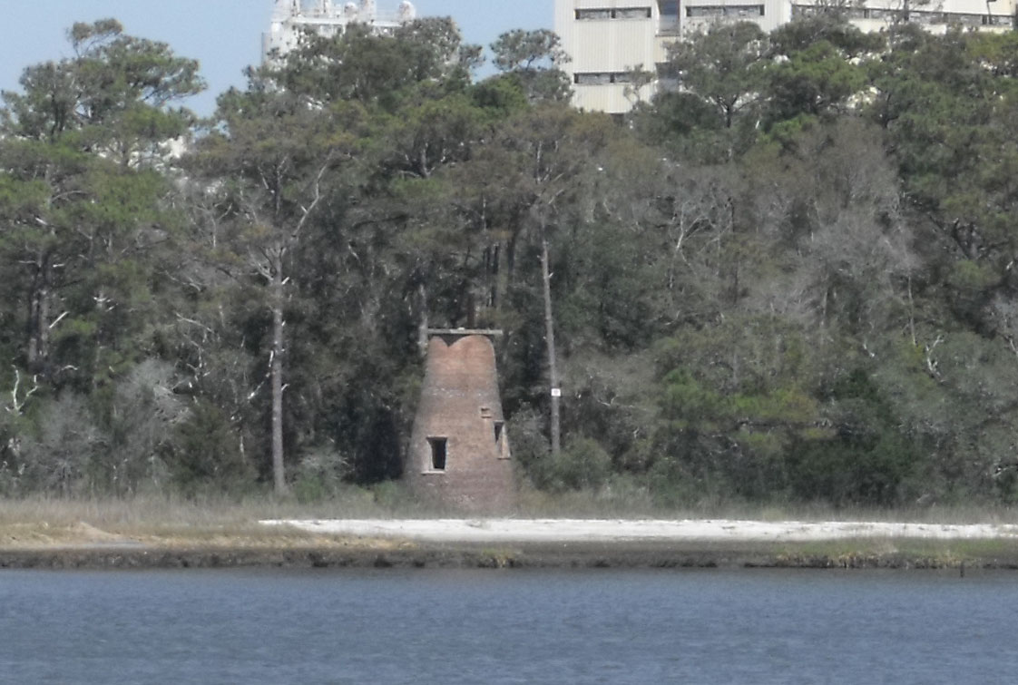
Price Creek Light
Lighthouse · 1.1 mi
Lighthouse in North Carolina, United States

Museums and landmarks13

Fort Johnston
Monument and historic site · National Register of Historic Places · 1.2 mi
Fort in North Carolina
203 East Bay Street, Southport
Mo-Sa 09:00-17:00; Su 12:00-17:00

Brunswick County Courthouse
Monument and historic site · National Register of Historic Places · 1.1 mi
Courthouse in North Carolina, United States
Fort Caswell Historic District
Monument and historic site · National Register of Historic Places · 3.1 mi
Historic district in Brunswick County, North Carolina, United States

Oak Island Life Saving Station
Monument and historic site · National Register of Historic Places · 3.2 mi
United States historic place

Oak Island Light
Lighthouse · National Register of Historic Places · 3.2 mi
Lighthouse in North Carolina, United States


Southport Historic District
Monument and historic site · National Register of Historic Places · 1.2 mi
Listed on the NRHP in North Carolina

North Carolina Maritime Museum at Southport
Museum · 1.2 mi
204 East Moore Street, Southport
Tu-Sa 10:00-16:00

1 more on the map.
Parks, trails and playgrounds18

Smithville Township District Park
Park · 1.9 mi
8392 River Road Southeast, Southport


6 more on the map.
Restaurants and cafes37

Ports of Call Bistro and Restaurant
Restaurant · Mediterranean · 1.2 mi
116 North Howe Street, Greensboro
Su 10:00-14:00; Tu-Sa 11:30-14:00, 17:00-22:00
Southport Siam Thai Bistro
Restaurant · Thai · 0.8 mi
1131 North Atlantic Avenue, Southport
Tu-Sa 11:30-14:30,17:00-20:00
Provision Company
Restaurant · Seafood · 1.4 mi
Seafood, burgers & beer from the counter of waterfront hut with boating supplies & charters.
130 Yacht Basin Drive, Southport
Southport Smoke House
Restaurant · 0.8 mi
1102 North Howe Street, Southport
Su-Sa 11:00-21:00
Mr. P's Bistro
Restaurant · 1.1 mi
309 North Howe Street, Southport

Cafe Koa & Market
Cafe · 1.1 mi
302 North Howe Street, Southport
Frying Pan
Restaurant · 1.4 mi
Chill, seasonal, waterfront bar/eatery preparing down-home Southern seafood meals a variety of ways.
319 West Bay Street, Southport
Local's Family Diner
Restaurant · 0.8 mi
832 North Howe Street, Southport
25 more on the map.
History
The Southport area was explored in the 1500s by Spanish explorers. During the 18th century, British settlements along the Carolina coast lacked fortifications to protect against pirates and privateers, and numerous Spanish attackers exploited this weakness. In response to these attacks, Governor Gabriel Johnston in 1744 appointed a committee to select the best location to construct a fort for the defense of the Cape Fear River region. It was determined that the fort should be constructed at a site at the mouth of the Cape Fear River. During the same year, France declared war against Britain, later known as King George's War, increasing the fort's need. Further, increasingly bold Spanish privateer raids led the North Carolina General Assembly to authorize the construction of "Johnston's Fort" in April 1745, which would come to be known as Fort Johnston. The governor of South Carolina agreed to lend ten small cannons for the fort, and the legislature, in spring 1748, appropriated 2,000 pounds for construction costs, and construction finally began. Southport developed around Fort Johnston.
From the History section of Southport, North Carolina on Wikipedia, under CC BY-SA 4.0.
Where to stay3
Wingate by Wyndham Southport
Motel and hotel · 1.1 mi
1511 North Howe Street, Southport
Churches and places of worship7
Shopping13
Gas and EV charging2
Schools, colleges and libraries6
Healthcare2
Map of Southport
105 places. The map loads OpenStreetMap tiles when you open it.
Climate by month
Monthly table
| Month | High | Low | Rain |
|---|---|---|---|
| Jan | 60°F | 36°F | 3.7 in |
| Feb | 62°F | 38°F | 3.3 in |
| Mar | 68°F | 43°F | 4.0 in |
| Apr | 76°F | 51°F | 3.1 in |
| May | 82°F | 60°F | 3.4 in |
| Jun | 88°F | 69°F | 4.0 in |
| Jul | 92°F | 73°F | 5.5 in |
| Aug | 90°F | 71°F | 6.8 in |
| Sep | 86°F | 66°F | 8.2 in |
| Oct | 79°F | 54°F | 5.4 in |
| Nov | 70°F | 44°F | 3.4 in |
| Dec | 63°F | 38°F | 3.7 in |
U.S. Climate Normals 1991-2020 for Southport 5 N Hcn (4 mi away), NOAA NCEI.
People and cost of living
American Community Survey 5-year estimates, 2020-2024, U.S. Census Bureau. Estimates have margins of error, larger for small towns.
Disaster history
Brunswick County has had 26 federal disaster declarations since 2000, most often for hurricanes.
- 2026-01-24: Severe Winter Storm (Winter Storm)
- 2025-05-03: Sunset Drive Fire (Fire)
- 2024-10-19: Potential Tropical Cyclone Eight (Tropical Storm)
- 2024-09-26: Hurricane Helene (Tropical Storm)
- 2024-08-06: Tropical Storm Debby (Tropical Storm)
- 2022-10-01: Hurricane Ian (Hurricane)
OpenFEMA disaster declarations summaries.
Getting there and nearby towns
Wilmington International Airport (ILM) is the nearest airport with scheduled flights listed in OpenStreetMap, 24 miles away.
- St. James 5 mi west, about 9 min by car
- Oak Island 6 mi west, about 10 min by car
- Kure Beach 7 mi northeast, about 12 min by car
- Boiling Spring Lakes 9 mi northwest, about 14 min by car
- Carolina Beach 10 mi northeast, about 16 min by car
- Sea Breeze 11 mi northeast, about 18 min by car
- Myrtle Grove 15 mi northeast, about 24 min by car
- Silver Lake 16 mi north, about 25 min by car
- Wilmington 20 mi north, about 33 min by car
- Leland 20 mi north, about 31 min by car
Drive times are estimates from straight-line distance, not routes.
Local news
Headlines from INDB, the NEMICO news database.
Reviews, tips and questions
Loading what members have shared...
Sources and licences
- NCES EDGE (Public domain): public schools
- NOAA NCEI U.S. Climate Normals 1991-2020 (Public domain): climate by month
- OpenFEMA (Public domain): disaster declarations
- OpenStreetMap contributors (ODbL 1.0): places, airports, map data
- U.S. Census Bureau (Public domain): population, income, housing, education, commute
- Wikidata (CC0 1.0): elevation, founding date, time zone, website, landmarks and historic places
- Wikimedia Commons (see each image): photos
- Wikipedia (CC BY-SA 4.0): overview and history text
Photo credits
- South Howe Street, Southport (July 2023) 06, DiscoA340, CC BY-SA 4.0
- Fort J, User:Dincher, CC BY-SA 3.0
- Oak Island Life Saving Station Jun 10, Pubdog ( talk ), Public domain
- Oak Island NC Lighthouse, Matt Trostle, CC BY 2.0
- Fort Caswell, Unknown author Unknown author, Public domain
- Brunswick County Courthouse Southport, NC Jun 10, Pubdog ( talk ), Public domain
- Captain Charlie's Station, Bald Head Island (Brunswick County, North Carolina), KudzuVine, CC BY-SA 3.0
- Southport Historic District Southport NC Jun 10, Pubdog ( talk ), Public domain
- Oak Island (Barbee) Bridge, Francisbausch, CC BY-SA 4.0
- PricesCreekRiverLight, Hennap, CC BY-SA 3.0
Page built October 30, 2026. Spotted a mistake? Tell us or suggest a place.