


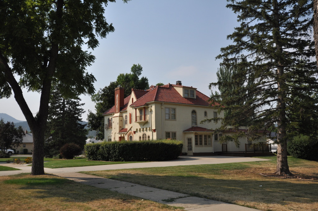

Spearfish, South Dakota
Spearfish is a city of 12,930 people in Lawrence County, South Dakota, founded in 1876.
Why visit Spearfish
Townapedia lists 11 museums and landmarks, 25 parks and trails, 52 places to eat, 18 places to stay and 4 attractions in and around town.
Highlights include Northern Hills Cinema, Spearfish Historic Commercial District, Arthur Hewes House and D.C. Booth Historic National Fish Hatchery.
July is the warmest month, with average highs of 84°F; January lows average 16°F, and about 70 inches of snow fall in a normal year.
Weather in Spearfish
Forecast from the National Weather Service. Full forecast
About Spearfish
Spearfish (Lakota: Hočhápȟe) is a city in Lawrence County, South Dakota, United States. The population was 12,193 at the 2020 census, and was estimated to be 13,803 in 2024, making it the 10th most populous city in South Dakota. Spearfish is the largest city in Lawrence County and the home of Black Hills State University.
From the Wikipedia article Spearfish, South Dakota (this version), under CC BY-SA 4.0.
Things to do4

Northern Hills Cinema
Cinema and theater · 2.3 mi
1830 North Main Street, Spearfish

Museums and landmarks11

Spearfish Historic Commercial District
Monument and historic site · National Register of Historic Places · 2.1 mi
Historic district in South Dakota, USA
Arthur Hewes House
Monument and historic site · National Register of Historic Places · 2.6 mi
Historic house in South Dakota, United States
Frawley Ranch
Monument and historic site · National Register of Historic Places · 5.3 mi
Historical landmark in Spearfish, South Dakota

James A. Corbin House
Monument and historic site · National Register of Historic Places · 2.1 mi
Historic house in South Dakota, United States
Spearfish Filling Station
Monument and historic site · National Register of Historic Places · 2.1 mi
Filling station in Spearfish, United States of America
Webb S. Knight House
Monument and historic site · National Register of Historic Places · 2.0 mi
Spearfish, South Dakota, listed on the NRHP in Lawrence County

Parks, trails and playgrounds25


D.C. Booth Historic National Fish Hatchery
Park · National Register of Historic Places · 2.4 mi
Fish hatchery and park in Lawrence County, South Dakota, United States
423 Hatchery Circle, Spearfish


Lyle Hare Stadium
Sports field and stadium · 2.7 mi
1615 Saint Joe Street, Spearfish
13 more on the map.
Restaurants and cafes52

Antunez
Restaurant · Spanish, Mexican, Latin American · 2.1 mi
117 East Illinois Street, Spearfish
Tu-Sa 11:00-21:00
Killian's Tavern
Restaurant · American, Steak House · 2.5 mi
539 West Jackson Boulevard, Spearfish
Su-Th 11:00-22:00; Fr-Sa 11:00-23:00

Basecamp Kitchen
Restaurant · Nepalese · 2.5 mi
541 West Jackson Boulevard, Spearfish
Tu-Su 11:00-21:00

Crow Peak Brewing Company
Bar and pub · Regional · 3.2 mi
125 West Highway 14, Spearfish
Mo-Th 12:00-22:00; Fr-Sa 12:00-24:00; Su 11:00-21:00
Berlin Spearfish
Restaurant · German · 2.5 mi
545 West Jackson Boulevard, Spearfish
Tu-Sa 11:30-20:30
Spearfish Brewing Company
Bar and pub · 2.2 mi
741 North Main Street, Spearfish
Su 11:00-21:00; Mo-Th 11:00-23:00; Fr-Sa 11:00-24:00

40 more on the map.
History
Before the Black Hills Gold Rush of 1876, the area was used by Native Americans (primarily bands of Sioux but others also ranged through the area). Once the gold rush started, the city was founded in 1876 at the mouth of Spearfish Canyon, and was originally called Queen City. Spearfish grew as a supplier of foodstuffs to the mining camps in the hills. Even today, a significant amount of truck farming and market gardening still occurs in the vicinity.
In 1887, the accepted history of gold mining in the Black Hills was thrown into question by the discovery of what has become known as the Thoen Stone. Discovered by Louis Thoen on Lookout Mountain, the stone purports to be the last testament of Ezra Kind who, along with six others, entered the Black Hills in 1833, "got all the gold we could carry" in June 1834, and were subsequently "killed by Indians beyond the high hill." There is corroborating historical evidence for the Ezra Kind party.
In the 20th century, the history of Spearfish was tied to mining and tourism. Architect Frank Lloyd Wright, who visited Spearfish Canyon in 1935, later called the area "unique and unparalleled elsewhere in our country," and wondered, "How is it that I've heard so little of this miracle and we, toward the Atlantic, have heard so much of the Grand Canyon when this is even more miraculous?"
From the History section of Spearfish, South Dakota on Wikipedia, under CC BY-SA 4.0.
Where to stay18
All Star Travelers Inn
Motel and hotel · 2.5 mi
517 West Jackson Boulevard, Spearfish
Churches and places of worship10
Episcopal Church of All Angels
Church · National Register of Historic Places · 2.2 mi
Kingdom Hall of Jehovah's Witnesses
Church · Jehovahs Witness · 0.9 mi
1900 Windmill Drive, Spearfish
Saint Joseph's Catholic Church
Church · Catholic · 2.2 mi
844 North 5th Street, Spearfish
Shopping15
Gas and EV charging8
Schools, colleges and libraries17
Black Hills Academy At Canyon Hills - 08
School · 0.5 mi
2519 Windmill Dr, Spearfish
Black Hills Academy At Canyon Hills High School - 07
School · 0.5 mi
2519 Windmill Dr, Spearfish
Spearfish Academy At Canyon Hills Elementary - 09
School · 0.5 mi
2519 Windmill Dr, Spearfish
Spearfish Academy At Canyon Hills High School - 10
School · 0.5 mi
2519 Windmill Dr, Spearfish
Healthcare10
Bella Pregnancy Resource Center
Clinic and pharmacy · 2.1 mi
East Grant Street, Spearfish
Map of Spearfish
170 places. The map loads OpenStreetMap tiles when you open it.
Climate by month
Monthly table
| Month | High | Low | Rain | Snow |
|---|---|---|---|---|
| Jan | 36°F | 16°F | 0.6 in | 8.2 in |
| Feb | 37°F | 16°F | 0.9 in | 12.7 in |
| Mar | 46°F | 24°F | 1.2 in | 12.0 in |
| Apr | 55°F | 32°F | 2.2 in | 8.5 in |
| May | 64°F | 42°F | 3.7 in | 2.3 in |
| Jun | 75°F | 51°F | 3.5 in | 0.0 in |
| Jul | 84°F | 58°F | 2.4 in | 0.0 in |
| Aug | 83°F | 56°F | 1.9 in | 0.0 in |
| Sep | 74°F | 48°F | 1.6 in | 0.1 in |
| Oct | 58°F | 35°F | 2.0 in | 5.5 in |
| Nov | 46°F | 26°F | 0.7 in | 6.3 in |
| Dec | 37°F | 18°F | 0.7 in | 14.9 in |
U.S. Climate Normals 1991-2020 for Spearfish (3 mi away), NOAA NCEI.
People and cost of living
American Community Survey 5-year estimates, 2020-2024, U.S. Census Bureau. Estimates have margins of error, larger for small towns.
Disaster history
Lawrence County has had 11 federal disaster declarations since 2000, most often for severe storms.
- 2020-04-05: Covid-19 Pandemic (Biological)
- 2020-03-13: Covid-19 (Biological)
- 2019-10-07: Severe Storms, Tornadoes, And Flooding (Severe Storm)
- 2013-11-08: Severe Winter Storm, Snowstorm, And Flooding (Severe Storm)
- 2013-06-28: Severe Storms, Tornado, And Flooding (Severe Storm)
- 2008-07-09: Severe Storms And Flooding (Severe Storm)
OpenFEMA disaster declarations summaries.
Getting there and nearby towns
Clyde Ice Field (SPF) is the nearest airport with scheduled flights listed in OpenStreetMap, 2 miles away.
- Mountain Plains 3 mi southwest, about 5 min by car
- North Spearfish 5 mi west, about 7 min by car
- Deadwood 9 mi southeast, about 14 min by car
- Whitewood 9 mi east, about 14 min by car
- Lead 10 mi south, about 16 min by car
- Belle Fourche 12 mi north, about 19 min by car
- Boulder Canyon 12 mi southeast, about 20 min by car
- Sturgis 17 mi east, about 27 min by car
- Blucksberg Mountain 20 mi southeast, about 32 min by car
- Box Elder 45 mi southeast, about 1 h 15 min by car
Drive times are estimates from straight-line distance, not routes.
Local news
Headlines from INDB, the NEMICO news database.
Reviews, tips and questions
Loading what members have shared...
Sources and licences
- NCES EDGE (Public domain): public schools
- NOAA NCEI U.S. Climate Normals 1991-2020 (Public domain): climate by month
- OpenFEMA (Public domain): disaster declarations
- OpenStreetMap contributors (ODbL 1.0): places, airports, map data
- U.S. Census Bureau (Public domain): population, income, housing, education, commute
- Wikidata (CC0 1.0): elevation, founding date, time zone, website, landmarks and historic places
- Wikimedia Commons (see each image): photos
- Wikipedia (CC BY-SA 4.0): overview and history text
Photo credits
- Spearfish historic commercial district, Lawrence County, SD, JERRYE AND ROY KLOTZ MD, CC BY-SA 3.0
- Mountain View Baptist Church in Spearfish, South Dakota, Mr. Satterly, CC0
- SpearfishSD HomestakeWorkersHouse, Magicpiano, CC BY-SA 4.0
- SpearfishSD HenryKeetsHouse, Magicpiano, CC BY-SA 4.0
- SpearfishSD WalterDickeyHouse, Magicpiano, CC BY-SA 4.0
- SpearfishSD MaryWhitneyHouse, Magicpiano, CC BY-SA 4.0
- SpearfishSD JohnWolzmuthHouse, Magicpiano, CC BY-SA 4.0
- SpearfishSD EleazerDickeyHouse, Magicpiano, CC BY-SA 4.0
- SpearfishSD OttoLUhligHouse, Magicpiano, CC BY-SA 4.0
- Knight House Spearfish SD, Bigstevex4, CC BY-SA 3.0
- SpearfishSD HalloranMatthewsBradyHouse, Magicpiano, CC BY-SA 4.0
- Arkansauce in spearfish, sd, RadicalHarmony, CC0
- SpearfishSD HistoricFillingStation, Magicpiano, CC BY-SA 4.0
- SpearfishSD HenryCourtHouse, Magicpiano, CC BY-SA 4.0
- Downtown Spearfish South Dakota at Sunrise (52755020246), Tony Webster, CC BY 2.0
- SpearfishSD OldCityHall, Magicpiano, CC BY-SA 4.0
- CarQuest Auto Parts Retail STore - Spearfish - South Dakota (52445901414), Tony Webster from Laramie, Wyoming, United States, CC BY-SA 2.0
- SpearfishSD MailBuilding, Magicpiano, CC BY-SA 4.0
- REDwater Kitchen - Restaurant in Spearfish South Dakota (52474863049), Tony Webster, CC BY-SA 2.0
- SpearfishSD ToomeyHouse, Magicpiano, CC BY-SA 4.0
- Downtown Spearfish South Dakota at Dawn (52706378881), Tony Webster, CC BY 2.0
- SpearfishSD WilliamErnestLownHouse, Magicpiano, CC BY-SA 4.0
- SpearfishSD EpiscopalChurchOfAllAngels, Magicpiano, CC BY-SA 4.0
- SpearfishSD WilliamDDriskillHouse, Magicpiano, CC BY-SA 4.0
- SpearfishSD KrollMeatHouse, Magicpiano, CC BY-SA 4.0
- Let's Play Library public toy library at City Park in Spearfish, South Dakota, Mr. Satterly, CC0
- Rear of the D.C. Booth Historic National Fish Hatchery & Archives visitor center in Spearfish, South Dakota, Mr. Satterly, CC0
- GMC Car Dealership in Spearfish - South Dakota (52204052745), Tony Webster, CC BY 2.0
- Von Bayer Museum at the D.C. Booth Historic National Fish Hatchery, 2013, TCMemoire, CC BY-SA 3.0
- JAMES A. CORBIN HOUSE; SPEARFISH, LAWRENCE COUNTY, SD, JERRYE AND ROY KLOTZ MD, CC BY-SA 3.0
- Super Wash (52504332029), Tony Webster, CC BY 2.0
- Jackson Boulevard Historic District2 NRHP 100003440 Lawrence County, SD, Jon Roanhaus, CC BY-SA 4.0
- Jackson Boulevard Historic District NRHP 100003440 Lawrence County, SD, Jon Roanhaus, CC BY-SA 4.0
- Viewing Trout Underwater at D C Booth Historic National Fish Hatchery (51237814332), USFWS Mountain Prairie, Public domain
- Going to the Hatchery (51237393692), USFWS Mountain Prairie, Public domain
- Rainbow Trout at D C Booth Historic National Fish Hatchery (51237018633), USFWS Mountain Prairie, Public domain


Page built October 30, 2026. Spotted a mistake? Tell us or suggest a place.