



Spring House, Pennsylvania
Spring House is a community of 5,137 people in Montgomery County, Pennsylvania.
Why visit Spring House
Townapedia lists 15 museums and landmarks, 35 parks and trails, 39 places to eat and 4 attractions in and around town.
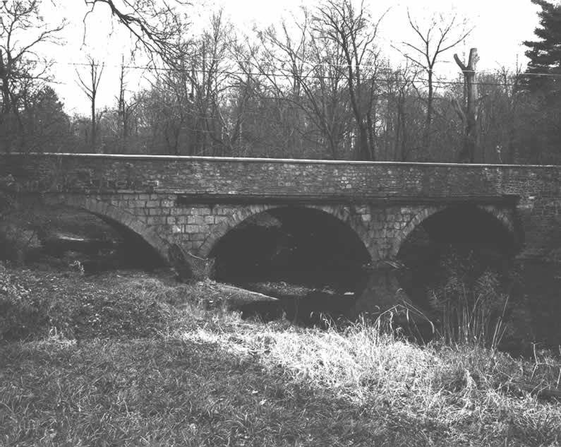
Highlights include Ambler Theater, County Bridge No. 54, Dawesfield and Gwynedd Hall.
July is the warmest month, with average highs of 85°F; January lows average 24°F.
Weather in Spring House
Forecast from the National Weather Service. Full forecast
About Spring House
Spring House is a census-designated place (CDP) in Lower Gwynedd Township, Pennsylvania, United States. The population was 3,978 at the 2020 census.
From the Wikipedia article Spring House, Pennsylvania (this version), under CC BY-SA 4.0.
Things to do4

County Bridge No. 54
Bridge · National Register of Historic Places · 2.6 mi
Arch bridge in Pennsylvania, United States of America
Julia Ball Auditorium
Cinema and theater · 1.7 mi
200 University Drive, Gwynedd Valley
Museums and landmarks15

Dawesfield
Monument and historic site · National Register of Historic Places · 2.2 mi
Building in Pennsylvania, United States

Gwynedd Hall
Monument and historic site · National Register of Historic Places · 2.3 mi
Building in Pennsylvania, United States

Hope Lodge
Monument and historic site · National Register of Historic Places · 3.6 mi
Mansion in Whitemarsh Township, Pennsylvania

Isaac Kulp Farm
Monument and historic site · National Register of Historic Places · 3.2 mi
Building in Upper Gwynedd Township, United States of America

Jacob Kastner Loghouse
Monument and historic site · National Register of Historic Places · 0.4 mi
Historic house in Pennsylvania, United States

Kenderdine Mill Complex
Monument and historic site · National Register of Historic Places · 3.4 mi
Historic grist mill complex

Knipe-Moore-Rupp Farm
Monument and historic site · National Register of Historic Places · 3.6 mi
Building in Pennsylvania, United States

Knipe–Johnson Farm
Monument and historic site · National Register of Historic Places · 3.2 mi
Building in Upper Gwynedd Township, United States of America

Quaker Manor House
Monument and historic site · National Register of Historic Places · 2.7 mi
Historic house in Pennsylvania, United States

The Highlands
Museum · National Register of Historic Places · 3.0 mi
Historic mansion and gardens located north of Philadelphia, Pennsylvania

Union School
Monument and historic site · National Register of Historic Places · 3.4 mi
Historic building in Fort Washington, Pennsylvania, United States

Keefe-Mumbower Mill
Museum · National Register of Historic Places · 3.2 mi
3 more on the map.
Parks, trails and playgrounds35






23 more on the map.
Restaurants and cafes39

Ambler Pizza
Restaurant · Pizza · 1.4 mi
1125 South Bethlehem Pike, Ambler
Mo-Th,Sa 11:00-22:00; Fr 11:00-22:30; Su 11:00-21:00

La Provence
Restaurant · French · 1.7 mi
27 West Butler Pike, Ambler
Mo off; Tu-Th 17:00-20:30; Fr,Sa 17:00-22:00; Su 11:00-15:00, 17:00-20:00
Bridgets Steakhouse
Restaurant · Steak House · 1.6 mi
8 West Butler Avenue, Ambler
Mo,Su 17:00-21:00; Tu 17:00-22:00; We-Th 16:00-22:00; Fr-Sa 16:00-23:00

Dettera Restaurant & Wine Bar
Diner · American · 1.5 mi
129 East Butler Avenue, Ambler
Mo,Su off; Tu-Th 16:00-22:00; Fr-Sa 16:00-23:00
From the Boot
Restaurant · Italian · 1.5 mi
110 East Butler Avenue, Ambler
Mo-Th 16:00-21:00; Fr-Sa 12:00-22:00; Su 12:00-21:00
Geronimo's Peruvian Cuisine
Restaurant · Peruvian · 1.5 mi
131 East Butler Avenue, Ambler
Mo-Tu off; We-Th 16:00-21:00; Fr 16:00-22:00; Sa 13:00-22:00; Su...
Guiseppes Restauant
Restaurant · Pizza, Italian · 1.4 mi
46 South Bethlehem Pike, Ambler
Mo-Th 11:00-23:00; Fr-Sa 11:00-24:00; Su 12:00-22:00
Planchette Bistro & Creperie
Cafe · French · 1.5 mi
95 East Butler Avenue, Ambler
Mo off; Tu-Th 11:30-21:00; Fr-Sa 11:30-22:00; Su 11:00-20:00

Sweet Briar Cafe
Diner · American · 1.4 mi
11 Lindenwold Avenue, Ambler
Mo,Su 08:00-14:00; Tu-Sa 08:00-21:00
27 more on the map.
Churches and places of worship11
Saint Anthony of Padua Roman Catholic Church
Church · Roman Catholic · 1.2 mi
259 Forest Avenue, Ambler
St. Joseph's Roman Catholic Church
Church · Roman Catholic · 1.7 mi
16 South Spring Garden Street, Ambler
Trinity Episcopal Church
Church · Anglican · 1.8 mi
708 South Bethlehem Pike, Ambler
Upper Dublin Lutheran Church
Church · Evangelical Lutheran · 1.1 mi
411 Susquehanna Road, Ambler
Shopping7
Spring House Window & Door
Hardware store · 0.5 mi
908 North Bethlehem Pike, Spring House
Gas and EV charging2
Schools, colleges and libraries48
Gwynedd Mercy University
School · 1.7 mi
1325 Sumneytown Pike, Gwynedd Valley
Healthcare4
Village Pharmacy
Clinic and pharmacy · 1.0 mi
1121 North Bethlehem Pike, Spring House
Map of Spring House
165 places. The map loads OpenStreetMap tiles when you open it.
Climate by month
Monthly table
| Month | High | Low | Rain |
|---|---|---|---|
| Jan | 40°F | 24°F | 3.6 in |
| Feb | 43°F | 26°F | 2.8 in |
| Mar | 51°F | 32°F | 4.4 in |
| Apr | 63°F | 42°F | 3.8 in |
| May | 72°F | 52°F | 4.0 in |
| Jun | 81°F | 61°F | 4.1 in |
| Jul | 85°F | 67°F | 4.7 in |
| Aug | 83°F | 65°F | 4.7 in |
| Sep | 76°F | 58°F | 4.7 in |
| Oct | 64°F | 47°F | 4.1 in |
| Nov | 54°F | 36°F | 3.3 in |
| Dec | 44°F | 30°F | 4.4 in |
U.S. Climate Normals 1991-2020 for Willow Grove Nas (4 mi away), rain and snow from Fort Washington 0.8 Nw, NOAA NCEI.
People and cost of living
American Community Survey 5-year estimates, 2020-2024, U.S. Census Bureau. Estimates have margins of error, larger for small towns.
Disaster history
Montgomery County has had 19 federal disaster declarations since 2000, most often for hurricanes.
- 2021-09-10: Remnants Of Hurricane Ida (Hurricane)
- 2020-03-30: Covid-19 Pandemic (Biological)
- 2020-03-13: Covid-19 (Biological)
- 2016-03-23: Severe Winter Storm And Snowstorm (Snowstorm)
- 2014-02-06: Severe Winter Storm (Severe Ice Storm)
- 2013-01-10: Hurricane Sandy (Hurricane)
OpenFEMA disaster declarations summaries.
Getting there and nearby towns
Wings Field (BBX) is the nearest airport with scheduled flights listed in OpenStreetMap, 4 miles away.
- Ambler 1 mi south, about 2 min by car
- Maple Glen 2 mi east, about 3 min by car
- Fort Washington 3 mi southeast, about 5 min by car
- Blue Bell 3 mi southwest, about 5 min by car
- North Wales 4 mi northwest, about 6 min by car
- Horsham 4 mi east, about 7 min by car
- Oreland 5 mi southeast, about 8 min by car
- Montgomeryville 5 mi north, about 8 min by car
- Flourtown 5 mi south, about 8 min by car
- Lansdale 6 mi northwest, about 9 min by car
Drive times are estimates from straight-line distance, not routes.
Local news
Headlines from INDB, the NEMICO news database.
Reviews, tips and questions
Loading what members have shared...
Sources and licences
- NCES EDGE (Public domain): public schools
- NOAA NCEI U.S. Climate Normals 1991-2020 (Public domain): climate by month
- OpenFEMA (Public domain): disaster declarations
- OpenStreetMap contributors (ODbL 1.0): places, airports, map data
- U.S. Census Bureau (Public domain): population, income, housing, education, commute
- Wikidata (CC0 1.0): elevation, founding date, time zone, website, landmarks and historic places
- Wikimedia Commons (see each image): photos
- Wikipedia (CC BY-SA 4.0): overview and history text
Photo credits
- 2022-10-29 12 01 14 View north along Pennsylvania State Route 309 (Fort Washington Expressway) at the exit for Norristown Road (Spring House) in Lower Gwynedd Township, Montgomery County, Pennsylvania, Famartin, CC BY-SA 4.0
- 2022-10-29 14 44 16 View south along Pennsylvania State Route 309 (Fort Washington Expressway) at the exit for Norristown Road (Spring House) in Lower Gwynedd Township, Montgomery County, Pennsylvania, Famartin, CC BY-SA 4.0
- Kulp Barn Montcp PA, Smallbones, CC0
- Jacob Kastner Loghouse, Shuvaev, CC BY-SA 3.0
- County Bridge No. 54, PennDOT, Public domain
- Union School Montco PA, Smallbones, CC0
- Highlands Montco PA, Smallbones, CC0
- Knipe MR farm Montco PA, Smallbones, CC0
- KNIPE-JOHNSON FARM, JERRYE & ROY KLOTZ MD, CC BY-SA 3.0
- The Mill at the Kenderdine Mill Complex, Carla Loughlin, CC BY-SA 3.0
- Gwynnedd Hall, Hshuvaeva, CC BY-SA 3.0
- Hope Lodge (Whitemarsh Township, Pennsylvania), Historic American Buildings Survey, Ian McLaughlin, Photographer, Public domain
- DAWESFIELD, JERRYE & ROY KLOTZ MD, CC BY-SA 3.0
- Quaker Manor Ft Washington PA, Smallbones, CC0
- Keefe-Mumbower Mill 01, Shuvaev, CC BY-SA 3.0
- Wissahickon High School, NameNameLikeWha, CC BY-SA 4.0
- 2022-10-29 12 03 19 View north along Pennsylvania State Route 309 (Fort Washington Expressway) just north of the exit for Norristown Road in Lower Gwynedd Township, Montgomery County, Pennsylvania, Famartin, CC BY-SA 4.0
- 2022-10-29 14 46 36 View south along Pennsylvania State Route 309 (Fort Washington Expressway) at the exit for Butler Pike (Ambler) in Upper Dublin Township, Montgomery County, Pennsylvania, Famartin, CC BY-SA 4.0
- Lower Gwynedd Township, Montgomery County Planning Commission, CC BY-SA 2.0
- Lower Gwynedd Township Building, Montgomery County Planning Commission, CC BY-SA 2.0
- Puccinia mariae-wilsoniae 265844923, Jason E. Farabaugh, CC BY 4.0
- 2022-10-12 11 52 37 View south along Pennsylvania State Route 309 (Fort Washington Expressway) from the overpass for Cedar Hill Road in Lower Gwynedd Township, Montgomery County, Pennsylvania, Famartin, CC BY-SA 4.0
- 2022-10-12 11 53 16 View north along Pennsylvania State Route 309 (Fort Washington Expressway) from the overpass for Cedar Hill Road in Lower Gwynedd Township, Montgomery County, Pennsylvania, Famartin, CC BY-SA 4.0
- Stepping Stones on the Green Ribbon Trail, Natecation, CC BY-SA 4.0
- 2022-10-26 10 44 05 View west along Pennsylvania State Route 63 (Welsh Road) just west of Tennis Avenue along the border of Lower Gwynedd Township and Horsham Township in Montgomery County..., Famartin, CC BY-SA 4.0
- 2022-10-12 16 25 36 View east along Pennsylvania State Route 63 (Welsh Road) just east of Tennis Avenue along the border of Upper Dublin Township and Horsham Township in Montgomery County..., Famartin, CC BY-SA 4.0
- 2022-10-29 14 42 18 View south along Pennsylvania State Route 309 (Fort Washington Expressway) just south of the exit for Bethlehem Pike in Lower Gwynedd Township, Montgomery County, Pennsylvania, Famartin, CC BY-SA 4.0
- Lindenwold Avenue, Montgomery County Planning Commission, CC BY-SA 2.0
- Ambler Borough Hall V, Montgomery County Planning Commission, CC BY-SA 2.0
- Ambler Borough Hall IV, Montgomery County Planning Commission, CC BY-SA 2.0
- Ambler Borough Hall II, Montgomery County Planning Commission, CC BY-SA 2.0
- 2022-10-29 12 05 14 View north along Pennsylvania State Route 309 (Bethlehem Pike) just south of the exit for Pennsylvania State Route 63 (Welsh Road) in Lower Gwynedd Township, Montgomery County..., Famartin, CC BY-SA 4.0
- Lindenwold Avenue - 8464818217, Montgomery County Planning Commission, CC BY-SA 2.0
- Exterior of Ambler Theater in Ambler Pennsylvania, Dorevabelfiore, CC BY-SA 4.0
- Lindenwold Avenue - 8465920500, Montgomery County Planning Commission, CC BY-SA 2.0
- Butler Avenue EB at Spring Garden Street Ambler, Dough4872, CC BY-SA 4.0
- 2022-10-30 12 53 31 View northeast along Butler Avenue at Main Street in Ambler, Montgomery County, Pennsylvania, Famartin, CC BY-SA 4.0
- 2022-10-30 12 53 03 View southwest along Butler Avenue at Main Street in Ambler, Montgomery County, Pennsylvania, Famartin, CC BY-SA 4.0
- Asbestos Collection - 1950s - Flickr - JFGryphon, Jim Griffin, CC0
- 2022-10-29 14 41 01 View south along Pennsylvania State Route 309 (Bethlehem Pike) at the exit for Bethlehem Pike in Lower Gwynedd Township, Montgomery County, Pennsylvania, Famartin, CC BY-SA 4.0


Page built October 30, 2026. Spotted a mistake? Tell us or suggest a place.