


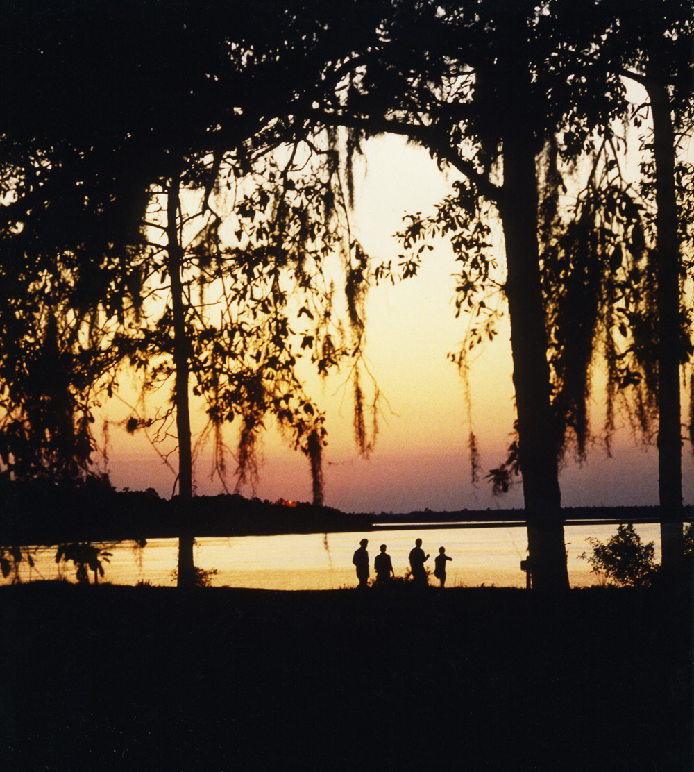

St. Marys, Georgia
St. Marys is a city of 19,166 people in Camden County, Georgia, founded in 1792.
Why visit St. Marys
Townapedia lists 9 museums and landmarks, 15 parks and trails, 28 places to eat, 4 places to stay and 3 attractions in and around town.
Highlights include Kings Bay Stadium Cinemas 9, McIntosh Sugarworks, Orange Hall and Crooked River State Park.
July is the warmest month, with average highs of 89°F; January lows average 43°F.
Weather in St. Marys
Forecast from the National Weather Service. Full forecast
About St. Marys
St. Marys is a city in Camden County, Georgia, United States, located on the southern border of Camden County on the St. Marys River. It had a population of 18,256 at the 2020 census, up from 17,121 at the 2010 census. It is part of the Kingsland, Georgia Micropolitan Statistical Area. The Florida border is just to the south across the river, Cumberland Island National Seashore is to the northeast, and Kingsland, Georgia, is to the west.
From the Wikipedia article St. Marys, Georgia (this version), under CC BY-SA 4.0.
Things to do3

Museums and landmarks9


McIntosh Sugarworks
Monument and historic site · National Register of Historic Places · 2.5 mi
McIntosh Sugarworks was built in the late 1820s by John Houstoun McIntosh
Orange Hall
Monument and historic site · National Register of Historic Places · 2.9 mi
Building in Georgia, USA

St. Marys Historic District
Monument and historic site · National Register of Historic Places · 2.9 mi
Historic district in Georgia, United States

Blue Star Memorial Highway
Monument and historic site · 4.2 mi
Sign with a torpedo on display behind it
USS George Bancroft
Monument and historic site · 1.7 mi
George Bancroft's sail only
Parks, trails and playgrounds15
Crooked River State Park
Park · 6.1 mi
State park in St. Marys, Georgia, USA




3 more on the map.
Restaurants and cafes28



16 more on the map.
History
The St. Marys river area was first explored by Spanish expeditions in the mid 16th century as part of the settlement of Spanish Florida, with nearby St. Augustine as the established capital. The original Spanish settlement was founded in 1566, making this the second-oldest continuously inhabited European-established settlement in what became the contiguous United States. Settlement for colonial Georgians became legal after the Treaty of Paris in 1763, when Britain exchanged some territory with Spain after defeating France in the Seven Years' War.
Following independence in the American Revolutionary War, local inhabitants of Camden County gathered on Cumberland Island and signed a charter for "a town on the St. Marys" on November 20, 1787. There were twenty charter members, who each received four town lots and one marsh lot (outside the boundary of the town on the east side in the marshes); each lot was 4 acres (1.6 ha) square, with the total town area being 2,041 acres (826 ha). These twenty city founders are named on an historical marker in downtown St. Marys: Isaac Wheeler, William Norris, Nathaniel Ashley, William Ashley, Lodowick Ashley, James Seagrove, James Finley, John Fleming, Robert Seagrove, Henry Osborne, Thomas Norris, Jacob Weed, John Alexander, Langley Bryant, Jonathan Bartlett, Stephen Conyers, William Ready, Prentis Gallup, Simeon Dillingham and Richard Cole.
From the History section of St. Marys, Georgia on Wikipedia, under CC BY-SA 4.0.
Where to stay4
Cumberland Kingsbay Lodge
Motel and hotel · 0.5 mi
603 Sand Bar Drive, Saint Marys
Churches and places of worship23
Kingdom Hall of Jehovah’s Witnesses
Church · Jehovahs Witness · 2.9 mi
200 Carnegie Drive, Saint Marys
Shopping14
Gas and EV charging11
Schools, colleges and libraries11
Healthcare6
Southeast Georgia Health System - Camden Campus
Hospital · 2.7 mi
2000 Dan Proctor Drive, Saint Marys
Map of St. Marys
124 places. The map loads OpenStreetMap tiles when you open it.
Climate by month
Monthly table
| Month | High | Low | Rain |
|---|---|---|---|
| Jan | 62°F | 43°F | 2.8 in |
| Feb | 65°F | 45°F | 2.8 in |
| Mar | 70°F | 51°F | 3.3 in |
| Apr | 76°F | 57°F | 2.8 in |
| May | 82°F | 65°F | 3.7 in |
| Jun | 86°F | 71°F | 6.3 in |
| Jul | 89°F | 74°F | 4.6 in |
| Aug | 88°F | 74°F | 6.5 in |
| Sep | 85°F | 71°F | 5.2 in |
| Oct | 79°F | 62°F | 4.4 in |
| Nov | 70°F | 52°F | 1.7 in |
| Dec | 65°F | 46°F | 3.1 in |
U.S. Climate Normals 1991-2020 for Brunswick 23 S 72321 (8 mi away), NOAA NCEI.
People and cost of living
American Community Survey 5-year estimates, 2020-2024, U.S. Census Bureau. Estimates have margins of error, larger for small towns.
Disaster history
Camden County has had 16 federal disaster declarations since 2000, most often for hurricanes.
- 2024-09-30: Hurricane Helene (Hurricane)
- 2024-09-26: Hurricane Helene (Tropical Storm)
- 2024-09-24: Tropical Storm Debby (Tropical Storm)
- 2024-08-05: Hurricane Debby (Tropical Storm)
- 2023-09-07: Hurricane Idalia (Hurricane)
- 2020-03-29: Covid-19 Pandemic (Biological)
OpenFEMA disaster declarations summaries.
Getting there and nearby towns
Jacksonville International Airport (JAX) is the nearest airport with scheduled flights listed in OpenStreetMap, 19 miles away.
- Yulee 8 mi south, about 14 min by car
- Fernandina Beach 10 mi southeast, about 17 min by car
- Brunswick 27 mi north, about 44 min by car
- Jacksonville 29 mi south, about 47 min by car
- Atlantic Beach 31 mi south, about 50 min by car
- Jacksonville Beach 35 mi south, about 57 min by car
- Palm Valley 40 mi south, about 1 h by car
- Bellair-Meadowbrook Terrace 41 mi south, about 1 h by car
- Oakleaf Plantation 43 mi south, about 1 h 15 min by car
- Lakeside 44 mi south, about 1 h 15 min by car
Drive times are estimates from straight-line distance, not routes.
Local news
Headlines from INDB, the NEMICO news database.
Reviews, tips and questions
Loading what members have shared...
Sources and licences
- NCES EDGE (Public domain): public schools
- NOAA NCEI U.S. Climate Normals 1991-2020 (Public domain): climate by month
- OpenFEMA (Public domain): disaster declarations
- OpenStreetMap contributors (ODbL 1.0): places, airports, map data
- U.S. Census Bureau (Public domain): population, income, housing, education, commute
- Wikidata (CC0 1.0): elevation, founding date, time zone, website, landmarks and historic places
- Wikimedia Commons (see each image): photos
- Wikipedia (CC BY-SA 4.0): overview and history text
Photo credits
- Montage St Marys GA, Legohead, CC BY-SA 3.0
- 1st Presbyterian Church, St. Marys, GA - panoramio, Wallace Parry, CC BY-SA 3.0
- Orange Hall (St Marys), Legohead, CC BY-SA 3.0
- GA St Marys McIntosh Sugarhouse01, Ebyabe, CC BY-SA 3.0
- 1994 Crooked River Sunset (612001088), anoldent from Asheville, NC, USA, CC BY-SA 2.0
- St Marys, GA 31558, USA - panoramio, Idawriter, CC BY-SA 3.0
- St Marys, GA 31558, USA - panoramio - Idawriter, Idawriter, CC BY-SA 3.0
- A lot of Canada Geese, St Marys, Mjrmtg, CC BY 4.0
- KingsBay Cinema 9, St Marys, Michael Rivera, CC BY 4.0
- Young Zion Missionary Baptist Church - panoramio, Idawriter, CC BY-SA 3.0
- Railroad Tracks crossing - panoramio, Idawriter, CC BY-SA 3.0
- St Marys City Limit, Legohead, CC BY-SA 3.0
- 20220221 05a St. Mary's Railroad, David Wilson, CC BY 2.0
- 20220221 06a St. Mary's Railroad, David Wilson, CC BY 2.0
- 20220221 07 St. Mary's Railroad, David Wilson, CC BY 2.0
- Flickr - Official U.S. Navy Imagery - USS West Virginia off the coast of Georgia., Official Navy Page from United States of America MC1 James Kimber/U.S. Navy, Public domain
- Flickr - DVIDSHUB - Fire Training at NSB Kings Bay (Image 1 of 2), DVIDSHUB, Public domain
- Flickr - Official U.S. Navy Imagery - Sailor-Georgia native instructs students during fire training., Official Navy Page from United States of America Machinist's Mate 2nd Class(SS) Dwain Martin/U.S. Navy, Public domain
- Sugar Mill Park historical marker, Mjrmtg, CC BY 4.0
- Sugar Mill Park ruins, Mjrmtg, CC BY 4.0
- Sugar Mill Park ruins closeup, Mjrmtg, CC BY 4.0
- HABS GA,20-SAMA.V,1- (sheet 0 of 2) - Santa Maria Mission (Ruins), Saint Marys, Camden County, GA, Related names: Mendenez, Public domain
- HABS GA,20-SAMA.V,1- (sheet 2 of 2) - Santa Maria Mission (Ruins), Saint Marys, Camden County, GA, Related names: Mendenez, Public domain
- HABS GA,20-SAMA.V,1- (sheet 1 of 2) - Santa Maria Mission (Ruins), Saint Marys, Camden County, GA, Related names: Mendenez, Public domain
- Sugar Mill Park bicycle rack, Mjrmtg, CC BY 4.0
- Sugar Mill Park restrooms, Mjrmtg, CC BY 4.0
- William Henry King resting plot, Saint Mary’s, Georgia, CSOLT, CC0
- Captain Samuel Flood gravestone, MauraWen, CC0
- St Marys City Hall 2026, Michael Rivera, CC BY 4.0
- Spanish Occupation of Georgia monument, St Marys, Mjrmtg, CC BY 4.0
- City of St Marys historical marker, Mjrmtg, CC BY 4.0
- Food Pantry next to First Presbyterian Church, St Marys, Mjrmtg, CC BY 4.0
- First Presbyterian Church, St Marys, Michael Rivera, CC BY 4.0


Page built October 30, 2026. Spotted a mistake? Tell us or suggest a place.