


Steamboat Springs, Colorado
Steamboat Springs is a city of 13,433 people in Routt County, Colorado.
Why visit Steamboat Springs
Townapedia lists 13 museums and landmarks, 19 parks and trails, 46 places to eat, 44 places to stay and 10 attractions in and around town.
Highlights include Fish Creek Falls, Howelsen Hill Ski Area, Chamber of Commerce Building and Crawford House.
July is the warmest month, with average highs of 83°F; January lows average 5°F, and about 184 inches of snow fall in a normal year.
Weather in Steamboat Springs
Forecast from the National Weather Service. Full forecast
About Steamboat Springs
Steamboat Springs is a home rule municipality that is the county seat of and the most populous municipality in Routt County, Colorado, United States. The population was 13,224 at the 2020 census. Steamboat Springs is the principal city of the Steamboat Springs Micropolitan Statistical Area, and it is the largest city in northwestern Colorado.
From the Wikipedia article Steamboat Springs, Colorado (this version), under CC BY-SA 4.0.
Things to do10
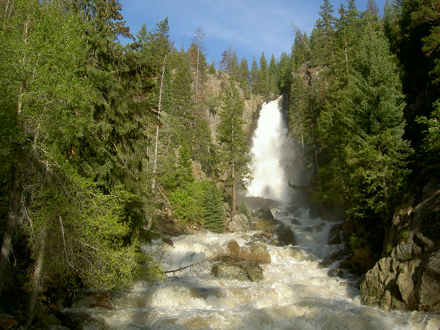
Fish Creek Falls
Waterfall · 2.8 mi
Waterfall
Fish Creek Falls Road, Steamboat Springs


Steamboat Ski Resort
Ski area · 3.1 mi
Major ski area in northwestern Colorado

Eagle Smoked Salmon
Farm and orchard · 0.9 mi
7th and Yampa Yampa Street, Steamboat Springs
Jun-Sep Sa 09:00-14:00

Strings Music Pavilion
Cinema and theater · 1.3 mi
900 Strings Road, Steamboat Springs

Museums and landmarks13

Chamber of Commerce Building
Monument and historic site · National Register of Historic Places · 1.2 mi
Historic building in Steamboat Springs, Colorado, United States
Crawford House
Monument and historic site · National Register of Historic Places · 1.3 mi
Historic house in Colorado, United States
First National Bank Building
Monument and historic site · National Register of Historic Places · 0.9 mi
Bank building in Steamboat Springs, Colorado

Mesa Schoolhouse
Monument and historic site · National Register of Historic Places · 4.4 mi
School building in Routt County, United States of America

Steamboat Springs Depot
Monument and historic site · National Register of Historic Places · 1.4 mi
Railway station in United States of America

Rotary Park Boardwalk
Monument and historic site · 1.2 mi
Mount Werner Road, Steamboat Springs
1 more on the map.
Parks, trails and playgrounds19





7 more on the map.
Restaurants and cafes46


Emerald
Cafe · Coffee Shop · 0.9 mi
700 Yampa Street, Steamboat Springs
Mo-Fr 08:00-12:00, Sa-Su 08:00-14:00
Steamboat Meat & Seafood Company
Restaurant · Seafood · 1.1 mi
1030 Yampa Street, Steamboat Springs
Mo-Sa 10:00-17:00
34 more on the map.
History
The area surrounding Steamboat Springs was originally inhabited by the Yampatika band of the Utes, who hunted in the valley during the summer. Trappers began to move through the area during the first decades of the 19th century. James Harvey Crawford, the founder of Steamboat Springs, first arrived in the spring of 1874. The Crawford family moved there in 1876, and for the first five years were the sole permanent white residents of the town. The native Utes were forcibly removed from the area to a reservation in Utah by the U.S. Army starting in 1879. Milestones in the development of the pioneer town included the first sawmill in 1873, incorporation of the town in 1900, and the arrival of the railroad in 1909. The economy of the region was originally based on ranching and mining, which still have a large presence in the county.
Steamboat is home to several natural hot springs that are located throughout the area (see Geography). Upon first hearing a chugging sound, early trappers believed that a steamboat was coming down the river. When the trappers saw that there was no steamboat, and that the sound was coming from a hot spring, they decided to name the spring Steamboat Spring.
From the History section of Steamboat Springs, Colorado on Wikipedia, under CC BY-SA 4.0.
Where to stay44
Holiday Inn Steamboat Springs
Motel and hotel · 2.0 mi
3190 South Lincoln Avenue, Steamboat Springs
Storm Meadows Townhomes 25-34
Motel and hotel · 1.8 mi
2430 Storm Meadows Drive, Steamboat Springs
Churches and places of worship3
Christian Science Society
Church · National Register of Historic Places · 0.9 mi
Shopping13
Gas and EV charging9
Schools, colleges and libraries12
Steamboat Schools Administration Building
School · 1.0 mi
325 7th Street, Steamboat Springs
Healthcare6
Map of Steamboat Springs
175 places. The map loads OpenStreetMap tiles when you open it.
Climate by month
Monthly table
| Month | High | Low | Rain | Snow |
|---|---|---|---|---|
| Jan | 29°F | 5°F | 2.5 in | 46.6 in |
| Feb | 34°F | 8°F | 1.9 in | 35.7 in |
| Mar | 45°F | 18°F | 1.6 in | 19.5 in |
| Apr | 54°F | 27°F | 2.5 in | 13.2 in |
| May | 65°F | 34°F | 2.6 in | 2.8 in |
| Jun | 76°F | 39°F | 1.6 in | 0.3 in |
| Jul | 83°F | 46°F | 1.7 in | 0.0 in |
| Aug | 82°F | 44°F | 1.8 in | 0.0 in |
| Sep | 74°F | 36°F | 2.3 in | 0.4 in |
| Oct | 59°F | 26°F | 2.2 in | 6.9 in |
| Nov | 43°F | 16°F | 1.9 in | 23.3 in |
| Dec | 30°F | 6°F | 2.0 in | 35.8 in |
U.S. Climate Normals 1991-2020 for Steamboat Springs Hcn (1 mi away), NOAA NCEI.
People and cost of living
American Community Survey 5-year estimates, 2020-2024, U.S. Census Bureau. Estimates have margins of error, larger for small towns.
Disaster history
Routt County has had 4 federal disaster declarations since 2000, most often for biologicals.
- 2020-03-28: Covid-19 Pandemic (Biological)
- 2020-03-13: Covid-19 (Biological)
- 2005-09-05: Hurricane Katrina Evacuation (Coastal Storm)
- 2002-06-19: Wildfires (Fire)
OpenFEMA disaster declarations summaries.
Getting there and nearby towns
Steamboat Springs Airport (SBS) is the nearest airport with scheduled flights listed in OpenStreetMap, 4 miles away.
- Oak Creek 16 mi southwest, about 25 min by car
- Phippsburg 18 mi south, about 29 min by car
- Hayden 23 mi west, about 37 min by car
- Walden 33 mi northeast, about 54 min by car
- Kremmling 37 mi southeast, about 1 h by car
- Craig 39 mi west, about 1 h by car
- Hot Sulphur Springs 47 mi southeast, about 1 h 15 min by car
- Encampment 51 mi north, about 1 h 15 min by car
- Granby 55 mi southeast, about 1 h 30 min by car
- Grand Lake 55 mi east, about 1 h 30 min by car
Drive times are estimates from straight-line distance, not routes.
Local news
Headlines from INDB, the NEMICO news database.
Reviews, tips and questions
Loading what members have shared...
Sources and licences
- NCES EDGE (Public domain): public schools
- NOAA NCEI U.S. Climate Normals 1991-2020 (Public domain): climate by month
- OpenFEMA (Public domain): disaster declarations
- OpenStreetMap contributors (ODbL 1.0): places, airports, map data
- U.S. Census Bureau (Public domain): population, income, housing, education, commute
- Wikidata (CC0 1.0): elevation, founding date, time zone, website, landmarks and historic places
- Wikimedia Commons (see each image): photos
- Wikipedia (CC BY-SA 4.0): overview and history text
Photo credits
- Steamboat Springs downtown, katkimchee, CC BY 2.0
- Routt County Courthouse, Steamboat Springs, Colorado, Notchcode, CC BY-SA 3.0
- Steamboat Springs Downtown Historic District, Jeffrey Beall, CC BY 4.0
- Steamboat Springs, United States (Unsplash), Nathan Anderson nathananderson, CC0
- First National Bank Building Steamboat Springs Colorado, Jeffrey Beall, CC BY-SA 3.0
- Chamber of Commerce Building, Steamboat Springs, Colorado - 20110301, Denverjeffrey (Jeffrey Beall) ., CC BY-SA 3.0
- Steamboat Springs Depot, Jeffrey Beall, CC BY-SA 3.0
- Mesa Schoolhouse in Steamboat Springs Colorado, Jeffrey Beall, CC BY-SA 3.0
- Fish Creek Falls, Routt County Colorado, Roy Brumback, CC BY-SA 3.0
- Steamboat springs ski resort, CarTick at English Wikipedia, CC BY-SA 3.0
- Richieweiss, Ranugad, CC BY-SA 4.0
- Yampa Valley Botanic Gardens (43046337282), Craig Talbert, CC BY 2.0
- Tucker Sno-cat - Flickr - brewbooks, brewbooks from near Seattle, USA, CC BY-SA 2.0
- Tucker Sno-cat - Flickr - brewbooks (1), brewbooks from near Seattle, USA, CC BY-SA 2.0
- Oh Boy... (5258744569), William J Sisti from Morristown, NJ, USA, CC BY-SA 2.0
- Frajita! (5258744091), William J Sisti from Morristown, NJ, USA, CC BY-SA 2.0
- Christian Science Society Building, Jeffrey Beall, CC BY-SA 3.0
- Routt County National Bank Building, Jeffrey Beall, CC BY-SA 3.0
- UCHealth Yampa Valley Medical Center, Kevinfonger, CC BY-SA 4.0
- Yampa Valley Medical Center (49219339951), Craig Talbert, CC BY 2.0
- Yampa Valley Medical Center (49219345536), Craig Talbert, CC BY 2.0
- Yampa Valley Medical Center (49218941726), Craig Talbert, CC BY 2.0
- Aceria parapopuli, iNaturalist user: threeagoutdoors, CC BY 4.0
- Maxwell Building, Jeffrey Beall, CC BY-SA 3.0
- Mount Werner, Jeffrey Beall, CC BY 4.0
- Howelsen Hill Ski Area, Jeffrey Beall, CC BY-SA 3.0
- Steamboat Laundry Building, Jeffrey Beall, CC BY-SA 3.0
- Crawford House, Jeffrey Beall, CC BY 3.0
- Steamboat Spring, Dicklyon, CC BY-SA 4.0


Page built October 30, 2026. Spotted a mistake? Tell us or suggest a place.