
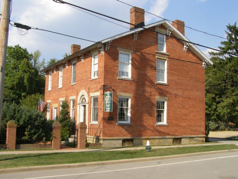


Strongsville, Ohio
Strongsville is a city of 45,983 people in Cuyahoga County, Ohio, founded in 1818.
Why visit Strongsville
Townapedia lists 14 museums and landmarks, 50 parks and trails, 125 places to eat, 8 places to stay and 2 attractions in and around town.
Highlights include Cinemark, Baldwin-Wallace College North Campus Historic District, Baldwin–Wallace College South Campus Historic District and Princess Ledges Nature Reserve.
July is the warmest month, with average highs of 84°F; January lows average 22°F, and about 64 inches of snow fall in a normal year.
Weather in Strongsville
Forecast from the National Weather Service. Full forecast
About Strongsville
Strongsville is a city in Cuyahoga County, Ohio, United States, and a suburb of Cleveland. As of the 2020 census, its population was 46,491.
From the Wikipedia article Strongsville, Ohio (this version), under CC BY-SA 4.0.
Things to do2


Museums and landmarks14

Baldwin-Wallace College North Campus Historic District
Monument and historic site · National Register of Historic Places · 4.4 mi
Historic district in Ohio, United States

Baldwin–Wallace College South Campus Historic District
Monument and historic site · National Register of Historic Places · 3.9 mi
Historic district in Ohio, United States

Berea Union Depot
Monument and historic site · National Register of Historic Places · 4.9 mi
Railway station in Berea, Ohio, the United States of America
Buehl House
Monument and historic site · National Register of Historic Places · 3.8 mi
Historic house in Ohio, United States

John and Maria Adams House
Monument and historic site · National Register of Historic Places · 6.1 mi
Building in Ohio, United States

John M. Annis House
Monument and historic site · National Register of Historic Places · 5.9 mi
Historic house in Ohio, United States

John Wheeler House
Monument and historic site · National Register of Historic Places · 3.2 mi
House in Berea, Ohio


Old District 10 Schoolhouse
Monument and historic site · National Register of Historic Places · 5.3 mi
School building in Middleburg Heights, Ohio

2 more on the map.
Parks, trails and playgrounds50

Princess Ledges Nature Reserve
Hiking and trails · 3.4 mi
4361 Spruce Avenue, Brunswick
06:00-(sunset+01:00)




38 more on the map.
Restaurants and cafes125

Another Broken Egg Cafe
Restaurant · Brunch · 2.2 mi
8913 Pearl Road, Strongsville
Mo-Fr 07:00-14:00; Sa-Su 07:00-15:00; Dec 25 off

Café Ah-Roma
Cafe · Bagel, Breakfast, Burger, Coffee Shop, Local, Sandwich · 3.9 mi
38 West Bridge Street
Mo-Fr 06:00-21:00; Sa 06:30-21:00; Su 07:30-21:00
Seafood Shake
Restaurant · Seafood · 0.9 mi
16523 Royalton Road, Strongsville
Mo-Th 11:30-22:00; Fr-Sa 11:30-22:30; Su 12:00-22:00


Buffalo Wild Wings
Restaurant · Wings · 2.4 mi
8465 Pearl Road, Strongsville
Mo-Th 11:00-24:00, Fr,Sa 11:00-24:00, Sa,Su 00:00-01:00, Su 11:00-23:00
113 more on the map.
History
Founded by settlers arriving in the newly purchased Connecticut Western Reserve, the city was named after John Stoughton Strong, the group's leader. He brought his oldest son, Emory Strong, his brother-in-law Elijah Lyman Sr., and Guilford Whitney, another relative of the Strongs. Along with Whitney came his daughter, her husband John Hilliard, and their daughter. Other pioneers in the group included William Fuller Jr., Obadiah Church, Zachariah Goodale, and George Fox Gilbert. They arrived in 1816 and cleared enough land to construct log cabins. The 25-square-mile area of land was surveyed and divided into lots for John Stoughton Strong to sell off by agreement with Oliver Ellsworth of Hartford, Connecticut. Strongsville officially became Township No. 5, 14th range on February 25, 1818. Strongsville became a village in 1923 and was ultimately designated a city in 1961.
From the History section of Strongsville, Ohio on Wikipedia, under CC BY-SA 4.0.
Where to stay8
Home2 Suites by Hilton Middleburg Heights Cleveland
Motel and hotel · 3.7 mi
7355 Engle Road, Middleburg Heights
Residence Inn Cleveland Airport/Middleburg Heights
Motel and hotel · 4.0 mi
19149 East Bagley Road, Middleburg Heights
Churches and places of worship28
Columbia Baptist Church
Church · National Register of Historic Places · 4.9 mi
Strongsville United Methodist Church
Church · United Methodist · 2.2 mi
13500 Royalton Road, Strongsville
Saint John Neumann Church
Church · Roman Catholic · 1.0 mi
16271 Pearl Road, Strongsville
Grace Church
Church · Christian And Missionary Alliance · 3.7 mi
7393 Pearl Road, Middleburg Heights
Kingdom Hall of Jehovah's Witnesses
Church · Jehovahs Witness · 3.4 mi
24000 Royalton Road, Columbia Station
Saint Batholomew Church
Church · Catholic · 4.0 mi
14865 Bagley Road, Middleburg Heights
Shopping32
SouthPark Mall
Shopping center · 0.7 mi
500 Southpark Center, Strongsville
Gas and EV charging20
Schools, colleges and libraries53
Albert Einstein Academy For Letters Arts And Sciences-Ohio
School · 1.8 mi
20566 Albion Rd, Strongsville
Healthcare16
MetroHealth Middleburg Heights November Family Health Center
Clinic and pharmacy · 2.9 mi
7800 Pearl Road, Middleburg Heights
Big Creek Medical Offices
Clinic and pharmacy · 4.1 mi
15299 Bagley Road, Middleburg Heights
Cleveland Clinic Middleburg Heights Family Health Center
Clinic and pharmacy · 4.2 mi
17840 Bagley Road, Middleburg Heights
Map of Strongsville
250 places. The map loads OpenStreetMap tiles when you open it.
Climate by month
Monthly table
| Month | High | Low | Rain | Snow |
|---|---|---|---|---|
| Jan | 36°F | 22°F | 3.0 in | 18.4 in |
| Feb | 38°F | 24°F | 2.5 in | 15.1 in |
| Mar | 47°F | 31°F | 3.1 in | 10.8 in |
| Apr | 60°F | 41°F | 3.8 in | 2.7 in |
| May | 71°F | 51°F | 3.8 in | 0.0 in |
| Jun | 80°F | 61°F | 3.8 in | 0.0 in |
| Jul | 84°F | 65°F | 3.7 in | 0.0 in |
| Aug | 82°F | 64°F | 3.6 in | 0.0 in |
| Sep | 76°F | 57°F | 3.9 in | 0.0 in |
| Oct | 64°F | 46°F | 3.6 in | 0.1 in |
| Nov | 51°F | 37°F | 3.4 in | 4.5 in |
| Dec | 40°F | 28°F | 3.0 in | 12.2 in |
U.S. Climate Normals 1991-2020 for Cleveland 72524 (7 mi away), NOAA NCEI.
People and cost of living
American Community Survey 5-year estimates, 2020-2024, U.S. Census Bureau. Estimates have margins of error, larger for small towns.
Disaster history
Cuyahoga County has had 11 federal disaster declarations since 2000, most often for severe storms.
- 2020-03-31: Covid-19 Pandemic (Biological)
- 2020-03-13: Covid-19 (Biological)
- 2013-01-03: Severe Storms And Flooding Due To The Remnants Of Hurricane Sandy (Hurricane)
- 2012-06-30: Severe Storms (Severe Storm)
- 2006-07-02: Severe Storms, Tornadoes, Straight Line Winds, And Flooding (Severe Storm)
- 2005-09-13: Hurricane Katrina Evacuation (Hurricane)
OpenFEMA disaster declarations summaries.
Getting there and nearby towns
Cleveland Hopkins International Airport (CLE) is the nearest airport with scheduled flights listed in OpenStreetMap, 7 miles away.
- Middleburg Heights 4 mi north, about 7 min by car
- North Royalton 4 mi east, about 7 min by car
- Berea 4 mi north, about 7 min by car
- Brunswick 5 mi south, about 8 min by car
- Parma Heights 6 mi northeast, about 10 min by car
- Brook Park 6 mi north, about 10 min by car
- Parma 7 mi northeast, about 12 min by car
- Broadview Heights 8 mi east, about 13 min by car
- North Olmsted 8 mi northwest, about 13 min by car
- Fairview Park 9 mi north, about 14 min by car
Drive times are estimates from straight-line distance, not routes.
Local news
Headlines from INDB, the NEMICO news database.
Reviews, tips and questions
Loading what members have shared...
Sources and licences
- NCES EDGE (Public domain): public schools
- NOAA NCEI U.S. Climate Normals 1991-2020 (Public domain): climate by month
- OpenFEMA (Public domain): disaster declarations
- OpenStreetMap contributors (ODbL 1.0): places, airports, map data
- U.S. Census Bureau (Public domain): population, income, housing, education, commute
- Wikidata (CC0 1.0): elevation, founding date, time zone, website, landmarks and historic places
- Wikimedia Commons (see each image): photos
- Wikipedia (CC BY-SA 4.0): overview and history text
Photo credits
- Strong House 2, Chris Light, CC BY-SA 3.0
- Curnayn Sales offices in Strongsville, Nyttend, Public domain
- Old School House 10 Middleburg Hts Ohio, Chris Light ( talk )., CC BY-SA 3.0
- Columbia Baptist Church, Nyttend, Public domain
- Buehl House P8300071, Chris Light, CC BY-SA 3.0
- John M. Annis House, Nyttend, Public domain
- John and Maria Adams House, Nyttend, Public domain
- Wheeler Hall Baldwin Wallace University, Pwojdacz, CC BY-SA 3.0
- John Wheeler House, Nyttend, Public domain
- Marting Hall BWC, IronGargoyle, CC BY-SA 3.0
- Baldwin Wallace University, Erik Drost, CC BY 4.0
- Alanson Pomeroy House, Martin Linsey, Public domain
- Paw Paw blossom, Geoffrey.landis, CC BY-SA 4.0
- Bonnie Park Waterfall - panoramio, Robbtronic, CC BY 3.0
- Bonnie Park Waterfall (15463866555), Erik Drost, CC BY 2.0
- Bonnie Park Waterfall (15463874235), Erik Drost, CC BY 2.0
- Bonnie Park Waterfall (15463890325), Erik Drost, CC BY 2.0
- Bonnie Park Waterfall (15277322527), Erik Drost, CC BY 2.0
- Bonnie Park Waterfall (15277309877), Erik Drost, CC BY 2.0
- Bonnie Park Waterfall (15463898015), Erik Drost, CC BY 2.0
- Bonnie Park Waterfall (15440776466), Erik Drost, CC BY 2.0
- Bonnie Park Waterfall (15277283627), Erik Drost, CC BY 2.0
- Bonnie Park Waterfall (15277153000), Erik Drost, CC BY 2.0
- Bonnie Park Waterfall (15440791436), Erik Drost, CC BY 2.0
- Bonnie Park Waterfall (15463868325), Erik Drost, CC BY 2.0
- Bonnie Park Waterfall (15277237268), Erik Drost, CC BY 2.0
- Bonnie Park Waterfall (15440800386), Erik Drost, CC BY 2.0
- Bonnie Park Waterfall (15277238568), Erik Drost, CC BY 2.0
- Bonnie Park Waterfall (15277164970), Erik Drost, CC BY 2.0
- Bonnie Park Waterfall (15463550202), Erik Drost, CC BY 2.0
- Bonnie Park Waterfall (15463886635), Erik Drost, CC BY 2.0
- Bonnie Park Waterfall (15277289297), Erik Drost, CC BY 2.0
- Bonnie Park Waterfall (15276995799), Erik Drost, CC BY 2.0
- Bonnie Park Waterfall (15440769506), Erik Drost, CC BY 2.0
- ISS047-E-151132 - View of Earth, Earth Science and Remote Sensing Unit , Lyndon B. Johnson Space Center, Public domain
- ISS060-E-3976 - View of Pennsylvania, Earth Science and Remote Sensing Unit, NASA Johnson Space Center, Public domain
- ISS060-E-3517 - View of Earth, Earth Science and Remote Sensing Unit, NASA Johnson Space Center, Public domain
- ISS060-E-3515 - View of Earth, Earth Science and Remote Sensing Unit, NASA Johnson Space Center, Public domain
- ISS060-E-3516 - View of Earth, Earth Science and Remote Sensing Unit, NASA Johnson Space Center, Public domain
- Mother of God Zyrovichy church, Timofei-online, CC BY-SA 4.0


Page built October 30, 2026. Spotted a mistake? Tell us or suggest a place.