


Why visit Sunriver
Townapedia lists 1 museum or landmark, 11 parks and trails, 21 places to eat and 2 attractions in and around town.
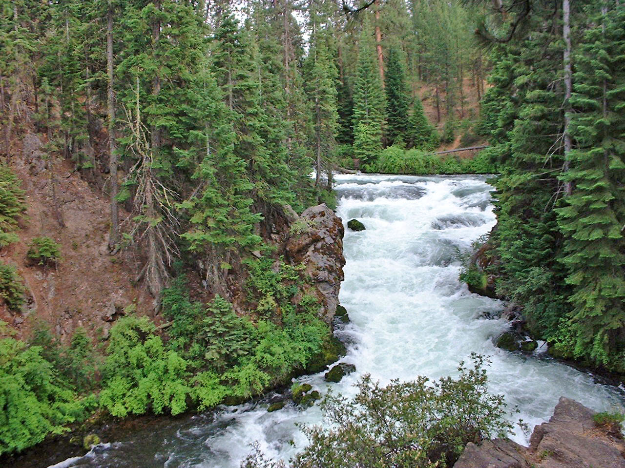
Highlights include Benham Falls and Artists' Gallery.
July is the warmest month, with average highs of 84°F; December lows average 19°F.
Weather in Sunriver
Forecast from the National Weather Service. Full forecast
About Sunriver
Sunriver is a census-designated place and 3,300-acre (13 km2) planned residential and resort community in Deschutes County, Oregon, United States. As of the 2020 census it had a population of 2,023, an increase from 1,393 in 2010. It is part of the Bend Metropolitan Statistical Area, located on the eastern side of the Deschutes River, about fifteen miles (25 km) south of Bend at the base of the Cascade Range.
From the Wikipedia article Sunriver, Oregon (this version), under CC BY-SA 4.0.
Things to do2



Museums and landmarks1

Parks, trails and playgrounds11



Restaurants and cafes21




9 more on the map.
History
Sunriver is located on the grounds of the former Camp Abbot, a World War II training facility designed to train combat engineers in a simulated combat environment. The U.S. Army camp opened in 1942, but by June 1944 the camp was abandoned and most of the settlement was razed.
The Officers' Club was spared; it has been preserved and renovated and is now known as the "Great Hall," under management of Sunriver Resort. The name "Sunriver" was selected by developers John Gray and Donald V. McCallum. The initial condominiums were built in 1968 in conjunction with the completion of Sunriver Lodge, and in 1969 the master plan was completed and developers began selling lots.
Sunriver was also the site of the pioneer Shonquest Ranch. Sunriver post office was established on July 18, 1969, at the same time as the public facilities were opened.
From the History section of Sunriver, Oregon on Wikipedia, under CC BY-SA 4.0.
Churches and places of worship2
Holy Trinity Catholic Church
Church · Roman Catholic · 1.3 mi
18160 Cottonwood Road, Sunriver
Shopping7
Gas and EV charging3
Schools, colleges and libraries2
Healthcare1
Map of Sunriver
50 places. The map loads OpenStreetMap tiles when you open it.
Climate by month
Monthly table
| Month | High | Low | Rain |
|---|---|---|---|
| Jan | 40°F | 20°F | 2.9 in |
| Feb | 43°F | 21°F | 1.9 in |
| Mar | 50°F | 24°F | 1.5 in |
| Apr | 57°F | 25°F | 1.2 in |
| May | 65°F | 33°F | 1.7 in |
| Jun | 72°F | 37°F | 1.1 in |
| Jul | 84°F | 41°F | 0.5 in |
| Aug | 83°F | 40°F | 0.6 in |
| Sep | 76°F | 34°F | 0.8 in |
| Oct | 62°F | 28°F | 1.4 in |
| Nov | 46°F | 24°F | 2.4 in |
| Dec | 38°F | 19°F | 3.2 in |
U.S. Climate Normals 1991-2020 for Sunriver (1 mi away), NOAA NCEI.
People and cost of living
American Community Survey 5-year estimates, 2020-2024, U.S. Census Bureau. Estimates have margins of error, larger for small towns.
Disaster history
Deschutes County has had 17 federal disaster declarations since 2000, most often for fires.
- 2026-07-23: Akawa Butte Fire (Fire)
- 2025-08-23: Flat Fire (Fire)
- 2024-08-02: Mile Marker 132 Fire (Fire)
- 2024-06-25: Darlene 3 Fire (Fire)
- 2021-06-30: 0419 Fire (Fire)
- 2020-09-15: Wildfires And Straight-Line Winds (Fire)
OpenFEMA disaster declarations summaries.
Getting there and nearby towns
Sunriver Airport (SUO) is the nearest airport with scheduled flights listed in OpenStreetMap, 1 miles away.
- Three Rivers 3 mi southwest, about 6 min by car
- Deschutes River Woods 8 mi northeast, about 13 min by car
- Seventh Mountain 9 mi north, about 14 min by car
- Tetherow 11 mi north, about 18 min by car
- Bend 14 mi northeast, about 22 min by car
- La Pine 14 mi south, about 22 min by car
- Tumalo 20 mi north, about 32 min by car
- Redmond 29 mi northeast, about 47 min by car
- Prineville 40 mi northeast, about 1 h by car
- Metolius 50 mi north, about 1 h 15 min by car
Drive times are estimates from straight-line distance, not routes.
Local news
Headlines from INDB, the NEMICO news database.
Reviews, tips and questions
Loading what members have shared...
Sources and licences
- NOAA NCEI U.S. Climate Normals 1991-2020 (Public domain): climate by month
- OpenFEMA (Public domain): disaster declarations
- OpenStreetMap contributors (ODbL 1.0): places, airports, map data
- U.S. Census Bureau (Public domain): population, income, housing, education, commute
- Wikidata (CC0 1.0): elevation, founding date, time zone, website, landmarks and historic places
- Wikimedia Commons (see each image): photos
- Wikipedia (CC BY-SA 4.0): overview and history text
Photo credits
- Deschutes River at Sunriver, Smithers7, CC BY-SA 3.0
- Sunriver Woodlands Golf Course, ryan harvey from Portland, OR, CC BY-SA 2.0
- Lake Aspen, Sunriver Oregon, Bill Reynolds from Lake Oswego, Oregon, CC BY 2.0
- Trees and golf course at Sunriver, Kirt Edblom from Corvallis, Oregon, United States, CC BY-SA 2.0
- Sunriver Lodge guest rooms, Kirt Edblom from Corvallis, Oregon, United States, CC BY-SA 2.0
- Sunriver Village parking lot, Nicolás Boullosa from Fontainebleau, France, CC BY 2.0
- Bike tunnel in Sunriver, Kirt Edblom from Corvallis, Oregon, United States, CC BY-SA 2.0
- Sunriver Meadows Golf Course, Kirt Edblom from Corvallis, Oregon, United States, CC BY-SA 2.0
- Sunset at Sunriver Resort in Central Oregon, Kirt Edblom, CC BY-SA 2.0
- Deer at Sunriver, Nicolás Boullosa from Fontainebleau, France, CC BY 2.0
- Houses at Sunriver, Oregon, Nicolás Boullosa from Fontainebleau, France, CC BY 2.0
- Sunriver Lodge October 2009 3, Brent, CC BY 2.0
- Sunriver Lodge October 2009, Brent, CC BY 2.0
- Sunriver Lodge October 2009 4, Brent, CC BY 2.0
- Sunriver Lodge October 2009 2, Brent, CC BY 2.0
- Pond at Sunriver Meadows course, Kirt Edblom from Corvallis, Oregon, United States, CC BY-SA 2.0
- Deschutes at Sunriver, May 2013, Brendon Connelly from Newberg, Oregon, CC BY-SA 2.0
- Water feature at Sunriver Lodge, Oregon, mahalie stackpole from seattle, USA, CC BY-SA 2.0
- Lake at Sunriver, Bill Reynolds from Lake Oswego, Oregon, CC BY 2.0
- Sunriver Deschutes, Kingofthedead, CC0
- Horses in Sunriver, Oregon, Kirt Edblom from Corvallis, Oregon, United States, CC BY-SA 2.0
- Sunriver WV banner, Horses on pasture in Sunriver.jpg : Kirt Edblom from Corvallis, Oregon, United States derivative work: ויקיג'אנקי, CC BY-SA 2.0
- Horses on pasture in Sunriver, Kirt Edblom from Corvallis, Oregon, United States, CC BY-SA 2.0
- Benham Falls, PJ Blalock, Public domain
- SHARC in July 2014, eyeliam from Portland, United States, CC BY 2.0
- SHARC, Kingofthedead, CC BY-SA 3.0
- Caps (43551988054), ryan harvey from Portland, OR, CC BY-SA 2.0
- Ft. Rock Park, Brendon Connelly from Newberg, Oregon, CC BY-SA 2.0
- SHARC in winter, Michael (a.k.a. moik) McCullough from Klamath Falls, Oregon, USA, CC BY 2.0
- Man fishing on the Deschutes, Nicolás Boullosa from Fontainebleau, France, CC BY 2.0
- Falco peregrinus, captive, injured, Jonathan Lidbeck from Eugene, USA, CC BY 2.0
- Deschutes River Oct 2015, Kirt Edblom from Corvallis, Oregon, United States, CC BY-SA 2.0
- Belt Failure (234582464), mahalie stackpole, CC BY-SA 2.0
- Central Oregon Training Exchange (41984632552), Bureau of Land Management Oregon and Washington from Portland, America, Public domain
- Central Oregon Training Exchange (41984632592), Bureau of Land Management Oregon and Washington from Portland, America, Public domain
- Central Oregon Training Exchange (41984632642), Bureau of Land Management Oregon and Washington from Portland, America, Public domain
- Central Oregon Training Exchange (41984632622), Bureau of Land Management Oregon and Washington from Portland, America, Public domain
- ISS029-E-28211 - View of Earth, Earth Science and Remote Sensing Unit , Lyndon B. Johnson Space Center, Public domain
- ISS029-E-27033 - View of Earth, Earth Science and Remote Sensing Unit , Lyndon B. Johnson Space Center, Public domain


Page built October 30, 2026. Spotted a mistake? Tell us or suggest a place.