


Why visit Superior
Townapedia lists 42 museums and landmarks, 42 parks and trails, 89 places to eat, 12 places to stay and 13 attractions in and around town.
Highlights include Wisconsin Point Light, Enger Tower, Minnesota Point Light and SS Meteor.
July is the warmest month, with average highs of 76°F; January lows average 6°F, and about 56 inches of snow fall in a normal year.
Weather in Superior
Forecast from the National Weather Service. Full forecast
About Superior
Superior is a city in Douglas County, Wisconsin, United States, and its county seat. The population was 26,751 at the 2020 census. Superior and nearby Duluth, Minnesota, sit at the western tip of Lake Superior and together form the Twin Ports, a major Great Lakes harbor.
From the Wikipedia article Superior, Wisconsin (this version), under CC BY-SA 4.0.
Things to do13

Wisconsin Point Light
Lighthouse · National Register of Historic Places · 3.7 mi
Lighthouse in Wisconsin, United States

Enger Tower
Monument and historic site · 6.1 mi
Building in Duluth, Minnesota

Great Lakes Aquarium
Zoo and aquarium · 6.0 mi
Public aquarium in Duluth, Minnesota, United States

Richard I. Bong Memorial Bridge
Bridge · 4.0 mi
Bridge in United States of America



Hanni Strahl Concert Hall
Cinema and theater · 2.1 mi
1401 Belknap Street, Superior
Thorpe Langley Auditorium
Cinema and theater · 1.7 mi
1710 Weeks Avenue, Superior
1 more on the map.
Museums and landmarks42

Minnesota Point Light
Lighthouse · National Register of Historic Places · 2.9 mi
Lighthouse in Minnesota, United States

SS Meteor
Monument and historic site · National Register of Historic Places · 2.2 mi
1896 ship, whaleback freighter converted to a museum ship
300 Marina Drive, Superior

Aerial Lift Bridge
Bridge · National Register of Historic Places · 6.0 mi
Transporter bridge in Duluth, MN
Berkshire Block
Monument and historic site · National Register of Historic Places · 2.6 mi
Commercial building in Superior, Wisconsin
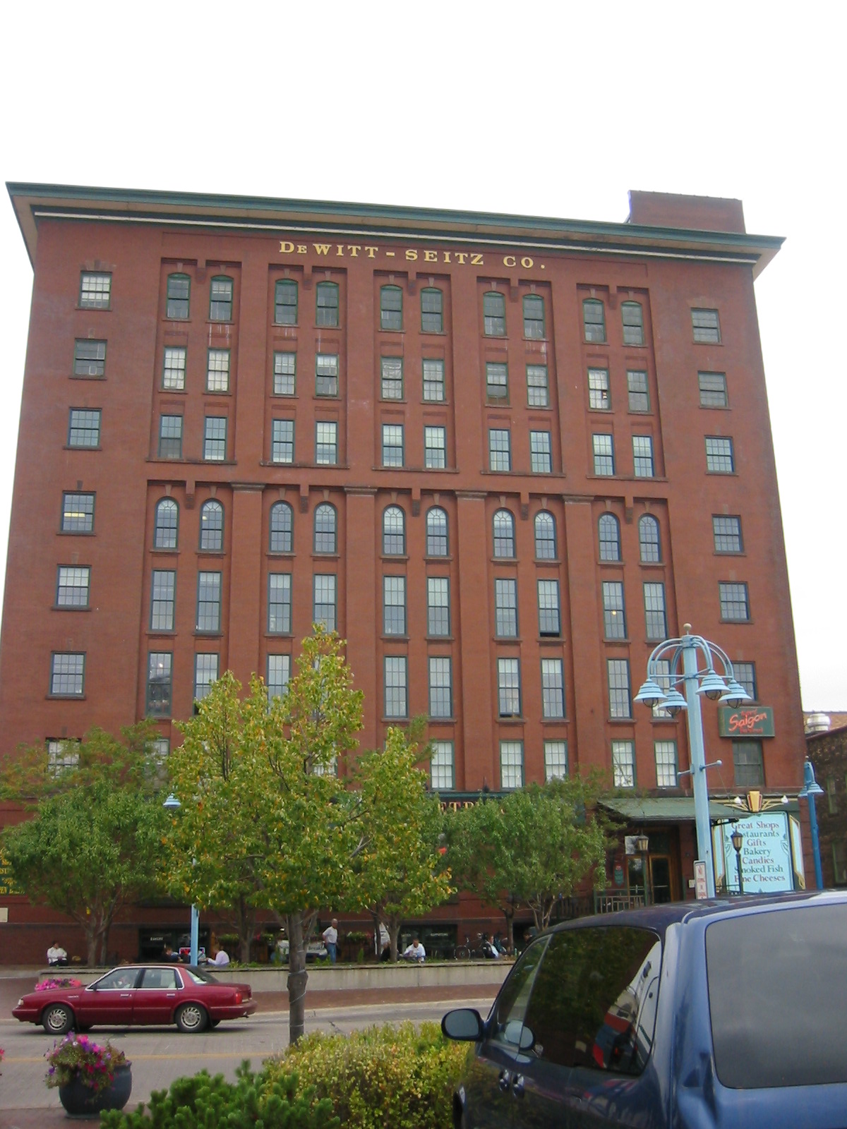
DeWitt-Seitz Building
Monument and historic site · National Register of Historic Places · 6.2 mi
Commercial building in Duluth, Minnesota

Douglas County Courthouse
Monument and historic site · National Register of Historic Places · 2.1 mi
Courthouse in Wisconsin

Duluth Civic Center Historic District
Monument and historic site · National Register of Historic Places · 6.3 mi
Historic district in Minnesota, United States
Duluth Depot
Monument and historic site · National Register of Historic Places · 6.2 mi
Railway museum in Minnesota, United States
Duluth Harbor North Pier Light
Lighthouse · National Register of Historic Places · 6.1 mi
Lighthouse in Minnesota, United States

Duluth Masonic Center
Monument and historic site · National Register of Historic Places · 6.6 mi
Masonic temple

Duluth Missabe and Iron Range Depot
Monument and historic site · National Register of Historic Places · 6.5 mi
Former train station in Duluth, Minnesota, United States


Duluth Public Library
Monument and historic site · National Register of Historic Places · 6.6 mi
Former Carnegie library at 101 W. 2nd Street in Duluth, Minnesota
30 more on the map.
Parks, trails and playgrounds42

Lake Superior Zoo
Park · 5.7 mi
Zoo in Duluth, Minnesota, United States




Minnesota Point Pine Forest Scientific and Natural Area
Hiking and trails · 2.7 mi
30 more on the map.
Restaurants and cafes89



Cedar Lounge
Bar and pub · 3.1 mi
1715 North 3rd Street, Superior
Mo-Tu 12:00-21:00; We-Th 12:00-22:00; Fr-Sa 11:00-23:00; Su 11:00-19:00
Hudy's Bar
Bar and pub · 1.6 mi
2126 E 5th St, Superior
Mo 02:00-14:00, Tu-Th 02:00-10:00; Fr-Sa 02:30-10:00; Su 02:00-10:00

New China
Restaurant · 1.9 mi
15 Belknap Street
Su 12:00-21:00; Mo 11:00-21:00; Tu-Th 11:00-21:30; Fr, Sa 11:00-22:00

Superior Family Restaurant
Restaurant · Diner · 2.4 mi
Sa-Th 07:00-15:00; Fr 07:00-20:00
77 more on the map.
History
The first log cabin in Superior was erected in September 1853 on the banks of the Nemadji River, at the same time that ground was broken for construction of the locks and ship canal at Sault Ste. Marie, Michigan. This was intended to allow ships to bypass the rapids at that site. Superior was founded as a settlement in 1854. A village government was organized on August 27, 1887, and Superior was incorporated as a city on March 25, 1889. Around the same time Superior became the seat of newly formed Douglas County, Wisconsin. Immediately there was eagerness for a railroad from Lake Superior to the Pacific Coast, and investment flowed in, but then the Panic of 1857 hit, investment slowed, and the population of the new city collapsed from 2500 to 500.
Twenty-five years later the Northern Pacific Railway and other rail lines finally arrived, fulfilling the dream of a rail and water highway from coast to coast. In 1883 General John Henry Hammond formed the Land and River Improvement Company, which developed much of West Superior, including the West Superior Iron and Steel plant. Numerous grain, coal and lumber businesses formed in the same period.
From the History section of Superior, Wisconsin on Wikipedia, under CC BY-SA 4.0.
Where to stay12
Barkers Island Inn Resort & Conference Center
Motel and hotel · 2.1 mi
300 Marina Drive, Superior
Quality Inn Superior - Duluth
Motel and hotel · 3.0 mi
1405 Susquehanna Avenue, Superior
Churches and places of worship21
Sacred Heart Cathedral, Sacred Heart School and Christian Brothers Home
Church · National Register of Historic Places · 6.6 mi
Bayside Baptist Church
Church · Baptist · 3.1 mi
3915 North 16th Street, Superior
Calvary Baptist Church
Church · Baptist · 2.3 mi
2812 North 21st Street, Superior
Holy Assumption Catholic Church
Church · Catholic · 1.8 mi
5601 Tower Avenue, Superior
Hope Congregational Church
Church · Congregational · 2.6 mi
1827 Wyoming Avenue, Superior
Our Savior's Lutheran Church
Church · Lutheran · 2.5 mi
1924 Wyoming Avenue, Superior
St. Alban's Episcopal Church
Church · Episcopal · 3.0 mi
1510 New York Avenue, Superior
St. Anthony Catholic Church
Church · Catholic · 3.0 mi
4315 East 3rd Street, Superior
Shopping18
Superior Harbor View Super One Foods
Grocery · 1.8 mi
2202 East 2nd Street, Superior
Gas and EV charging16
Schools, colleges and libraries33
Healthcare11
Aspirus St. Luke’s Superior Surgery Center
Clinic and pharmacy · 1.1 mi
109 North 28th Street, Superior
Essentia Health Convenient Care-Superior
Clinic and pharmacy · 1.8 mi
2202 East 2nd Street, Superior
Essentia Health St. Mary's-Superior Clinic
Clinic and pharmacy · 1.1 mi
3500 Tower Avenue, Superior
Essentia Health-Superior East Pharmacy
Clinic and pharmacy · 1.8 mi
2202 East 2nd Street, Superior
Essentia Health-Superior Pharmacy
Clinic and pharmacy · 1.1 mi
3500 Tower Avenue, Superior
Map of Superior
250 places. The map loads OpenStreetMap tiles when you open it.
Climate by month
Monthly table
| Month | High | Low | Rain | Snow |
|---|---|---|---|---|
| Jan | 22°F | 6°F | 0.8 in | 14.5 in |
| Feb | 27°F | 9°F | 0.9 in | 12.4 in |
| Mar | 36°F | 21°F | 1.4 in | 9.1 in |
| Apr | 46°F | 32°F | 2.6 in | 1.7 in |
| May | 57°F | 41°F | 3.4 in | 0.0 in |
| Jun | 67°F | 50°F | 4.6 in | 0.0 in |
| Jul | 76°F | 58°F | 3.9 in | 0.0 in |
| Aug | 75°F | 58°F | 3.9 in | 0.0 in |
| Sep | 67°F | 50°F | 3.4 in | 0.0 in |
| Oct | 53°F | 39°F | 3.2 in | 0.2 in |
| Nov | 39°F | 26°F | 2.1 in | 5.8 in |
| Dec | 27°F | 13°F | 1.3 in | 12.3 in |
U.S. Climate Normals 1991-2020 for Superior (2 mi away), NOAA NCEI.
People and cost of living
American Community Survey 5-year estimates, 2020-2024, U.S. Census Bureau. Estimates have margins of error, larger for small towns.
Disaster history
Douglas County has had 7 federal disaster declarations since 2000, most often for biologicals.
- 2020-04-04: Covid-19 Pandemic (Biological)
- 2020-03-13: Covid-19 (Biological)
- 2018-08-10: Severe Storms, Straight-Line Winds, And Flooding (Flood)
- 2016-08-09: Severe Storms And Flooding (Severe Storm)
- 2012-08-02: Severe Storms And Flooding (Severe Storm)
- 2005-09-13: Hurricane Katrina Evacuation (Hurricane)
OpenFEMA disaster declarations summaries.
Getting there and nearby towns
Richard I Bong Airport (SUW) is the nearest airport with scheduled flights listed in OpenStreetMap, 1 miles away.
- Superior 3 mi southwest, about 5 min by car
- Duluth 6 mi northwest, about 10 min by car
- Oliver 6 mi southwest, about 9 min by car
- Proctor 8 mi northwest, about 12 min by car
- Hermantown 11 mi northwest, about 18 min by car
- Esko 14 mi west, about 22 min by car
- Rice Lake 15 mi north, about 24 min by car
- Wrenshall 15 mi west, about 24 min by car
- Scanlon 16 mi west, about 27 min by car
- Cloquet 20 mi west, about 32 min by car
Drive times are estimates from straight-line distance, not routes.
Local news
Headlines from INDB, the NEMICO news database.
Reviews, tips and questions
Loading what members have shared...
Sources and licences
- NCES EDGE (Public domain): public schools
- NOAA NCEI U.S. Climate Normals 1991-2020 (Public domain): climate by month
- OpenFEMA (Public domain): disaster declarations
- OpenStreetMap contributors (ODbL 1.0): places, airports, map data
- U.S. Census Bureau (Public domain): population, income, housing, education, commute
- Wikidata (CC0 1.0): elevation, founding date, time zone, website, landmarks and historic places
- Wikimedia Commons (see each image): photos
- Wikipedia (CC BY-SA 4.0): overview and history text
Photo credits
- Tower Avenue, Nfarmakes, CC BY-SA 4.0
- NorthernBlockSuperiorWI, Jonathunder, CC BY-SA 3.0
- St. Francis Xavier Church - Superior, Wisconsin 02, Farragutful, CC BY-SA 4.0
- St. Francis Xavier Church - Superior, Wisconsin 03, Farragutful, CC BY-SA 4.0
- St. Francis Xavier Church - Superior, Wisconsin 01, Farragutful, CC BY-SA 4.0
- St. Francis Xavier Church - Superior, Wisconsin 04, Farragutful, CC BY-SA 4.0
- Pilgrim Lutheran Church - Superior, Wisconsin 02, Farragutful, CC BY-SA 4.0
- Pilgrim Lutheran Church - Superior, Wisconsin 01, Farragutful, CC BY-SA 4.0
- Pilgrim Lutheran Church - Superior, Wisconsin 03, Farragutful, CC BY-SA 4.0
- Cathedral of Christ the King - Superior, Wisconsin 09, Farragutful, CC BY-SA 4.0
- Superior Fire Department, Jayme Young, CC BY-SA 4.0
- Douglas County Courthouse Superior WI, Jayme Young, CC BY-SA 4.0
- Cathedral of Christ the King interior - Superior, Wisconsin 05, Farragutful, CC BY-SA 4.0
- Cathedral of Christ the King interior - Superior, Wisconsin 10, Farragutful, CC BY-SA 4.0
- Cathedral of Christ the King interior - Superior, Wisconsin 04, Farragutful, CC BY-SA 4.0
- Cathedral of Christ the King interior - Superior, Wisconsin 12, Farragutful, CC BY-SA 4.0
- Cathedral of Christ the King interior - Superior, Wisconsin 11, Farragutful, CC BY-SA 4.0
- Swenson Hall at the University of Wisconsin-Superior, Jbiros715, CC BY-SA 4.0
- SSMeteor-whaleback-050507, Bobak Ha'Eri, CC BY 3.0
- Minnesota Point Lighthouse, McGhiever, CC BY-SA 4.0
- Endion Depot, Todd Murray, CC BY-SA 3.0
- USS Essex (1876), US government employee, Public domain
- Duluth Entry, Pete Markham from Loretto, USA, CC BY-SA 2.0
- Former Sacred Heart Cathedral - Duluth 01, Farragutful, CC BY-SA 4.0
- Duluth South Pier Inner Range Light (7564441122), Pete Markham from Loretto, USA, CC BY-SA 2.0
- DeWitt-Seitz 3, Elkman, CC BY-SA 3.0
- DouglasCountyCourthouseSuperiorWI, Jonathunder, GFDL 1.2
- Firehouse1, The original uploader was Appraiser at English Wikipedia ., CC BY-SA 2.0
- Munger Terrace 1, Elkman, CC BY-SA 3.0
- Aerial lift bridge duluth mn, Mfield , Matthew Field, http://www.photography.mattfield.com, CC BY-SA 4.0
- Fitger's Brewing Company complex 2016, David Wilson from Oak Park, Illinois, USA, CC BY 2.0
- Duluth City Hall, Elkman, CC BY-SA 3.0
- Old Duluth Central High School, McGhiever, CC BY-SA 4.0
- Fairlawn 4x3 300 dpi, Nfarmakes, CC BY-SA 4.0
- Wisconsin Point Light house, Randen Pederson, CC BY-SA 2.0
- Lincoln Branch Library 1, Chris857, CC BY-SA 3.0
- EmpireBlockSuperiorWI, Jonathunder, GFDL 1.2
- Irving School 1, Elkman, CC BY-SA 4.0
- Old Duluth Public Library, McGhiever, CC BY-SA 4.0
- Duluth Masonic Temple 3, Chris857, CC BY-SA 4.0


Page built October 30, 2026. Spotted a mistake? Tell us or suggest a place.