
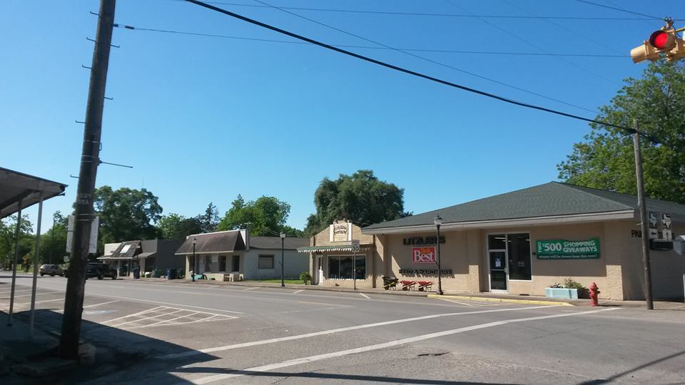
Why visit Sweeny
Townapedia lists 2 museums and landmarks, 3 parks and trails, 7 places to eat and 1 place to stay in and around town.
August is the warmest month, with average highs of 93°F; January lows average 45°F.
Weather in Sweeny
Forecast from the National Weather Service. Full forecast
About Sweeny
Sweeny is a city in Brazoria County, Texas, United States, the westernmost incorporated town in the county. The population was 3,626 as of 2020. The city's motto is "A City with Pride". The city was once known as Adamston.
From the Wikipedia article Sweeny, Texas (this version), under CC BY-SA 4.0.
Museums and landmarks2

Parks, trails and playgrounds3



Restaurants and cafes7


Where to stay1

History
Sweeny's settlement, though not under this name, began before Texas was even a Republic. Imla Keep, a doctor and member of Stephen F. Austin's Old Three Hundred colonists, received title to a league and labor of land that included the site of Sweeny on July 24, 1824. Keep eventually returned to Louisiana, and Martin Varner acquired the land. The land was named for John Sweeny, a Tennessee colonist who arrived with family members and 250 slaves in the area in 1833. He came after his sons, William Burrell and Thomas Jefferson Sweeny, had purchased land grants near the townsite. They purchased the land grants for the price of a load of mules, and came to examine their new land holdings in 1831. John Sweeny settled nearby, and in 1835, purchased the original Imla Keep League from Varner and constructed a house on the site. The home, today the Sweeny Plantation, a Recorded Texas Historic Landmark, was occupied by original family members through the 1990s. The original home was built in 1837 by slaves using only bricks, nails, and cypress and ash wood from the land. There were also 30 slave cabins made of cypress wood. The plantation had its own sawmill, sugar house, cotton gin, blacksmith shop, commissary, and a kiln for brick manufacture.
From the History section of Sweeny, Texas on Wikipedia, under CC BY-SA 4.0.
Shopping1
Gas and EV charging2
Schools, colleges and libraries10
Healthcare2
Map of Sweeny
28 places. The map loads OpenStreetMap tiles when you open it.
Climate by month
Monthly table
| Month | High | Low | Rain |
|---|---|---|---|
| Jan | 65°F | 45°F | 4.2 in |
| Feb | 68°F | 49°F | 2.2 in |
| Mar | 74°F | 54°F | 3.1 in |
| Apr | 79°F | 60°F | 2.4 in |
| May | 86°F | 68°F | 4.3 in |
| Jun | 91°F | 73°F | 3.8 in |
| Jul | 93°F | 75°F | 3.9 in |
| Aug | 93°F | 75°F | 4.2 in |
| Sep | 89°F | 71°F | 6.0 in |
| Oct | 84°F | 62°F | 4.4 in |
| Nov | 74°F | 53°F | 3.6 in |
| Dec | 67°F | 47°F | 3.7 in |
U.S. Climate Normals 1991-2020 for Angleton Brazoria Ap (15 mi away), NOAA NCEI.
People and cost of living
American Community Survey 5-year estimates, 2020-2024, U.S. Census Bureau. Estimates have margins of error, larger for small towns.
Disaster history
Brazoria County has had 23 federal disaster declarations since 2000, most often for hurricanes.
- 2024-07-09: Hurricane Beryl (Hurricane)
- 2021-02-19: Severe Winter Storms (Severe Ice Storm)
- 2021-02-14: Severe Winter Storm (Severe Ice Storm)
- 2020-08-24: Tropical Storms Marco And Laura (Hurricane)
- 2020-07-26: Hurricane Hanna (Hurricane)
- 2020-03-25: Covid-19 Pandemic (Biological)
OpenFEMA disaster declarations summaries.
Getting there and nearby towns
Eagle Air Park (BZT) is the nearest airport with scheduled flights listed in OpenStreetMap, 9 miles away.
- Brazoria 8 mi east, about 13 min by car
- Lake Jackson 15 mi east, about 24 min by car
- Jones Creek 15 mi east, about 24 min by car
- Bay City 16 mi west, about 26 min by car
- Angleton 18 mi northeast, about 30 min by car
- Clute 18 mi east, about 29 min by car
- Freeport 22 mi east, about 35 min by car
- Oyster Creek 23 mi east, about 37 min by car
- Danbury 25 mi northeast, about 40 min by car
- Needville 26 mi north, about 41 min by car
Drive times are estimates from straight-line distance, not routes.
Local news
Headlines from INDB, the NEMICO news database.
Reviews, tips and questions
Loading what members have shared...
Sources and licences
- NCES EDGE (Public domain): public schools
- NOAA NCEI U.S. Climate Normals 1991-2020 (Public domain): climate by month
- OpenFEMA (Public domain): disaster declarations
- OpenStreetMap contributors (ODbL 1.0): places, airports, map data
- U.S. Census Bureau (Public domain): population, income, housing, education, commute
- Wikidata (CC0 1.0): elevation, founding date, time zone, website
- Wikimedia Commons (see each image): photos
- Wikipedia (CC BY-SA 4.0): overview and history text
Photo credits
- Sweeny2015, Kmiec2015, CC BY-SA 4.0
Page built October 30, 2026. Spotted a mistake? Tell us or suggest a place.