


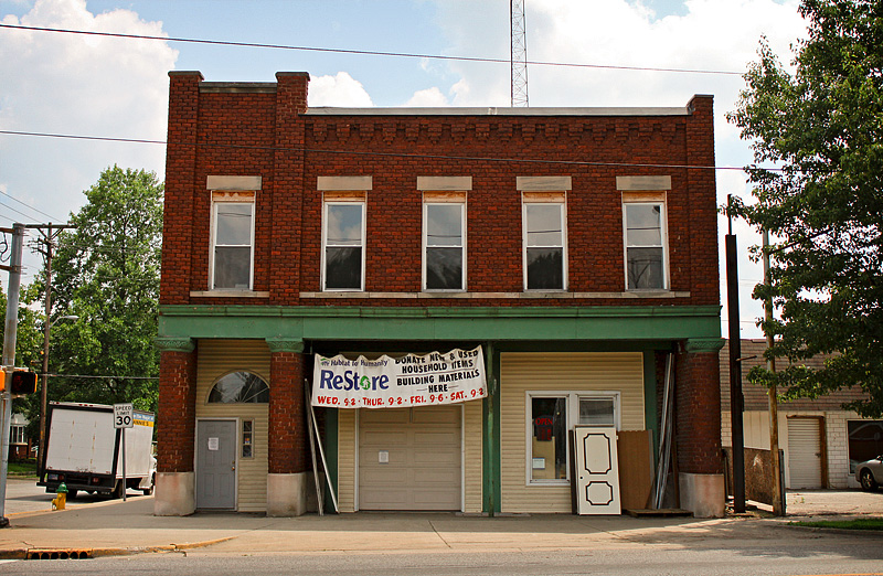


Terre Haute, Indiana
Terre Haute is a city of 58,427 people in Vigo County, Indiana, founded in 1811.
Why visit Terre Haute
Townapedia lists 52 museums and landmarks, 53 parks and trails, 171 places to eat, 23 places to stay and 8 attractions in and around town.
Highlights include Indiana Theatre, AMC Classic Terre Haute 12, Collett Park and Greenwood Elementary School.
July is the warmest month, with average highs of 90°F; January lows average 19°F.
Weather in Terre Haute
Forecast from the National Weather Service. Full forecast
About Terre Haute
Terre Haute is a city in Vigo County, Indiana, United States, and its county seat. As of the 2020 census, the city had a population of 58,389 and its metropolitan area had a population of 168,716.
From the Wikipedia article Terre Haute, Indiana (this version), under CC BY-SA 4.0.
Things to do8

Indiana Theatre
Cinema and theater · National Register of Historic Places · 1.7 mi
Movie theater and theater in Terre Haute, Indiana

Indiana State University
School · 1.7 mi
Public university in Terre Haute, Indiana, United States
Museums and landmarks52

Collett Park
Monument and historic site · National Register of Historic Places · 2.6 mi
On the National Register of Historic Places in Indiana

Greenwood Elementary School
Monument and historic site · National Register of Historic Places · 2.7 mi
Historic building

810 Wabash Avenue
Monument and historic site · National Register of Historic Places · 1.6 mi
Historic building in Terre Haute, Indiana, USA
Booker T. Washington School
Monument and historic site · National Register of Historic Places · 1.4 mi
Historic building in Terre Haute, Indiana

Building at 23–27 S. Sixth Street
Monument and historic site · National Register of Historic Places · 1.8 mi
Historic building in Terre Haute, Indiana, United States

Building at 510–516 Ohio Street
Monument and historic site · National Register of Historic Places · 1.9 mi
Historic building in Terre Haute, Indiana, United States
Butternut Hill
Monument and historic site · National Register of Historic Places · 1.5 mi
Building in Indiana, United States


Carr's Hall
Monument and historic site · National Register of Historic Places · 2.0 mi
Building in Indiana, United States
Chamber of Commerce Building
Monument and historic site · National Register of Historic Places · 1.8 mi
Building in Indiana, United States
Citizens' Trust Company Building
Monument and historic site · National Register of Historic Places · 1.8 mi
Historic building in Terre Haute, Indiana, USA
Collett Park Neighborhood Historic District
Monument and historic site · National Register of Historic Places · 2.7 mi
Historic district in Indiana, United States
Condit House
Monument and historic site · National Register of Historic Places · 1.8 mi
Historic house in Terre Haute, Indiana
40 more on the map.
Parks, trails and playgrounds53


Hawthorn Park
Park · 3.3 mi
Hawthorn Park & JI Case Wetland Wildlife Refuge consists of 256.72 acres and total water area of 68.6 acres. Inside Hawthorn Park is a...
6067 East Old Maple Avenue, Terre Haute

Wildlife Mitigation & Nature Trail
Park · 3.3 mi
Public access hiking and walking trails.
4799 E 30th, Terre Haute
sunrise-sunset
41 more on the map.
Restaurants and cafes171

Azzip Pizza
Restaurant · Pizza · 4.0 mi
4432 South US 41, Terre Haute
Su-Th 11:00-21:00,Fr-Sa 11:00-22:00

Babo's Cafe
Diner · American · 0.5 mi
2918 Wabash Avenue, Terre Haute
Mo-Fr 07:00-20:00; Sa 07:00-20:00; Su off

Baskin-Robbins
Ice cream · Ice Cream · 1.1 mi
85 South Fruitridge Avenue, Terre Haute
Mo-Th 10:00-22:00; Fr-Sa 10:00-23:00; Su 10:00-22:00
Buffalo Wild Wings
Restaurant · Wings · 3.6 mi
3718 South US 41, Terre Haute
Su-Th 11:00-24:00; Fr 11:00-01:00; Sa 11:00-01:00
China Garden
Restaurant · Chinese · 1.1 mi
1353 Wabash Ave, Terre Haute
Mo-Th 10:30-22:30; Fr, Sa 10:30-23:00; Su 11:00-22:30
Cracker Barrel
Diner · American · 2.9 mi
429 Margaret Avenue, Terre Haute
Mo-Th 06:00-22:00, Fr-Sa 06:00-23:00, Su 06:00-22:00
J. Gumbo's
Restaurant · Mexican · 1.7 mi
665 Wabash Avenue, Terre Haute
Mo-We 11:00-20:00, Th-Sa 11:00-21:00, Su 11:30-20:00
Logan's Roadhouse
Diner · American · 1.1 mi
100 South Fruitridge Avenue, Terre Haute
Mo-Th 11:00-20:30, Fr 11:00-21:00, Sa 11:30-21:00, Su 11:30-20:00
LongHorn Steakhouse
Restaurant · Steak House · 3.2 mi
3290 South US Highway 41, Terre Haute
Mo-Th 11:00-22:00; Fr-Sa 11:00-23:00
159 more on the map.
History
Terre Haute's name is derived from the French phrase terre haute (pronounced [tɛʁ ot] in French), meaning "highland". It was named by French-Canadian explorers and fur trappers to the area in the early 18th century to describe the unique location above the Wabash River (see French colonization of the Americas). At the time, the area was claimed by the French and British and these highlands were considered the border between Canada and Louisiana.
The construction of Fort Harrison in 1811 marked the known beginning of a permanent population of European-Americans in the area that would become known as Terre Haute. A Wea Indian village already existed near the fort, and the orchards and meadows they kept a few miles south of the fort became the site of the present-day city. The village of Terre Haute, then a part of Knox County, Indiana, was platted in 1816.
Terre Haute became the county seat of the newly formed Vigo County in 1818, leading to increased population growth. The village's estimated 1,000 residents voted to incorporate in 1832; the village was elevated to city status in 1853.
From the History section of Terre Haute, Indiana on Wikipedia, under CC BY-SA 4.0.
Where to stay23
Comfort Suites Terre Haute University Area
Motel and hotel · 2.8 mi
501 East Margaret Avenue, Terre Haute
Churches and places of worship41
Allen Chapel African Methodist Episcopal Church
Church · National Register of Historic Places · 2.1 mi
Bethany Congregational Church
Church · National Register of Historic Places · 3.7 mi
First Congregational Church
Church · National Register of Historic Places · 1.8 mi
Terre Haute Reformed Presbyterian Church
Church · Reformed · 1.2 mi
1407 North 25th Street, Terre Haute
Shopping39
Gas and EV charging39
Schools, colleges and libraries48
Woodrow Wilson Junior High School
School · National Register of Historic Places
301 South 25th Street, Terre Haute
Benjamin Franklin Elem School
School · 1.1 mi
1600 Dr Iverson C Bell Ln, Terre Haute
Healthcare18
Map of Terre Haute
250 places. The map loads OpenStreetMap tiles when you open it.
Climate by month
Monthly table
| Month | High | Low | Rain |
|---|---|---|---|
| Jan | 40°F | 19°F | 2.5 in |
| Feb | 45°F | 23°F | 2.5 in |
| Mar | 56°F | 33°F | 3.4 in |
| Apr | 69°F | 44°F | 4.9 in |
| May | 78°F | 54°F | 4.8 in |
| Jun | 87°F | 63°F | 5.1 in |
| Jul | 90°F | 66°F | 4.3 in |
| Aug | 89°F | 64°F | 3.3 in |
| Sep | 84°F | 56°F | 3.3 in |
| Oct | 70°F | 43°F | 3.7 in |
| Nov | 56°F | 33°F | 3.7 in |
| Dec | 45°F | 25°F | 3.2 in |
U.S. Climate Normals 1991-2020 for Terre Haute Indiana State (2 mi away), NOAA NCEI.
People and cost of living
American Community Survey 5-year estimates, 2020-2024, U.S. Census Bureau. Estimates have margins of error, larger for small towns.
Disaster history
Vigo County has had 9 federal disaster declarations since 2000, most often for severe storms.
- 2026-01-24: Severe Winter Storm (Winter Storm)
- 2020-04-03: Covid-19 Pandemic (Biological)
- 2020-03-13: Covid-19 (Biological)
- 2014-04-22: Severe Winter Storm And Snowstorm (Severe Storm)
- 2008-06-08: Severe Storms, Flooding, And Tornadoes (Severe Storm)
- 2005-09-10: Hurricane Katrina Evacuation (Hurricane)
OpenFEMA disaster declarations summaries.
Getting there and nearby towns
Terre Haute Regional Airport (HUF) is the nearest airport with scheduled flights listed in OpenStreetMap, 4 miles away.
- West Terre Haute 4 mi west, about 6 min by car
- Charleston 43 mi west, about 1 h 15 min by car
- Crawfordsville 47 mi northeast, about 1 h 15 min by car
- Danville 49 mi north, about 1 h 15 min by car
- Bloomington 50 mi southeast, about 1 h 15 min by car
- Martinsville 51 mi east, about 1 h 15 min by car
- Danville 51 mi northeast, about 1 h 15 min by car
- Mattoon 53 mi west, about 1 h 30 min by car
- Vincennes 55 mi south, about 1 h 30 min by car
- Plainfield 56 mi east, about 1 h 30 min by car
Drive times are estimates from straight-line distance, not routes.
Local news
Headlines from INDB, the NEMICO news database.
Reviews, tips and questions
Loading what members have shared...
Sources and licences
- NCES EDGE (Public domain): public schools
- NOAA NCEI U.S. Climate Normals 1991-2020 (Public domain): climate by month
- OpenFEMA (Public domain): disaster declarations
- OpenStreetMap contributors (ODbL 1.0): places, airports, map data
- U.S. Census Bureau (Public domain): population, income, housing, education, commute
- Wikidata (CC0 1.0): elevation, founding date, time zone, website, landmarks and historic places
- Wikimedia Commons (see each image): photos
- Wikipedia (CC BY-SA 4.0): overview and history text
Photo credits
- Greetings from Terre Haute, Indiana, on the Banks of the Beautiful Wabash River- Large Letter Postcard (5625803684), Steve Shook from Moscow, Idaho, USA, CC BY 2.0
- Woodrow Wilson School Terre Haute IN, Christina Blust, CC BY-SA 2.0
- Terre Haute Fire Station 8, Christina Blust, CC BY-SA 2.0
- Greetings from Terre Haute, Indiana - Large Letter Postcard (5794986420), Steve Shook from Moscow, Idaho, USA, CC BY 2.0
- Booker T Washington School Terre Haute IN, Christina Blust, CC BY-SA 2.0
- Booker T. Washington School in Terre Haute, Nyttend, Public domain
- Site of the house at 209-211 S. Ninth Street in Terre Haute, Nyttend, Public domain
- House at 823 Ohio Street in Terre Haute, Nyttend, Public domain
- Building at 810 Wabash Avenue in Terre Haute, Nyttend, Public domain
- Terre Haute Masonic Temple, Nyttend, Public domain
- Terre Haute Post Office and Federal Building, Nyttend, Public domain
- Terre Haute Post Office and Federal Building 2008, C. Bedford Crenshaw, Attribution
- VCSC offices, Terre Haute, Nyttend, Public domain
- Chamber of Commerce Building in Terre Haute, Nyttend, Public domain
- First Congregational Church in Terre Haute, Nyttend, Public domain
- Collett Park pavilion, Nyttend, Public domain
- Greenwood Elementary School in Terre Haute, Nyttend, Public domain
- Church in the Farrington's Grove Historic District, Nyttend, Public domain
- Site of Carr's Hall in Terre Haute, Nyttend, Public domain
- Sage-Robinson-Nagel House, Nyttend, Public domain
- 600 Block Wabash Avenue, C. Bedford Crenshaw, aka Bedford at en.wikipedia, Attribution
- Terre Haute Masonic Temple 2008, C. Bedford Crenshaw, Attribution
- Eugene V Debs Home 3, C. Bedford Crenshaw, Attribution
- Building at 23-27 S. Sixth Street, Nyttend, Public domain
- Highland Lawn Cemetery, Christina Blust, CC BY-SA 2.0
- VigoCoHomeforDependentChildren, Christina Blust, CC BY-SA 2.0
- Building at 510-516 Ohio Street in Terre Haute, Nyttend, Public domain
- Twelve Points Historic District, Nyttend, Public domain
- Terminal Arcade, C. Bedford Crenshaw, Attribution
- Percopo, Cjeiler, Public domain
- Plastic straws littered on gravel driveway, The earth hero, CC BY-SA 4.0
- Butternut Hill driveway, Nyttend, Public domain
- Building in the Wabash Avenue-East HD, Nyttend, Public domain
- Normal Hall (former library) from south east, EchoEternal, CC BY-SA 4.0
- South entrance of normal hall from south east, EchoEternal, CC BY-SA 4.0
- South Entrance of Normal Hall from East, EchoEternal, CC BY-SA 4.0
- State Normal Library, Indiana State University, Nyttend, Public domain
- Normal hall exterior main entrance from south, EchoEternal, CC BY-SA 4.0
- Normal Hall Exterior from South, EchoEternal, CC BY-SA 4.0
- Condit House Side View from East, EchoEternal, CC BY-SA 4.0


Page built October 30, 2026. Spotted a mistake? Tell us or suggest a place.