
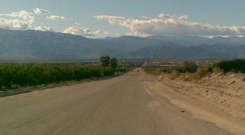


Thermal, California
Thermal is a community of 1,800 people in Riverside County, California.
Why visit Thermal
Townapedia lists 1 park or trail in and around town.
July is the warmest month, with average highs of 107°F; December lows average 38°F.
Weather in Thermal
Forecast from the National Weather Service. Full forecast
About Thermal
Thermal is an unincorporated community within the Coachella Valley in Riverside County, California, United States, located approximately 25 miles (40 km) southeast of Palm Springs and about 9.5 miles (15.3 km) north of the Salton Sea. The community's elevation is 138 feet (42 m) below mean sea level. It is served by area codes 760 and 442 and is in ZIP Code 92274. The population was 2,676 at the 2020 census.
From the Wikipedia article Thermal, California (this version), under CC BY-SA 4.0.
Parks, trails and playgrounds1

Gas and EV charging1

Schools, colleges and libraries22

College of the Desert East Valley Campus, Mecca/Thermal
School · 2.8 mi
61120 Buchanan Street, Thermal
10 more on the map.
History
On December 30, 1823, Brevet Captain Jose Romero led a military expedition finding a route to Tucson from San Gabriel passes in the foothills west of Thermal and Martinez Indian Village (South of Thermal).
Thermal (originally Kokell) began as a railroad camp in 1910 for employees of the Southern Pacific Railroad, followed by Mecca (originally called Walters) in 1915 and Arabia in between, each with about 1,000 residents. Permanent dwellings were soon established on Avenue 56 (renamed Airport Boulevard), former U.S. Route 99 (State Route 86) and State Route 111 by the 1930s.
Agricultural development from canal irrigation made the area thrive in greenery by the 1950s, followed by the former Camp Young U.S. Naval Air station converted into Thermal Airport by 1965. In the early 1990s, a four-lane highway (State Route 86) was constructed over an earlier transportation route. There is a proposal for a major commercial aviation Airport known as the Jackie Cochran-Desert Cities Regional Airport on the same site.
From the History section of Thermal, California on Wikipedia, under CC BY-SA 4.0.
Map of Thermal
24 places. The map loads OpenStreetMap tiles when you open it.
Climate by month
Monthly table
| Month | High | Low | Rain | Snow |
|---|---|---|---|---|
| Jan | 71°F | 39°F | 0.6 in | 0.0 in |
| Feb | 74°F | 43°F | 0.6 in | 0.0 in |
| Mar | 81°F | 49°F | 0.3 in | 0.0 in |
| Apr | 87°F | 55°F | 0.1 in | 0.0 in |
| May | 95°F | 63°F | 0.0 in | 0.0 in |
| Jun | 103°F | 69°F | 0.0 in | 0.0 in |
| Jul | 107°F | 76°F | 0.1 in | 0.0 in |
| Aug | 106°F | 75°F | 0.1 in | 0.0 in |
| Sep | 102°F | 68°F | 0.3 in | 0.0 in |
| Oct | 91°F | 57°F | 0.2 in | 0.0 in |
| Nov | 79°F | 45°F | 0.2 in | 0.0 in |
| Dec | 69°F | 38°F | 0.3 in | 0.0 in |
U.S. Climate Normals 1991-2020 for Desert Resorts Rgnl Ap (2 mi away), NOAA NCEI.
People and cost of living
American Community Survey 5-year estimates, 2020-2024, U.S. Census Bureau. Estimates have margins of error, larger for small towns.
Disaster history
Riverside County has had 47 federal disaster declarations since 2000, most often for fires.
- 2026-05-20: Bain Fire (Fire)
- 2024-09-11: Airport Fire (Fire)
- 2024-07-21: Hawarden Fire (Fire)
- 2023-11-21: Tropical Storm Hilary (Hurricane)
- 2023-01-09: Severe Winter Storms, Flooding, And Mudslides (Flood)
- 2022-09-06: Fairview Fire (Fire)
OpenFEMA disaster declarations summaries.
Getting there and nearby towns
Jacqueline Cochran Regional Airport (TRM) is the nearest airport with scheduled flights listed in OpenStreetMap, 2 miles away.
- Coachella 4 mi north, about 7 min by car
- La Quinta 8 mi west, about 13 min by car
- Indio 9 mi northwest, about 15 min by car
- Palm Desert 15 mi northwest, about 25 min by car
- Rancho Mirage 20 mi northwest, about 31 min by car
- Cathedral City 24 mi northwest, about 39 min by car
- Palm Springs 26 mi northwest, about 43 min by car
- Desert Edge 27 mi northwest, about 44 min by car
- Borrego Springs 30 mi southwest, about 48 min by car
- Desert Hot Springs 33 mi northwest, about 53 min by car
Drive times are estimates from straight-line distance, not routes.
Local news
Headlines from INDB, the NEMICO news database.
Reviews, tips and questions
Loading what members have shared...
Sources and licences
- NCES EDGE (Public domain): public schools
- NOAA NCEI U.S. Climate Normals 1991-2020 (Public domain): climate by month
- OpenFEMA (Public domain): disaster declarations
- OpenStreetMap contributors (ODbL 1.0): places, airports, map data
- U.S. Census Bureau (Public domain): population, income, housing, education, commute
- Wikidata (CC0 1.0): elevation, founding date, time zone, website
- Wikimedia Commons (see each image): photos
- Wikipedia (CC BY-SA 4.0): overview and history text
Photo credits
- AirportBlvd ThermalCalifornia, MarsRover, Public domain
- Whitewater River pano near Thermal CA, Dicklyon, CC BY-SA 4.0
- Thermal, California and Santa Rosa Mountains 2, Z3lvs, CC0
- Thermal, California and Santa Rosa Mountains, Z3lvs, CC0
- The Thermal Club (16747736935), Curt Smith from Bellevue, WA, USA, CC BY 2.0
- Thermal Club aerial photo 2022-04-15, National Agriculture Imagery Program, Public domain
- ISS047-E-6363 - View of Earth, Earth Science and Remote Sensing Unit , Lyndon B. Johnson Space Center, Public domain
- ISS047-E-6364 - View of Earth, Earth Science and Remote Sensing Unit , Lyndon B. Johnson Space Center, Public domain
- ISS047-E-6362 - View of Earth, Earth Science and Remote Sensing Unit , Lyndon B. Johnson Space Center, Public domain
- ISS065-E-429973 - View of Earth, Earth Science and Remote Sensing Unit , Lyndon B. Johnson Space Center, Public domain
- ISS053-E-383015 - View of Earth, Earth Science and Remote Sensing Unit , Lyndon B. Johnson Space Center, Public domain
- ISS030-E-266183 - View of Earth, Earth Science and Remote Sensing Unit , Lyndon B. Johnson Space Center, Public domain
- ISS065-E-213193 - View of Earth, Earth Science and Remote Sensing Unit , Lyndon B. Johnson Space Center, Public domain
- ISS061-E-77233 - View of Earth, Earth Science and Remote Sensing Unit, NASA Johnson Space Center, Public domain
- ISS065-E-213192 - View of Earth, Earth Science and Remote Sensing Unit , Lyndon B. Johnson Space Center, Public domain
- ISS022-E-50966 - View of Earth, Earth Science and Remote Sensing Unit , Lyndon B. Johnson Space Center, Public domain
- ISS061-E-77234 - View of Earth, Earth Science and Remote Sensing Unit, NASA Johnson Space Center, Public domain
- ISS022-E-44241 - View of Earth, Earth Science and Remote Sensing Unit , Lyndon B. Johnson Space Center, Public domain
- ISS061-E-77235 - View of Earth, Earth Science and Remote Sensing Unit, NASA Johnson Space Center, Public domain


Page built October 30, 2026. Spotted a mistake? Tell us or suggest a place.