


Thorofare, New Jersey
Thorofare is a community of 2,348 people in Gloucester County, New Jersey.
Why visit Thorofare
Townapedia lists 31 museums and landmarks, 10 parks and trails, 10 places to eat, 1 place to stay and 4 attractions in and around town.
Highlights include Tinicum Island Rear Range Light, George C. Platt Bridge, Fort Mifflin and Red Bank Battlefield.
July is the warmest month, with average highs of 88°F; January lows average 26°F, and about 23 inches of snow fall in a normal year.
Weather in Thorofare
Forecast from the National Weather Service. Full forecast
About Thorofare
Thorofare is an unincorporated community and census-designated place (CDP) located within West Deptford Township in northwestern Gloucester County, situated in the South Jersey region of the U.S. state of New Jersey. The area is served as United States Postal Service ZIP Code 08086. As of the 2020 United States census, the CDP's population was 2,806. As of the 2000 census, the population of a different geographic entity containing Thorofare, namely ZIP Code Tabulation Area 08086, was 5,424.
From the Wikipedia article Thorofare, New Jersey (this version), under CC BY-SA 4.0.
Things to do4

Tinicum Island Rear Range Light
Lighthouse · National Register of Historic Places · 2.2 mi
Lighthouse in New Jersey, United States

George C. Platt Bridge
Bridge · 3.1 mi
Bridge in Philadelphia, Pennsylvania

Girard Point Bridge
Bridge · 2.6 mi
Bridge in Philadelphia County, Pennsylvania, United States

Museums and landmarks31
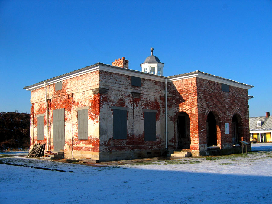
Fort Mifflin
Museum · National Register of Historic Places · 1.6 mi
On the Delaware River below Philadelphia, Pennsylvania

Red Bank Battlefield
Monument and historic site · National Register of Historic Places · 1.2 mi
Battlefield in National Park, Gloucester County, New Jersey

Commandant's Quarters
Monument and historic site · National Register of Historic Places · 3.1 mi
Listed on the NRHP in Philadelphia, Pennsylvania

G. G. Green's Block
Monument and historic site · National Register of Historic Places · 2.7 mi
Building in New Jersey, United States of America

Hunter-Lawrence-Jessup House
Monument and historic site · National Register of Historic Places · 2.7 mi
Historic house in Woodbury, New Jersey

James Whitall Jr. House
Monument and historic site · National Register of Historic Places · 1.2 mi
Historic house in New Jersey, United States

Ladd's Castle
Monument and historic site · National Register of Historic Places · 2.9 mi
Historic house in Gloucester County, New Jersey

Marine Barracks
Monument and historic site · National Register of Historic Places · 2.9 mi
National Register of Historic Places listings in Philadelphia County, Pennsylvania

Philadelphia Naval Shipyard
Monument and historic site · National Register of Historic Places · 2.6 mi
Naval shipyard of the United States

Thompson House
Monument and historic site · National Register of Historic Places · 2.5 mi
Historic house in New Jersey, United States

Woodbury Friends' Meetinghouse
Monument and historic site · National Register of Historic Places · 2.7 mi
Historic meetinghouse in New Jersey, United States

Carpenter Street School
Monument and historic site · National Register of Historic Places · 2.8 mi
19 more on the map.
Parks, trails and playgrounds10

Franklin Delano Roosevelt Park
Park · 3.4 mi
Park in Philadelphia, Pennsylvania, USA

Red Bank Battlefield Park
Park · 0.8 mi
Park in Gloucester County, New Jersey



Restaurants and cafes10






Where to stay1
Best Western Philadelphia South - West Deptford Inn
Motel and hotel · 1.2 mi
98 Friars Boulevard, West Deptford
Churches and places of worship1
Gas and EV charging3
Schools, colleges and libraries42
Map of Thorofare
102 places. The map loads OpenStreetMap tiles when you open it.
Climate by month
Monthly table
| Month | High | Low | Rain | Snow |
|---|---|---|---|---|
| Jan | 41°F | 26°F | 3.1 in | 7.1 in |
| Feb | 44°F | 28°F | 2.8 in | 8.4 in |
| Mar | 53°F | 34°F | 4.0 in | 3.6 in |
| Apr | 65°F | 44°F | 3.5 in | 0.3 in |
| May | 74°F | 54°F | 3.3 in | 0.0 in |
| Jun | 83°F | 64°F | 4.0 in | 0.0 in |
| Jul | 88°F | 70°F | 4.4 in | 0.0 in |
| Aug | 86°F | 68°F | 4.3 in | 0.0 in |
| Sep | 79°F | 61°F | 4.4 in | 0.0 in |
| Oct | 67°F | 49°F | 3.5 in | 0.0 in |
| Nov | 56°F | 39°F | 2.9 in | 0.2 in |
| Dec | 46°F | 31°F | 4.0 in | 3.5 in |
U.S. Climate Normals 1991-2020 for Philadelphia Intl Ap 72408 (2 mi away), NOAA NCEI.
People and cost of living
American Community Survey 5-year estimates, 2020-2024, U.S. Census Bureau. Estimates have margins of error, larger for small towns.
Disaster history
Gloucester County has had 20 federal disaster declarations since 2000, most often for hurricanes.
- 2021-09-05: Remnants Of Hurricane Ida (Hurricane)
- 2021-09-02: Remnants Of Hurricane Ida (Hurricane)
- 2020-12-11: Tropical Storm Isaias (Hurricane)
- 2020-03-25: Covid-19 Pandemic (Biological)
- 2020-03-13: Covid-19 (Biological)
- 2015-07-22: Severe Storm (Severe Storm)
OpenFEMA disaster declarations summaries.
Getting there and nearby towns
Philadelphia International Airport (PHL) is the nearest airport with scheduled flights listed in OpenStreetMap, 3 miles away.
- National Park 1 mi northeast, about 2 min by car
- Paulsboro 2 mi southwest, about 4 min by car
- Woodbury 3 mi southeast, about 4 min by car
- Mount Royal 3 mi south, about 5 min by car
- Oak Valley 4 mi southeast, about 6 min by car
- Brooklawn 4 mi east, about 7 min by car
- Gloucester City 5 mi northeast, about 8 min by car
- Gibbstown 5 mi southwest, about 8 min by car
- Bellmawr 6 mi east, about 9 min by car
- Darby 6 mi northwest, about 9 min by car
Drive times are estimates from straight-line distance, not routes.
Local news
Headlines from INDB, the NEMICO news database.
Reviews, tips and questions
Loading what members have shared...
Sources and licences
- NCES EDGE (Public domain): public schools
- NOAA NCEI U.S. Climate Normals 1991-2020 (Public domain): climate by month
- OpenFEMA (Public domain): disaster declarations
- OpenStreetMap contributors (ODbL 1.0): places, airports, map data
- U.S. Census Bureau (Public domain): population, income, housing, education, commute
- Wikidata (CC0 1.0): elevation, founding date, time zone, website, landmarks and historic places
- Wikimedia Commons (see each image): photos
- Wikipedia (CC BY-SA 4.0): overview and history text
Photo credits
- Mifflin Commandant's House03, Joe Minardi, CC BY 2.5
- Red Bank Battle Monument, 1906, National Park, NJ, Zeete, CC BY-SA 4.0
- HUNTER-LAWRENCE-JESSUP HOUSE, Ton2cats, CC BY-SA 3.0
- James Whitall Jr. House, National Park, NJ, Zeete, CC BY-SA 4.0
- Aerial view of the Philadelphia Naval Shipyard Reserve Basin on 19 May 1955 (80-G-668655), Unknown author Unknown author, Public domain
- THOMPSON HOUSE(1), Ton2cats, CC BY-SA 3.0
- WOODBURY FRIENDS' MEETINGHOUSE(1), Ton2cats, CC BY-SA 3.0
- LADD'S CASTLE, Ton2cats, CC BY-SA 3.0
- Phila MarineBarracks01, Davidt8, Public domain
- Tinicum Island Rear Range Light, Paulsboro, NJ, Zeete, CC BY-SA 4.0
- G.G.GREEN BLOCK 1880, Ton2cats, CC BY-SA 3.0
- Commandants Quarters PNS, Smallbones, Public domain
- G Wolf School Philly, Smallbones, Public domain
- GLOUCESTER CO. NJ, CARPENTER STREET SCHOOL, Ton2cats, CC BY-SA 3.0
- 1600 Callowhill, Smallbones, Public domain
- James and Ann Whitall House, Red Bank Battlefield, National Park, NJ, Zeete, CC BY-SA 4.0
- FDR Park 2A, Smallbones, Public domain
- Basin Bridge of Philadelphia Naval Shipyard 1995, Jet Lowe, Public domain
- Christ Church Woodbury quarter view, RasputinAXP, CC BY-SA 4.0
- Delaware River walkway, Red Bank Battlefield Park, NJ, Zeete, CC BY-SA 4.0
- American Swedish Museum, Smallbones, Public domain
- Phila Platt Bridge02, Davidt8, Public domain
- Red Bank Battle Monument, 1829, National Park, NJ, Zeete, CC BY-SA 4.0


Page built October 30, 2026. Spotted a mistake? Tell us or suggest a place.