


Why visit Tonopah
Townapedia lists 39 museums and landmarks, 6 parks and trails, 16 places to eat, 10 places to stay and 14 attractions in and around town.
Highlights include Mizpah Hotel and Arthur Raycraft House.
July is the warmest month, with average highs of 88°F; December lows average 21°F.
Weather in Tonopah
Forecast from the National Weather Service. Full forecast
About Tonopah
Tonopah ( TOHN-ə-pah, Shoshoni language: Tonampaa) is a census-designated place in and the county seat of Nye County, Nevada, United States. Nicknamed the Queen of the Silver Camps for its mining-rich history, it is now primarily a tourism-based resort city, notable for attractions like the Mizpah Hotel and the Clown Motel.
From the Wikipedia article Tonopah, Nevada (this version), under CC BY-SA 4.0.
Things to do14

2 more on the map.
Museums and landmarks39

Mizpah Hotel
Monument and historic site · National Register of Historic Places · 1.0 mi
Historic hotel in Tonopah, Nevada
100 Main Street, Tonopah

Arthur Raycraft House
Monument and historic site · National Register of Historic Places · 1.2 mi
Historic house in Nevada, United States

Bass Building
Monument and historic site · National Register of Historic Places · 1.1 mi
Listed on the National Register of Historic Places

Brann Boardinghouse
Monument and historic site · National Register of Historic Places · 1.2 mi
Building in Nevada, United States

Cada C. Boak House
Monument and historic site · National Register of Historic Places · 1.4 mi
Historic house in Nevada, United States

Cal Shaw Adobe Duplex
Monument and historic site · National Register of Historic Places · 1.0 mi
Building in Nevada, United States

Cal Shaw Stone Row House
Monument and historic site · National Register of Historic Places · 1.0 mi
Historic house in Nevada, United States
Campbell and Kelly Building
Monument and historic site · National Register of Historic Places · 0.8 mi
Historic building in Tonopah, Nevada, US

Combellack Adobe Row House
Monument and historic site · National Register of Historic Places · 1.0 mi
Historic house in Nevada, United States

Dr. J.R. Masterson House
Monument and historic site · National Register of Historic Places · 1.2 mi
Historic house in Nevada, United States

E. E. Burdick House
Monument and historic site · National Register of Historic Places · 1.2 mi
Historic house in Nevada, United States
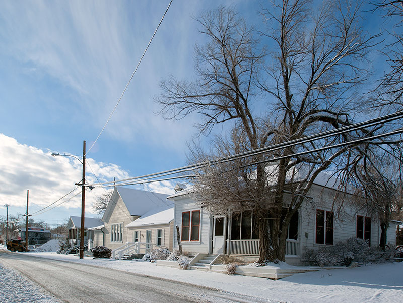


E.R. Shields House
Monument and historic site · National Register of Historic Places · 1.2 mi
Historic house in Nevada, United States
27 more on the map.
Parks, trails and playgrounds6

Restaurants and cafes16


Beans & Brews Coffee House
Cafe · Coffee Shop · 1.8 mi
1300 South Main Street, Tonopah
Mo-Su 06:00-17:00

El Marqués
Restaurant · Mexican · 0.9 mi
348 Main Street, Tonopah
Tu-Su 11:00-21:00
Godfather's Pizza Express
Restaurant · Pizza · 1.6 mi
1170 Grand Army of the Republic Highway;Veterans Memorial Highway, Tonopah

4 more on the map.
History
The American community began circa 1900 with the discovery of silver-rich ore by prospector Jim Butler. The legendary tale of discovery says that he went looking for a burro that had wandered off during the night and sought shelter near a rock outcropping. When Butler discovered the animal the next morning, he picked up a rock to throw at it in frustration, noticing that the rock was unusually heavy. He had stumbled upon the second-richest silver strike in Nevada history. However, this commonly-told story is likely apocryphal. Butler was married to a local Paiute woman named Belle—her family guided Butler to the area long known by indigenous peoples for its surface minerals.
From February 1905, Tonopah experienced a disease outbreak known as the Tonopah plague. The disease reportedly affected primarily adult men and caused acute pneumonia.
From the History section of Tonopah, Nevada on Wikipedia, under CC BY-SA 4.0.
Where to stay10
American Quality Suites & Tonopah RV
Campground · 1.8 mi
1160 Grand Army of the Republic Highway;Veterans Memorial Highway, Tonopah
Churches and places of worship3
St. Mark's Episcopal Church
Church · National Register of Historic Places · 1.2 mi
Saint Patrick Catholic Church
Church · Roman Catholic · 1.2 mi
144 South Street, Tonopah
Shopping5
Gas and EV charging10
Love's
Gas station · 1.6 mi
1170 Grand Army of the Republic Highway;Veterans Memorial Highway, Tonopah
Love's Travel Stop
Gas station · 1.6 mi
1170 Grand Army of the Republic Highway;Veterans Memorial Highway, Tonopah
Schools, colleges and libraries4
Healthcare1
Map of Tonopah
108 places. The map loads OpenStreetMap tiles when you open it.
Climate by month
Monthly table
| Month | High | Low | Rain |
|---|---|---|---|
| Jan | 41°F | 23°F | 0.7 in |
| Feb | 44°F | 25°F | 1.1 in |
| Mar | 52°F | 30°F | 0.7 in |
| Apr | 59°F | 35°F | 0.5 in |
| May | 69°F | 44°F | 0.7 in |
| Jun | 81°F | 54°F | 0.3 in |
| Jul | 88°F | 61°F | 0.6 in |
| Aug | 86°F | 60°F | 0.5 in |
| Sep | 79°F | 51°F | 0.4 in |
| Oct | 64°F | 40°F | 0.6 in |
| Nov | 50°F | 30°F | 0.5 in |
| Dec | 42°F | 21°F | 0.4 in |
U.S. Climate Normals 1991-2020 for Tonopah (1 mi away), NOAA NCEI.
People and cost of living
American Community Survey 5-year estimates, 2020-2024, U.S. Census Bureau. Estimates have margins of error, larger for small towns.
Disaster history
Nye County has had 5 federal disaster declarations since 2000, most often for biologicals.
- 2020-04-04: Covid-19 Pandemic (Biological)
- 2020-03-13: Covid-19 (Biological)
- 2005-09-13: Hurricane Katrina Evacuation (Hurricane)
- 2005-02-23: Snow (Snowstorm)
- 2005-02-17: Record And/Or Near Record Snow (Snowstorm)
OpenFEMA disaster declarations summaries.
Getting there and nearby towns
Tonopah Airport (TPH) is the nearest airport with scheduled flights listed in OpenStreetMap, 8 miles away.
- Goldfield 26 mi south, about 41 min by car
Drive times are estimates from straight-line distance, not routes.
Local news
Headlines from INDB, the NEMICO news database.
Reviews, tips and questions
Loading what members have shared...
Sources and licences
- NCES EDGE (Public domain): public schools
- NOAA NCEI U.S. Climate Normals 1991-2020 (Public domain): climate by month
- OpenFEMA (Public domain): disaster declarations
- OpenStreetMap contributors (ODbL 1.0): places, airports, map data
- U.S. Census Bureau (Public domain): population, income, housing, education, commute
- Wikidata (CC0 1.0): elevation, founding date, time zone, website, landmarks and historic places
- Wikimedia Commons (see each image): photos
- Wikipedia (CC BY-SA 4.0): overview and history text
Photo credits
- 2013-09-19 12 59 58 View of downtown Tonopah, Nevada from the southwest, Famartin, CC BY-SA 3.0
- Mizpah Hotel Tonopah Nevada, Raquel Baranow, CC BY-SA 3.0
- 2015-05-04 09 29 51 View northwest along Main Street (U.S. Routes 6 and 95) near Everett Street in Tonopah, Nevada, Famartin, CC BY-SA 4.0
- Stone Jail Building And Row House NRHP 82003248 Nye County, NV, Jon Roanhaus, CC BY-SA 4.0
- Judge W A Sawle House, NoeHill, CC BY-SA 3.0
- Combellack Adobe Row House2 NRHP 82003226 Nye County, NV, Jon Roanhaus, CC BY-SA 4.0
- 2015-05-04 09 28 09 The United States Post Office on Main Street (U.S. Routes 6 and 95) in Tonopah, Nevada, Famartin, CC BY-SA 4.0
- Tonopah Extension Mining Company Power Building 82003254 Nye County, NV, Jon Roanhaus, CC BY-SA 4.0
- Bass Building, NoeHill, CC BY-SA 3.0
- John gregovich house, Rloisclark, CC BY-SA 4.0
- Jim Butler Mining Company Row Houses NRHP 82003224 Nye County, NV, Jon Roanhaus, CC BY-SA 4.0
- Brann Boardinghouse NRHP 82003220 Nye County, NV, Jon Roanhaus, CC BY-SA 4.0
- Burdick House NRHP 82003223 Ney County, NV, Jon Roanhaus, CC BY-SA 4.0
- Old Nye County Courthouse, Tonopah, Nevada, Ken Lund from Las Vegas, Nevada, USA, CC BY-SA 2.0
- E R Shields House, NoeHill, CC BY-SA 3.0
- Cal Shaw Adobe Duplex NRHP 82003243 Nye County, NV, Jon Roanhaus, CC BY-SA 4.0
- Cada C. Boak House NRHP 82003217 Nye County, NV, Jon Roanhaus, CC BY-SA 4.0
- Irving McDonald House NRHP 82003235 Nye County, NV, Jon Roanhaus, CC BY-SA 4.0
- Street view of the St. Marks P. E. Church, Freckledilemma, CC BY-SA 4.0
- Curtis Oddie House2 NRHP 82003228 Nye County, NV, Jon Roanhaus, CC BY-SA 4.0
- Wieland Brewery Building, E.W. Smith, Public domain
- Uri B Curtis House, NoeHill, CC BY-SA 3.0
- Arthur Raycraft House 82003240 Nye County, NV, Jon Roanhaus, CC BY-SA 4.0
- Masterson House NRHP 82003234 Nye County, NV, Jon Roanhaus, CC BY-SA 4.0
- Tonopah Liquor Company Building 2, Tom Hilton, CC BY 2.0
- Brokers Exchange NRHP 82003221 Nye County, NV, Jon Roanhaus, CC BY-SA 4.0
- Frank Golden Block NRHP 82003231 Nye County, NV, Jon Roanhaus, CC BY-SA 4.0
- H.A. McKim Building, Willem van Bergen, CC BY-SA 2.0


Page built October 30, 2026. Spotted a mistake? Tell us or suggest a place.