


Trent Woods, North Carolina
Trent Woods is a town of 4,032 people in Craven County, North Carolina, founded in 1959.
Why visit Trent Woods
Townapedia lists 40 museums and landmarks, 2 parks and trails, 37 places to eat, 5 places to stay and 2 attractions in and around town.
Highlights include Masonic Temple and Theater, Bear Town Cinema, Attmore-Oliver House and Baxter Clock.
July is the warmest month, with average highs of 88°F; January lows average 35°F.
Weather in Trent Woods
Forecast from the National Weather Service. Full forecast
About Trent Woods
Trent Woods is a town in Craven County, North Carolina, United States. As of the 2020 census, the town had a population of 4,074. It is part of the New Bern, North Carolina Micropolitan Statistical Area.
From the Wikipedia article Trent Woods, North Carolina (this version), under CC BY-SA 4.0.
Things to do2

Masonic Temple and Theater
Cinema and theater · National Register of Historic Places · 3.5 mi
Masonic temple and theatre in New Bern, North Carolina, also known as St. John's Lodge No. 3
Museums and landmarks40

Attmore-Oliver House
Monument and historic site · National Register of Historic Places · 3.4 mi
Historic house in North Carolina, United States

Baxter Clock
Monument and historic site · National Register of Historic Places · 3.4 mi
Historic street clock located in New Bern, North Carolina

Benjamin Smith House
Monument and historic site · National Register of Historic Places · 3.3 mi
Historic house in North Carolina, United States

Blades House
Monument and historic site · National Register of Historic Places · 3.6 mi
Historic house in North Carolina, United States

Bryan House and Office
Monument and historic site · National Register of Historic Places · 3.2 mi
New Bern, North Carolina, NRHP-listed
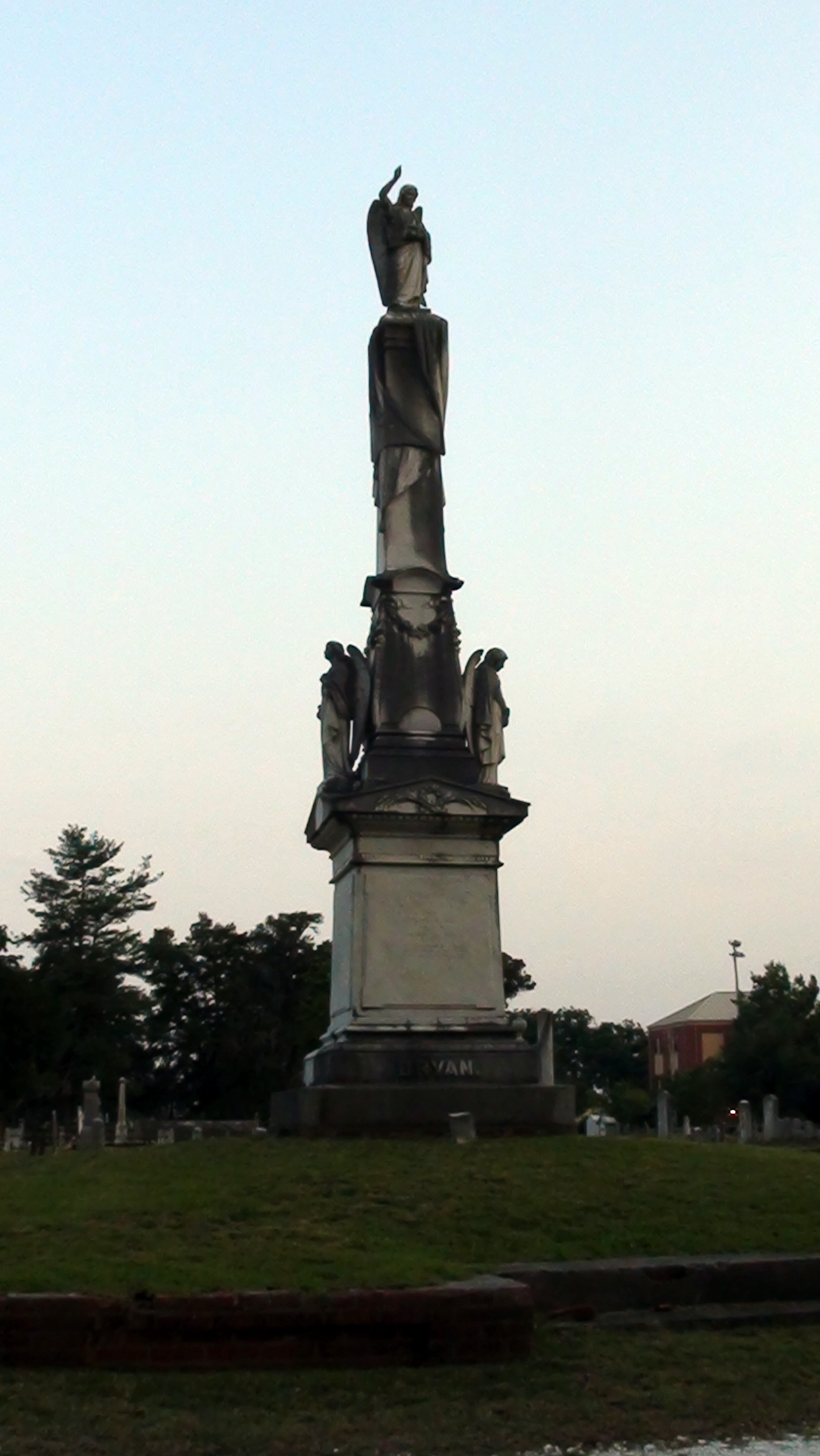
Cedar Grove Cemetery
Monument and historic site · National Register of Historic Places · 3.5 mi
Cemetery in New Bern, North Carolina, United States

Central Elementary School
Monument and historic site · National Register of Historic Places · 3.5 mi
Listed on the NRHP in Craven County, North Carolina

Coor-Bishop House
Monument and historic site · National Register of Historic Places · 3.7 mi
New Bern, North Carolina, listed on the NRHP in Craven County

Coor-Gaston House
Monument and historic site · National Register of Historic Places · 3.6 mi
Historic house in North Carolina, United States

Craven Terrace
Monument and historic site · National Register of Historic Places · 3.1 mi
Historic apartment complex located at New Bern, Craven County, North Carolina


DeGraffenried Park Historic District
Monument and historic site · National Register of Historic Places · 2.5 mi
Historic district in North Carolina, United States
Dr. Earl S. Sloan House
Monument and historic site · National Register of Historic Places · 0.5 mi
Trent Woods, North Carolina, listed on the NRHP in Craven County, North Carolina
28 more on the map.
Parks, trails and playgrounds2


Restaurants and cafes37



Gardner's Barbecue
Restaurant · 1.5 mi
3820 M L King Jr Boulevard, New Bern
Mad Hatter Tea House
Restaurant · Coffee Shop · 1.4 mi
3809 Dr. Martin Luther King Junior Boulevard, New Bern

25 more on the map.
History
The Dr. Earl S. Sloan House was listed on the National Register of Historic Places in 1986.
From the History section of Trent Woods, North Carolina on Wikipedia, under CC BY-SA 4.0.
Where to stay5
Holiday Inn Express & Suites New Bern - Medical Park
Motel and hotel · 1.7 mi
1020 Newman Road, New Bern
Holiday Inn Express New Bern
Motel and hotel · 1.1 mi
3455 M L King Jr Boulevard, New Bern
Churches and places of worship13
Centenary Methodist Church
Church · National Register of Historic Places · 3.5 mi
Christ Episcopal Church and Parish House
Church · National Register of Historic Places · 3.4 mi
Ebenezer Presbyterian Church
Church · National Register of Historic Places · 3.3 mi
First Baptist Church
Church · National Register of Historic Places · 3.0 mi
First Church of Christ, Scientist
Church · National Register of Historic Places · 3.5 mi
First Missionary Baptist Church
Church · National Register of Historic Places · 3.4 mi
First Presbyterian Church and Churchyard
Church · National Register of Historic Places · 3.5 mi
Mount Shiloh Missionary Baptist Church
Church · National Register of Historic Places · 3.0 mi
Rue Chapel AME Church
Church · National Register of Historic Places · 3.1 mi
St. John's Missionary Baptist Church
Church · National Register of Historic Places · 2.7 mi
St. Peter's AME Zion Church
Church · National Register of Historic Places · 3.4 mi
Shopping16
Gas and EV charging9
Schools, colleges and libraries18
Healthcare4
Map of Trent Woods
146 places. The map loads OpenStreetMap tiles when you open it.
Climate by month
Monthly table
| Month | High | Low | Rain |
|---|---|---|---|
| Jan | 56°F | 35°F | 4.0 in |
| Feb | 59°F | 37°F | 3.5 in |
| Mar | 65°F | 42°F | 3.4 in |
| Apr | 74°F | 50°F | 3.7 in |
| May | 79°F | 59°F | 4.3 in |
| Jun | 86°F | 67°F | 5.6 in |
| Jul | 88°F | 72°F | 6.2 in |
| Aug | 87°F | 70°F | 7.5 in |
| Sep | 82°F | 66°F | 7.3 in |
| Oct | 74°F | 54°F | 4.0 in |
| Nov | 66°F | 44°F | 3.5 in |
| Dec | 59°F | 39°F | 4.1 in |
U.S. Climate Normals 1991-2020 for Perrytown (2 mi away), NOAA NCEI.
People and cost of living
American Community Survey 5-year estimates, 2020-2024, U.S. Census Bureau. Estimates have margins of error, larger for small towns.
Disaster history
Craven County has had 23 federal disaster declarations since 2000, most often for hurricanes.
- 2026-01-24: Severe Winter Storm (Winter Storm)
- 2024-09-26: Hurricane Helene (Tropical Storm)
- 2024-08-06: Tropical Storm Debby (Tropical Storm)
- 2022-10-01: Hurricane Ian (Hurricane)
- 2020-10-14: Hurricane Isaias (Hurricane)
- 2020-08-02: Hurricane Isaias (Hurricane)
OpenFEMA disaster declarations summaries.
Getting there and nearby towns
Coastal Carolina Regional Airport (EWN) is the nearest airport with scheduled flights listed in OpenStreetMap, 3 miles away.
- New Bern 1 mi northeast, about 2 min by car
- Brices Creek 3 mi south, about 5 min by car
- River Bend 3 mi west, about 5 min by car
- James City 6 mi southeast, about 9 min by car
- Maysville 15 mi southwest, about 24 min by car
- Havelock 16 mi southeast, about 26 min by car
- Bayboro 19 mi east, about 30 min by car
- Newport 25 mi southeast, about 40 min by car
- Piney Green 26 mi southwest, about 41 min by car
- Jacksonville 30 mi southwest, about 48 min by car
Drive times are estimates from straight-line distance, not routes.
Local news
Headlines from INDB, the NEMICO news database.
Reviews, tips and questions
Loading what members have shared...
Sources and licences
- NCES EDGE (Public domain): public schools
- NOAA NCEI U.S. Climate Normals 1991-2020 (Public domain): climate by month
- OpenFEMA (Public domain): disaster declarations
- OpenStreetMap contributors (ODbL 1.0): places, airports, map data
- U.S. Census Bureau (Public domain): population, income, housing, education, commute
- Wikidata (CC0 1.0): elevation, founding date, time zone, website, landmarks and historic places
- Wikimedia Commons (see each image): photos
- Wikipedia (CC BY-SA 4.0): overview and history text
Photo credits
- StJohnsMBChurch 5533, Cecouchman, CC BY-SA 3.0
- First Presbyterian Church-New Bern, Tradewinds, CC BY-SA 3.0
- FirstBaptistNewBern 5461, Cecouchman, CC BY-SA 3.0
- RueChapelAME 5460, Cecouchman, CC BY-SA 3.0
- MountShilohMBChurch 5866, Cecouchman, CC BY-SA 3.0
- Episcopal Church, Tradewinds, CC BY-SA 3.0
- First Church of Christ, Scientist - New Bern, Tradewinds, CC BY-SA 3.0
- St Peter's AME Zion Church, Tradewinds, CC BY-SA 3.0
- CentenaryMethodist 5440, Cecouchman, CC BY-SA 3.0
- First Baptist Church-New Bern NC, Tradewinds, CC BY-SA 3.0
- EbenezerPresbyterian 5429, Cecouchman, CC BY-SA 3.0
- Thomas Jerkins House, Tradewinds, CC BY-SA 3.0
- Harvey Mansion ca. 1798, Tradewinds, CC BY-SA 3.0
- Stevenson House, Tradewinds, CC BY-SA 3.0
- NewBernHouse1, Smallbones ( talk ), Public domain
- HawksHouse 5963, Cecouchman, CC BY-SA 3.0
- Bryan House and Office, Tradewinds, CC BY-SA 3.0
- Eli Smallwood House, Tradewinds, CC BY-SA 3.0
- Coor-Gaston House, Tradewinds, CC BY-SA 3.0
- Monument in Cedar Grove Cemetery (New Bern, NC), KathyAnn, Public domain
- JTBarberSchool 5469, Cecouchman, CC BY-SA 3.0
- William Hollister House, Tradewinds, CC BY-SA 3.0
- Central Elementary School - New Bern Academy, Tradewinds, CC BY-SA 3.0
- Isaac Taylor House, Tradewinds, CC BY-SA 3.0
- Baxter Clock, Tradewinds, CC BY-SA 3.0
- Gull Harbor, Tradewinds, CC BY-SA 3.0
- Attmore-Oliver House, self, CC BY-SA 3.0
- IsaacHSmithHouse 5422, Cecouchman, CC BY-SA 3.0
- Ghent Historic District, Tradewinds, CC BY-SA 3.0
- Craven Terrace 1, NCSherrie, CC BY-SA 4.0
- Jerkins-Duffy House, Tradewinds, CC BY-SA 3.0
- Smith-Whitford House, Tradewinds, CC BY-SA 3.0
- Rhem-Waldrop House (John L. Rhem House), Tradewinds, CC BY-SA 3.0
- Tisdale-Jones House, Tradewinds, CC BY-SA 3.0
- York-Gordon House, Tradewinds, CC BY-SA 3.0
- Coor-Bishop House, Tradewinds, CC BY-SA 3.0
- DeGraffenried Park Historic District, Tradewinds, CC BY-SA 3.0
- RiversideHistoricDistrict 5973, Cecouchman, CC BY-SA 3.0
- Ulysses S. Mace, Tradewinds, CC BY-SA 3.0
- Benjamin Smith House, Tradewinds, CC BY-SA 3.0


Page built October 30, 2026. Spotted a mistake? Tell us or suggest a place.