



Why visit Tyler
Townapedia lists 60 museums and landmarks, 38 parks and trails, 164 places to eat, 34 places to stay and 11 attractions in and around town.
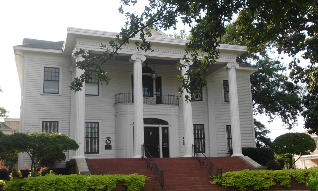
Highlights include Caldwell Zoo, Studio Movie Grill, D.R. Glass Library and Goodman-LeGrand House.
August is the warmest month, with average highs of 94°F; January lows average 38°F.
Weather in Tyler
Forecast from the National Weather Service. Full forecast
About Tyler
Tyler is a city in and the county seat of Smith County, Texas, United States. As of 2020, the population is 105,995. Tyler is the 38th most populous city in Texas (as well as the most populous in Northeast Texas) and 289th in the United States. It is the principal city of the Tyler metropolitan statistical area, which is the 198th most populous metropolitan area in the U.S. and 16th in Texas after Waco and the College Station–Bryan areas, with a population of 233,479 in 2020.
From the Wikipedia article Tyler, Texas (this version), under CC BY-SA 4.0.
Things to do11

Caldwell Zoo
Zoo and aquarium · 3.9 mi
Local zoo which is home to over 3,000 individual animals over more than 80 acres of land divided between 3 regions, featuring animals...
2203 West Martin Luther King Jr Boulevard, Tyler
09:00-17:00; Jan 01,Nov Th[4],Dec 25 off

Liberty Hall
Cinema and theater · 2.3 mi
Downtown theater operated by the city of Tyler, Texas, USA

University of Texas at Tyler
School · 3.2 mi
American university located in Tyler, Texas
Museums and landmarks60

D.R. Glass Library
Monument and historic site · National Register of Historic Places · 3.9 mi
Building in Tyler (vicinity), Smith County, Texas

Goodman-LeGrand House
Monument and historic site · National Register of Historic Places · 2.7 mi
Historic house in Texas, United States
624 North Broadway Avenue, Tyler
Ramey House
Monument and historic site · National Register of Historic Places · 1.8 mi
Historic place in Tyler, Smith County, Texas

Whitaker-McClendon House
Monument and historic site · National Register of Historic Places · 1.8 mi
Historic place in Tyler, Smith County, Texas

Blackstone Building
Monument and historic site · National Register of Historic Places · 2.5 mi
Building in Tyler, Smith County, Texas

Carnegie Public Library
Monument and historic site · National Register of Historic Places · 2.3 mi
Historic place in Tyler, Smith County, Texas

Charnwood Residential Historic District
Monument and historic site · National Register of Historic Places · 1.7 mi
Historic district in Tyler, Smith County, Texas

Cotton Belt Depot Museum
Monument and historic site · National Register of Historic Places · 2.6 mi
Historic place in Tyler, Smith County, Texas
Elks Club Building
Monument and historic site · National Register of Historic Places · 2.2 mi
Building in Tyler, Smith County, Texas

Jenkins-Harvey Super Service Station and Garage
Monument and historic site · National Register of Historic Places · 2.3 mi
Building in Tyler, Smith County, Texas

People's National Bank Building
Monument and historic site · National Register of Historic Places · 2.3 mi
Building in Tyler, Smith County, Texas


Rose Garden Center
Monument and historic site · National Register of Historic Places · 2.1 mi
Building in Tyler, Smith County, Texas
48 more on the map.
Parks, trails and playgrounds38


Idlewilde Neighborhood Park and Pool
Park · 1.4 mi
Neighborhood Club
4810 Richmond Road, Tyler

CHRISTUS Trinity Mother Frances Rose Stadium
Sports field and stadium · 2.0 mi
609 Fair Park Drive, Tyler
Mike Carter Field
Sports field and stadium · 1.9 mi
1718 West Houston Street, Tyler
26 more on the map.
Restaurants and cafes164

Janie's Cakes
Bakery · 2.1 mi
Established in 1987. One part Mother-Daughter owned bakery. One part old-fashioned pound cake. In the shape of a bundt. Made with pure,...
308 East Front Street, Tyler
Mo-Fr 10:00-17:30

Ohayo Sushi Seafood & Japanese Fusion
Restaurant · Sushi · 2.5 mi
6205 South Broadway Avenue, Tyler
11:00-21:30
Olive Garden
Restaurant · Italian · 2.0 mi
5520 South Broadway Avenue, Tyler
Su-Th 11:00-22:00, Fr-Sa 11:00-23:00
Rudy's Country Store and Bar-B-Q
Restaurant · Barbecue · 2.2 mi
1410 South Southwest Loop 323, Tyler
Mo-Th,Su 07:00-21:00; Fr-Sa 07:00-22:00
Stanley's Famous Pit BBQ
Restaurant · Barbecue · 2.0 mi
525 South Beckham Avenue
Mo-Su 11:00-21:00+ "later on nights with live music"


Joey's Tacos
Restaurant · Mexican · 3.8 mi
2122 Grand Avenue, Tyler
Mo-Th 11:00-22:00; Fr-Sa 11:00-03:00
152 more on the map.
Where to stay34
La Quinta Inn & Suites Tyler - University Area
Motel and hotel · 2.4 mi
2552 South Southeast Loop 323, Tyler
Churches and places of worship112
Cathedral of the Immaculate Conception
Church · Roman Catholic · 2.0 mi
423 South Broadway Avenue, Tyler
Marvin Methodist Episcopal Church, South
Church · National Register of Historic Places · 2.3 mi
St. James Colored Methodist Episcopal Church
Church · National Register of Historic Places · 2.5 mi
Christian Teaching Center
Church · Nondenominational · 3.8 mi
2121 North Broadway Avenue
Shopping44
Gas and EV charging36
Schools, colleges and libraries100
Healthcare36
Action Behavior Centers - ABA Therapy for Autism
Clinic and pharmacy · 3.3 mi
6555 Old Jacksonville Highway, Tyler
UT Health South Broadway Emergency Center
Clinic and pharmacy · 2.5 mi
6210 South Broadway Avenue, Tyler
Brookshire's Pharmacy
Clinic and pharmacy · 0.8 mi
2020 Roseland Boulevard, Tyler
Map of Tyler
250 places. The map loads OpenStreetMap tiles when you open it.
Climate by month
Monthly table
| Month | High | Low | Rain |
|---|---|---|---|
| Jan | 58°F | 38°F | 4.0 in |
| Feb | 63°F | 42°F | 4.3 in |
| Mar | 70°F | 49°F | 4.2 in |
| Apr | 77°F | 55°F | 4.0 in |
| May | 84°F | 64°F | 4.3 in |
| Jun | 90°F | 71°F | 4.8 in |
| Jul | 93°F | 74°F | 2.7 in |
| Aug | 94°F | 73°F | 2.9 in |
| Sep | 88°F | 67°F | 3.2 in |
| Oct | 78°F | 57°F | 4.7 in |
| Nov | 66°F | 47°F | 3.8 in |
| Dec | 59°F | 40°F | 4.7 in |
U.S. Climate Normals 1991-2020 for Tyler (1 mi away), NOAA NCEI.
People and cost of living
American Community Survey 5-year estimates, 2020-2024, U.S. Census Bureau. Estimates have margins of error, larger for small towns.
Disaster history
Smith County has had 24 federal disaster declarations since 2000, most often for hurricanes.
- 2024-05-17: Severe Storms, Straight-Line Winds, Tornadoes, And Flooding (Flood)
- 2021-02-19: Severe Winter Storms (Severe Ice Storm)
- 2021-02-14: Severe Winter Storm (Severe Ice Storm)
- 2020-08-24: Tropical Storms Marco And Laura (Hurricane)
- 2020-03-25: Covid-19 Pandemic (Biological)
- 2020-03-13: Covid-19 (Biological)
OpenFEMA disaster declarations summaries.
Getting there and nearby towns
Tyler Pounds Regional Airport (TYR) is the nearest airport with scheduled flights listed in OpenStreetMap, 6 miles away.
- Noonday 7 mi southwest, about 12 min by car
- Whitehouse 8 mi southeast, about 13 min by car
- New Chapel Hill 8 mi east, about 13 min by car
- Chandler 10 mi west, about 16 min by car
- Bullard 12 mi south, about 19 min by car
- Emerald Bay 13 mi southwest, about 21 min by car
- Lindale 14 mi northwest, about 22 min by car
- Winona 14 mi northeast, about 23 min by car
- Hideaway 15 mi northwest, about 24 min by car
- Shadybrook 16 mi southwest, about 25 min by car
Drive times are estimates from straight-line distance, not routes.
Local news
Headlines from INDB, the NEMICO news database.
Reviews, tips and questions
Loading what members have shared...
Sources and licences
- NCES EDGE (Public domain): public schools
- NOAA NCEI U.S. Climate Normals 1991-2020 (Public domain): climate by month
- OpenFEMA (Public domain): disaster declarations
- OpenStreetMap contributors (ODbL 1.0): places, airports, map data
- U.S. Census Bureau (Public domain): population, income, housing, education, commute
- Wikidata (CC0 1.0): elevation, founding date, time zone, website, landmarks and historic places
- Wikimedia Commons (see each image): photos
- Wikipedia (CC BY-SA 4.0): overview and history text
Photo credits
- Tyler TX Montage, Cletus Ditto , Billy Hathorn , Billy Hathorn, Billy Hathorn, Billy Hathorn, Billy Hathorn, CC BY-SA 3.0
- Caldwell Zoo, Tyler, TX, Photo 2 IMG 0548, Billy Hathorn, CC BY-SA 3.0
- Cathedral of the Immaculate Conception, Altar, Easter 2013, Peytonlow, CC BY-SA 3.0
- Goodman Home, Tyler, TX IMG 0447, Billy Hathorn, CC BY-SA 3.0
- Ramey House, Mastersyfodiaz, CC BY-SA 3.0
- DRGlassLibrary (1 of 1), Renelibrary, CC BY-SA 4.0
- WhitakerMcClendonHouse1, Renelibrary, CC BY-SA 4.0
- StJohns2, Renelibrary, CC BY-SA 4.0
- Charnwood District (1 of 1), Renelibrary, CC BY-SA 4.0
- StJamesChurch1, Renelibrary, CC BY-SA 4.0
- MarvinMethodistChurch1, Renelibrary, CC BY-SA 4.0
- Tyler carnegie library, Larry D. Moore, CC BY 4.0
- TylerCityHall1, Renelibrary, CC BY-SA 4.0
- Cotton Belt Depot (1 of 1), Renelibrary, CC BY-SA 4.0
- J-H Service Station, Mastersyfodiaz, CC BY-SA 3.0
- Tyler Texas Rose Garden Archway 2019, Larry D. Moore, CC BY 4.0
- Peoples National Bank (1 of 1), Renelibrary, CC BY-SA 4.0
- TylerCourtHouse1, Renelibrary, CC BY-SA 4.0


Page built October 30, 2026. Spotted a mistake? Tell us or suggest a place.