
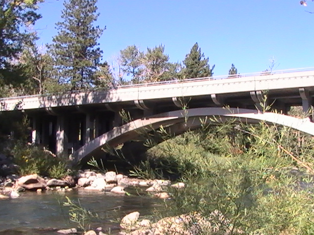


Why visit Verdi
Townapedia lists 8 museums and landmarks, 3 parks and trails, 6 places to eat and 3 places to stay in and around town.
Highlights include 1872 California-Nevada State Boundary Marker, The 1926 Verdi Public School Building and Crystal Peak Park.
July is the warmest month, with average highs of 84°F; December lows average 23°F.
Weather in Verdi
Forecast from the National Weather Service. Full forecast
About Verdi
Verdi is a census-designated place (CDP) in Washoe County, Nevada, United States. It is on the western side of the Reno metropolitan area near Interstate 80 and stretches eastward towards its neighborhood-exclave of Lawton, Nevada, surrounded by Reno, Nevada, west of Mae Anne Avenue. The CDP of Verdi, California, lies immediately adjacent across the state line. Both are in the shadow of California's Verdi Range.
From the Wikipedia article Verdi, Nevada (this version), under CC BY-SA 4.0.
Museums and landmarks8

1872 California-Nevada State Boundary Marker
Monument and historic site · National Register of Historic Places · 1.0 mi
United States historic place

Parks, trails and playgrounds3


Restaurants and cafes6





Where to stay3


Reno KOA Journey At Boomtown
Campground · 1.2 mi
2100 Interstate 80 West, Verdi
History
It was originally known as O'Neil's Crossing, named for the man who built a bridge there in 1860.
From the History section of Verdi, Nevada on Wikipedia, under CC BY-SA 4.0.
Shopping1
Gas and EV charging1
Schools, colleges and libraries8
Verdi Community Library and Nature Center
Library · 0.4 mi
270 Bridge Street, Verdi
Map of Verdi
30 places. The map loads OpenStreetMap tiles when you open it.
Climate by month
Monthly table
| Month | High | Low | Rain |
|---|---|---|---|
| Jan | 42°F | 24°F | 3.9 in |
| Feb | 44°F | 26°F | 4.2 in |
| Mar | 51°F | 30°F | 3.6 in |
| Apr | 56°F | 33°F | 1.8 in |
| May | 65°F | 40°F | 1.3 in |
| Jun | 75°F | 47°F | 0.6 in |
| Jul | 84°F | 53°F | 0.5 in |
| Aug | 84°F | 52°F | 0.4 in |
| Sep | 77°F | 47°F | 0.3 in |
| Oct | 64°F | 38°F | 1.6 in |
| Nov | 52°F | 30°F | 2.8 in |
| Dec | 42°F | 23°F | 4.8 in |
U.S. Climate Normals 1991-2020 for Verdi 2W (2 mi away), NOAA NCEI.
People and cost of living
American Community Survey 5-year estimates, 2020-2024, U.S. Census Bureau. Estimates have margins of error, larger for small towns.
Disaster history
Washoe County has had 50 federal disaster declarations since 2000, most often for fires.
- 2026-10-02: Bull Fire (Fire)
- 2026-09-01: Hawk Fire (Fire)
- 2026-08-22: Hawk Fire (Fire)
- 2026-08-11: Fred Mountain Fire (Fire)
- 2026-08-11: Stallion Fire (Fire)
- 2026-08-08: Bug Fire (Fire)
OpenFEMA disaster declarations summaries.
Getting there and nearby towns
Reno-Tahoe International Airport (RNO) is the nearest airport with scheduled flights listed in OpenStreetMap, 12 miles away.
- Mogul 3 mi east, about 5 min by car
- Reno 7 mi east, about 12 min by car
- Golden Valley 11 mi northeast, about 17 min by car
- Sun Valley 13 mi northeast, about 20 min by car
- Lemmon Valley 14 mi northeast, about 22 min by car
- Sparks 15 mi east, about 24 min by car
- Truckee 16 mi southwest, about 26 min by car
- Incline Village 18 mi south, about 28 min by car
- Spanish Springs 19 mi northeast, about 31 min by car
- Washoe Valley 19 mi southeast, about 31 min by car
Drive times are estimates from straight-line distance, not routes.
Local news
Headlines from INDB, the NEMICO news database.
Reviews, tips and questions
Loading what members have shared...
Sources and licences
- NCES EDGE (Public domain): public schools
- NOAA NCEI U.S. Climate Normals 1991-2020 (Public domain): climate by month
- OpenFEMA (Public domain): disaster declarations
- OpenStreetMap contributors (ODbL 1.0): places, airports, map data
- U.S. Census Bureau (Public domain): population, income, housing, education, commute
- Wikidata (CC0 1.0): elevation, founding date, time zone, website, landmarks and historic places
- Wikimedia Commons (see each image): photos
- Wikipedia (CC BY-SA 4.0): overview and history text
Photo credits
- NV SR 425 - Truckee River, Ljthefro, CC BY-SA 3.0
- Verdi, Nevada (526801696), Ken Lund from Reno, Nevada, USA, CC BY-SA 2.0
- The Great Train Robbery, Nevada Historical Marker No. 128, Verdi, Nevada (21154648438), Ken Lund from Reno, Nevada, USA, CC BY-SA 2.0
- The Great Train Robbery, Nevada Historical Marker No. 128, Verdi, Nevada (21154395470), Ken Lund from Reno, Nevada, USA, CC BY-SA 2.0
- Truckee River, Verdi, Nevada (526890569), Ken Lund from Reno, Nevada, USA, CC BY-SA 2.0
- Truckee River, Verdi, Nevada (526801158), Ken Lund from Reno, Nevada, USA, CC BY-SA 2.0
- Bridge, Verdi, Nevada (526800886), Ken Lund from Reno, Nevada, USA, CC BY-SA 2.0
- Crystal Peak Golf Course, Verdi, Nevada (526801624), Ken Lund from Reno, Nevada, USA, CC BY-SA 2.0
- Truckee River, Verdi, Nevada (526890925), Ken Lund from Reno, Nevada, USA, CC BY-SA 2.0
- Truckee River, Verdi, Nevada (526801472), Ken Lund from Reno, Nevada, USA, CC BY-SA 2.0
- Truckee River, Verdi, Nevada (526891249), Ken Lund from Reno, Nevada, USA, CC BY-SA 2.0
- 2015-10-28 11 28 47 Closeup of the historical marker in Verdi, Nevada, Famartin, CC BY-SA 4.0
- 2015-10-28 11 28 44 Historical marker in Verdi, Nevada, Famartin, CC BY-SA 4.0
- Verdi History, Verdi, Nevada (526890421), Ken Lund from Reno, Nevada, USA, CC BY-SA 2.0
- Dry Field in Verdi, Nevada (526800330), Ken Lund from Reno, Nevada, USA, CC BY-SA 2.0
- Verdi, Nevada Historical Marker No. 191, Verdi, Nevada (526800210), Ken Lund from Reno, Nevada, USA, CC BY-SA 2.0
- 1872 California-Nevada State Boundary Marker, Verdi, Nevada-California Border (21316272226), Ken Lund from Reno, Nevada, USA, CC BY-SA 2.0
- 1872 California-Nevada State Boundary Marker, Verdi, Nevada-California Border (21154671898), Ken Lund from Reno, Nevada, USA, CC BY-SA 2.0
- 1872 California-Nevada State Boundary Marker, Verdi, Nevada-California Border (21154676138), Ken Lund from Reno, Nevada, USA, CC BY-SA 2.0
- 1872 California-Nevada State Boundary Marker, Verdi, Nevada-California Border (20719831604), Ken Lund from Reno, Nevada, USA, CC BY-SA 2.0
- Henness Pass Road, Verdi, California-Nevada Border (21342541955), Ken Lund from Reno, Nevada, USA, CC BY-SA 2.0
- 1872 California-Nevada State Boundary Marker, Verdi, Nevada-California Border (20719837264), Ken Lund from Reno, Nevada, USA, CC BY-SA 2.0
- 1872 California-Nevada State Boundary Marker Park, Verdi, Nevada-California Border (21350772111), Ken Lund from Reno, Nevada, USA, CC BY-SA 2.0
- 1872 California-Nevada State Boundary Marker, Verdi, Nevada-California Border (21154413770), Ken Lund from Reno, Nevada, USA, CC BY-SA 2.0
- 1872 California-Nevada State Boundary Marker, Verdi, Nevada-California Border (20719840434), Ken Lund from Reno, Nevada, USA, CC BY-SA 2.0
- 1872 California-Nevada State Boundary Marker Park, Verdi, Nevada-California Border (20719813834), Ken Lund from Reno, Nevada, USA, CC BY-SA 2.0
- 1872 California-Nevada State Boundary Marker Park, Verdi, Nevada-California Border (21350781301), Ken Lund from Reno, Nevada, USA, CC BY-SA 2.0
- 1872 California-Nevada State Boundary Marker Park, Verdi, Nevada-California Border (21350777891), Ken Lund from Reno, Nevada, USA, CC BY-SA 2.0
- 1872 California-Nevada State Boundary Marker, Verdi, Nevada-California Border (21154667538), Ken Lund from Reno, Nevada, USA, CC BY-SA 2.0
- 1872 California-Nevada State Boundary Marker, Verdi, Nevada-California Border (20721427663), Ken Lund from Reno, Nevada, USA, CC BY-SA 2.0
- 1872 California-Nevada State Boundary Marker Park, Verdi, Nevada-California Border (20721409953), Ken Lund from Reno, Nevada, USA, CC BY-SA 2.0
- Ye Olde Threshing Machine - panoramio, Loco Steve, CC BY 3.0
- Flowering Dogwood, Tim36272, CC BY-SA 3.0
- Washoe County - panoramio, On^ste82, CC BY 3.0
- Oregon-California Side, ThirteenOaks, CC BY-SA 3.0
- Nevada-Longitude Side, ThirteenOaks, CC BY-SA 3.0
- Donner Pass, California, roger4336, CC BY-SA 2.0
- Boomtown Reno - 2021-10-16 - Sarah Stierch 02, Missvain, CC BY 4.0
- Boomtown Steakhouse - 2021-10-16 - Sarah Stierch 02, Missvain, CC BY 4.0
- Boomtown Steakhouse - 2021-10-16 - Sarah Stierch 06, Missvain, CC BY 4.0


Page built October 30, 2026. Spotted a mistake? Tell us or suggest a place.