
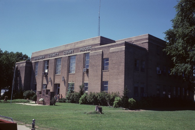


Why visit Wagoner
Townapedia lists 6 museums and landmarks, 5 parks and trails, 20 places to eat, 2 places to stay and 1 attraction in and around town.
Highlights include Cobb Building and Collin McKinney House.
August is the warmest month, with average highs of 92°F; January lows average 29°F.
Weather in Wagoner
Forecast from the National Weather Service. Full forecast
About Wagoner
Wagoner is a city in Wagoner County, Oklahoma, United States. As of the 2020 census, Wagoner had a population of 7,621. It is the county seat of Wagoner County. Wagoner became the first city incorporated in Indian Territory on January 4, 1896.
From the Wikipedia article Wagoner, Oklahoma (this version), under CC BY-SA 4.0.
Things to do1

Museums and landmarks6

Cobb Building
Monument and historic site · National Register of Historic Places · 0.4 mi
On the National Register of Historic Places in Oklahoma

Collin McKinney House
Monument and historic site · National Register of Historic Places · 1.3 mi
Historic house in Oklahoma, United States

Frederick Parkinson House
Monument and historic site · National Register of Historic Places
Historic house in Oklahoma, United States

John W. Gibson House
Monument and historic site · National Register of Historic Places · 0.9 mi
Historic house in Oklahoma, United States


Wagoner Armory
Monument and historic site · National Register of Historic Places · 0.5 mi
Armory in Oklahoma, United States of America

Parks, trails and playgrounds5



Restaurants and cafes20

Asian Star Restaurant
Restaurant · Asian · 0.8 mi
1009 West Cherokee Street, Wagoner

Russ Restaurant
Diner · American · 0.6 mi
609 East Cherokee Street, Wagoner
Ron's Hamburgers & Chili
Restaurant · Burger, American · 0.9 mi
West Cherokee Street, Wagoner

8 more on the map.
History
Wagoner is along the path of the Texas Road cattle trail, and the later Jefferson Highway of the early National Trail System, both roughly along the route of U.S. Route 69 through Oklahoma today. The town began as a small community at the intersection of the Missouri-Kansas-Texas (MKT) Railway and the Kansas and Arkansas Valley Railway (later the Missouri Pacific Railway), when William McAnally, a foreman for the MKT built a small hotel at this isolated location in June 1887. By the next summer others had built two more hotels and two general stores. The town was named for railroad dispatcher Henry "Big Foot" Wagoner, who had reported the need for a railroad switch nearby to accommodate the shipment of logs and hay. The switch had been previously named "Wagoner's Switch." The switch soon relocated to the town and caused the development of a major cattle shipping business.
By 1894, the community had 642 names in a local census. A local newspaper began promoting the town in 1895, encouraging more people to move to there. By 1896, there were approximately 1,500 residents. In the fall of 1895, the community formed a commission that circulated a petition requesting incorporation under the statutes of Arkansas. Incorporation was granted by the U. S. District Court on January 4, 1896, making Wagoner the first city incorporated in Indian Territory.
From the History section of Wagoner, Oklahoma on Wikipedia, under CC BY-SA 4.0.
Where to stay2
Churches and places of worship18
St. James Episcopal Church
Church · National Register of Historic Places · 0.6 mi
Shopping4
Gas and EV charging7
Schools, colleges and libraries9
Healthcare6
Map of Wagoner
78 places. The map loads OpenStreetMap tiles when you open it.
Climate by month
Monthly table
| Month | High | Low | Rain | Snow |
|---|---|---|---|---|
| Jan | 49°F | 29°F | 1.9 in | 0.9 in |
| Feb | 55°F | 33°F | 2.4 in | 0.3 in |
| Mar | 64°F | 41°F | 3.1 in | 0.5 in |
| Apr | 73°F | 50°F | 4.9 in | 0.0 in |
| May | 80°F | 60°F | 5.2 in | 0.0 in |
| Jun | 87°F | 68°F | 5.0 in | 0.0 in |
| Jul | 92°F | 73°F | 3.3 in | 0.0 in |
| Aug | 92°F | 71°F | 3.1 in | 0.0 in |
| Sep | 84°F | 63°F | 4.3 in | 0.0 in |
| Oct | 73°F | 51°F | 4.1 in | 0.0 in |
| Nov | 62°F | 40°F | 3.2 in | 0.0 in |
| Dec | 52°F | 32°F | 2.6 in | 0.9 in |
U.S. Climate Normals 1991-2020 for Wagoner (0 mi away), rain and snow from Muskogee Hcn, NOAA NCEI.
People and cost of living
American Community Survey 5-year estimates, 2020-2024, U.S. Census Bureau. Estimates have margins of error, larger for small towns.
Disaster history
Wagoner County has had 25 federal disaster declarations since 2000, most often for severe storms.
- 2024-04-30: Severe Storms, Straight-Line Winds, Tornadoes, And Flooding (Tornado)
- 2023-07-19: Severe Storms, Straight-Line Winds, And Tornadoes (Severe Storm)
- 2021-02-24: Severe Winter Storms (Severe Ice Storm)
- 2021-02-17: Severe Winter Storm (Severe Ice Storm)
- 2020-04-05: Covid-19 Pandemic (Biological)
- 2020-03-13: Covid-19 (Biological)
OpenFEMA disaster declarations summaries.
Getting there and nearby towns
Muskogee-Davis Regional Airport (MKO) is the nearest airport with scheduled flights listed in OpenStreetMap, 22 miles away.
- Toppers 3 mi east, about 5 min by car
- Fort Gibson 14 mi southeast, about 23 min by car
- Muskogee 15 mi south, about 25 min by car
- Norwood 15 mi southeast, about 24 min by car
- Coweta 16 mi west, about 25 min by car
- Chouteau 16 mi north, about 25 min by car
- Haskell 20 mi southwest, about 32 min by car
- Locust Grove 20 mi northeast, about 32 min by car
- Broken Arrow 23 mi west, about 38 min by car
- Tahlequah 23 mi east, about 37 min by car
Drive times are estimates from straight-line distance, not routes.
Local news
Headlines from INDB, the NEMICO news database.
Reviews, tips and questions
Loading what members have shared...
Sources and licences
- NCES EDGE (Public domain): public schools
- NOAA NCEI U.S. Climate Normals 1991-2020 (Public domain): climate by month
- OpenFEMA (Public domain): disaster declarations
- OpenStreetMap contributors (ODbL 1.0): places, airports, map data
- U.S. Census Bureau (Public domain): population, income, housing, education, commute
- Wikidata (CC0 1.0): elevation, founding date, time zone, website, landmarks and historic places
- Wikimedia Commons (see each image): photos
- Wikipedia (CC BY-SA 4.0): overview and history text
Photo credits
- Wagoner County Oklahoma Courthouse, Calvin Beale, Public domain
- Collin McKinney House, Caleb Long, CC BY-SA 2.5
- St. James Episcopal Church, Caleb Long, CC BY-SA 2.5
- John W. Gibson House, Caleb Long, CC BY-SA 2.5
- Fredrick Parkinson House, Caleb Long, CC BY-SA 2.5
- The Cobb Building, Caleb Long, CC BY-SA 2.5
- Wagoner Armory, Caleb Long, CC BY-SA 2.5
Page built October 30, 2026. Spotted a mistake? Tell us or suggest a place.