


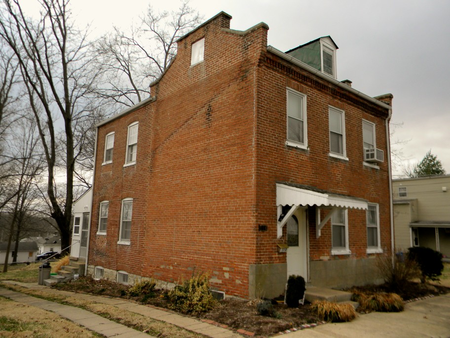


Washington, Missouri
Washington is a city of 15,130 people in Franklin County, Missouri.
Why visit Washington
Townapedia lists 58 museums and landmarks, 19 parks and trails, 66 places to eat, 7 places to stay and 3 attractions in and around town.
Highlights include Washington Bridge, Cinema One Plus, Albert Krog House and Bartsch-Jasper House.
July is the warmest month, with average highs of 88°F; January lows average 20°F.
Weather in Washington
Forecast from the National Weather Service. Full forecast
About Washington
Washington is a city on the south banks of the Missouri River, 50 miles west of St. Louis, Missouri. It is considered an exurb of the Greater St. Louis area. As of the 2020 census, Washington had a population of 14,500. It is the largest city in Franklin County, Missouri.
From the Wikipedia article Washington, Missouri (this version), under CC BY-SA 4.0.
Things to do3



Washington Farmers Market
Farm and orchard · 0.7 mi
317 West Main Street, Washington
Museums and landmarks58

Albert Krog House
Monument and historic site · National Register of Historic Places · 1.4 mi
Building in Missouri, United States

Bartsch-Jasper House
Monument and historic site · National Register of Historic Places · 1.0 mi
Building in Missouri, United States

Brehe Farmstead Historic District
Monument and historic site · National Register of Historic Places · 2.1 mi
Building in Missouri, United States

Caldwell Farm
Monument and historic site · National Register of Historic Places · 3.4 mi
Building in Missouri, United States

Casper Kruse House
Monument and historic site · National Register of Historic Places · 0.7 mi
Building in Missouri, United States
Charles H. Helm House
Monument and historic site · National Register of Historic Places · 0.4 mi
Building in Missouri, United States
Downtown Washington Historic District
Monument and historic site · National Register of Historic Places · 0.5 mi
Historic district in Missouri, United States
Dr. H. A. May House
Monument and historic site · National Register of Historic Places · 0.4 mi
Building in Missouri, United States

Fore Shoe Company Building
Monument and historic site · National Register of Historic Places · 0.6 mi
Building in Missouri, United States

Frank Mense House
Monument and historic site · National Register of Historic Places · 0.8 mi
Building in Missouri, United States


Franz Schwarzer House
Monument and historic site · National Register of Historic Places · 0.6 mi
Building in Missouri, United States
Fred Schnier Building
Monument and historic site · National Register of Historic Places · 0.5 mi
Building in Missouri, United States
46 more on the map.
Parks, trails and playgrounds19


Agnes Nolting Aquatic Complex
Sports field and stadium · 1.0 mi
201 Aquatic Circle Drive, Washington


7 more on the map.
Restaurants and cafes66


St. Louis Bread Company (Panera Bread)
Restaurant · Sandwich · 1.0 mi
880 Washington Corners, Washington



Pulque Mexican
Restaurant · Mexican · 2.1 mi
3051 Phoenix Center Drive, Washington
54 more on the map.
History
Named after George Washington after it came under American control, the town was first settled during the rule of the Spanish Empire. It was originally called St. John Meyer's Settlement and was the site of the Spanish log fort San Juan del Misuri (1796–1803).
Family and followers of Daniel Boone settled the area across the river from Washington, Missouri starting in 1799. In 1814 a ferry boat was licensed for crossing the Missouri River to the north, and the settlement became known as Washington Landing. In 1827 a town was laid out, with sale of lots starting in 1829. The cost of land was waived if the buyer could build a substantial house within two years. This encouraged many new settlers.
Substantial numbers of anti-slavery German families started moving to the town in 1833, and they soon overwhelmed the existing population of slaveowners. However, many of the original slaveowners' homes still remain throughout the town. Washington became a strong supporter of the Union during the American Civil War. The town was ransacked by Confederate General Sterling Price's soldiers, but they were unable to keep control of the area.
After the war, Washington became a railroad and steamboat transportation center. Its manufacturing industry, while strong, is not as vibrant as it was decades ago.
From the History section of Washington, Missouri on Wikipedia, under CC BY-SA 4.0.
Where to stay7
Gottfried Cabin Gast Haus
Motel and hotel · 0.5 mi
124 Jefferson Street, Washington
Churches and places of worship17
First Baptist Church
Church · Southern Baptist · 0.4 mi
111 East 14th Street, Washington
First Church of Christian Scientist
Church · Christ Scientist · 0.5 mi
109 East 3rd Street, Washington
Jubilee Church
Church · Nondenominational · 1.7 mi
1920 East 5th Street, Washington
Life Stream Church
Church · Nondenominational · 1.0 mi
551 Lewis and Clark Drive, Washington
St. Francis Borgia
Church · Roman Catholic · 0.6 mi
310 West Main Street, Washington
St. Peter's United Church of Christ
Church · United Church Of Christ
20 East 5th Street, Washington
The Church of Jesus Christ of Latter-day Saints
Church · Mormon · 0.5 mi
110 East 14th Street, Washington
the Experience church
Church · Nondenominational · 0.9 mi
1925 Bedford Center Drive, Washington
Shopping23
Gas and EV charging7
Schools, colleges and libraries17
St. Francis Borgia Regional High School
School · 0.6 mi
1000 Borgia Drive, Washington
Healthcare12
Department of Veterans Affairs Outpatient Cliniv
Clinic and pharmacy · 1.4 mi
1627 A. Roy Drive, Washington
Megan Whittmore M.D.
Clinic and pharmacy · 0.7 mi
120 West Front Street, Washington
Mercy Coprorate Health
Clinic and pharmacy · 0.5 mi
1351 Jefferson Street, Washington
Map of Washington
229 places. The map loads OpenStreetMap tiles when you open it.
Climate by month
Monthly table
| Month | High | Low | Rain | Snow |
|---|---|---|---|---|
| Jan | 40°F | 20°F | 2.5 in | 2.6 in |
| Feb | 45°F | 23°F | 2.5 in | 1.4 in |
| Mar | 56°F | 32°F | 3.7 in | 0.7 in |
| Apr | 67°F | 43°F | 4.6 in | 0.1 in |
| May | 76°F | 54°F | 5.3 in | 0.0 in |
| Jun | 84°F | 64°F | 4.2 in | 0.0 in |
| Jul | 88°F | 67°F | 4.2 in | 0.0 in |
| Aug | 87°F | 65°F | 3.8 in | 0.0 in |
| Sep | 80°F | 56°F | 3.7 in | 0.0 in |
| Oct | 69°F | 44°F | 3.4 in | 0.0 in |
| Nov | 55°F | 33°F | 3.7 in | 0.4 in |
| Dec | 44°F | 24°F | 2.6 in | 2.7 in |
U.S. Climate Normals 1991-2020 for Washington (2 mi away), NOAA NCEI.
People and cost of living
American Community Survey 5-year estimates, 2020-2024, U.S. Census Bureau. Estimates have margins of error, larger for small towns.
Disaster history
Franklin County has had 15 federal disaster declarations since 2000, most often for floods.
- 2025-05-21: Severe Storms, Straight-Line Winds, Tornadoes, And Wildfires (Severe Storm)
- 2020-03-26: Covid-19 Pandemic (Biological)
- 2020-03-13: Covid-19 (Biological)
- 2017-06-02: Severe Storms, Tornadoes, Straight-Line Winds And Flooding (Flood)
- 2016-01-21: Severe Storms, Tornadoes, Straight-Line Winds, And Flooding (Flood)
- 2016-01-02: Severe Storms, Tornadoes, Straight-Line Winds, And Flooding (Flood)
OpenFEMA disaster declarations summaries.
Getting there and nearby towns
Spirit of Saint Louis Airport (SUS) is the nearest airport with scheduled flights listed in OpenStreetMap, 21 miles away.
- Union 8 mi south, about 13 min by car
- Lake St. Louis 20 mi northeast, about 32 min by car
- Eureka 20 mi east, about 33 min by car
- Dardenne Prairie 21 mi northeast, about 33 min by car
- O'Fallon 22 mi northeast, about 36 min by car
- Ellisville 23 mi east, about 37 min by car
- Chesterfield 25 mi east, about 40 min by car
- Ballwin 25 mi east, about 41 min by car
- St. Peters 27 mi northeast, about 44 min by car
- Manchester 28 mi east, about 44 min by car
Drive times are estimates from straight-line distance, not routes.
Local news
Headlines from INDB, the NEMICO news database.
Reviews, tips and questions
Loading what members have shared...
Sources and licences
- NCES EDGE (Public domain): public schools
- NOAA NCEI U.S. Climate Normals 1991-2020 (Public domain): climate by month
- OpenFEMA (Public domain): disaster declarations
- OpenStreetMap contributors (ODbL 1.0): places, airports, map data
- U.S. Census Bureau (Public domain): population, income, housing, education, commute
- Wikidata (CC0 1.0): elevation, founding date, time zone, website, landmarks and historic places
- Wikimedia Commons (see each image): photos
- Wikipedia (CC BY-SA 4.0): overview and history text
Photo credits
- Stfrancisborgiams, WhisperToMe, CC BY 3.0
- 607 Jefferson Washington, Jon Roanhaus, CC BY-SA 3.0
- 110 W Sixth Washington, Jon Roanhaus, CC BY-SA 3.0
- 408 E. 6th Street, Washington, Missouri, Martin Casagrand, CC BY-SA 4.0
- May House Washington, Jon Roanhaus, CC BY-SA 3.0
- Brick House Washington MO, TCP04, CC BY 4.0
- City Hall Washington MO, TCP04, CC BY 4.0
- Library Washington MO, TCP04, CC BY 4.0
- Washingtonmolib, WhisperToMe, CC BY 3.0
- Immluthchurchdchwashingtonmo, WhisperToMe, CC BY 3.0
- Washingtonmolibrary, WhisperToMe, CC BY 3.0
- Tibbe Historic District Washington MO, TCP04, CC BY 4.0
- 212 Jefferson St Washington MO, TCP04, CC BY 4.0
- Calvin Theater Washington MO, TCP04, CC BY 4.0
- Washington School District Building, TCP04, CC BY 4.0
- Elm Street Washington MO, TCP04, CC BY 4.0
- Washington MO HD, Jon Roanhaus, CC BY-SA 3.0
- Schwegmann House, Jon Roanhaus, CC BY-SA 3.0
- Kruse House, Jon Roanhaus, CC BY-SA 3.0
- Albert Krog House, Jim Roberts, CC BY-SA 4.0
- Louis Kohmueller House, Jim Roberts, CC BY-SA 4.0
- Front of Mark O’Hara House, Jim Roberts, CC BY-SA 4.0
- Jones Building, Jon Roanhaus, CC BY-SA 3.0
- Joseph Raaf House, Jim Roberts, CC BY-SA 4.0
- Brehe Farmstead Historic District, Jim Roberts, CC BY-SA 4.0
- Stafford-Olive HD, Jon Roanhaus, CC BY-SA 3.0
- Frank Mense House, Jim Roberts, CC BY-SA 4.0
- GEORGE Tamm Building, Jim Roberts, CC BY-SA 4.0
- Bartsch-Jasper House, Jim Roberts, CC BY-SA 4.0
- Fore Shoe Co, Jon Roanhaus, CC BY-SA 3.0
- Franz Schwarzenegger’s House, Jim Roberts, CC BY-SA 4.0
- Paul Monkey House, Jim Roberts, CC BY-SA 4.0
- John B Busch HD, Jon Roanhaus, CC BY-SA 3.0
- Ernst House, Jon Roanhaus, CC BY-SA 3.0
- Beinke House, Jon Roanhaus, CC BY-SA 3.0
- John Abkemeyer House, TCP04, CC BY 4.0
- Beins House, Jon Roanhaus, CC BY-SA 3.0
- Broeker House, Jon Roanhaus, CC BY-SA 3.0
- Dr H A May House, TCP04, CC BY 4.0
- Tuepker House, Jon Roanhaus, CC BY-SA 3.0


Page built October 30, 2026. Spotted a mistake? Tell us or suggest a place.