


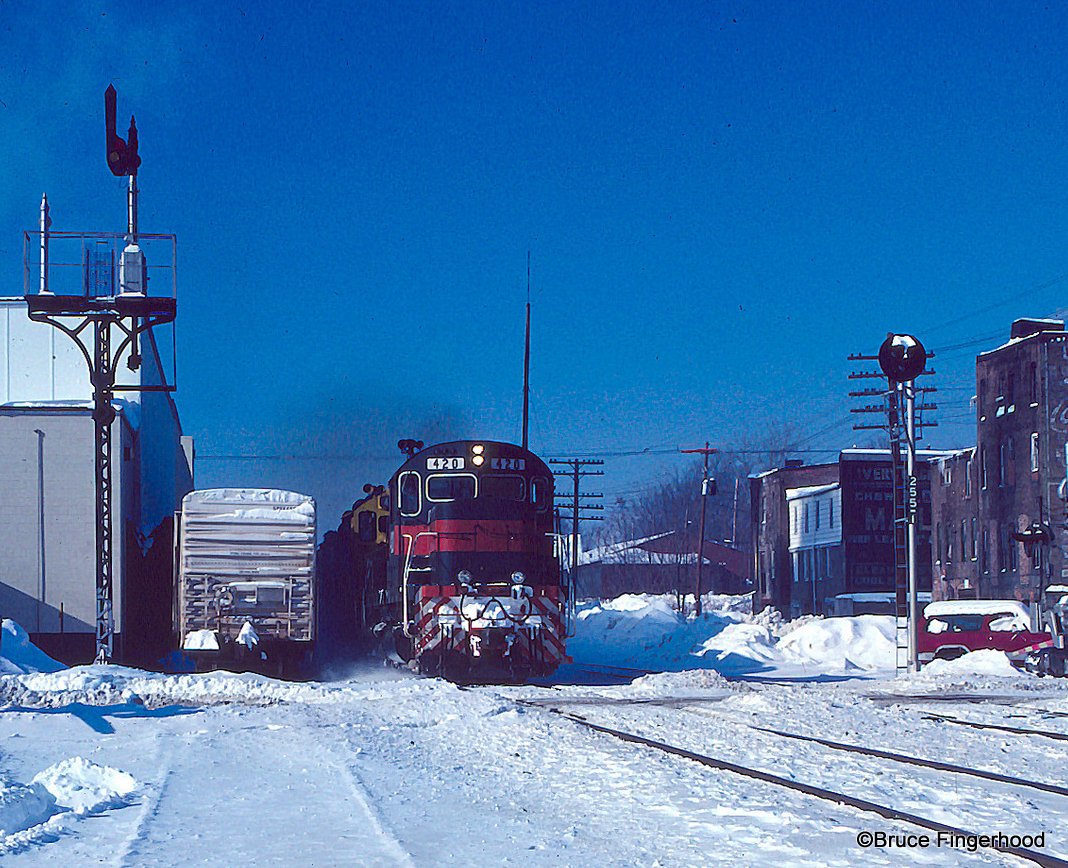


Waverly, New York
Waverly is a village of 4,305 people in Tioga County, New York, founded in 1854.
Why visit Waverly
Townapedia lists 5 museums and landmarks, 9 parks and trails, 13 places to eat, 2 places to stay and 2 attractions in and around town.
Highlights include Glory Hill, Spanish Hill, United States Post Office and Waverly Junior and Senior High School.
July is the warmest month, with average highs of 83°F; January lows average 16°F.
Weather in Waverly
Forecast from the National Weather Service. Full forecast
About Waverly
Waverly is the largest village in Tioga County, New York, United States. As of the 2010 U.S. census, Waverly had a population of 4,177. It is located southeast of Elmira in the Southern Tier region. This village was incorporated as the southwest part of the town of Barton in 1854.
From the Wikipedia article Waverly, Tioga County, New York (this version), under CC BY-SA 4.0.
Things to do2

Museums and landmarks5

United States Post Office
Monument and historic site · National Register of Historic Places · 0.7 mi
Post office in Waverly, New York, United States
Waverly Junior and Senior High School
Monument and historic site · National Register of Historic Places · 0.6 mi
Secondary school in New York, United States of America
Waverly Village Hall
Monument and historic site · National Register of Historic Places · 0.8 mi
Listed on the NRHP in New York

S.R.A.C. Susquehanna River Archaeological Center
Museum · 0.8 mi
343 Broad Street, Waverly
War Veterans Memorial
Monument and historic site · 0.9 mi
198 Broad Street, Waverly
Parks, trails and playgrounds9

Restaurants and cafes13

Sam’s Bar & Grill
Restaurant · 1.4 mi
912 North Wilbur Avenue, Sayre





Subway
Fast food · Sandwich · 1.3 mi
477 North Keystone Avenue, Sayre
Mo-Fr 08:00-22:00; Sa 09:00-21:00; Su 09:00-17:30
1 more on the map.
History
In earlier times, this territory was a prime location for Native American travel, trade, and warfare because of its strategic location a valley surrounding the confluence of two rivers along the New York state border where the mouth of the Chemung River empties into the Susquehanna River as it turns southward into Pennsylvania. This locale was likely occupied by the Susquehannock people for several centuries before European pathfinders discovered this place.
From the History section of Waverly, Tioga County, New York on Wikipedia, under CC BY-SA 4.0.
Where to stay2
Churches and places of worship11
Grace Episcopal Church
Church · National Register of Historic Places · 0.6 mi
Waverly Presbyterian Church
Church · Presbyterian · 0.5 mi
459 Park Avenue, Waverly
Shopping6
Gas and EV charging1
Schools, colleges and libraries16
Healthcare4
Map of Waverly
69 places. The map loads OpenStreetMap tiles when you open it.
Climate by month
Monthly table
| Month | High | Low | Rain |
|---|---|---|---|
| Jan | 34°F | 16°F | 2.2 in |
| Feb | 37°F | 17°F | 1.8 in |
| Mar | 45°F | 24°F | 2.6 in |
| Apr | 59°F | 34°F | 3.4 in |
| May | 71°F | 45°F | 3.0 in |
| Jun | 79°F | 54°F | 4.3 in |
| Jul | 83°F | 58°F | 3.6 in |
| Aug | 82°F | 57°F | 3.3 in |
| Sep | 75°F | 50°F | 4.0 in |
| Oct | 62°F | 39°F | 3.5 in |
| Nov | 50°F | 30°F | 2.4 in |
| Dec | 39°F | 23°F | 2.4 in |
U.S. Climate Normals 1991-2020 for Waverly (1 mi away), NOAA NCEI.
People and cost of living
American Community Survey 5-year estimates, 2020-2024, U.S. Census Bureau. Estimates have margins of error, larger for small towns.
Disaster history
Tioga County has had 21 federal disaster declarations since 2000, most often for severe storms.
- 2021-10-08: Remnants Of Tropical Storm Fred (Hurricane)
- 2020-03-20: Covid-19 Pandemic (Biological)
- 2020-03-13: Covid-19 (Biological)
- 2019-12-19: Severe Storms, Straight-Line Winds, And Flooding (Severe Storm)
- 2018-10-01: Severe Storms And Flooding (Flood)
- 2017-07-12: Severe Winter Storm And Snowstorm (Snowstorm)
OpenFEMA disaster declarations summaries.
Getting there and nearby towns
Elmira-Corning Regional Airport (ELM) is the nearest airport with scheduled flights listed in OpenStreetMap, 21 miles away.
- Elmira 15 mi west, about 24 min by car
- Southport 15 mi west, about 24 min by car
- Owego 16 mi northeast, about 25 min by car
- Elmira Heights 17 mi northwest, about 27 min by car
- Horseheads 18 mi northwest, about 30 min by car
- Horseheads North 19 mi northwest, about 30 min by car
- Apalachin 20 mi east, about 32 min by car
- Big Flats 22 mi northwest, about 35 min by car
- Tioga Terrace 22 mi east, about 35 min by car
- Crest View Heights 22 mi east, about 35 min by car
Drive times are estimates from straight-line distance, not routes.
Local news
Headlines from INDB, the NEMICO news database.
Reviews, tips and questions
Loading what members have shared...
Sources and licences
- NCES EDGE (Public domain): public schools
- NOAA NCEI U.S. Climate Normals 1991-2020 (Public domain): climate by month
- OpenFEMA (Public domain): disaster declarations
- OpenStreetMap contributors (ODbL 1.0): places, airports, map data
- U.S. Census Bureau (Public domain): population, income, housing, education, commute
- Wikidata (CC0 1.0): elevation, founding date, time zone, website, landmarks and historic places
- Wikimedia Commons (see each image): photos
- Wikipedia (CC BY-SA 4.0): overview and history text
Photo credits
- Waverly, New York, Doug Kerr, CC BY-SA 2.0
- Waverly Village Hall Waverly NY Oct 09, Doug Kerr from Albany, NY, United States, CC BY-SA 2.0
- WaverlyPO, Malachi77, CC BY-SA 3.0
- Former Lefty's bar, Waverly, NY, Daniel Case, CC BY-SA 4.0
- Waverly (3779866062), Bruce Fingerhood from Springfield, Oregon, US, CC BY 2.0
- Asclepias tuberosa 213100072, Larry Jensen, CC BY 4.0
- Dollar General (10386771825), Random Retail from PA, United States, CC BY 2.0
- Subaru Outback Limited (2004) (53652203224), Charles from Port Chester, New York, CC BY 2.0


Page built October 30, 2026. Spotted a mistake? Tell us or suggest a place.