


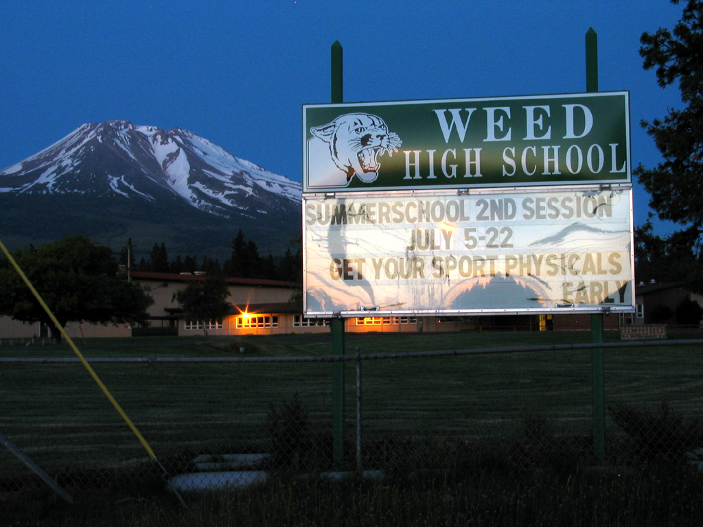


Weed, California
Weed is a city of 2,737 people in Siskiyou County, California, founded in January 25, 1961.
Why visit Weed
Townapedia lists 1 museum or landmark, 4 parks and trails, 16 places to eat and 7 places to stay in and around town.
Highlights include Charles Byrd Park and Weed Golf Club.
July is the warmest month, with average highs of 85°F; December lows average 28°F.
Weather in Weed
Forecast from the National Weather Service. Full forecast
About Weed
Weed is a city in Siskiyou County, California, United States. As of the 2020 Census, the city had a total population of 2,862, down from 2,967 in 2010. There are several unincorporated communities adjacent to, or just outside of Weed, including Edgewood, Carrick, and Lake Shastina. These communities generally have mailing addresses that use Weed or its ZIP Code.
From the Wikipedia article Weed, California (this version), under CC BY-SA 4.0.
Museums and landmarks1

Parks, trails and playgrounds4




Restaurants and cafes16

Asian American Bar BQ
Restaurant · Thai · 0.7 mi
10 North Weed Boulevard, Weed
Tu-Fr 10:00-20:00; Sa-Su 12:00-20:00
Pizza Factory
Restaurant · Pizza, Italian, Sandwich · 0.8 mi
134 North Weed Boulevard, Weed
Mo-Su 11:00-21:00




4 more on the map.
Where to stay7


Townhouse Motel;Townhouse
Motel and hotel · 0.6 mi
157 South Weed Boulevard, Weed
History
The city of Weed derives its name from the founder of the local lumber mill and pioneer Abner Weed, who discovered that the area's strong winds were helpful in drying lumber. In 1897, Abner Weed bought the Siskiyou Lumber and Mercantile Mill and 280 acres (110 hectares) of land in what is now the city of Weed, for $400.
From the History section of Weed, California on Wikipedia, under CC BY-SA 4.0.
Churches and places of worship3
Shopping5
Gas and EV charging10
Schools, colleges and libraries8
Map of Weed
54 places. The map loads OpenStreetMap tiles when you open it.
Climate by month
Monthly table
| Month | High | Low | Rain |
|---|---|---|---|
| Jan | 44°F | 29°F | 6.3 in |
| Feb | 47°F | 29°F | 6.4 in |
| Mar | 52°F | 32°F | 5.6 in |
| Apr | 59°F | 35°F | 2.9 in |
| May | 69°F | 41°F | 2.1 in |
| Jun | 76°F | 47°F | 1.1 in |
| Jul | 85°F | 52°F | 0.3 in |
| Aug | 85°F | 50°F | 0.2 in |
| Sep | 78°F | 45°F | 0.5 in |
| Oct | 65°F | 38°F | 2.0 in |
| Nov | 50°F | 31°F | 3.6 in |
| Dec | 42°F | 28°F | 6.6 in |
U.S. Climate Normals 1991-2020 for Mt Shasta (6 mi away), NOAA NCEI.
People and cost of living
American Community Survey 5-year estimates, 2020-2024, U.S. Census Bureau. Estimates have margins of error, larger for small towns.
Disaster history
Siskiyou County has had 16 federal disaster declarations since 2000, most often for fires.
- 2023-11-21: Tropical Storm Hilary (Hurricane)
- 2023-01-14: Severe Winter Storms, Flooding, Landslides, And Mudslides (Flood)
- 2022-09-02: Mill Fire (Fire)
- 2021-06-29: Lava Fire (Fire)
- 2020-10-16: Wildfires (Fire)
- 2020-09-09: Slater Fire (Fire)
OpenFEMA disaster declarations summaries.
Getting there and nearby towns
Dunsmuir Municipal-Mott Airport (MHS) is the nearest airport with scheduled flights listed in OpenStreetMap, 12 miles away.
- Mount Shasta 7 mi southeast, about 12 min by car
- Lake Shastina 8 mi north, about 12 min by car
- Dunsmuir 14 mi southeast, about 22 min by car
- McCloud 17 mi southeast, about 27 min by car
- Montague 23 mi north, about 37 min by car
- Yreka 25 mi northwest, about 40 min by car
- Etna 27 mi west, about 43 min by car
- Shasta Lake 51 mi south, about 1 h 15 min by car
- Burney 52 mi southeast, about 1 h 30 min by car
- Lewiston 55 mi southwest, about 1 h 30 min by car
Drive times are estimates from straight-line distance, not routes.
Local news
Headlines from INDB, the NEMICO news database.
Reviews, tips and questions
Loading what members have shared...
Sources and licences
- NCES EDGE (Public domain): public schools
- NOAA NCEI U.S. Climate Normals 1991-2020 (Public domain): climate by month
- OpenFEMA (Public domain): disaster declarations
- OpenStreetMap contributors (ODbL 1.0): places, airports, map data
- U.S. Census Bureau (Public domain): population, income, housing, education, commute
- Wikidata (CC0 1.0): elevation, founding date, time zone, website
- Wikimedia Commons (see each image): photos
- Wikipedia (CC BY-SA 4.0): overview and history text
Photo credits
- Weed, California, USA 001, Barabas, CC BY 3.0
- Weed, CA 8-28-13 (10070782953), inkknife_2000 (7.5 million views +), CC BY-SA 2.0
- Mt. Shasta - Weed, California, Janusz Sobolewski, CC BY 2.0
- Weed High School billboard, Bahn Mi at English Wikipedia, CC BY-SA 2.0
- Weed Lumber Company Boarding House, NoeHill, CC BY-SA 3.0
- Mt. Shasta Brewing Company, Wrassler66, CC BY-SA 4.0
- Mt. Shasta Brewing Company 2, Wrassler66, CC BY-SA 4.0
- Mt. Shasta Brewing Company - Lemurian Lager, Wrassler66, CC BY-SA 4.0
- College of the Siskiyous, Wrassler66, CC BY-SA 4.0
- Herschel Meredith Stadium, Wrassler66, CC BY-SA 4.0
- College courts - panoramio, Scott Thompson, CC BY 3.0
- Mt. Shasta - panoramio (1), On^ste82, CC BY 3.0
- ISS030-E-98700 - View of Earth, Earth Science and Remote Sensing Unit , Lyndon B. Johnson Space Center, Public domain
- ISS030-E-98701 - View of Earth, Earth Science and Remote Sensing Unit , Lyndon B. Johnson Space Center, Public domain
- Mt. Shasta 2 - panoramio, On^ste82, CC BY 3.0


Page built October 30, 2026. Spotted a mistake? Tell us or suggest a place.