


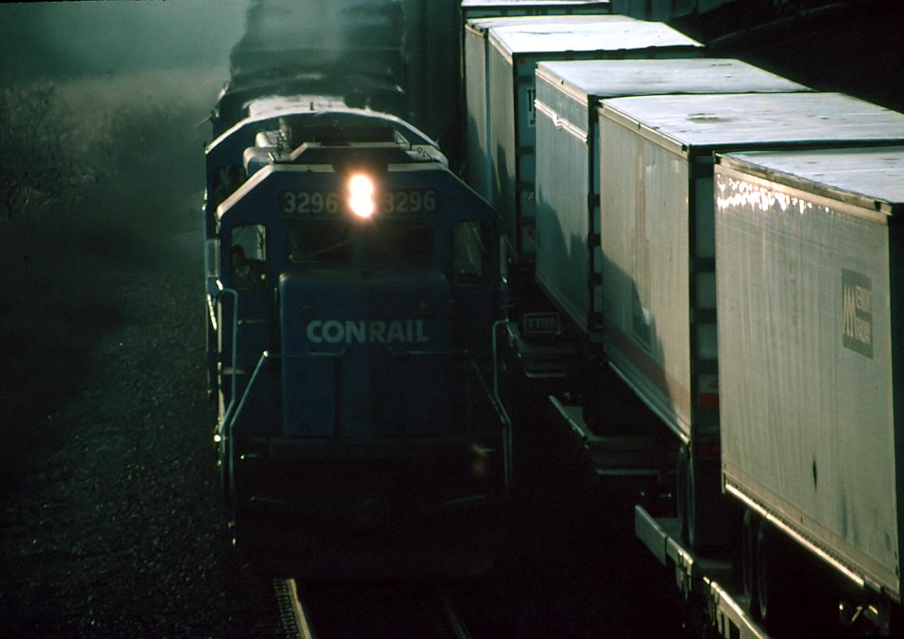
Why visit Weedsport
Townapedia lists 4 museums and landmarks, 1 park or trail, 4 places to eat, 2 places to stay and 1 attraction in and around town.
Highlights include Centreport Aqueduct and Frank and Eliza Tryon House.
July is the warmest month, with average highs of 81°F; January lows average 15°F, and about 109 inches of snow fall in a normal year.
Weather in Weedsport
Forecast from the National Weather Service. Full forecast
About Weedsport
Weedsport is a village in Cayuga County, New York, United States. As of the 2020 census, Weedsport had a population of 1,788. The name is from Elihu and Edward Weed, merchants who helped found the village. Weedsport is in the town of Brutus, west of Syracuse.
From the Wikipedia article Weedsport, New York (this version), under CC BY-SA 4.0.
Things to do1

Museums and landmarks4

Centreport Aqueduct
Monument and historic site · National Register of Historic Places · 0.8 mi
Historic aqueduct in Cayuga County, New York
Frank and Eliza Tryon House
Monument and historic site · National Register of Historic Places
Historic house in Cayuga County, New York
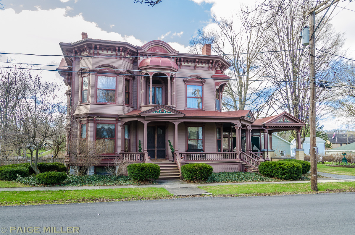


Orrin W. Burritt House
Monument and historic site · National Register of Historic Places
Historic house in New York, United States

Northeast Dirt Modified Hall of Fame
Museum
Hall of Fame in Weedsport, New York
Parks, trails and playgrounds1

Restaurants and cafes4


Lunkenheimer Craft Brewing Co.
Brewery and winery
8931 North Seneca Street, Weedsport

Dunkin' Donuts
Fast food · Donut, Coffee Shop · 0.5 mi
9032 North Seneca Street, Weedsport
Mo-Fr 04:00-19:00; Sa-Su 05:00-19:00
History
Weedsport was within the Central New York Military Tract. The village was originally named "Weed's Basin" because the town had a basin (boat turnaround) during the Erie Canal era. The name was then changed to Weedsport.
During the Erie Canal era, Weedsport competed with the neighboring village, Port Byron, to be an entry port for the city of Auburn. The two villages competed economically until both fell under financial troubles during the closing of their respective ports (a friendly rivalry remains to this day, mostly in local sports).
Weedsport Elementary School was built in 1908. Renovations to the elementary school in 1986 added more classrooms, a gymnasium, and a homemaking facility. Weedsport Junior/Senior High School was built in 1957 and later expanded in 1967 and 2005.
The Centreport Aqueduct was listed on the National Register of Historic Places in 2000. The First Baptist Church of Weedsport was listed in 2002, the Orrin W. Burritt House in 2007, and the Frank and Eliza Tryon House in 2014.
From the History section of Weedsport, New York on Wikipedia, under CC BY-SA 4.0.
Where to stay2
Churches and places of worship5
First Baptist Church of Weedsport
Church · National Register of Historic Places
Gas and EV charging1
Schools, colleges and libraries7
Map of Weedsport
25 places. The map loads OpenStreetMap tiles when you open it.
Climate by month
Monthly table
| Month | High | Low | Rain | Snow |
|---|---|---|---|---|
| Jan | 31°F | 15°F | 2.9 in | 29.1 in |
| Feb | 33°F | 16°F | 2.5 in | 25.9 in |
| Mar | 42°F | 23°F | 3.2 in | 17.2 in |
| Apr | 55°F | 34°F | 3.7 in | 3.1 in |
| May | 69°F | 45°F | 3.8 in | 0.2 in |
| Jun | 77°F | 55°F | 4.1 in | 0.0 in |
| Jul | 81°F | 60°F | 4.3 in | 0.0 in |
| Aug | 80°F | 58°F | 4.3 in | 0.0 in |
| Sep | 72°F | 52°F | 3.9 in | 0.0 in |
| Oct | 59°F | 41°F | 4.5 in | 0.4 in |
| Nov | 48°F | 32°F | 3.6 in | 8.8 in |
| Dec | 37°F | 23°F | 3.6 in | 24.7 in |
U.S. Climate Normals 1991-2020 for Auburn Hcn (8 mi away), NOAA NCEI.
People and cost of living
American Community Survey 5-year estimates, 2020-2024, U.S. Census Bureau. Estimates have margins of error, larger for small towns.
Disaster history
Cayuga County has had 13 federal disaster declarations since 2000, most often for hurricanes.
- 2021-10-08: Remnants Of Tropical Storm Fred (Hurricane)
- 2020-03-20: Covid-19 Pandemic (Biological)
- 2020-03-13: Covid-19 (Biological)
- 2017-11-14: Flooding (Flood)
- 2012-10-28: Hurricane Sandy (Hurricane)
- 2005-09-30: Hurricane Katrina Evacuation (Hurricane)
OpenFEMA disaster declarations summaries.
Getting there and nearby towns
Syracuse Hancock International Airport (SYR) is the nearest airport with scheduled flights listed in OpenStreetMap, 23 miles away.
- Jordan 5 mi east, about 8 min by car
- Elbridge 6 mi east, about 10 min by car
- Auburn 8 mi south, about 13 min by car
- Melrose Park 10 mi south, about 16 min by car
- Marcellus 12 mi east, about 20 min by car
- Camillus 13 mi east, about 21 min by car
- Seneca Knolls 15 mi east, about 24 min by car
- Union Springs 15 mi southwest, about 25 min by car
- Clyde 16 mi west, about 25 min by car
- Syracuse 21 mi east, about 34 min by car
Drive times are estimates from straight-line distance, not routes.
Local news
Headlines from INDB, the NEMICO news database.
Reviews, tips and questions
Loading what members have shared...
Sources and licences
- NCES EDGE (Public domain): public schools
- NOAA NCEI U.S. Climate Normals 1991-2020 (Public domain): climate by month
- OpenFEMA (Public domain): disaster declarations
- OpenStreetMap contributors (ODbL 1.0): places, airports, map data
- U.S. Census Bureau (Public domain): population, income, housing, education, commute
- Wikidata (CC0 1.0): elevation, founding date, time zone, website, landmarks and historic places
- Wikimedia Commons (see each image): photos
- Wikipedia (CC BY-SA 4.0): overview and history text
Photo credits
- Weedsport, New York downtown, Kenneth C. Zirkel, CC BY 4.0
- First Baptist Church of Weedsport May 09, Doug Kerr from Upstate New York, CC BY-SA 2.0
- WeedsportNY FrankAndElizaTryonHouse, Magicpiano, CC BY-SA 4.0
- Weedsport New York Free Library, Kenneth C. Zirkel, CC BY 4.0
- Weedsport Free Library, New York, Kenneth C. Zirkel, CC BY 4.0
- Eastbound and westbound trains meet at twilight near North Weedsport, New York, November 1991, Bruce Fingerhood from Springfield, Oregon, US, CC BY 2.0
- Orrin W Burritt House, Dj paige, CC BY 4.0
- Sponsered teams on the wall, Kkelley6, CC BY-SA 4.0
- DB's menu, Kkelley6, CC BY-SA 4.0
- Gazebo for patron use, Kkelley6, CC BY-SA 4.0
- Beautiful mural behind building, Kkelley6, CC BY-SA 4.0
- Gazebo owned and maintained by DB's, Kkelley6, CC BY-SA 4.0
- View of DB's from route 34, Kkelley6, CC BY-SA 4.0
- Sponsered team on the wall part 2, Kkelley6, CC BY-SA 4.0
- Gazebo view from Route 31, Kkelley6, CC BY-SA 4.0
- Aqueduct from the towpath, Darlingtrk, CC BY-SA 3.0
- Centreport Aqueduct, Darlingtrk, CC BY-SA 3.0
- Towpath bridge, Darlingtrk, CC BY-SA 3.0
- Cayuga County, New York - 4368889405, Dougtone, CC BY-SA 2.0


Page built October 30, 2026. Spotted a mistake? Tell us or suggest a place.