


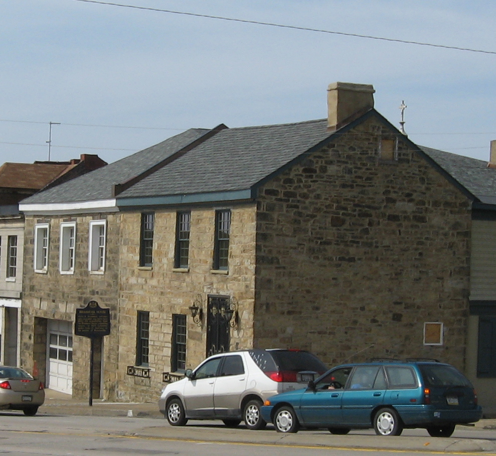

West Brownsville, Pennsylvania
West Brownsville is a borough of 1,100 people in Washington County, Pennsylvania, founded in 1831.
Why visit West Brownsville
Townapedia lists 19 museums and landmarks, 2 parks and trails, 5 places to eat and 5 attractions in and around town.
Highlights include Lane Bane Bridge, Mon-Fayette Expressway Bridge, Dunlap's Creek Bridge and Bowman's Castle.
July is the warmest month, with average highs of 85°F; January lows average 21°F.
Weather in West Brownsville
Forecast from the National Weather Service. Full forecast
About West Brownsville
West Brownsville is a former important transportation nexus and a present-day borough in Washington County, Pennsylvania, United States, and part of the Pittsburgh metropolitan area. The population was 972 at the 2020 census. Culturally, by postal route, and socially, the community is connected to cross-river sister-city Brownsville. The two towns were long joined by the Amerindian trail known as Nemacolin's Path that became a wagon road after the American Revolution.
From the Wikipedia article West Brownsville, Pennsylvania (this version), under CC BY-SA 4.0.
Things to do5


Mon-Fayette Expressway Bridge
Bridge · 2.9 mi
Bridge in United States of America

PennWest California
School · 2.1 mi
Public university located in California, Pennsylvania, United States

West Brownsville Junction Bridge
Bridge · 0.8 mi
Bridge in United States of America

Museums and landmarks19
Dunlap's Creek Bridge
Bridge · National Register of Historic Places · 0.8 mi
Bridge in United States of America

Bowman's Castle
Monument and historic site · National Register of Historic Places · 0.8 mi
Brownsville, Pennsylvania, NRHP-listed

Brownsville Bridge
Bridge · National Register of Historic Places · 0.7 mi
Bridge in United States of America

Brownsville Commercial Historic District
Monument and historic site · National Register of Historic Places · 0.8 mi
Historic district in Pennsylvania, United States
Brownsville Northside Historic District
Monument and historic site · National Register of Historic Places · 0.9 mi
Historic district in Pennsylvania, United States

California Area Public Library
Monument and historic site · National Register of Historic Places · 2.5 mi
Public library in Pennsylvania

Harrison House
Monument and historic site · National Register of Historic Places · 3.3 mi
Historic house in Centerville, Pennsylvania, United States

Jennings-Gallagher House
Monument and historic site · National Register of Historic Places · 2.2 mi
California, Pennsylvania

Joseph Dorsey House
Monument and historic site · National Register of Historic Places · 1.9 mi
Historic house in Pennsylvania, United States

Malden Inn
Monument and historic site · National Register of Historic Places · 2.1 mi
Hotel in Blainsburg, United States of America

Molly Fleming House
Monument and historic site · National Register of Historic Places · 2.2 mi
Historic building in California, Pennsylvania


Old Main
Monument and historic site · National Register of Historic Places · 2.3 mi
Academic building in California University of Pennsylvania
7 more on the map.
Parks, trails and playgrounds2

Restaurants and cafes5


Pickers Pub & Grub
Bar and pub · 0.8 mi
101 High Street, Brownsville

History
The first "improvement" made on the present site of West Brownsville was made by William Peters, alias "Indian Peter" and "Mohawk Peter", a Mohawk man who bought land from the state of Pennsylvania across from Redstone Old Fort in 1769. Peters is mentioned as living "opposite ye Fort Burd" with his Euro-American wife and children in the early 1760s in the journals of Quaker merchant James Kenny.
From the History section of West Brownsville, Pennsylvania on Wikipedia, under CC BY-SA 4.0.
Churches and places of worship5
St. Peter's Church
Church · National Register of Historic Places · 1.0 mi
Saint Peter's Church
Church · Roman Catholic · 1.0 mi
304 Shaffner Avenue, Brownsville
Holy Resurrection Orthodox Church
Church · Orthodox · 0.6 mi
118 Main Street, West Brownsville
Shopping2
Gas and EV charging2
Schools, colleges and libraries10
Healthcare1
Map of West Brownsville
51 places. The map loads OpenStreetMap tiles when you open it.
Climate by month
Monthly table
| Month | High | Low | Rain | Snow |
|---|---|---|---|---|
| Jan | 39°F | 21°F | 3.2 in | 3.8 in |
| Feb | 42°F | 22°F | 2.8 in | 2.7 in |
| Mar | 51°F | 29°F | 3.4 in | 2.1 in |
| Apr | 64°F | 39°F | 3.5 in | 0.0 in |
| May | 74°F | 51°F | 3.9 in | 0.0 in |
| Jun | 81°F | 60°F | 4.3 in | 0.0 in |
| Jul | 85°F | 64°F | 4.0 in | 0.0 in |
| Aug | 84°F | 62°F | 3.5 in | 0.0 in |
| Sep | 78°F | 56°F | 3.3 in | 0.0 in |
| Oct | 66°F | 44°F | 2.9 in | 0.0 in |
| Nov | 54°F | 34°F | 2.9 in | 0.2 in |
| Dec | 43°F | 27°F | 3.3 in | 1.5 in |
U.S. Climate Normals 1991-2020 for Charleroi Lock 4 (8 mi away), NOAA NCEI.
People and cost of living
American Community Survey 5-year estimates, 2020-2024, U.S. Census Bureau. Estimates have margins of error, larger for small towns.
Disaster history
Washington County has had 7 federal disaster declarations since 2000, most often for hurricanes.
- 2020-03-30: Covid-19 Pandemic (Biological)
- 2020-03-13: Covid-19 (Biological)
- 2012-10-29: Hurricane Sandy (Hurricane)
- 2005-09-10: Hurricane Katrina (Hurricane)
- 2004-09-19: Tropical Depression Ivan (Hurricane)
- 2004-09-19: Severe Storms And Flooding Associated With Tropical Depression Frances (Severe Storm)
OpenFEMA disaster declarations summaries.
Getting there and nearby towns
Greene County Airport (WAY) is the nearest airport with scheduled flights listed in OpenStreetMap, 16 miles away.
- Hiller 2 mi southwest, about 3 min by car
- Republic 5 mi south, about 7 min by car
- Speers 6 mi north, about 10 min by car
- Fairhope 6 mi northeast, about 10 min by car
- North Belle Vernon 7 mi north, about 11 min by car
- Perryopolis 8 mi northeast, about 13 min by car
- North Charleroi 8 mi north, about 13 min by car
- Nemacolin 11 mi south, about 17 min by car
- South Uniontown 12 mi southeast, about 20 min by car
- Collinsburg 14 mi northeast, about 23 min by car
Drive times are estimates from straight-line distance, not routes.
Local news
Headlines from INDB, the NEMICO news database.
Reviews, tips and questions
Loading what members have shared...
Sources and licences
- NCES EDGE (Public domain): public schools
- NOAA NCEI U.S. Climate Normals 1991-2020 (Public domain): climate by month
- OpenFEMA (Public domain): disaster declarations
- OpenStreetMap contributors (ODbL 1.0): places, airports, map data
- U.S. Census Bureau (Public domain): population, income, housing, education, commute
- Wikidata (CC0 1.0): landmarks and historic places
- Wikimedia Commons (see each image): photos
- Wikipedia (CC BY-SA 4.0): overview and history text
Photo credits
- Dunlap creek bridge jet lowe 1983, Jet Lowe, Public domain
- BrownsvilleNeck, Breakfastchief a/k/a Jonathan R. Henke, Public domain
- Calpubliclib, VitaleBaby ( talk ), Public domain
- Harrison House (Centerville, Pennsylvania) Lot, Generic1139, CC BY-SA 3.0
- Brashear House, Brownsville_Northside_Historic_District.jpg : Nyttend derivative work: Sisyphos23 ( talk ), Public domain
- Oldbrownsville, VitaleBaby ( talk ), Public domain
- Malden Inn, Generic1139, CC BY-SA 3.0
- Nemacolin Castle PA1, Acroterion, CC BY-SA 4.0
- St. Peters from Church Street in Brownsville, The original uploader was Ikcerog at English Wikipedia ., Public domain
- CalOldMain, Wjmoore17, CC BY-SA 3.0
- Joseph Dorsey House, Jack Boucher, Public domain
- Jennings-Gallagher House south side, Generic1139, CC BY-SA 3.0
- Molly Fleming House, Generic1139, CC BY-SA 3.0
- Thomas H. Thompson House angle, Generic1139, CC BY-SA 3.0
- Wbvillerr, VitaleBaby at en.wikipedia, Public domain
- Lanebane, VitaleBaby ( talk ), Public domain


Page built October 30, 2026. Spotted a mistake? Tell us or suggest a place.