




West Des Moines, Iowa
West Des Moines is a city of 71,083 people in Dallas County, Iowa, founded in 1893.
Why visit West Des Moines
Townapedia lists 61 museums and landmarks, 61 parks and trails, 284 places to eat, 38 places to stay and 12 attractions in and around town.
Highlights include Des Moines University, Drake University, Historic Valley Junction Foundation and Jordan House.
July is the warmest month, with average highs of 86°F; January lows average 14°F, and about 36 inches of snow fall in a normal year.
Weather in West Des Moines
Forecast from the National Weather Service. Full forecast
About West Des Moines
West Des Moines is a city in Iowa, United States. Most of the city is in Polk County, some of it is in Dallas County, and small portions extend into Warren and Madison Counties.
From the Wikipedia article West Des Moines, Iowa (this version), under CC BY-SA 4.0.
Things to do12

Des Moines University
School · 1.9 mi
Medical school located in Des Moines, Iowa
8025 Grand Avenue, West Des Moines
Drake University
School · 7.6 mi
Private university in Des Moines, Iowa

George Washington Carver Bridge
Bridge · 7.6 mi
Bridge in United States of America

Blue Zoo
Zoo and aquarium · 1.5 mi
Interactive aquarium with hands on learning, live shows, and play areas.
6925 Mills Civic Parkway, West Des Moines

Century 20 Jordan Creek
Cinema and theater · 1.7 mi
101 South Jordan Creek Parkway, West Des Moines
Drake University College of Pharmacy and Health Sciences
School · 7.6 mi
Last Laugh Comedy Club
Cinema and theater · 4.0 mi
1701 25th Street, West Des Moines
Tallgrass Theatre Company
Cinema and theater · 2.8 mi
2019 Grand Avenue, West Des Moines
Museums and landmarks61

Historic Valley Junction Foundation
Monument and historic site · 4.0 mi
137 5th Street, West Des Moines


Jordan House
Monument and historic site · National Register of Historic Places · 2.5 mi
Listed on the NRHP in Polk County, Iowa
2001 Fuller Road
Albert Baird Cummins House
Monument and historic site · National Register of Historic Places · 7.2 mi
Des Moines, Iowa, listed on the NRHP in Polk County, Iowa
Allen Hazen Water Tower
Monument and historic site · National Register of Historic Places · 6.1 mi
Water tower in Des Moines, Iowa
Anson O. Reynolds House
Monument and historic site · National Register of Historic Places · 7.4 mi
Historic house in Des Moines, Iowa
Bryn Mawr Apartments
Monument and historic site · National Register of Historic Places · 6.9 mi
Apartment building in Des Moines, Iowa
Byron and Ivan Boyd House
Monument and historic site · National Register of Historic Places · 5.9 mi
Des Moines, IA, listed on the NRHP in Iowa
Crawford House
Monument and historic site · National Register of Historic Places · 7.3 mi
Historic house in Iowa, United States
Des Moines Art Center
Monument and historic site · National Register of Historic Places · 5.7 mi
Art museum in Des Moines, Iowa
Dr. Richard and Paulina Stuart House
Monument and historic site · National Register of Historic Places · 7.5 mi
Historic building located in Des Moines, Iowa, United States
Drake University Campus Historic District
Monument and historic site · National Register of Historic Places · 7.6 mi
Historic district in Iowa, United States
F. F. Odenweller-James P. and Nettie Morey House
Monument and historic site · National Register of Historic Places · 7.4 mi
Historic house in Des Moines, Iowa
49 more on the map.
Parks, trails and playgrounds61

Raccoon River Park
Park · 2.8 mi
Park in Polk County, Iowa, United States of America
2500 Grand Avenue, West Des Moines
Water Works Park (Des Moines)
Park · 5.8 mi
Public park in Des Moines, Iowa, USA


49 more on the map.
Restaurants and cafes284

Maxie's Supper Club
Diner · American · 3.7 mi
Welcome to Maxie’s Supper Club, a beloved American dining tradition proudly serving West Des Moines since 1967. Our cozy, welcoming...
1311 Grand Avenue, West Des Moines
Su-Mo closed, Tu-Fr 11:00-14:00, 16:00-21:00

Blaze Pizza
Restaurant · Pizza · 1.0 mi
6305 Mills Civic Parkway, West Des Moines
Su-Th 10:30-21:00; Fr-Sa 10:30-22:00
Buffalo Wild Wings
Restaurant · Wings · 1.5 mi
6925 Mills Civic Parkway, West Des Moines
Su-Th 11:00-24:00; Fr-Sa 11:00-01:00
Buffet City
Restaurant · Chinese, Mongolian Grill · 4.2 mi
8801 University Avenue, Clive
Su-Th 10:30-21:30; Fr-Sa 10:30-22:30
Coach's Pizza
Restaurant · Pizza · 0.9 mi
560 South Prairie View Drive, West Des Moines
Su-Th 14:00-21:00; Fr-Sa 14:00-22:00
Cooper's on 5th
Restaurant · American, Burger, Sandwich, Salad · 4.1 mi
227 5th Street, West Des Moines
Tu-Sa 11:00-22:00
Dave & Buster's
Diner · American · 1.7 mi
190 S. Jordan Creek Parkway, West Des Moines
Mo-Th 11:00-24:00; Fr 11:00-01:00; Sa 10:00-01:00; Su 10:00-24:00
Denny's
Diner · American · 4.4 mi
11820 Hickman Road, Clive
Mo,Sa,Su 08:00-20:00; Tu,We 09:00-20:00; Th,Fr 07:00-22:00
Early Bird
Restaurant · Breakfast, American · 4.4 mi
9250 SE University Avenue, West Des Moines
06:30-14:30
Eat Thai
Restaurant · Thai · 4.2 mi
1821 22nd Street, West Des Moines
Tu-Fr 11:00-14:00,17:00-20:00; Sa 12:00-14:30,16:00-20:00; Su 16:00-20:00
Fleming's
Restaurant · Steak House · 1.6 mi
150 South Jordan Creek Parkway, West Des Moines
Mo 16:00-22:00; Tu-Sa 11:00-22:00; Su 16:00-21:00
Grimaldi's Pizzeria
Restaurant · Pizza · 0.8 mi
5485 Mills Civic Parkway, West Des Moines
Su-Th 11:00-22:00; Fr-Sa 11:00-24:00
272 more on the map.
Where to stay38
Best Western Plus Des Moines West Inn & Suites
Motel and hotel · 3.7 mi
1450 Northwest 118th Street, Clive
Country Inn & Suites, Des Moines West, IA
Motel and hotel · 3.7 mi
1350 Northwest 118th Street, Clive
Courtyard Des Moines West/Jordan Creek
Motel and hotel · 1.3 mi
410 South 68th Street, West Des Moines
Days Inn by Wyndham West Des Moines / Clive
Motel and hotel · 3.8 mi
1600 Northwest 114th Street, Clive
Hampton Inn & Suites West Des Moines/SW Mall Area
Motel and hotel · 0.9 mi
6160 Mills Civic Parkway, West Des Moines
Holiday Inn Express West Des Moines - Jordan Creek
Motel and hotel · 2.1 mi
240 Jordan Creek Parkway, West Des Moines
Churches and places of worship42
Beautiful Savior Evangelical Lutheran Church
Church · Lutheran · 2.6 mi
8051 E P True Parkway
Covenant United Presbyterian Church
Church · Presbyterian · 3.2 mi
1025 28th Street, West Des Moines
Shopping65
Gas and EV charging31
Schools, colleges and libraries40
Learning Resource Center
School · 1.7 mi
3350 Mills Civic Parkway, West Des Moines
Healthcare32
Hy-Vee Pharmacy
Clinic and pharmacy · 0.8 mi
555 South 51st Street, West Des Moines
Map of West Des Moines
250 places. The map loads OpenStreetMap tiles when you open it.
Climate by month
Monthly table
| Month | High | Low | Rain | Snow |
|---|---|---|---|---|
| Jan | 31°F | 14°F | 1.1 in | 9.4 in |
| Feb | 36°F | 18°F | 1.3 in | 10.2 in |
| Mar | 49°F | 30°F | 2.2 in | 4.4 in |
| Apr | 62°F | 41°F | 4.0 in | 1.2 in |
| May | 72°F | 52°F | 5.2 in | 0.2 in |
| Jun | 82°F | 62°F | 5.3 in | 0.0 in |
| Jul | 86°F | 66°F | 3.8 in | 0.0 in |
| Aug | 84°F | 64°F | 4.2 in | 0.0 in |
| Sep | 77°F | 55°F | 3.2 in | 0.0 in |
| Oct | 63°F | 43°F | 2.8 in | 0.5 in |
| Nov | 48°F | 30°F | 1.9 in | 2.7 in |
| Dec | 36°F | 20°F | 1.6 in | 7.9 in |
U.S. Climate Normals 1991-2020 for Des Moines Intl Ap Gsn 72546 (7 mi away), NOAA NCEI.
People and cost of living
American Community Survey 5-year estimates, 2020-2024, U.S. Census Bureau. Estimates have margins of error, larger for small towns.
Disaster history
Dallas County has had 13 federal disaster declarations since 2000, most often for severe storms.
- 2024-05-24: Severe Storms, Tornadoes, And Flooding (Severe Storm)
- 2020-08-17: Severe Storms (Severe Storm)
- 2020-03-23: Covid-19 Pandemic (Biological)
- 2020-03-13: Covid-19 (Biological)
- 2019-03-23: Severe Storms And Flooding (Flood)
- 2018-08-20: Severe Storms, Tornadoes, Straight-Line Winds, And Flooding (Severe Storm)
OpenFEMA disaster declarations summaries.
Getting there and nearby towns
Des Moines International Airport (DSM) is the nearest airport with scheduled flights listed in OpenStreetMap, 6 miles away.
- Clive 4 mi north, about 7 min by car
- Windsor Heights 5 mi northeast, about 8 min by car
- Urbandale 6 mi north, about 10 min by car
- Waukee 6 mi northwest, about 10 min by car
- Norwalk 6 mi southeast, about 10 min by car
- Des Moines 9 mi east, about 14 min by car
- Grimes 9 mi north, about 14 min by car
- Van Meter 9 mi west, about 14 min by car
- Johnston 10 mi north, about 16 min by car
- Saylorville 12 mi northeast, about 19 min by car
Drive times are estimates from straight-line distance, not routes.
Local news
Headlines from INDB, the NEMICO news database.
Reviews, tips and questions
Loading what members have shared...
Sources and licences
- NCES EDGE (Public domain): public schools
- NOAA NCEI U.S. Climate Normals 1991-2020 (Public domain): climate by month
- OpenFEMA (Public domain): disaster declarations
- OpenStreetMap contributors (ODbL 1.0): places, airports, map data
- U.S. Census Bureau (Public domain): population, income, housing, education, commute
- Wikidata (CC0 1.0): elevation, founding date, time zone, website, landmarks and historic places
- Wikimedia Commons (see each image): photos
- Wikipedia (CC BY-SA 4.0): overview and history text
Photo credits
- HistoricValleyJunction, Iowahwyman, CC BY-SA 3.0
- Jordan House front enterance, Goddesshanna, CC BY-SA 3.0
- I.O.O.F. Valley Junction Lodge Hall No. 604, Jim Roberts, CC BY-SA 4.0
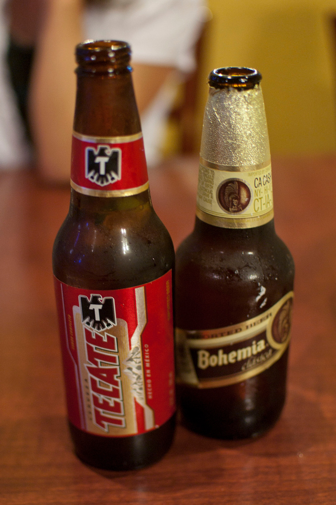
- Mexican beer - Tecate, AnneCN, CC BY 2.0
- Vivek Ramaswamy (53459561155), Gage Skidmore from Surprise, AZ, United States of America, CC BY-SA 2.0
- Vivek Ramaswamy (53459561235), Gage Skidmore from Surprise, AZ, United States of America, CC BY-SA 2.0
- Matt Schultz (53459561060), Gage Skidmore from Surprise, AZ, United States of America, CC BY-SA 2.0
- Vivek Ramaswamy (53459278478), Gage Skidmore from Surprise, AZ, United States of America, CC BY-SA 2.0
- Jeff Shipley with attendees (53459279113), Gage Skidmore from Surprise, AZ, United States of America, CC BY-SA 2.0
- Vivek Ramaswamy (53459459669), Gage Skidmore from Surprise, AZ, United States of America, CC BY-SA 2.0
- Jeff Shipley (53459459784), Gage Skidmore from Surprise, AZ, United States of America, CC BY-SA 2.0
- Vivek Ramaswamy (53459459269), Gage Skidmore from Surprise, AZ, United States of America, CC BY-SA 2.0
- Vivek Ramaswamy (53459560965), Gage Skidmore from Surprise, AZ, United States of America, CC BY-SA 2.0
- Vivek Ramaswamy (53459561430), Gage Skidmore from Surprise, AZ, United States of America, CC BY-SA 2.0
- Vivek Ramaswamy (53459459629), Gage Skidmore from Surprise, AZ, United States of America, CC BY-SA 2.0
- Vivek Ramaswamy with supporters (53458225447), Gage Skidmore from Surprise, AZ, United States of America, CC BY-SA 2.0
- Vivek Ramaswamy with supporters (53459278583), Gage Skidmore from Surprise, AZ, United States of America, CC BY-SA 2.0
- Vivek Ramaswamy (53459561245), Gage Skidmore from Surprise, AZ, United States of America, CC BY-SA 2.0
- Apoorva & Vivek Ramaswamy (53459561135), Gage Skidmore from Surprise, AZ, United States of America, CC BY-SA 2.0
- Vivek Ramaswamy (53459561275), Gage Skidmore from Surprise, AZ, United States of America, CC BY-SA 2.0
- Vivek Ramaswamy (53459459489), Gage Skidmore from Surprise, AZ, United States of America, CC BY-SA 2.0
- Vivek Ramaswamy (53458225717), Gage Skidmore from Surprise, AZ, United States of America, CC BY-SA 2.0
- Jake Chapman (53459278993), Gage Skidmore from Surprise, AZ, United States of America, CC BY-SA 2.0
- Vivek Ramaswamy (53459561550), Gage Skidmore from Surprise, AZ, United States of America, CC BY-SA 2.0
- Vivek Ramaswamy (53459278748), Gage Skidmore from Surprise, AZ, United States of America, CC BY-SA 2.0
- Jake Chapman (53458225797), Gage Skidmore from Surprise, AZ, United States of America, CC BY-SA 2.0
- Vivek Ramaswamy (53459278713), Gage Skidmore from Surprise, AZ, United States of America, CC BY-SA 2.0
- Vivek Ramaswamy with supporters (53459459759), Gage Skidmore from Surprise, AZ, United States of America, CC BY-SA 2.0
- Apoorva & Vivek Ramaswamy (53459561095), Gage Skidmore from Surprise, AZ, United States of America, CC BY-SA 2.0
- Vivek Ramaswamy (53459278888), Gage Skidmore from Surprise, AZ, United States of America, CC BY-SA 2.0
- Vivek Ramaswamy (53458225387), Gage Skidmore from Surprise, AZ, United States of America, CC BY-SA 2.0
- Vivek Ramaswamy (53459146666), Gage Skidmore from Surprise, AZ, United States of America, CC BY-SA 2.0
- Apoorva & Vivek Ramaswamy (53459459444), Gage Skidmore from Surprise, AZ, United States of America, CC BY-SA 2.0
- Vivek Ramaswamy (53459459494), Gage Skidmore from Surprise, AZ, United States of America, CC BY-SA 2.0
- Jeff Shipley (53458225877), Gage Skidmore from Surprise, AZ, United States of America, CC BY-SA 2.0
- Vivek Ramaswamy (53459278843), Gage Skidmore from Surprise, AZ, United States of America, CC BY-SA 2.0
- Vivek Ramaswamy & Jeff Shipley (53459279028), Gage Skidmore from Surprise, AZ, United States of America, CC BY-SA 2.0
- Vivek Ramaswamy (53459278803), Gage Skidmore from Surprise, AZ, United States of America, CC BY-SA 2.0
- Vivek Ramaswamy (53459278483), Gage Skidmore from Surprise, AZ, United States of America, CC BY-SA 2.0
- Vivek Ramaswamy (53459561040), Gage Skidmore from Surprise, AZ, United States of America, CC BY-SA 2.0


Page built October 30, 2026. Spotted a mistake? Tell us or suggest a place.