


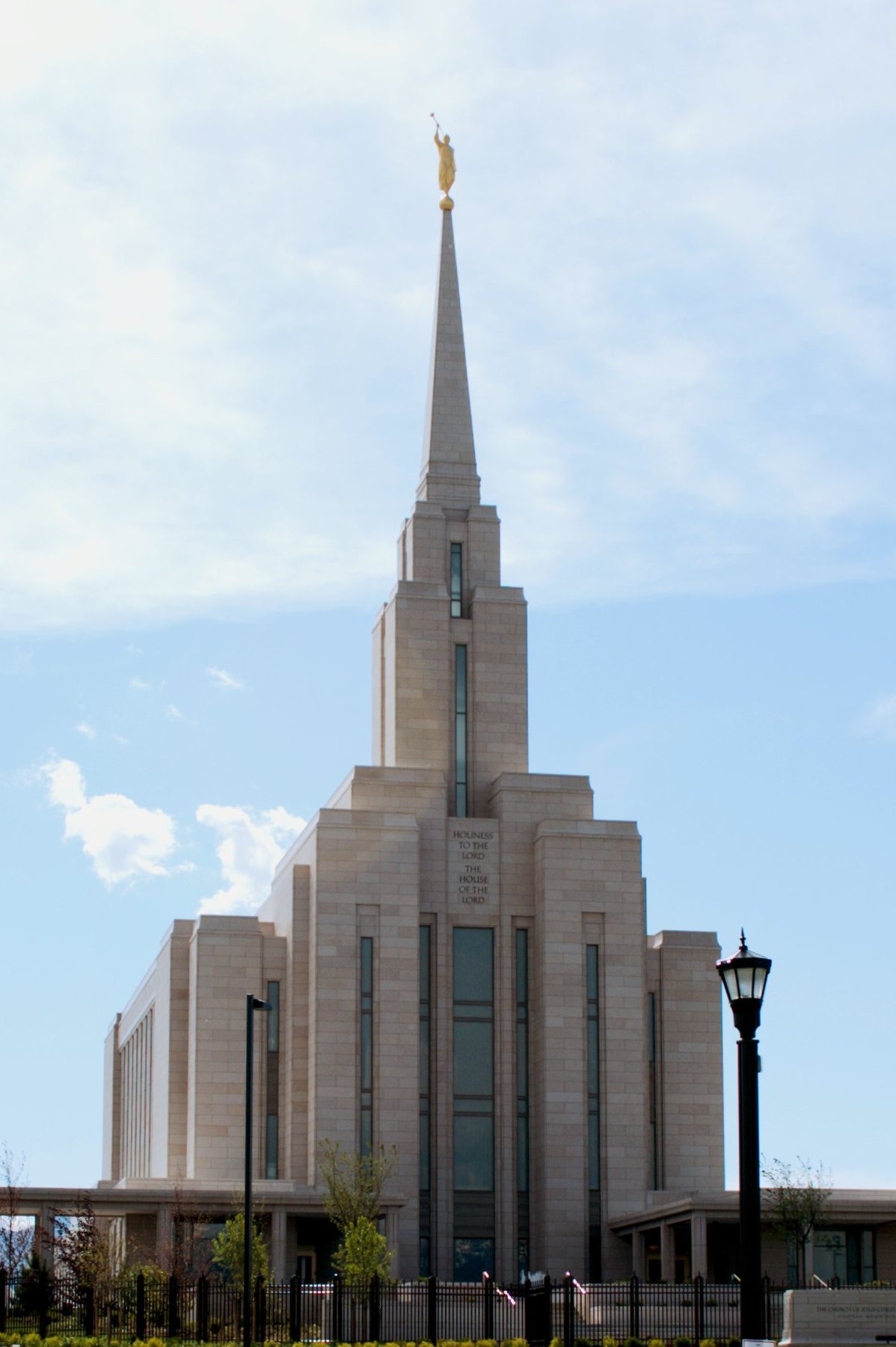

West Jordan, Utah
West Jordan is a city of 116,692 people in Salt Lake County, Utah, founded in 1849.
Why visit West Jordan
Townapedia lists 33 museums and landmarks, 133 parks and trails, 202 places to eat, 4 places to stay and 3 attractions in and around town.
Highlights include AMC Theaters West Jordan 12, Cinemark, Alfred C. and Annie L. Olsen Anderson House and Allsop-Jensen House.
July is the warmest month, with average highs of 94°F; January lows average 25°F.
Weather in West Jordan
Forecast from the National Weather Service. Full forecast
About West Jordan
West Jordan is a city in Salt Lake County, Utah, United States. It is a suburb of Salt Lake City. According to the 2020 Census, the city had a population of 116,961, placing it as the third most populous in the state. The city occupies the southwest end of the Salt Lake Valley at an elevation of 4,330 feet (1,320 m).
From the Wikipedia article West Jordan, Utah (this version), under CC BY-SA 4.0.
Things to do3

Cinemark
Cinema and theater · 1.5 mi
7301 South Jordan Landing Boulevard, West Jordan
Museums and landmarks33

Alfred C. and Annie L. Olsen Anderson House
Monument and historic site · National Register of Historic Places · 6.0 mi
Historic house in Sandy, Utah, United States
Allsop-Jensen House
Monument and historic site · National Register of Historic Places · 6.4 mi
Historic house in Sandy, Utah, United States
Copperton Historic District
Monument and historic site · National Register of Historic Places · 5.7 mi
Historic district in Copperton, Utah, United States
Dyre and Maria Amundsen House
Monument and historic site · National Register of Historic Places · 6.6 mi
House in Murray, Utah
Garside-McMullin House
Monument and historic site · National Register of Historic Places · 4.8 mi
House in South Jordan, Utah
Hannah Nash Dowding House
Monument and historic site · National Register of Historic Places · 6.0 mi
Historic house in Sandy, Utah, United States
John and Mary Mattson House
Monument and historic site · National Register of Historic Places · 6.3 mi
Historic house in Sandy, Utah, United States
Joseph F. and Isabelle Jensen House
Monument and historic site · National Register of Historic Places · 6.5 mi
Historic house in Sandy, Utah, United States
Mary Ellen Parmley House
Monument and historic site · National Register of Historic Places · 5.7 mi
Historic house in Sandy, Utah, United States
Matthew and Johanna Rowan House
Monument and historic site · National Register of Historic Places · 5.9 mi
House in Murray, Utah
Orlando H. and Emma H. Hardcastle House
Monument and historic site · National Register of Historic Places · 5.9 mi
Single-family detached home in Sandy, United States of America
Riverton Elementary School
Monument and historic site · National Register of Historic Places · 6.7 mi
School building in Riverton, United States of America
21 more on the map.
Parks, trails and playgrounds133





121 more on the map.
Restaurants and cafes202

Jim's Family Restaurant
Restaurant · American, Breakfast · 3.4 mi
7609 South Redwood Road, West Jordan
07:00-21:00
Naivedhyam Cafe
Restaurant · Indian · 3.6 mi
All-vegetarian largely South Indian fast-casual restaurant. Features dosas, idli, uttapam, etc.
1617 West 9000 South, West Jordan
Tu-Fr 11:00-14:30, 17:00-21:00; Sa-Su 10:00-15:00, 17:00-21:00; Mo off

RISE Bakery & Market
Bakery · Polish · 1.7 mi
Polish food: a bakery, cafe, and market. They also operate a food truck and they also do catering.
7872 South Old Bingham Highway, West Jordan
Tu-Fr 09:00-19:00; Sa 09:00-17:00
SLC Dhaba
Restaurant · Indian · 2.0 mi
North Indian cuisine with a weekday lunch buffet, weekend brunch buffet, and a dinner / a la carte menu.
3078 West 7800 South, West Jordan
Tu-Fr 11:30-14:30, 17:00-22:00; Sa-Su 09:00-14:00, 17:00-22:00
Saigon Blossom
Restaurant · Vietnamese · 3.4 mi
Vietnamese and Thai restaurant
4655 West 5415 South, Kearns
Mo 11:00-20:00; Tu off; We-Sa 11:00-20:00; Su 11:00-18:00
Big Tortas
Restaurant · Mexican · 3.5 mi
4153 West 5415 South, Kearns
Mo-Th,Su 10:00-21:00; Fr-Sa 10:00-22:00
Cafe Rio
Restaurant · Mexican · 1.0 mi
7677 South Jordan Landing Boulevard, West Jordan
Mo-We,Su 10:30-22:00; Th-Sa 10:30-23:00

IHOP
Restaurant · Breakfast, Pancake · 1.7 mi
7188 South Plaza Center Drive, West Jordan
Mo-Th,Su 06:00-22:00; Fr,Sa 06:00-24:00
Lolo's Hawaiian
Restaurant · Hawaiian · 1.3 mi
7552 South Plaza Center Drive, West Jordan
Mo-Th 10:30-21:30; Fr-Sa 10:30-22:00; Su 11:00-21:30
Nacho House
Restaurant · Mexican · 1.8 mi
7191 South Plaza Center Drive, West Jordan
Mo-Sa 11:00-21:30; Su off
190 more on the map.
History
West Jordan received its name from Mormon settlers who entered the Salt Lake Valley in 1847 under the leadership of their prophet, Brigham Young. These first European-Americans named the river flowing west of their first settlement, Salt Lake City, the Western Jordan, a reference to the River Jordan in Jordan. The name was later simplified to "Jordan River". Like its Middle Eastern namesake, the Jordan River flows from a fresh water lake (Utah Lake) to an inland salt sea (Great Salt Lake). West Jordan was founded around 1849 on the western banks of the Jordan River.
One of the first sawmills in the area was built in 1850 in the city by Archibald Gardner. Gardner was a devout Mormon whose legacy can still be seen in modern West Jordan. His collection of mills and houses, now historic, have been renovated into a specialty shopping district known as Gardner Village.
Early West Jordan relied primarily on agriculture, mills, and mining activity to form the base of its economy. The first leather tannery west of the Mississippi River was constructed in the city in 1851.
From the History section of West Jordan, Utah on Wikipedia, under CC BY-SA 4.0.
Where to stay4
Residence Inn Salt Lake City-West Jordan
Motel and hotel · 1.2 mi
7558 South Plaza Center Drive, West Jordan
My Place Hotel - West Jordan/Jordan Landing, UT
Motel and hotel · 1.3 mi
7424 South Campus View Drive, West Jordan
Churches and places of worship81
Sandy Second Ward Chapel
Church · National Register of Historic Places · 6.5 mi
Our Lady of Perpetual Help Catholic Church
Church · Roman Catholic · 3.5 mi
4360 West 5415 South, Kearns
Saint Joseph the Worker Catholic Church
Church · Roman Catholic · 3.5 mi
7405 South Redwood Road, West Jordan
The Church of Jesus Christ of Latter-day Saints
Church · Mormon · 2.5 mi
2680 West 7530 South, West Jordan
Shopping37
Gas and EV charging39
Schools, colleges and libraries95
Healthcare13
Apothecary West Prescriptions
Clinic and pharmacy · 3.5 mi
4188 West 5415 South, Kearns
Copper View Medical Center
Clinic and pharmacy · 2.4 mi
3556 West 9800 South, South Jordan
Map of West Jordan
250 places. The map loads OpenStreetMap tiles when you open it.
Climate by month
Monthly table
| Month | High | Low | Rain |
|---|---|---|---|
| Jan | 40°F | 25°F | 1.8 in |
| Feb | 45°F | 28°F | 1.7 in |
| Mar | 56°F | 36°F | 2.2 in |
| Apr | 62°F | 40°F | 2.7 in |
| May | 74°F | 49°F | 2.6 in |
| Jun | 85°F | 58°F | 1.2 in |
| Jul | 94°F | 66°F | 0.8 in |
| Aug | 92°F | 64°F | 0.8 in |
| Sep | 81°F | 54°F | 1.2 in |
| Oct | 66°F | 42°F | 1.8 in |
| Nov | 51°F | 32°F | 1.6 in |
| Dec | 40°F | 26°F | 1.8 in |
U.S. Climate Normals 1991-2020 for Draper-Point Of Mtn (10 mi away), rain and snow from Taylorsville-Bennion 2.0 Wsw, NOAA NCEI.
People and cost of living
American Community Survey 5-year estimates, 2020-2024, U.S. Census Bureau. Estimates have margins of error, larger for small towns.
Disaster history
Salt Lake County has had 9 federal disaster declarations since 2000, most often for fires.
- 2021-08-14: Parleys Canyon Fire (Fire)
- 2021-01-12: Straight-Line Winds (Severe Storm)
- 2020-07-09: Earthquake And Aftershocks (Earthquake)
- 2020-04-04: Covid-19 Pandemic (Biological)
- 2020-03-13: Covid-19 (Biological)
- 2012-06-29: Rose Crest Fire (Fire)
OpenFEMA disaster declarations summaries.
Getting there and nearby towns
Salt Lake City International Airport (SLC) is the nearest airport with scheduled flights listed in OpenStreetMap, 13 miles away.
- South Jordan 3 mi south, about 5 min by car
- Kearns 3 mi north, about 5 min by car
- Taylorsville 5 mi northeast, about 7 min by car
- West Valley City 6 mi north, about 10 min by car
- Midvale 6 mi east, about 9 min by car
- Riverton 6 mi south, about 10 min by car
- Copperton 6 mi southwest, about 9 min by car
- Murray 7 mi northeast, about 11 min by car
- Salt Lake City 13 mi north, about 20 min by car
- Provo 31 mi southeast, about 50 min by car
Drive times are estimates from straight-line distance, not routes.
Local news
Headlines from INDB, the NEMICO news database.
Reviews, tips and questions
Loading what members have shared...
Sources and licences
- NCES EDGE (Public domain): public schools
- NOAA NCEI U.S. Climate Normals 1991-2020 (Public domain): climate by month
- OpenFEMA (Public domain): disaster declarations
- OpenStreetMap contributors (ODbL 1.0): places, airports, map data
- U.S. Census Bureau (Public domain): population, income, housing, education, commute
- Wikidata (CC0 1.0): elevation, founding date, time zone, website, landmarks and historic places
- Wikimedia Commons (see each image): photos
- Wikipedia (CC BY-SA 4.0): overview and history text
Photo credits
- West Jordan city offices, Utah, An Errant Knight, CC BY-SA 4.0
- Race and ethnicity 2020 West Jordan, UT, CensusDots, CC BY-SA 4.0
- Saint Joseph the Worker Catholic Church in West Jordan Utah Tower, Always dreamin, CC BY-SA 4.0
- West Jordan Antelope - panoramio, runt35, CC BY 3.0
- Oquirrh Mountain front view, Oqquirhtemple5252009.jpg : Cookiecaper derivative work: -- Trödel, CC BY-SA 3.0
- ISS066-E-43327 - View of Earth, Earth Science and Remote Sensing Unit , Lyndon B. Johnson Space Center, Public domain
- ISS067-E-114184 - View of Earth, Earth Science and Remote Sensing Unit , Lyndon B. Johnson Space Center, Public domain
- ISS067-E-117103 - View of Earth, Earth Science and Remote Sensing Unit , Lyndon B. Johnson Space Center, Public domain
- ISS054-E-42044 - View of Earth, Earth Science and Remote Sensing Unit, NASA Johnson Space Center, Public domain
- ISS067-E-114185 - View of Earth, Earth Science and Remote Sensing Unit , Lyndon B. Johnson Space Center, Public domain
- ISS067-E-117102 - View of Earth, Earth Science and Remote Sensing Unit , Lyndon B. Johnson Space Center, Public domain
- Life - Flickr - KellyB., KellyB., CC BY 2.0
- END UT-48 Shield - panoramio, Rover_0, CC BY 3.0
- Chooch - Chihuahua - panoramio, runt35, CC BY 3.0
- 23-365 Into the Darkness, Walking - Flickr - Cliff Johnson, Cliff Johnson from West Jordan, UT, USA, CC BY-SA 2.0
- Tristan Gale with Randall Parker, Ajrparker333, CC BY-SA 4.0
- Tristan Gale and Jimmy Shea, Ajrparker333, CC BY-SA 4.0
- Cherry Chocolate Donut detail, Jaime Skelton from Layton, UT, United States, CC BY 2.0
- UTA Red Line and Bus Bridge, Utah Transit, CC BY-SA 4.0
- Collier's The National Weekly, Kurt Kaiser, CC0
- Classic Cheese Dream, Cheesedreamcharlie, CC BY-SA 4.0
- M and M (3163961698), Cliff Johnson from West Jordan, UT, USA, CC BY-SA 2.0
- Droplets on the window, Ctel2177, CC0
- 2015-11-03 10 13 03 View east from an airplane along the southern portion of Interstate 215 as it crosses the cities of Taylorsville, Murray and Midvale, Utah and interchanges with Interstate 15, Famartin, CC BY-SA 4.0
- 2015-11-03 10 13 04 View east from an airplane along the southern portion of Interstate 215 as it crosses the cities of Taylorsville, Murray and Midvale, Utah and interchanges with Interstate 15, Famartin, CC BY-SA 4.0
- Two Temples - panoramio, runt35, CC BY 3.0
- Trax tracks - panoramio, runt35, CC BY 3.0
- Utah Olympic Oval, Kearns, Utah (7186841402), Ken Lund from Reno, Nevada, USA, CC BY-SA 2.0
- Utah Olympic Oval, Ken Lund from Las Vegas, Nevada, USA, CC BY-SA 2.0
- Two Coyotes and an Antelope - panoramio, runt35, CC BY 3.0
- Kennecott Super People - panoramio, runt35, CC BY 3.0
- Flying People Art - panoramio, runt35, CC BY 3.0
- South Jordan Parkway Flying People - panoramio, runt35, CC BY 3.0
- UT-68-48 Implicit Duplex 1 - panoramio, Rover_0, CC BY 3.0
- Daybreak Community Utah 2011-06-20, Dean Derhak, CC BY-SA 3.0
- South Jordan Parkway TRAX station - panoramio, Garrett in SLC, CC BY 3.0
- UT-68-48 Implicit Duplex 3 - panoramio, Rover_0, CC BY 3.0
- Solo UT-68 Shield, N from 7800 S - panoramio, Rover_0, CC BY 3.0
- Caradrina montana, Hillbros, CC BY-SA 3.0
- UT-68-209 Junction, Looking South - panoramio, Rover_0, CC BY 3.0


Page built October 30, 2026. Spotted a mistake? Tell us or suggest a place.