
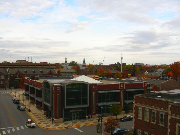


West Lafayette, Indiana
West Lafayette is a city of 45,159 people in Tippecanoe County, Indiana, founded in 1888.
Why visit West Lafayette
Townapedia lists 50 museums and landmarks, 62 parks and trails, 177 places to eat, 10 places to stay and 12 attractions in and around town.
Highlights include Long Center for the Performing Arts, Wabash Landing 9, Centennial Neighborhood District and Chauncey-Stadium Avenues Historic District.
July is the warmest month, with average highs of 84°F; January lows average 18°F.
Weather in West Lafayette
Forecast from the National Weather Service. Full forecast
About West Lafayette
West Lafayette ( LA(H)F-ee-ET) is a city in Tippecanoe County, Indiana, United States. The population was 44,595 at the 2020 census. West Lafayette sits across the Wabash River from its sister city, Lafayette, and is a college town, home to Purdue University. It is the most densely populated city in Indiana, located 65 miles (105 km) northwest of Indianapolis and 113 miles (182 km) southeast of Chicago.
From the Wikipedia article West Lafayette, Indiana (this version), under CC BY-SA 4.0.
Things to do12

Long Center for the Performing Arts
Cinema and theater · National Register of Historic Places · 2.5 mi
Performing arts center and former movie theater in Lafayette, Indiana, United States
611 North 6th Street, Lafayette

Elliott Hall of Music
Cinema and theater · 1.2 mi
Concert hall and theater on the campus of Purdue University in West Lafayette, Indiana, United States

Purdue University
School · 1.3 mi
Public research university in West Lafayette, Indiana, United States
Purdue University School of Mechanical Engineering
School · 1.0 mi
Academic unit in West Lafayette, Indiana, US
Slayter Center of Performing Arts
Cinema and theater · 0.8 mi
Outdoor concert bandshell on the campus of Purdue University in West Lafayette, Indiana, United States
Weldon School of Biomedical Engineering
School · 1.5 mi
School at Purdue University
Purdue University College of Health and Human Sciences
School · 1.4 mi
Civic Theatre of Greater Lafayette
Cinema and theater · 2.3 mi
320 North 5th Street, Lafayette
Tippecanoe County Amphitheater
Cinema and theater · 3.2 mi
4449 North River Road, West Lafayette
Museums and landmarks50

Centennial Neighborhood District
Monument and historic site · National Register of Historic Places · 2.3 mi
Lafayette, Indiana

Chauncey-Stadium Avenues Historic District
Monument and historic site · National Register of Historic Places · 1.3 mi
National historic district located at West Lafayette, Tippecanoe County, Indiana
Curtis-Grace House
Monument and historic site · National Register of Historic Places · 0.9 mi
Building in Indiana, United States
Downtown Lafayette Historic District
Monument and historic site · National Register of Historic Places · 2.4 mi
Historic district in Indiana, United States
Ellsworth Historic District
Monument and historic site · National Register of Historic Places · 2.7 mi
National historic district located at Lafayette, Indiana
Ely Homestead
Monument and historic site · National Register of Historic Places · 5.1 mi
Building in Indiana, United States
Enterprise Hotel
Monument and historic site · National Register of Historic Places · 2.7 mi
Hotel in Indiana, United States of America


Falley Home
Monument and historic site · National Register of Historic Places · 2.7 mi
Building in Indiana, United States
Former Alpha Tau Omega Fraternity House
Monument and historic site · National Register of Historic Places · 1.2 mi
United States historic place
Fort Ouiatenon
Monument and historic site · National Register of Historic Places · 3.3 mi
First fortified European fort in Indiana
Happy Hollow Heights Historic District
Monument and historic site · National Register of Historic Places · 1.2 mi
Building in Indiana, United States
Highland Park Neighborhood Historic District
Monument and historic site · National Register of Historic Places · 3.2 mi
National historic district located at Lafayette, Tippecanoe County, Indiana
38 more on the map.
Parks, trails and playgrounds62

Linnwood Park
Park · 2.4 mi
This 1/2-acre park is located near the former Linnwood Elementary School on Greenbush Street.
1501 Greenbush Street, Lafayette


50 more on the map.
Restaurants and cafes177

BRU Burger Bar
Restaurant · Burger · 2.3 mi
Has a heated outdoor seating area.
101 Main Street, Lafayette
Su-Th 11:00-21:00; Fr-Sa 11:00-22:00
Bahn Mi Eatery
Restaurant · Sandwich, Vietnamese · 3.1 mi
1201 South 4th Street, Lafayette
Tu-Su 11:00-20:00
Budges Drive In
Restaurant · American, Burger, Ice Cream · 2.4 mi
1102 North 14th Street, Lafayette
Mo-Sa 11:00-20:00; Su 14:00-20:00
Buffalo Wild Wings
Restaurant · Wings · 1.9 mi
360 Brown Street, West Lafayette
Tu-Sa 11:00-02:00, Su-Mo 11:00-24:00
Chick Master | Chi Hotpot
Restaurant · Hotpot, Dessert, Barbecue · 1.9 mi
124 South River Road, West Lafayette
Mo-Su 12:00-22:00
Dos Amigos Mexican Restaurant
Restaurant · Mexican · 1.9 mi
360 Brown Street, West Lafayette
Mo-We 11:00-22:00, Th-Sa 11:00-01:30, Su 11:00-22:00
Insomnia Cookies
Restaurant · Ice Cream, Cookie · 1.0 mi
602 West Stadium Avenue, West Lafayette
12:00-03:00
Maru Sushi
Restaurant · Sushi · 1.6 mi
102 Chauncey Avenue, West Lafayette
Mo-Fr 11:00-21:30, Sa 12:00-21:30, Su 17:00-21:00
Nom Nom Tacos & Tequila
Restaurant · Mexican · 2.3 mi
102 North 3rd Street, Lafayette
Su 10:00-21:00; Mo 11:00-21:00; Tu 11:00-22:00; We-Th 11:00-21:00;...
O'Bryan's Nine Irish Brothers
Restaurant · Pub · 1.8 mi
119 Howard Avenue, West Lafayette
Mo-Th 11:00-23:00; Fr-Sa 11:00-01:00; Su 11:00-22:00
Ohana Eats
Restaurant · Asian, Korean, Seafood · 1.0 mi
620 West Stadium Avenue, West Lafayette
Mo-Su 10:30-21:00
165 more on the map.
History
Augustus Wylie laid out a town in 1836 in the Wabash River floodplain south of the present Levee. Due to regular flooding of the site, Wylie's town was never built. The present city was formed in 1888 by the merger of the adjacent suburban towns of Chauncey, Oakwood, and Kingston, located on a bluff across the Wabash River from Lafayette, Indiana. The three towns had been small suburban villages which were directly adjacent to one another. Kingston was laid out in 1855 by Jesse B. Lutz. Chauncey was platted in 1860 by the Chauncey family of Philadelphia, wealthy land speculators. Chauncey and Kingston formed a municipal government in 1866 which selected the name "Chauncey".
From the History section of West Lafayette, Indiana on Wikipedia, under CC BY-SA 4.0.
Where to stay10
Four Points by Sheraton
Motel and hotel · 1.3 mi
1600 Cumberland Avenue, West Lafayette
Churches and places of worship49
Cathedral of Saint Mary of the Immaculate Conception
Church · Roman Catholic · 2.7 mi
1207 Columbia Street, Lafayette
St. John's Episcopal Church
Church · National Register of Historic Places · 2.4 mi
Temple Israel
Church · National Register of Historic Places · 2.7 mi
Trinity United Methodist Church
Church · United Methodist · 2.3 mi
509 North Street, Lafayette
Shopping26
Gas and EV charging13
Schools, colleges and libraries46
Tippecanoe Public Library - Klondike Branch
Library · 2.1 mi
3062 Lindberg Road, Wabash Township
Humanities, Social Sciences and Education (HSSE) Library
Library · 1.4 mi
504 West State Street, West Lafayette
Healthcare16
Indiana University Health Arnett Urgent Care
Clinic and pharmacy · 1.0 mi
253 Sagamore Parkway West, West Lafayette
Walgreens
Clinic and pharmacy · 0.8 mi
1000 Sagamore Parkway West, West Lafayette
Map of West Lafayette
250 places. The map loads OpenStreetMap tiles when you open it.
Climate by month
Monthly table
| Month | High | Low | Rain |
|---|---|---|---|
| Jan | 33°F | 18°F | 2.2 in |
| Feb | 38°F | 21°F | 1.8 in |
| Mar | 50°F | 30°F | 2.7 in |
| Apr | 62°F | 40°F | 3.8 in |
| May | 72°F | 51°F | 4.0 in |
| Jun | 81°F | 60°F | 4.6 in |
| Jul | 84°F | 63°F | 4.1 in |
| Aug | 83°F | 62°F | 3.1 in |
| Sep | 77°F | 54°F | 2.6 in |
| Oct | 64°F | 43°F | 2.9 in |
| Nov | 50°F | 33°F | 2.9 in |
| Dec | 38°F | 24°F | 2.3 in |
U.S. Climate Normals 1991-2020 for Lafayette Purdue Univ Ap (2 mi away), NOAA NCEI.
People and cost of living
American Community Survey 5-year estimates, 2020-2024, U.S. Census Bureau. Estimates have margins of error, larger for small towns.
Disaster history
Tippecanoe County has had 10 federal disaster declarations since 2000, most often for severe storms.
- 2026-01-24: Severe Winter Storm (Winter Storm)
- 2020-04-03: Covid-19 Pandemic (Biological)
- 2020-03-13: Covid-19 (Biological)
- 2008-06-08: Severe Storms, Flooding, And Tornadoes (Severe Storm)
- 2008-01-30: Severe Storms And Flooding (Severe Storm)
- 2007-03-12: Snow (Snowstorm)
OpenFEMA disaster declarations summaries.
Getting there and nearby towns
Purdue University Airport (LAF) is the nearest airport with scheduled flights listed in OpenStreetMap, 2 miles away.
- Lafayette 4 mi southeast, about 7 min by car
- Frankfort 23 mi southeast, about 37 min by car
- Crawfordsville 28 mi south, about 45 min by car
- Logansport 37 mi northeast, about 59 min by car
- Lebanon 37 mi southeast, about 1 h by car
- Kokomo 42 mi east, about 1 h by car
- Danville 42 mi southwest, about 1 h by car
- Whitestown 44 mi southeast, about 1 h 15 min by car
- Westfield 49 mi southeast, about 1 h 15 min by car
- Carmel 53 mi southeast, about 1 h 30 min by car
Drive times are estimates from straight-line distance, not routes.
Local news
Headlines from INDB, the NEMICO news database.
Reviews, tips and questions
Loading what members have shared...
Sources and licences
- NCES EDGE (Public domain): public schools
- NOAA NCEI U.S. Climate Normals 1991-2020 (Public domain): climate by month
- OpenFEMA (Public domain): disaster declarations
- OpenStreetMap contributors (ODbL 1.0): places, airports, map data
- U.S. Census Bureau (Public domain): population, income, housing, education, commute
- Wikidata (CC0 1.0): elevation, founding date, time zone, website, landmarks and historic places
- Wikimedia Commons (see each image): photos
- Wikipedia (CC BY-SA 4.0): overview and history text
Photo credits
- West Lafayette, Indiana Public Library and urban spread, Autumn, Quinn Thomson, CC BY-SA 3.0
- West Lafayette, IN, USA - panoramio (7), Evan Nichols (Virtua…, CC BY 3.0
- West Lafayette, IN, USA - panoramio (10), Evan Nichols (Virtua…, CC BY 3.0
- West Lafayette, IN, USA - panoramio (27), Evan Nichols (Virtua…, CC BY 3.0
- West Lafayette, IN, USA - panoramio (5), Evan Nichols (Virtua…, CC BY 3.0
- West Lafayette, IN, USA - panoramio (25), Evan Nichols (Virtua…, CC BY 3.0
- West Lafayette, IN, USA - panoramio (26), Evan Nichols (Virtua…, CC BY 3.0
- West Lafayette, IN, USA - panoramio (4), Evan Nichols (Virtua…, CC BY 3.0
- West Lafayette, IN, USA - panoramio (28), Evan Nichols (Virtua…, CC BY 3.0
- West Lafayette, IN, USA - panoramio (29), Evan Nichols (Virtua…, CC BY 3.0
- Celery bog in West Lafayette, Indiana, Graceisabird, CC0
- West Lafayette, IN, USA - panoramio (2), Evan Nichols (Virtua…, CC BY 3.0
- Payless, West Lafayette, Indiana, Huw Williams ( Huwmanbeing ), Public domain
- West Lafayette, IN, USA - panoramio (30), Evan Nichols (Virtua…, CC BY 3.0
- West Lafayette, IN, USA - panoramio (1), Evan Nichols (Virtua…, CC BY 3.0
- West Lafayette, IN, USA - panoramio (31), Evan Nichols (Virtua…, CC BY 3.0
- Cathedral of Saint Mary of the Immaculate Conception in Indiana, Nyttend, Public domain
- Mars Theatre, Lafayette, Nyttend, Public domain
- Marian Apartments, Lafayette, Nyttend, Public domain
- Jesse Andrew House, Nyttend, Public domain
- Falley Home, Nyttend, Public domain
- Morton School, West Lafayette, Nyttend, Public domain
- Street marker P9030217, Chris Light, CC BY-SA 3.0
- Hills and Dales Historic District, Nyttend, Public domain
- John and Catherine Christian House, Nyttend, Public domain
- Ross-Ade Stadium, Lectrician2, CC BY-SA 4.0
- Indiana BMV license branch, Huw Williams ( Huwmanbeing ), Public domain
- RossAde, Tstuddud at English Wikipedia, Public domain
- Slayter Center for the Performing Arts Purdue University 2016 01, Julian Herzog ( Website ), CC BY 4.0
- Slayter center, Unknown author, CC BY-SA 3.0
- T-Mobile (50686259141), Han Dai from West Lafayette, United States, CC BY 2.0
- MackeyArenaInterior, Mattwleft, CC BY-SA 4.0
- Purdue MackeyArena, Unknown author, CC BY-SA 3.0
- Cary Quad Purdue University 2016 02, Julian Herzog ( Website ), CC BY 4.0
- Cary Quad Purdue University 2016 03, Julian Herzog ( Website ), CC BY 4.0
- Mackey Arena Purdue University 2016 02, Julian Herzog ( Website ), CC BY 4.0
- Purdue University street on campus, Shocksingularity, CC0
- A street on the campus of Purdue University, Shocksingularity, CC0
- Mackey Arena Purdue University 2016 01, Julian Herzog ( Website ), CC BY 4.0
- Curtis-Grace House, Nyttend, Public domain


Page built October 30, 2026. Spotted a mistake? Tell us or suggest a place.