


Westfield, New York
Westfield is a village of 3,185 people in Chautauqua County, New York.
Why visit Westfield
Townapedia lists 24 museums and landmarks, 11 parks and trails, 26 places to eat, 7 places to stay and 2 attractions in and around town.
Highlights include Rorig Bridge, Barcelona Light, McClurg Museum and Kent Street Park & Field.
July is the warmest month, with average highs of 83°F; January lows average 21°F.
Weather in Westfield
Forecast from the National Weather Service. Full forecast
About Westfield
Westfield is a village in Chautauqua County, New York, United States. The population was 2993 at the 2020 census. The village lies within the town of Westfield in the northern part of the county.
From the Wikipedia article Westfield (village), New York (this version), under CC BY-SA 4.0.
Things to do2

Rorig Bridge
Bridge · National Register of Historic Places · 0.4 mi
Bridge in United States of America

Museums and landmarks24

Barcelona Light
Lighthouse · National Register of Historic Places · 1.7 mi
Lighthouse in New York, United States
8234 East Lake Road, Westfield


Atwater-Stone House
Monument and historic site · National Register of Historic Places
Historic house in New York, United States

East Main Street Historic District
Monument and historic site · National Register of Historic Places · 0.4 mi
Listed on the NRHP in Westfield, New York

Fay-Usborne Mill
Monument and historic site · National Register of Historic Places · 0.4 mi
Building in New York, United States

Frank A. Hall House
Monument and historic site · National Register of Historic Places
Westfield, Chautauqua County, New York

French Portage Road Historic District
Monument and historic site · National Register of Historic Places
Historic district in New York, United States
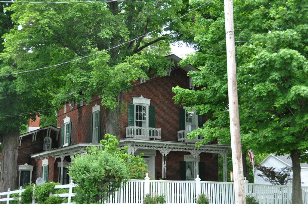
Gerald Mack House
Monument and historic site · National Register of Historic Places · 0.4 mi
Historic house in New York, United States

Harriet Campbell-Taylor House
Monument and historic site · National Register of Historic Places · 0.5 mi
Westfield, New York, NRHP-listed

Henry Dwight Thompson House
Monument and historic site · National Register of Historic Places · 0.4 mi
Historic house in New York, United States

L. Bliss House
Monument and historic site · National Register of Historic Places · 0.4 mi
Historic house in New York, United States


Lake Shore & Michigan Southern Freight Depot
Monument and historic site · National Register of Historic Places · 0.6 mi
Railway station in Westfield, the United States of America
12 more on the map.
Parks, trails and playgrounds11

Wells St Pool & Field
Park
Has a neighborhood pool, parking area, a flagpole statue dedication, playground and trampoline for kids, large field to play in while...
24/7

Welch Field Park
Park · 0.4 mi
Has a Pool, skatepark, field house, recreation room, street hockey, playground, walking trail, baseball fields, basketball courts.


Restaurants and cafes26


Buttercream babe
Bakery
33 East Main Street, Westfield
Th-Fr 11:00-18:00; Sa 10:00-16:00; Su 10:00-14:00


When Pigs Fly
Restaurant · American, Barbecue, Burger, Grill, Regional · 1.8 mi
8254 First Street, Westfield
Brazill's On Main
Restaurant
7 East Main Street, Westfield
Tu-Th 16:00-20:00; Fr 17:00-20:00; Sa 11:30-14:30,17:00-20:00


Tap Room
Bar and pub
43 East Main Street, Westfield
Mo-Fr 15:00-26:00; Sa-Su 13:00-26:00
Calarco's Italian Restaurant
Restaurant
15 Market Street, Westfield
Mo,We,Th 11:30-20:30; Fr 11:30-21:00; Sa 15:00-21:00; Su 16:00-20:00
14 more on the map.
History
The community was settled in 1802 and was formerly known as "Crossroads". The village of Westfield was incorporated in 1833. The discovery of a pasteurization method for grape juice made by the Welch family promoted the production of grapes for this purpose in this region.
It was here in 1861 that Abraham Lincoln met a little girl named Grace Bedell, who, during the preceding year's presidential campaign, urged Lincoln by letter to grow his beard out fully as an attempt to improve his chances at being elected. Lincoln responded by brief letter thanking Grace for the suggestion. He made no promises but shortly afterwards allowed his beard to grow, and by the time he began his inaugural journey by train from Illinois to Washington, D.C., he had a full beard. The trip took him through New York State, and included a stop in Westfield, where thousands gathered to meet the President-Elect. Lincoln asked by name to meet Grace Bedell.
The February 19, 1861, edition of the New York World recounted the meeting as follows:
From the History section of Westfield (village), New York on Wikipedia, under CC BY-SA 4.0.
Where to stay7
Thruway Holiday Motel
Motel and hotel · 1.1 mi
223 North Portage Street, Westfield
Churches and places of worship11
First Presbyterian Church
Church · Presbyterian
49 South Portage Street, Westfield
Shopping9
Gas and EV charging2
Schools, colleges and libraries8
Healthcare1
Map of Westfield
101 places. The map loads OpenStreetMap tiles when you open it.
Climate by month
Monthly table
| Month | High | Low | Rain |
|---|---|---|---|
| Jan | 34°F | 21°F | 2.6 in |
| Feb | 36°F | 21°F | 2.4 in |
| Mar | 44°F | 28°F | 2.9 in |
| Apr | 57°F | 38°F | 3.5 in |
| May | 69°F | 50°F | 3.8 in |
| Jun | 78°F | 60°F | 3.6 in |
| Jul | 83°F | 64°F | 4.4 in |
| Aug | 80°F | 62°F | 3.8 in |
| Sep | 73°F | 57°F | 4.6 in |
| Oct | 61°F | 47°F | 4.9 in |
| Nov | 49°F | 36°F | 3.8 in |
| Dec | 39°F | 28°F | 3.2 in |
U.S. Climate Normals 1991-2020 for Westfield 2 Sse (2 mi away), NOAA NCEI.
People and cost of living
American Community Survey 5-year estimates, 2020-2024, U.S. Census Bureau. Estimates have margins of error, larger for small towns.
Disaster history
Chautauqua County has had 18 federal disaster declarations since 2000, most often for severe storms.
- 2022-11-20: Severe Winter Storm And Snowstorm (Winter Storm)
- 2020-03-20: Covid-19 Pandemic (Biological)
- 2020-03-13: Covid-19 (Biological)
- 2019-12-19: Severe Storms, Straight-Line Winds, And Flooding (Severe Storm)
- 2014-12-22: Severe Winter Storm, Snowstorm, And Flooding (Snowstorm)
- 2014-07-08: Severe Storms And Flooding (Severe Storm)
OpenFEMA disaster declarations summaries.
Getting there and nearby towns
Chautauqua County-Dunkirk Airport (DKK) is the nearest airport with scheduled flights listed in OpenStreetMap, 19 miles away.
- Mayville 6 mi southeast, about 10 min by car
- Brocton 8 mi northeast, about 13 min by car
- Fredonia 15 mi northeast, about 24 min by car
- Dunkirk 17 mi northeast, about 27 min by car
- Lakewood 20 mi southeast, about 32 min by car
- Celoron 21 mi southeast, about 34 min by car
- Jamestown West 22 mi southeast, about 35 min by car
- Jamestown 23 mi southeast, about 37 min by car
- Falconer 24 mi southeast, about 38 min by car
- Erie 29 mi southwest, about 47 min by car
Drive times are estimates from straight-line distance, not routes.
Local news
Headlines from INDB, the NEMICO news database.
Reviews, tips and questions
Loading what members have shared...
Sources and licences
- NCES EDGE (Public domain): public schools
- NOAA NCEI U.S. Climate Normals 1991-2020 (Public domain): climate by month
- OpenFEMA (Public domain): disaster declarations
- OpenStreetMap contributors (ODbL 1.0): places, airports, map data
- U.S. Census Bureau (Public domain): population, income, housing, education, commute
- Wikidata (CC0 1.0): elevation, founding date, time zone, website, landmarks and historic places
- Wikimedia Commons (see each image): photos
- Wikipedia (CC BY-SA 4.0): overview and history text
Photo credits
- Westfield, New York (1921), Internet Archive Book Images, No restrictions
- Christian Education Building, First Presbyterian Church, Westfield, New York - 20230107, Andre Carrotflower, CC BY-SA 4.0
- First United Methodist Church, Westfield, New York - 20210604, Andre Carrotflower, CC BY-SA 4.0
- First Presbyterian Church, Westfield, New York - 20210131, Andre Carrotflower, CC BY-SA 4.0
- Downtown Westfield, New York at blue hour - 20210131, Andre Carrotflower, CC BY-SA 4.0
- Cliff's edge in Westfield, Nyttend, Public domain
- Westfield NY station, Cards84664, CC BY-SA 4.0
- Westfield NY station (4), Cards84664, CC BY-SA 4.0
- Westfield NY station (3), Cards84664, CC BY-SA 4.0
- Westfield NY station (2), Cards84664, CC BY-SA 4.0
- Welcome to Westfield, New York - panoramio, Idawriter, CC BY-SA 3.0
- Westfield & Barcelona Tourism Center (53861091815), Chris Rycroft from Madison, Wisconsin, United States, CC BY 2.0
- Westfield & Barcelona Tourism Center (53861041109), Chris Rycroft from Madison, Wisconsin, United States, CC BY 2.0
- Westfield vineyards in October, Nyttend, Public domain
- Barcelona Harbor House and Westfield Fisheries in Barcelona, New York - panoramio, Idawriter, CC BY-SA 3.0
- Barcelona Lighthouse and Keepers Cottage Barcelona Light, also known as Portland Harbor Light, is a lighthouse overlooking Barcelona Harbor on Lake Erie in the Town of Westfield, New York, Leon J Stein, CC BY-SA 4.0
- WestfieldNY Cemetery, User:Magicpiano, CC BY-SA 4.0
- WestfieldNY FayUsborneMill, User:Magicpiano, CC BY-SA 4.0
- Harriet Campbell-Taylor House Westfield NY Jul 12, Pubdog, Public domain
- Atwater-Stone House Jul 12, Pubdog, Public domain
- WestfieldNY FrenchPortageRoadHD, User:Magicpiano, CC BY-SA 4.0
- York-Skinner House Westfield NY Jul 12, Pubdog, Public domain
- Nixon Homestead Westfield NY Jul 12, Pubdog, Public domain
- Ward House Westfield NY Jul 12, Pubdog, Public domain
- WestfieldNY 79NorthPortage, User:Magicpiano, CC BY-SA 4.0
- WestfieldNY FrankAHallHouse, User:Magicpiano, CC BY-SA 4.0
- WestfieldNY OldWelchFactory 02, User:Magicpiano, CC BY-SA 4.0
- WestfieldNY FreightDepot, User:Magicpiano, CC BY-SA 4.0
- Henry Dwight Thompson House Westfield NY Jul 12, Pubdog, Public domain
- WestfieldNY Depot, User:Magicpiano, CC BY-SA 4.0
- L. Bliss House, Nyttend, Public domain
- Reuben Gridley Wright Farmhouse, Nyttend, Public domain
- Reuben Wright House, Nyttend, Public domain
- McMahan Homestead farmhouse, Nyttend, Public domain
- Great Lakes Seaway Trail National Scenic Byway - Oct 2022, SlapTheWorld, CC0
- Great Lakes Seaway Trail National Scenic Byway - Oct 2022 - 52922841914, SlapTheWorld, CC0
- Barcelona Lighthouse (53860924088), Chris Rycroft from Madison, Wisconsin, United States, CC BY 2.0
- Great Lakes Seaway Trail National Scenic Byway - Oct 2022 - 52923139003, SlapTheWorld, CC0
- Barcelona Lighthouse (53861091510), Chris Rycroft from Madison, Wisconsin, United States, CC BY 2.0
- Barcelona Harbor Pier and Daniel Reed Memorial Pier (53859779677), Chris Rycroft from Madison, Wisconsin, United States, CC BY 2.0


Page built October 30, 2026. Spotted a mistake? Tell us or suggest a place.