


Why visit Westwood
Townapedia lists 67 museums and landmarks, 24 parks and trails, 133 places to eat, 13 places to stay and 11 attractions in and around town.
Highlights include Vox Theatre, 12th Street Bridge, H.W. Gates Funeral Home and Hanover Heights Neighborhood Historic District.
July is the warmest month, with average highs of 90°F; January lows average 22°F.
Weather in Westwood
Forecast from the National Weather Service. Full forecast
About Westwood
Westwood is a city in northeastern Johnson County, Kansas, United States. As of the 2020 census, the population of the city was 1,750. It is the second most densely populated city in the Kansas City Metropolitan Area.
From the Wikipedia article Westwood, Kansas (this version), under CC BY-SA 4.0.
Things to do11

Vox Theatre
Cinema and theater · 1.5 mi
Theater in Rosedale, Kansas City, Kansas

12th Street Bridge
Bridge · 2.7 mi
Bridge in United States of America
18th Street Expressway Bridge
Bridge · 3.2 mi
Bridge in United States of America
7th Street Trafficway Bridge
Bridge · 2.5 mi
Bridge in United States of America
Highline Bridge
Bridge · 3.1 mi
Double-deck railroad bridge in Kansas City

Rockhurst University
School · 2.4 mi
Private university in Kansas City, Missouri, United States

Unicorn Theatre
Cinema and theater · 2.0 mi
Theater and theater company in Kansas City, Missouri, United States
University of Missouri–Kansas City
School · 2.2 mi
American public university
Museums and landmarks67

H.W. Gates Funeral Home
Monument and historic site · National Register of Historic Places · 1.1 mi
Historical landmark in Kansas City, Kansas, United States
1901 Olathe Boulevard, Kansas City

Hanover Heights Neighborhood Historic District
Monument and historic site · National Register of Historic Places · 0.9 mi
Human settlement in Kansas City, Kansas, United States of America
Judge Louis Gates House
Monument and historic site · National Register of Historic Places · 0.9 mi
House in Kansas City, Kansas
4146 Cambridge Street, Kansas City
Bernard Corrigan House
Monument and historic site · National Register of Historic Places · 1.0 mi
Historic house in Missouri, United States
Bertrand Rockwell House
Monument and historic site · National Register of Historic Places · 1.0 mi
Kansas City, Missouri, listed on the NRHP in Jackson County
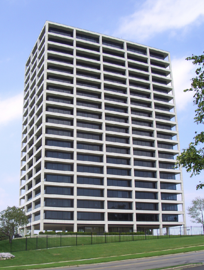
BMA Tower
Monument and historic site · National Register of Historic Places · 2.7 mi
Commercial building in Kansas City, United States of America
Charles S. Keith House
Monument and historic site · National Register of Historic Places · 0.8 mi
Historic house in Missouri, United States
Emily Rockwell Love House
Monument and historic site · National Register of Historic Places · 1.0 mi
Historic house in Missouri, United States

F. W. Woolworth Building
Monument and historic site · National Register of Historic Places · 3.2 mi
Troost Avenue, Kansas City
Floyd Jacobs House
Monument and historic site · National Register of Historic Places · 1.0 mi
Historic house in Missouri, United States


Horn–Vincent–Russell Estate
Monument and historic site · National Register of Historic Places · 2.1 mi
Historic mansion in Mission Hills, Kansas
House at 5011 Sunset Drive
Monument and historic site · National Register of Historic Places · 1.7 mi
Historic house in Missouri, United States
55 more on the map.
Parks, trails and playgrounds24


Loose Memorial Park
Park · 1.2 mi
Public park in Kansas City, Missouri
Penn Valley Park
Park · 3.0 mi
Urban park in Kansas City, Missouri, US

12 more on the map.
Restaurants and cafes133

Aloha Chop Stix
Restaurant · Chinese · 0.7 mi
4316 Rainbow Boulevard
Tu-Th 11:00-21:15; Fr-Sa 11:00-22:00; Su 11:00-21:20

Bruú Café
Cafe · Bubble Tea · 1.4 mi
4709 Central Street, Kansas City
Mo-Sa 10:00-20:00; Su 11:00-18:00
Cafe Corazon
Cafe · Coffee Shop · 0.9 mi
1721 Westport Road, Kansas City
Mo-Fr 07:00-18:00; Sa-Su 08:00-18:00
Chixen Kansas City
Restaurant · Chicken, Burger · 1.5 mi
1407 Southwest Boulevard, Kansas City
Fr-Sa 11:00-22:00; Tu-Th 11:00-21:00
Cupini's
Restaurant · Italian · 0.9 mi
1809 Westport Road, Kansas City
Mo-Th 11:00-20:00; Fr-Sa 11:00-21:00
Fairway Creamery
Cafe · Bagel, Breakfast, Cake, Coffee Shop, Donut, Ice Cream · 1.5 mi
5938 Mission Road
Tu-Su 07:00-21:00

Fifth & Emery
Ice cream · Frozen Yogurt · 1.5 mi
4853 Main Street
Su-Th 11:00-21:00; Fr-Sa 11:00-22:00
Friends Sushi & Bento Place
Restaurant · Sushi, Bento, Ramen · 1.3 mi
1808 West 39th Street, Kansas City
Mo-Th 11:00-14:30,17:00-20:45; Fr 11:00-14:30,17:00-21:30; Sa...
Gus's World Famous Fried Chicken
Restaurant · Fried Chicken · 0.4 mi
2816 West 47th Avenue, Kansas City
Su-Th 11:00-21:00; Fr-Sa 11:00-22:00
Hokibar
Restaurant · Barbecue, Sushi, Japanese, Hawaiian, Ramen · 1.5 mi
100 Ward Parkway, Kansas City
Mo-Sa 11:00-21:30; Su 12:00-21:00
IHOP
Restaurant · Breakfast, Pancake · 1.2 mi
3928 Rainbow Boulevard, Kansas City
Mo-Th,Su 06:00-22:00; Fr 06:00-24:00; Sa 00:00-24:00
Joe's Kansas City Bar-B-Que
Restaurant · Barbecue · 0.4 mi
3002 West 47th Avenue, Kansas City
Mo-Th 11:00-21:00; Fr-Sa 11:00-22:00
121 more on the map.
History
The land where Westwood is located was originally occupied by the Kansa and Pawnee Indians. However, beginning in the 1830s, Captain Joseph Parks, then Head Chief of the Shawnee, worked with the U.S. Government to remove the Shawnee tribes from Ohio to the newly opened reservations in northeastern Kansas. In exchange for his services, the government awarded Parks 1,290 acres of land straddling what is now Johnson and Wyandotte counties as part of an 1854 treaty with the Shawnee. In 1859, Parks died without leaving a will stating what should happen to the land. His heirs spent the next 60 years disputing how the land should be divided. The land that would eventually become Westwood was ultimately awarded to Parks' granddaughter and her husband, Catherine and John Swatzell. In 1898, the Swatzells built a stone home. That home is still located at 4958 Rainbow and is considered the beginnings of the community that would eventually become Westwood.
From the History section of Westwood, Kansas on Wikipedia, under CC BY-SA 4.0.
Where to stay13
Courtyard Kansas City Country Club Plaza
Motel and hotel · 1.5 mi
4600 Mill Creek Parkway, Kansas City
Hampton Inn & Suites Kansas City Country Club Plaza
Motel and hotel · 1.1 mi
4600 Summit Street, Kansas City
Residence Inn Kansas City Country Club Plaza
Motel and hotel · 1.3 mi
4601 Broadway Street, Kansas City
Hotel Westport Kansas City, Tapestry Collection by Hilton
Motel and hotel · 1.3 mi
801 Westport Road, Kansas City
Churches and places of worship26
Saint James Missionary Baptist Church
Church · Baptist · 1.4 mi
508 West 43rd Street, Kansas City
St. Gerebed Armenian Church of Kansas City
Church · Armenian Apostolic · 0.8 mi
4400 Wyoming Street, Kansas City
Shopping25
Gas and EV charging5
Schools, colleges and libraries68
Healthcare5
Map of Westwood
250 places. The map loads OpenStreetMap tiles when you open it.
Climate by month
Monthly table
| Month | High | Low | Rain | Snow |
|---|---|---|---|---|
| Jan | 40°F | 22°F | 1.0 in | 3.4 in |
| Feb | 45°F | 26°F | 1.5 in | 3.2 in |
| Mar | 57°F | 36°F | 2.1 in | 0.4 in |
| Apr | 67°F | 46°F | 3.9 in | 0.1 in |
| May | 76°F | 57°F | 5.1 in | 0.0 in |
| Jun | 86°F | 67°F | 5.3 in | 0.0 in |
| Jul | 90°F | 72°F | 4.4 in | 0.0 in |
| Aug | 89°F | 70°F | 4.7 in | 0.0 in |
| Sep | 80°F | 61°F | 3.8 in | 0.0 in |
| Oct | 68°F | 49°F | 3.2 in | 0.3 in |
| Nov | 54°F | 36°F | 1.8 in | 0.1 in |
| Dec | 44°F | 27°F | 1.3 in | 3.5 in |
U.S. Climate Normals 1991-2020 for Kansas City Downtown Ap (6 mi away), NOAA NCEI.
People and cost of living
American Community Survey 5-year estimates, 2020-2024, U.S. Census Bureau. Estimates have margins of error, larger for small towns.
Disaster history
Johnson County has had 7 federal disaster declarations since 2000, most often for severe storms.
- 2023-10-26: Severe Storms, Straight-Line Winds, Tornadoes, And Flooding (Severe Storm)
- 2020-03-29: Covid-19 Pandemic (Biological)
- 2020-03-13: Covid-19 (Biological)
- 2017-11-07: Severe Storms, Straight-Line Winds, And Flooding (Severe Storm)
- 2007-12-12: Severe Winter Storms (Severe Storm)
- 2005-09-10: Hurricane Katrina Evacuation (Hurricane)
OpenFEMA disaster declarations summaries.
Getting there and nearby towns
Charles B. Wheeler Downtown Airport (MKC) is the nearest airport with scheduled flights listed in OpenStreetMap, 6 miles away.
- Roeland Park 1 mi west, about 2 min by car
- Fairway 1 mi southwest, about 2 min by car
- Mission Hills 2 mi south, about 3 min by car
- Mission 2 mi west, about 4 min by car
- Prairie Village 4 mi south, about 6 min by car
- Merriam 4 mi west, about 7 min by car
- Kansas City 7 mi northeast, about 11 min by car
- Kansas City 9 mi northwest, about 14 min by car
- Raytown 9 mi east, about 14 min by car
- Leawood 9 mi south, about 15 min by car
Drive times are estimates from straight-line distance, not routes.
Local news
Headlines from INDB, the NEMICO news database.
Reviews, tips and questions
Loading what members have shared...
Sources and licences
- NCES EDGE (Public domain): public schools
- NOAA NCEI U.S. Climate Normals 1991-2020 (Public domain): climate by month
- OpenFEMA (Public domain): disaster declarations
- OpenStreetMap contributors (ODbL 1.0): places, airports, map data
- U.S. Census Bureau (Public domain): population, income, housing, education, commute
- Wikidata (CC0 1.0): elevation, founding date, time zone, website, landmarks and historic places
- Wikimedia Commons (see each image): photos
- Wikipedia (CC BY-SA 4.0): overview and history text
Photo credits
- Westwood-ks-cityhall, Americasroof at en.wikipedia, CC BY-SA 3.0
- Missouri - H.W. Gates Funeral Home - 20211030145225, CruznOz, CC BY-SA 4.0
- Knickerbocker Apartments, Mwkruse, CC BY-SA 3.0
- Wolcott House, Safire1k, CC BY-SA 3.0
- Villa Serena Apartment Hotel, Mwkruse, CC BY-SA 3.0
- Union Cemetery, Kansas City, Missouri with vault, potter's field, and skyline, Smuckola, CC BY-SA 4.0
- BMA Building Kansas City MO, User:Charvex, Public domain
- Memorial arch - panoramio, Stephen Edmonds, CC BY-SA 3.0
- Shawnee Street Overpass, Safire1k, CC BY-SA 3.0
- JohnWornallHouse, User:Iknowthegoods, CC BY-SA 3.0
- Newbern Hotel KCMO, Bartokie, CC BY-SA 4.0
- Laugh-o-gram 2010, Iknowthegoods ( talk ) 07:05, 1 December 2010 (UTC), CC BY-SA 3.0
- House at 54 E. 53rd Terrace, Mwkruse, CC BY-SA 3.0
- Horn-Vincent-Russell Estate, Safire1k, CC BY-SA 3.0
- Seth-ward-house, Americasroof at en.wikipedia, CC BY-SA 3.0
- F. W. Woolworth Building, Troost Ave., Kansas City, Missouri, Mwkruse, CC BY-SA 3.0


Page built October 30, 2026. Spotted a mistake? Tell us or suggest a place.