


Why visit Wethersfield
Townapedia lists 95 museums and landmarks, 86 parks and trails, 135 places to eat, 23 places to stay and 6 attractions in and around town.
Highlights include Cedar Mountain, Hang-Dog Hill, The Village South and Cedar Hill Cemetery.
July is the warmest month, with average highs of 85°F; January lows average 20°F.
Weather in Wethersfield
Forecast from the National Weather Service. Full forecast
Things to do6

Museums and landmarks95


Cedar Hill Cemetery
Monument and historic site · National Register of Historic Places · 2.1 mi
Cemetery in Hartford, Connecticut

Curtisville Historic District
Monument and historic site · National Register of Historic Places · 2.9 mi
Predominantly residential area along Naubuc Avenue and Pratt Streets in northwestern Glastonbury, Connecticut

Elm Street Historic District
Monument and historic site · National Register of Historic Places · 2.9 mi
District in Rocky Hill, Connecticut

Engine Company 15 Fire Station
Monument and historic site · National Register of Historic Places · 3.0 mi
Fire station in Connecticut, United States of America
8 Fairfield Avenue, Hartford

Engine Company 9 Fire Station
Monument and historic site · National Register of Historic Places · 2.8 mi
Fire station in Connecticut, United States of America
655 New Britain Avenue, Hartford

Fairfield Avenue Historic District
Monument and historic site · National Register of Historic Places · 2.5 mi
Historic district in Hartford, Connecticut, United States

Naubuc Avenue-Broad Street Historic District
Monument and historic site · National Register of Historic Places · 2.9 mi
Historic district in East Hartford, Connecticut
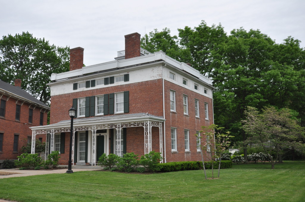
Selden Brewer House
Monument and historic site · National Register of Historic Places · 3.1 mi
Historic house in Connecticut, United States
165 Main Street, East Hartford
Academy Hall
Monument and historic site · National Register of Historic Places · 3.0 mi
Historic building in Rocky Hill, Connecticut, USA
Aetna Diner
Monument and historic site · National Register of Historic Places · 4.7 mi
Historic diner in Hartford, Connecticut


Allen Place–Lincoln Street Historic District
Monument and historic site · National Register of Historic Places · 3.6 mi
Small neighborhood of late 19th-century housing built for white-collar service workers in southern Hartford, Connecticut
83 more on the map.
Parks, trails and playgrounds86

Goodwin Park Golf Course
Golf course · 1.9 mi
Two separate courses, one 18-hole and one 9-hole.
1130 Maple Avenue, Hartford


Wintergreen Woods
Hiking and trails · 0.6 mi
Municipal, Open To Public Without Fee; Existing Preserved Open Space
74 more on the map.
Restaurants and cafes135

The Cove Deli
Restaurant · Deli · 1.2 mi
Small deli with excellent sandwiches
282 Silas Deane Highway, Wethersfield
Mo-Fr 07:00-15:00; Sa 08:00-15:00; Su 10:00-15:00
DORO Marketplace
Restaurant · Brunch · 1.4 mi
1301 Silas Deane Highway, Wethersfield
Mo-Su 07:00-20:00

Kiwi Spoon
Ice cream · Frozen Yogurt · 3.1 mi
397 Cromwell Avenue, Rocky Hill
Mo-Th 13:00-21:30; Fr 13:00-22:00; Sa 12:00-22:00; Su 12:00-21:30
LongHorn Steakhouse
Restaurant · Steak House · 1.8 mi
1489 Silas Deane Highway, Rocky Hill
Mo-Th,Su 11:00-22:00; Fr-Sa 11:00-23:00
Lucky Lou's
Restaurant · 1.1 mi
Modern American flare, in a historic setting.
222 Main Street, Wethersfield
Tu-Su 12:00-21:00
Max Fish
Restaurant · Seafood · 2.9 mi
110 Glastonbury Boulevard, Glastonbury
Mo-Th 11:30-21:00; Fr-Sa 11:30-22:00; Su 11:00-21:00
Newington Pizza & Restaurant
Restaurant · Pizza · 2.7 mi
75 Market Square, Newington
Mo-Th 11:00-21:30; Fr,Sa 11:00-22:00; Su 12:00-21:00
Ninja Japan
Restaurant · Asian · 2.9 mi
396 Cromwell Avenue, Rocky Hill
Jan-Dec: Mo-Sa 11:30-10:00, Su 12:00-10:00
No Mames Mexican Cantina
Restaurant · Mexican · 1.1 mi
1140 Silas Deane Highway, Wethersfield
Mo-Th 11:30-22:00; Fr-Sa 11:30-23:00; Su 11:30-21:00
Sally's Apizza
Restaurant · Pizza · 1.2 mi
1178 Silas Deane Highway, Wethersfield
Su-Th 11:30-22:00; Fr-Sa 11:30-23:00
123 more on the map.
Where to stay23
Hilton Garden Inn Hartford South/Glastonbury
Motel and hotel · 3.0 mi
85 Glastonbury Boulevard, Glastonbury
Americas Best Value Inn
Motel and hotel · 1.6 mi
1730 Berlin Turnpike, Wethersfield
Churches and places of worship34
Rocky Hill Congregational Church
Church · United Church Of Christ · National Register of Historic Places · 3.0 mi
805 Old Main Street, Rocky Hill
Northam Memorial Chapel
Church · 2.0 mi
453 Fairfield Avenue, Hartford
Church of Christ Congregational
Church · United Church Of Christ · 2.8 mi
1075 Main Street, Newington
First Church of Christ Congregational
Church · United Church Of Christ · 3.2 mi
2183 Main Street, Glastonbury
Greater Hartford Korean United Methodist Church
Church · United Methodist · 2.8 mi
711 New Britain Avenue, Hartford
Shopping27
Gas and EV charging34
Schools, colleges and libraries70
Healthcare12
Map of Wethersfield
250 places. The map loads OpenStreetMap tiles when you open it.
Climate by month
Monthly table
| Month | High | Low | Rain |
|---|---|---|---|
| Jan | 37°F | 20°F | 2.9 in |
| Feb | 40°F | 22°F | 2.6 in |
| Mar | 48°F | 30°F | 3.5 in |
| Apr | 60°F | 40°F | 3.8 in |
| May | 71°F | 50°F | 3.4 in |
| Jun | 80°F | 60°F | 3.9 in |
| Jul | 85°F | 66°F | 3.9 in |
| Aug | 83°F | 64°F | 3.5 in |
| Sep | 76°F | 56°F | 4.0 in |
| Oct | 64°F | 44°F | 4.2 in |
| Nov | 52°F | 35°F | 3.4 in |
| Dec | 42°F | 26°F | 3.8 in |
U.S. Climate Normals 1991-2020 for Hartford Brainard Fld (3 mi away), NOAA NCEI.
People and cost of living
American Community Survey 5-year estimates, 2020-2024, U.S. Census Bureau. Estimates have margins of error, larger for small towns.
Disaster history
The county has had 21 federal disaster declarations since 2000, most often for hurricanes.
- 2024-10-24: Hawthorne Fire (Fire)
- 2021-08-22: Hurricane Henri (Hurricane)
- 2021-01-12: Tropical Storm Isaias (Hurricane)
- 2020-08-06: Tropical Storm Isaias (Hurricane)
- 2020-03-28: Covid-19 Pandemic (Biological)
- 2020-03-13: Covid-19 (Biological)
OpenFEMA disaster declarations summaries.
Getting there and nearby towns
Hartford–Brainard Airport (HFD) is the nearest airport with scheduled flights listed in OpenStreetMap, 2 miles away.
- Newington 3 mi west, about 5 min by car
- Glastonbury Center 4 mi east, about 6 min by car
- Hartford 4 mi north, about 7 min by car
- East Hartford 5 mi northeast, about 8 min by car
- New Britain 6 mi west, about 10 min by car
- West Hartford 6 mi northwest, about 10 min by car
- Kensington 7 mi southwest, about 12 min by car
- Blue Hills 8 mi north, about 13 min by car
- Manchester 9 mi northeast, about 15 min by car
- Portland 9 mi south, about 15 min by car
Drive times are estimates from straight-line distance, not routes.
Local news
Headlines from INDB, the NEMICO news database.
Reviews, tips and questions
Loading what members have shared...
Sources and licences
- NCES EDGE (Public domain): public schools
- NOAA NCEI U.S. Climate Normals 1991-2020 (Public domain): climate by month
- OpenFEMA (Public domain): disaster declarations
- OpenStreetMap contributors (ODbL 1.0): places, airports, map data
- U.S. Census Bureau (Public domain): population, income, housing, education, commute
- Wikidata (CC0 1.0): landmarks and historic places
- Wikimedia Commons (see each image): photos
Photo credits
- Wethersfield High School, Wethersfield CT, John Phelan, CC BY 4.0
- CT Route 175 West, Wethersfield CT, John Phelan, CC BY 4.0
- CT Route 287, Wethersfield CT, John Phelan, CC BY 4.0
- CT Route 99 North, Wethersfield CT, John Phelan, CC BY 4.0
- 20241220 ring billed gull wethersfield cove PD208574, Paul Danese, CC BY-SA 4.0
- Rocky Hill Congregational Church Rocky Hill CT, – Grondemar, CC BY-SA 3.0
- Elm Street, Rocky Hill CT, John Phelan, CC BY 4.0
- Yung Wing Grave 2012 FRD 4735, Fred Hsu ( Wikipedia:User:Fred Hsu on en.wikipedia ), CC BY-SA 3.0
- Engine Co 9 Fire Station Hartford CT, – Grondemar, CC BY-SA 3.0
- HartfordCT FairfieldAvenueHD 2, Magicpiano, CC BY-SA 4.0
- EastHartfordCT NaubucBroadHD 2, Magicpiano, CC BY-SA 4.0
- GlastonburyCT CurtisvilleHD GrangeHall, Jerry Dougherty, CC BY 2.5
- Engine Co 15 Fire Station Hartford CT, – Grondemar, CC BY-SA 3.0
- EastHartfordCT SeldenBrewerHouse, Magicpiano, CC BY-SA 4.0
- Kimberly Mansion, Glastonbury (Hartford County, Connecticut), NPS photographer (perhaps Robert C. Post, the Federal employee who authored the NRHP nomination form at http://pdfhost.focus.nps.gov/docs/NHLS/Text/74002178.pdf , which was accompanied by this photo..., Public domain
- Joseph Webb and Isaac Stevens Houses - Wethersfield, CT - 2, Daderot, Public domain
- 140-144 Retreat Avenue, Hartford, CT, Alden Street, CC BY-SA 4.0
- Noah Webster House (West Hartford, CT) - front facade, Daderot, Public domain
- HartfordCT JohnAndIsabellaHookerHouse, Magicpiano, CC BY-SA 4.0
- The Progress, Seymour Street, Hartford CT, John Phelan, CC BY-SA 3.0
- JohnHollisterHouseGlastonburyCT, Unknown author Unknown author, Public domain
- Perkins-Clark House in Hartford, Connecticut 2, 2009-09-02, Sage Ross, CC BY-SA 3.0
- HartfordCT ImlayAndLaurelStreetsHD 3, Magicpiano, CC BY-SA 4.0
- HartfordCT LittleHollywoodHD 2, Magicpiano, CC BY-SA 4.0
- Elisha Seymour, Jr. House in West Hartford, August 22, 2008, Ragesoss, CC BY-SA 3.0
- House of Mark Twain, Makemake at German Wikipedia, CC BY-SA 3.0
- CaptNathanielHaydenHouseWindsorCT, Chrissypan, Public domain
- Timothy Goodman House in West Hartford, August 22, 2008, Ragesoss, CC BY-SA 3.0
- HartfordCT AllenLincolnHD 4, Magicpiano, CC BY-SA 4.0
- IMG 4136 Rocky Hill - Glastonbury Ferry, Denimadept, CC BY-SA 3.0
- Northam Chapel and Gallup Gateway Cedar Hill Cemetery Hartford CT c.1906 (cropped), Unknown photographer, Public domain
- HartfordCT FormerUnderwoodCompanyFactory, Magicpiano, CC BY-SA 4.0
- 130 Washington Street, Hartford CT, John Phelan, CC BY-SA 3.0
- USPS Ram Truck, Mike Mozart, CC BY 2.0
- Office Max (28687508352), Mike Mozart from Funny YouTube, USA, CC BY 2.0
- Frontier Communications Cable Truck (28175038654), Mike Mozart, CC BY 2.0
- Please close lights, Khu'hamgaba Kitap, CC BY-SA 4.0
- 20250105 iceland gull beaver brook open space PD200402 1, Paul Danese, CC BY-SA 4.0
- 20241220 ring billed gull beaver brook open space PD208603, Paul Danese, CC BY-SA 4.0
- 20250105 iceland gull beaver brook open space PD200339 1, Paul Danese, CC BY-SA 4.0


Page built October 30, 2026. Spotted a mistake? Tell us or suggest a place.