



Why visit Wildwood
Townapedia lists 44 museums and landmarks, 83 parks and trails, 94 places to eat, 15 places to stay and 14 attractions in and around town.
Highlights include Daniel Boone Bridge, Hidden Valley Ski Area, Big Chief Restaurant and Burkhardt Historic District.
July is the warmest month, with average highs of 90°F; January lows average 22°F.
Weather in Wildwood
Forecast from the National Weather Service. Full forecast
About Wildwood
Wildwood is a city in St. Louis County, Missouri, United States. It is located in the far western portion of the county. It was incorporated on September 1st, 1995.As of the 2020 census, the population was 35,417. Wildwood is the home of the Al Foster Trail, and numerous other trails, parks, and reserves such as Rockwoods Reservation and Babler State Park.
From the Wikipedia article Wildwood, Missouri (this version), under CC BY-SA 4.0.
Things to do14

Daniel Boone Bridge
Bridge · 7.6 mi
Bridges across the Missouri River




2 more on the map.
Museums and landmarks44

Big Chief Restaurant
Monument and historic site · National Register of Historic Places · 0.5 mi
Eatery in Wildwood, Missouri

Burkhardt Historic District
Monument and historic site · National Register of Historic Places · 7.7 mi
Historic district in Missouri, United States

Gustav Grauer Farm
Monument and historic site · National Register of Historic Places · 4.0 mi
Building in Missouri, United States

Red Cedar Inn
Monument and historic site · National Register of Historic Places · 7.1 mi
Fomer restaurant, now a Visitor Center und museum
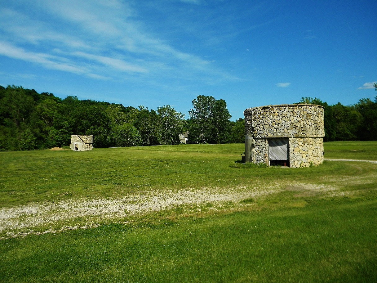
St. Albans Farms Stone Barn
Monument and historic site · National Register of Historic Places · 4.9 mi
Building in Missouri, United States

St. Albans General Store
Monument and historic site · National Register of Historic Places · 5.6 mi
Building in Missouri, United States
Wolf-Ruebeling House
Monument and historic site · National Register of Historic Places · 7.2 mi
Building in Missouri, United States
Kesselring-Werther House
Monument and historic site · 4.1 mi
A principal building from the earliest era of Orrville is the Kesselring-Werther House at 538 Eatherton Road. It dates from 1867. This...
538 Eatherton Road, Wildwood
Landings at Spirit Golf Club
Monument and historic site · 5.7 mi
180 North Eatherton Rd.
Mo-Su 07:00-20:00
Old Pond School
Monument and historic site · 1.1 mi
Old Pond School is a restored 1914 one-room schoolhouse on one acre of land.
17123 Manchester Road, Wildwood
Cobb Cavern
Monument and historic site · 0.5 mi
Room and pillar limestone mine from the former Cobb-Wright-Case mining company, now located in Rockwood Reservation. Interior of mine is...
32 more on the map.
Parks, trails and playgrounds83

Mid America Adventure
Sports field and stadium · 4.3 mi
Amusement park operated by Enchanted Parks
4900 Six Flags Road, Eureka


Howell Island Conservation Area
Hiking and trails · 6.1 mi
Protected area in St. Charles County, Missouri, United States
Su-Sa 04:00-22:00



71 more on the map.
Restaurants and cafes94

Dynasty Chinese Restaurant
Restaurant · Chinese · 5.9 mi
54 Clarkson Wilson Center, Chesterfield
Mo-We, Su 11:00-21:00; Th-Sa 11:00-22:00

J+B Wellness Cafe
Cafe · Smoothie, Juice, Tea, Coffee, Snack, Sandwich, Salad · 1.7 mi
16962 Manchester Road, Wildwood
Mo-Tu 09:00-15:00; We-Fr 08:00-15:00; Sa 08:00-16:00; Su 09:00-16:00
Sunny Side Street Cafe
Restaurant · Breakfast, Sandwich, Salad · 2.3 mi
2480 Taylor Road, Wildwood
07:00-14:30

Scarecrow
Restaurant · 6.4 mi
101 Chesterfield City Center
Mo-Th 09:00-24:00; Fr-Sa 11:00-01:00; Su 11:00-22:00

The Wolf Public House
Diner · American · 5.8 mi
15480 Clayton Road, Ballwin
Mo-Fr 06:00-22:00; Sa 07:00-22:00; Su 08:00-14:00
Vito's in the Valley
Restaurant · 6.5 mi
138 Chesterfield City Center
Su-Th 11:00-21:00; Fr-Sa 11:00-23:00
82 more on the map.
Where to stay15
Holiday Inn Saint Louis West at Six Flags
Motel and hotel · 4.8 mi
4901 Six Flags Road, Eureka
Dr. Edmund A. Babler Memorial State Park Special-use Camping Area
Campground · 2.5 mi
Churches and places of worship23
Saint Clare of Assisi Catholic Church
Church · Roman Catholic · 5.4 mi
15642 Clayton Road, Ellisville
Eureka United Methodist Church
Church · Methodist · 5.4 mi
215 North Central Avenue, Eureka
Ignite Church
Church · Nondenominational · 4.9 mi
1729 West 5th Street;West Fifth Street, Eureka
Saint Mark Presbyterian Church
Church · Presbyterian · 6.6 mi
601 Claymont Drive, Ballwin
St. Alban Roe Catholic Parish
Church · Catholic · 2.0 mi
2001 Shepard Road, Wildwood
The Church of Jesus Christ of Latter-day Saints
Church · Latter-Day Saints · 1.0 mi
17132 Manchester Road, Grover
Shopping23
Gas and EV charging16
Schools, colleges and libraries54
Healthcare9
Total Access Urgent Care
Clinic and pharmacy · 5.8 mi
15420 Manchester Road, Ellisville
Map of Wildwood
250 places. The map loads OpenStreetMap tiles when you open it.
Climate by month
Monthly table
| Month | High | Low | Rain |
|---|---|---|---|
| Jan | 41°F | 22°F | 2.4 in |
| Feb | 46°F | 26°F | 2.0 in |
| Mar | 57°F | 34°F | 3.5 in |
| Apr | 68°F | 44°F | 4.6 in |
| May | 77°F | 55°F | 4.6 in |
| Jun | 86°F | 64°F | 4.3 in |
| Jul | 90°F | 68°F | 3.3 in |
| Aug | 88°F | 66°F | 3.4 in |
| Sep | 81°F | 56°F | 3.0 in |
| Oct | 70°F | 45°F | 3.1 in |
| Nov | 56°F | 34°F | 3.3 in |
| Dec | 45°F | 26°F | 2.3 in |
U.S. Climate Normals 1991-2020 for St Louis Sprt Of S L Ap (6 mi away), NOAA NCEI.
People and cost of living
American Community Survey 5-year estimates, 2020-2024, U.S. Census Bureau. Estimates have margins of error, larger for small towns.
Disaster history
St. Louis County has had 23 federal disaster declarations since 2000, most often for severe storms.
- 2025-06-09: Severe Storms, Straight-Line Winds, Tornadoes, And Flooding (Severe Storm)
- 2025-05-21: Severe Storms, Straight-Line Winds, Tornadoes, And Wildfires (Severe Storm)
- 2022-08-08: Severe Storms And Flooding (Flood)
- 2020-03-26: Covid-19 Pandemic (Biological)
- 2020-03-13: Covid-19 (Biological)
- 2017-06-02: Severe Storms, Tornadoes, Straight-Line Winds And Flooding (Flood)
OpenFEMA disaster declarations summaries.
Getting there and nearby towns
Spirit of Saint Louis Airport (SUS) is the nearest airport with scheduled flights listed in OpenStreetMap, 6 miles away.
- Ellisville 4 mi east, about 7 min by car
- Eureka 6 mi south, about 9 min by car
- Ballwin 6 mi east, about 10 min by car
- Chesterfield 7 mi northeast, about 12 min by car
- Manchester 9 mi east, about 14 min by car
- Town and Country 11 mi east, about 18 min by car
- Dardenne Prairie 12 mi north, about 19 min by car
- Kirkwood 13 mi east, about 21 min by car
- Creve Coeur 13 mi northeast, about 22 min by car
- O'Fallon 14 mi north, about 23 min by car
Drive times are estimates from straight-line distance, not routes.
Local news
Headlines from INDB, the NEMICO news database.
Reviews, tips and questions
Loading what members have shared...
Sources and licences
- NCES EDGE (Public domain): public schools
- NOAA NCEI U.S. Climate Normals 1991-2020 (Public domain): climate by month
- OpenFEMA (Public domain): disaster declarations
- OpenStreetMap contributors (ODbL 1.0): places, airports, map data
- U.S. Census Bureau (Public domain): population, income, housing, education, commute
- Wikidata (CC0 1.0): elevation, founding date, time zone, website, landmarks and historic places
- Wikimedia Commons (see each image): photos
- Wikipedia (CC BY-SA 4.0): overview and history text
Photo credits
- St. Louis Community College, Wildwood, MoaiWiki, CC BY-SA 4.0
- Pond School Wildwood Mo, Allegrorondo, CC BY-SA 3.0
- Batman - The Ride - St. Louis, Chris Hagerman from New Port Richey, FL, US, CC BY 2.0
- St. Albans General Store NRHP 03000204 Franklin County, MO, Jon Roanhaus, CC BY-SA 3.0
- Saint Albans Farms Stone Barn NRHP 05001550 Franklin County, MO, Jon Roanhaus, CC BY-SA 3.0
- Big Chief Restaurant, Liezl Moss, CC BY-SA 3.0
- Red Cedar Inn Pacific MO-med, Original uploader was Kbh3rd ( talk ), Public domain
- Old Chesterfield, Missouri, Mark Ravenscraft, CC BY-SA 3.0
- Endangered Wolf Center, Fredlyfish4, CC BY-SA 3.0
- Daniel-boone-bridge, The original uploader was Americasroof at English Wikipedia ., CC BY-SA 2.5
- Rockwoods Reservation 20130928-13, Kbh3rd, CC BY 3.0
- Rockwoods Reservation Trail Among the Trees, Fredlyfish4, CC BY-SA 3.0
- Rockwoods Quarry, Fredlyfish4, CC BY-SA 3.0
- Rock pile in Rockwoods, Fredlyfish4, CC BY-SA 3.0
- Rockwoods quarry cave, Fredlyfish4, CC BY-SA 3.0
- Trail Among the Trees, Fredlyfish4, CC BY-SA 3.0
- Rockwoods Cave entrance, Fredlyfish4, CC BY-SA 3.0
- Rockwoods Reservation cliffs, Fredlyfish4, CC BY-SA 3.0
- Rockwoods Reservation 20130928-11, Kbh3rd, CC BY 3.0
- Rockwoods Cave, Fredlyfish4, CC BY-SA 3.0
- View of Rockwoods Reservation from Trail Among the Trees - panoramio, Fredlyfish4, CC BY-SA 4.0
- Rockwoods Reservation Overlook, Fredlyfish4, CC BY-SA 3.0
- Pyrausta niveicilialis 122011209, Chrissy McClarren and Andy Reago, CC0
- Rock Quarry Trail Rockwoods, Fredlyfish4, CC BY-SA 3.0
- Rocks along the Green Rock Trail - panoramio, Fredlyfish4, CC BY-SA 4.0
- Rockwoods Reservation 20130928-01, Kbh3rd, CC BY 3.0
- Valley along the Lime Kiln Trail - panoramio, Fredlyfish4, CC BY-SA 4.0
- Green Rock Trail, Fredlyfish4, CC BY-SA 3.0
- Lime Kiln in Rockwoods Reservation, Fredlyfish4, CC BY-SA 3.0
- Lime kiln - panoramio, Fredlyfish4, CC BY-SA 4.0
- Turkey Ridge Trail, Fredlyfish4, CC BY-SA 3.0
- Turkey Ridge Trail Rockwoods, Fredlyfish4, CC BY-SA 3.0
- Guard (49045442866), Christian Collins, CC BY-SA 2.0
- ISS062-E-70597 - View of Earth, Earth Science and Remote Sensing Unit, NASA Johnson Space Center, Public domain
- ISS064-E-9735 - View of Earth, Earth Science and Remote Sensing Unit, NASA Johnson Space Center, Public domain
- ISS059-E-39731 - View of Earth, Earth Science and Remote Sensing Unit, NASA Johnson Space Center, Public domain
- ISS062-E-70596 - View of Earth, Earth Science and Remote Sensing Unit, NASA Johnson Space Center, Public domain
- Greensfelder Overlook, Fredlyfish4, CC BY-SA 3.0
- Babler SP campground-20131102-001, Kbh3rd, CC BY 3.0
- Eagle Valley Trail 3, Fredlyfish4, CC BY-SA 3.0


Page built October 30, 2026. Spotted a mistake? Tell us or suggest a place.