

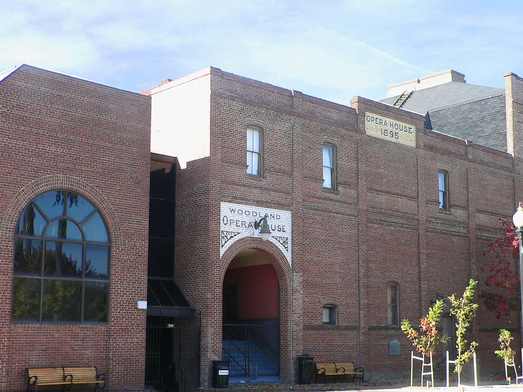


Woodland, California
Woodland is a city of 61,854 people in Yolo County, California, founded in 1871.
Why visit Woodland
Townapedia lists 13 museums and landmarks, 29 parks and trails, 76 places to eat, 12 places to stay and 3 attractions in and around town.
Highlights include Woodland Opera House, State Theatre, Woodland Public Library and Downtown Woodland Historic District.
July is the warmest month, with average highs of 95°F; December lows average 38°F.
Weather in Woodland
Forecast from the National Weather Service. Full forecast
About Woodland
Woodland is a city in and the county seat of Yolo County, California, United States. Located approximately 15 miles (24 km) northwest of Sacramento, it is a part of the Sacramento metropolitan area.
From the Wikipedia article Woodland, California (this version), under CC BY-SA 4.0.
Things to do3

Woodland Opera House
Cinema and theater · National Register of Historic Places · 1.2 mi
Theater and former movie theater in Woodland, California, United States
340 2nd Street, Woodland
Museums and landmarks13

Woodland Public Library
Monument and historic site · National Register of Historic Places · 1.4 mi
Public library in Woodland, California, USA

Downtown Woodland Historic District
Monument and historic site · National Register of Historic Places · 1.2 mi
Historic district in California, United States
Gibson Mansion
Monument and historic site · National Register of Historic Places · 1.4 mi
Single-family detached home in Woodland, California

Hotel Woodland
Monument and historic site · National Register of Historic Places · 1.4 mi
Hotel in Woodland, United States of America

I.O.O.F. Building
Monument and historic site · National Register of Historic Places · 1.1 mi
Building in California, United States

Porter Building
Monument and historic site · National Register of Historic Places · 1.3 mi
Building in California, United States of America
R. H. Beamer House
Monument and historic site · National Register of Historic Places · 1.3 mi
Historic house in California, United States

Yolo Branch Library
Monument and historic site · National Register of Historic Places · 5.3 mi
Public library in Yolo, California, USA

Yolo County Courthouse
Monument and historic site · National Register of Historic Places · 1.2 mi
County courthouse in California, United States of America

Reiff's Antique Gas Station Automotive Museum
Museum · 1.7 mi
Car museum in California, US
1 more on the map.
Parks, trails and playgrounds29





17 more on the map.
Restaurants and cafes76




Ranch Kitchen
Restaurant · American, Breakfast, Mexican · 1.5 mi
240 North East Street
Mo,We-Sa 07:00-14:00; Su 07:00-13:00
Chicago Cafe
Restaurant · Chinese · 1.4 mi
411 Main Street, Woodland

Red Robin
Restaurant · Burger · 1.3 mi
2031 Bronze Star Drive, Woodland
64 more on the map.
Where to stay12
Fairfield Inn & Suites Sacramento Airport Woodland
Motel and hotel · 1.4 mi
2100 Freeway Drive, Woodland
Journey Inn Woodland - Sacramento Airport
Motel and hotel · 2.1 mi
99 West Main Street, Woodland
Motel 6 Woodland, CA – Sacramento Airport
Motel and hotel
1564 East Main Street, Woodland
Quality Inn & Suites Woodland - Sacramento Airport
Motel and hotel
1562 East Main Street, Woodland
Churches and places of worship19
Shopping20
Gas and EV charging21
Schools, colleges and libraries43
Healthcare7
Herbert Bauer M.D. Health and Alcohol, Drug & Mental Health Building
Clinic and pharmacy · 2.6 mi
137 North Cottonwood Street, Woodland
Map of Woodland
243 places. The map loads OpenStreetMap tiles when you open it.
Climate by month
Monthly table
| Month | High | Low | Rain | Snow |
|---|---|---|---|---|
| Jan | 56°F | 38°F | 4.5 in | 0.0 in |
| Feb | 62°F | 41°F | 4.2 in | 0.0 in |
| Mar | 68°F | 44°F | 2.8 in | 0.0 in |
| Apr | 74°F | 47°F | 1.3 in | 0.0 in |
| May | 82°F | 52°F | 0.7 in | 0.0 in |
| Jun | 90°F | 57°F | 0.2 in | 0.0 in |
| Jul | 95°F | 58°F | 0.0 in | 0.0 in |
| Aug | 94°F | 57°F | 0.0 in | 0.0 in |
| Sep | 90°F | 56°F | 0.2 in | 0.0 in |
| Oct | 80°F | 50°F | 0.8 in | 0.0 in |
| Nov | 65°F | 43°F | 1.9 in | 0.0 in |
| Dec | 56°F | 38°F | 3.8 in | 0.0 in |
U.S. Climate Normals 1991-2020 for Woodland 1 Wnw (2 mi away), NOAA NCEI.
People and cost of living
American Community Survey 5-year estimates, 2020-2024, U.S. Census Bureau. Estimates have margins of error, larger for small towns.
Disaster history
Yolo County has had 13 federal disaster declarations since 2000, most often for floods.
- 2023-01-14: Severe Winter Storms, Flooding, Landslides, And Mudslides (Flood)
- 2023-01-09: Severe Winter Storms, Flooding, And Mudslides (Flood)
- 2020-08-22: Wildfires (Fire)
- 2020-08-18: Lnu Lightning Fire Complex (Fire)
- 2020-03-22: Covid-19 Pandemic (Biological)
- 2020-03-13: Covid-19 (Biological)
OpenFEMA disaster declarations summaries.
Getting there and nearby towns
Sacramento International Airport (SMF) is the nearest airport with scheduled flights listed in OpenStreetMap, 9 miles away.
- Davis 8 mi south, about 13 min by car
- West Sacramento 14 mi southeast, about 22 min by car
- Dixon 16 mi south, about 26 min by car
- Sacramento 17 mi southeast, about 27 min by car
- Rio Linda 17 mi east, about 27 min by car
- Lemon Hill 19 mi southeast, about 31 min by car
- Arden-Arcade 20 mi east, about 33 min by car
- North Highlands 20 mi east, about 33 min by car
- Parkway 20 mi southeast, about 32 min by car
- Antelope 21 mi east, about 34 min by car
Drive times are estimates from straight-line distance, not routes.
Local news
Headlines from INDB, the NEMICO news database.
Reviews, tips and questions
Loading what members have shared...
Sources and licences
- NCES EDGE (Public domain): public schools
- NOAA NCEI U.S. Climate Normals 1991-2020 (Public domain): climate by month
- OpenFEMA (Public domain): disaster declarations
- OpenStreetMap contributors (ODbL 1.0): places, airports, map data
- U.S. Census Bureau (Public domain): population, income, housing, education, commute
- Wikidata (CC0 1.0): elevation, founding date, time zone, website, landmarks and historic places
- Wikimedia Commons (see each image): photos
- Wikipedia (CC BY-SA 4.0): overview and history text
Photo credits
- DowntownWoodland, User:Bluewing405, Public domain
- Woodland Opera House, Flickr user basykes, CC BY 2.0
- Woodland Opera House 2, Orin Zebest, CC BY 2.0
- Woodland Opera House stage, Orin Zebest, CC BY 2.0
- R.H. Beamer House - Woodland, CA, Brian Wickstrom, CC BY-SA 3.0
- Woodland Polar Sundial, 10 AM, PDT, 10-23-2023, Timmonswilliams, CC0
- Woodland Polar Sundial, 4 00 PM, PDT,, Timmonswilliams, CC0
- Woodland Public Library, Epolk, CC0
- Porter Building - Woodland, CA, Epolk, CC0
- Hotel Woodland, Epolk, CC0
- Yolo County Courthouse, Epolk, CC0
- IOOF building, Epolk, CC0
- Yolo Branch Library - Yolo, CA, Brian Wickstrom, CC BY-SA 3.0
- Gable Mansion, Killiondude, CC BY-SA 3.0
- A dry levee system (9297057060), U.S. Army Corps of Engineers Sacramento District, Public domain
- Upstairs Window Balcony Rail, Brian Wickstrom, CC BY-SA 3.0
- Second Story Window and Eve Detail, Brian Wickstrom, CC BY-SA 3.0
- Stained Glass Window With Address, Brian Wickstrom, CC BY-SA 3.0
- Gibson Mansion, Killiondude, CC BY-SA 3.0
- A rainy day at the movies - Flickr - sandeepskh, Sandeep Sharma from Woodland, California, USA, CC BY 4.0
- Spatula cyanoptera 393919740, Jonathan Eisen, CC BY 4.0
- Larus smithsonianus, Sacramento, California 111399189, Jonathan Eisen, CC BY 4.0
- Falco peregrinus 139669463, Jonathan Eisen, CC BY 4.0
- Astragalus tener tener 119080817, Scott Yarger, CC0
- Falco peregrinus 113345024, Jonathan Eisen, CC BY 4.0
- Falco peregrinus 113345020, Jonathan Eisen, CC BY 4.0
- Sagittarius Has Arrived, Timmonswilliams, CC0
- Astragalus tener tener 184881625, Scott Yarger, CC0
- Nelson Ranch 2014, T71024, CC BY-SA 4.0
- Blood moon (55128078643), Sandeep Sharma from Woodland, California, USA, CC BY 4.0
- Taking the guided tour (9294278631), U.S. Army Corps of Engineers Sacramento District, Public domain
- A view from the bridge (9294278877), U.S. Army Corps of Engineers Sacramento District, Public domain
- Iced tea by Jarrod Baniqued, Jarrod Baniqued, CC0
- Veggie Mini-Pizza, Jarrod Baniqued, CC0
- Tortilla española kuku sabzi hybrid, Jarrod Baniqued, CC0
- Breakfast Dürüm, Jarrod Baniqued, CC0
- Jarrod Baniqued, July 28, 2020, Jarrod Baniqued, CC BY-SA 4.0


Page built October 30, 2026. Spotted a mistake? Tell us or suggest a place.