
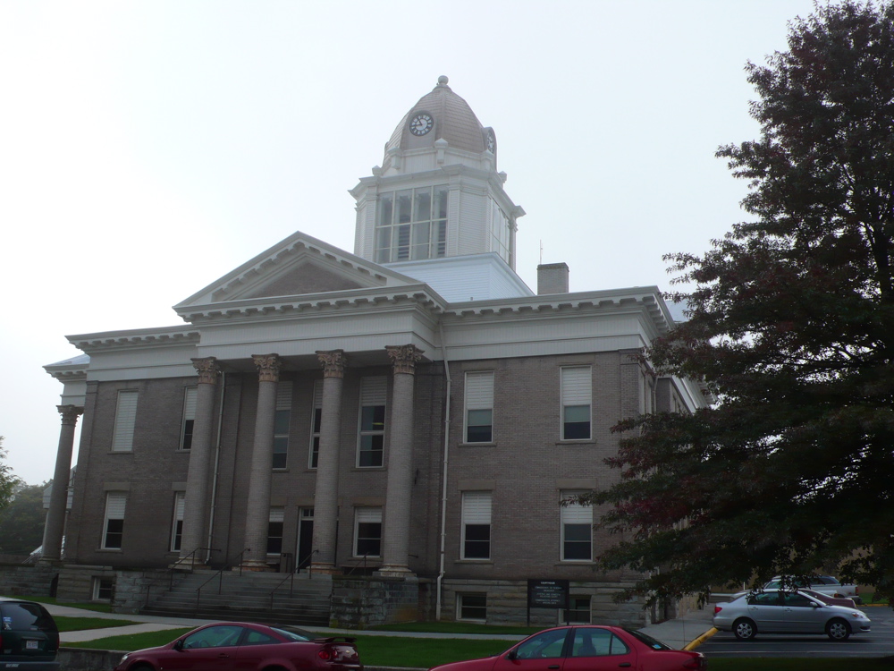


Why visit Wytheville
Townapedia lists 5 museums and landmarks, 3 parks and trails, 37 places to eat, 19 places to stay and 5 attractions in and around town.
Highlights include Marquee Cinemas - Wytheville, Chimney Rocks, Haller-Gibboney Rock House and Loretto.
July is the warmest month, with average highs of 83°F; January lows average 24°F.
Weather in Wytheville
Forecast from the National Weather Service. Full forecast
About Wytheville
Wytheville is a town in and the county seat of Wythe County, Virginia, United States. It is named after George Wythe, a signer of the United States Declaration of Independence and mentor to Thomas Jefferson. Wytheville's population was 8,264 at the 2020 census. Interstate Highways 77 and 81 were constructed to intersect at the town.
From the Wikipedia article Wytheville, Virginia (this version), under CC BY-SA 4.0.
Things to do5

Marquee Cinemas - Wytheville
Cinema and theater · 0.9 mi
187 Dominion Street, Wytheville

Museums and landmarks5

Haller-Gibboney Rock House
Monument and historic site · National Register of Historic Places
Historic house in Virginia, United States

Loretto
Monument and historic site · National Register of Historic Places · 0.5 mi
Historic house in Virginia, United States

Reed Creek Mill
Monument and historic site · National Register of Historic Places · 1.4 mi
Historic grist mill at 1565 South Church Street in Wytheville, Virginia

Wythe County Poorhouse Farm
Monument and historic site · National Register of Historic Places · 3.9 mi
Building in Wythe County, Virginia, United States


Wytheville Historic District
Monument and historic site · National Register of Historic Places · 0.6 mi
Historic district in Wytheville, Virginia
Parks, trails and playgrounds3


Restaurants and cafes37



25 more on the map.
History
Wythe County was created in 1789 and named for George Wythe, the "father of American Jurisprudence" and signer of the Declaration of Independence. In May 1790, Chris Simmerman donated 85 acres, Robert Williams II donated 50 acres, and John Davis donated 10 acres to establish a town and county seat. Robert Adams completed a town survey in November of that year, dividing the area into half-acre lots. The town did not have an official name yet, but was generally known as Wythe Court House.
Two years later, in October 1792, the town was officially named Evansham, for prominent local citizen Jesse Evans. After a disastrous fire in March 1839, the town was renamed Wytheville. At that time, it was home to about 500 residents.
From the History section of Wytheville, Virginia on Wikipedia, under CC BY-SA 4.0.
Where to stay19
Churches and places of worship28
St. John's Episcopal Church
Church · National Register of Historic Places · 0.4 mi
St. John's Lutheran Church and Cemetery
Church · National Register of Historic Places · 0.9 mi
Wytheville Seventh-day Adventist Church
Church · Seventh Day Adventist · 2.5 mi
1600 Chapman Road, Wytheville
Saint Mary the Mother of God Catholic Church
Church · Catholic · 0.4 mi
370 East Main Street, Wytheville
Shopping8
Gas and EV charging7
Schools, colleges and libraries11
Healthcare6
Map of Wytheville
129 places. The map loads OpenStreetMap tiles when you open it.
Climate by month
Monthly table
| Month | High | Low | Rain | Snow |
|---|---|---|---|---|
| Jan | 42°F | 24°F | 3.2 in | 5.9 in |
| Feb | 46°F | 26°F | 2.9 in | 4.9 in |
| Mar | 54°F | 31°F | 3.6 in | 2.9 in |
| Apr | 64°F | 39°F | 3.8 in | 0.5 in |
| May | 72°F | 48°F | 4.3 in | 0.0 in |
| Jun | 79°F | 57°F | 4.1 in | 0.0 in |
| Jul | 83°F | 61°F | 4.2 in | 0.0 in |
| Aug | 82°F | 60°F | 3.6 in | 0.0 in |
| Sep | 76°F | 53°F | 3.4 in | 0.0 in |
| Oct | 67°F | 41°F | 2.9 in | 0.0 in |
| Nov | 56°F | 31°F | 2.6 in | 0.4 in |
| Dec | 46°F | 27°F | 3.2 in | 3.8 in |
U.S. Climate Normals 1991-2020 for Wytheville (1 mi away), NOAA NCEI.
People and cost of living
American Community Survey 5-year estimates, 2020-2024, U.S. Census Bureau. Estimates have margins of error, larger for small towns.
Disaster history
Wythe County has had 12 federal disaster declarations since 2000, most often for severe storms.
- 2026-01-23: Severe Winter Storm (Winter Storm)
- 2025-04-04: Severe Winter Storms And Flooding (Severe Storm)
- 2024-10-01: Tropical Storm Helene (Tropical Storm)
- 2024-09-29: Post-Tropical Cyclone Helene (Tropical Storm)
- 2020-04-02: Covid-19 Pandemic (Biological)
- 2020-03-13: Covid-19 (Biological)
OpenFEMA disaster declarations summaries.
Getting there and nearby towns
Mercer County Airport (BLF) is the nearest airport with scheduled flights listed in OpenStreetMap, 24 miles away.
- Rural Retreat 11 mi west, about 18 min by car
- Pulaski 19 mi east, about 31 min by car
- Woodlawn 21 mi southeast, about 34 min by car
- Galax 22 mi southeast, about 36 min by car
- Bluefield 22 mi northwest, about 35 min by car
- Independence 23 mi south, about 37 min by car
- Hillsville 24 mi southeast, about 38 min by car
- Dublin 24 mi northeast, about 39 min by car
- Marion 25 mi west, about 40 min by car
- Tazewell 26 mi northwest, about 42 min by car
Drive times are estimates from straight-line distance, not routes.
Local news
Headlines from INDB, the NEMICO news database.
Reviews, tips and questions
Loading what members have shared...
Sources and licences
- NCES EDGE (Public domain): public schools
- NOAA NCEI U.S. Climate Normals 1991-2020 (Public domain): climate by month
- OpenFEMA (Public domain): disaster declarations
- OpenStreetMap contributors (ODbL 1.0): places, airports, map data
- U.S. Census Bureau (Public domain): population, income, housing, education, commute
- Wikidata (CC0 1.0): elevation, founding date, time zone, website, landmarks and historic places
- Wikimedia Commons (see each image): photos
- Wikipedia (CC BY-SA 4.0): overview and history text
Photo credits
- WythevilleVACourthouse, DwayneP ( talk ), CC BY-SA 3.0
- St. John's Episcopal Church, Wytheville, Virginia, Skye Marthaler, CC BY-SA 3.0
- HALLER-GIBONEY ROCK HOUSE, JERRYE & ROY KLOTZ MD, CC BY-SA 3.0
- WytheCoCourthouse, RebelAt at en.wikipedia, Public domain
- Wythe County Poorhouse Farm, Nyttend, Public domain
- ST. JOHN'S LUTHERAN CHURCH AND CEMETERY, JERRYE & ROY KLOTZ MD, CC BY-SA 3.0
- Reed Creek Mill in Wytheville, VA, IxieVerns, CC BY-SA 4.0
- LORETTO, WYTHEVILLE, WYTHE COUNTY, VA, Jerrye & Roy Klotz, MD, CC BY-SA 4.0
Page built October 30, 2026. Spotted a mistake? Tell us or suggest a place.