
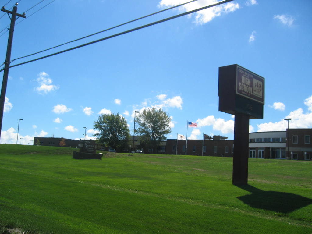


Zion, Illinois
Zion is a city of 24,600 people in Lake County, Illinois, founded in 1901.
Why visit Zion
Townapedia lists 7 museums and landmarks, 40 parks and trails, 32 places to eat, 14 places to stay and 1 attraction in and around town.
Highlights include Adeline Jay Geo-Karis Illinois Beach State Park, Shiloh House, Camp Logan and North Point Marina.
July is the warmest month, with average highs of 81°F; January lows average 16°F.
Weather in Zion
Forecast from the National Weather Service. Full forecast
About Zion
Zion is a city in Lake County, Illinois, United States. Per the 2020 United States census, the population was 24,655.
From the Wikipedia article Zion, Illinois (this version), under CC BY-SA 4.0.
Things to do1

Adeline Jay Geo-Karis Illinois Beach State Park
Beach · 3.6 mi
State park on Lake Michigan in Lake County, Illinois
Museums and landmarks7

Shiloh House
Monument and historic site · National Register of Historic Places · 1.4 mi
House in Zion, Illinois
Elisha Avenue, Zion

Camp Logan
Monument and historic site · National Register of Historic Places · 2.2 mi


Henry I. Paddock House
Monument and historic site · National Register of Historic Places · 2.4 mi
Historic house at 346 Sheridan Road in Winthrop Harbor, Illinois
Zion Chapter House
Monument and historic site · National Register of Historic Places · 1.5 mi
Building in Illinois, United States

Founders Memorial
Monument and historic site · 2.9 mi
Memorial for First Mayor of Beach Park Illinois.
Parks, trails and playgrounds40




North Point Marina
Marina and boat launch · 2.8 mi
701 North Point Drive, Winthrop Harbor
28 more on the map.
Restaurants and cafes32


Emily's Pancake House
Restaurant · Breakfast, Lunch · 2.8 mi
38730 North Sheridan Road, Beach Park




20 more on the map.
Where to stay14
American Inn Motel
Motel and hotel · 2.5 mi
39018 North Sheridan Road, Beach Park
Churches and places of worship13
Fath-e-Azeem Mosque
Place of worship · Ahmadiyya · 1.0 mi
2700 Lewis Avenue, Zion
Christ Community Church
Church · Nondenominational · 1.1 mi
2500 Dowie Memorial Drive
Shopping7
Harbor Centrella Foods
Grocery · 1.6 mi
Sheridan Road, Winthrop Harbor
Gas and EV charging16
Schools, colleges and libraries45
New Tech High at Zion-Benton East
School · 1.0 mi
1634 23rd Street, Zion
Healthcare6
Map of Zion
181 places. The map loads OpenStreetMap tiles when you open it.
Climate by month
Monthly table
| Month | High | Low | Rain |
|---|---|---|---|
| Jan | 31°F | 16°F | 1.4 in |
| Feb | 34°F | 18°F | 1.5 in |
| Mar | 44°F | 27°F | 2.2 in |
| Apr | 56°F | 36°F | 3.8 in |
| May | 67°F | 46°F | 3.9 in |
| Jun | 77°F | 56°F | 4.5 in |
| Jul | 81°F | 62°F | 3.5 in |
| Aug | 80°F | 61°F | 3.6 in |
| Sep | 73°F | 54°F | 3.6 in |
| Oct | 61°F | 43°F | 3.2 in |
| Nov | 48°F | 31°F | 2.3 in |
| Dec | 36°F | 22°F | 1.9 in |
U.S. Climate Normals 1991-2020 for Chicago Waukegan Rgnl Ap (3 mi away), NOAA NCEI.
People and cost of living
American Community Survey 5-year estimates, 2020-2024, U.S. Census Bureau. Estimates have margins of error, larger for small towns.
Disaster history
Lake County has had 9 federal disaster declarations since 2000, most often for snowstorms.
- 2020-03-26: Covid-19 Pandemic (Biological)
- 2020-03-13: Covid-19 (Biological)
- 2013-05-10: Severe Storms, Straight-Line Winds, And Flooding (Flood)
- 2011-03-17: Severe Winter Storm And Snowstorm (Snowstorm)
- 2008-06-24: Severe Storms And Flooding (Severe Storm)
- 2008-03-13: Record Snow And Near Record Snow (Snowstorm)
OpenFEMA disaster declarations summaries.
Getting there and nearby towns
Waukegan National Airport (UGN) is the nearest airport with scheduled flights listed in OpenStreetMap, 3 miles away.
- Beach Park 2 mi southwest, about 3 min by car
- Waukegan 6 mi south, about 10 min by car
- Gurnee 8 mi southwest, about 12 min by car
- Lindenhurst 9 mi west, about 15 min by car
- North Chicago 10 mi south, about 16 min by car
- Gages Lake 10 mi southwest, about 16 min by car
- Antioch 11 mi west, about 18 min by car
- Grayslake 12 mi southwest, about 20 min by car
- Round Lake Beach 13 mi southwest, about 21 min by car
- Libertyville 13 mi southwest, about 22 min by car
Drive times are estimates from straight-line distance, not routes.
Local news
Headlines from INDB, the NEMICO news database.
Reviews, tips and questions
Loading what members have shared...
Sources and licences
- NCES EDGE (Public domain): public schools
- NOAA NCEI U.S. Climate Normals 1991-2020 (Public domain): climate by month
- OpenFEMA (Public domain): disaster declarations
- OpenStreetMap contributors (ODbL 1.0): places, airports, map data
- U.S. Census Bureau (Public domain): population, income, housing, education, commute
- Wikidata (CC0 1.0): elevation, founding date, time zone, website, landmarks and historic places
- Wikimedia Commons (see each image): photos
- Wikipedia (CC BY-SA 4.0): overview and history text
Photo credits
- Zionbenton, Original uploader was Dhalls at en.wikipedia, CC BY-SA 3.0
- JETHRO AVE, ZION, IL - panoramio, DOLL2011.ZION, CC BY-SA 3.0
- Mt. Olivet Memorial Park, Zion, ILL - panoramio, DOLL2011.ZION, CC BY-SA 3.0
- Zion, IL 60099, USA - panoramio, Kashif Ahmed, CC BY 3.0
- Shiloh House in Zion, Nyttend, Public domain
- Old Zion Library..shiloh pond - panoramio, DOLL2011.ZION, CC BY-SA 3.0
- Zion Chapter House, American Women's League, Nyttend, Public domain
- Greetings from Zion, Illinois - Large Letter Postcard (7853751780), Steve Shook from Moscow, Idaho, USA, CC BY 2.0
- PNC Bank, Zion, ILLINOIS - panoramio, DOLL2011.ZION, CC BY-SA 3.0
- Henry I. Paddock House, Nyttend, Public domain
- Camp Logan Building, Kaytill, CC BY-SA 4.0
- Illinois Beach State Park Main Beach, Wrongdave at English Wikipedia, Public domain
- GALILEE APARTMENTS - panoramio, DOLL2011.ZION, CC BY-SA 3.0
- Psectrotanypus dyari 5410040, psweet, CC BY-SA 4.0
- Astylidius parvus 146857596, psweet, CC BY-SA 4.0
- Astylidius parvus 146857581, psweet, CC BY-SA 4.0
- Astylidius parvus 146857546, psweet, CC BY-SA 4.0
- Herpyllus ecclesiasticus 243651664, psweet, CC BY-SA 4.0
- Plochionus timidus - inat 5133809, psweet Depicted place: Zion, IL 60099, USA ( 42°27′22″N 87°49′37″W / 42.4559915355°N 87.8270459175°W / 42.4559915355; -87.8270459175 ), CC BY-SA 4.0
- - panoramio (4519), DOLL2011.ZION, CC BY-SA 3.0
- Ambystoma tigrinum 3552236, psweet, CC BY-SA 4.0
- Erigeron philadelphicus 216621320, psweet, CC BY-SA 4.0
- USBR 37 south along the McClory Bike Path - Waukegan, IL - June 2025, AlphaBeta135, CC BY 4.0
- Lepiseodina superba 224364124, psweet, CC BY-SA 4.0
- Thamnophis sirtalis semifasciatus 52722280, psweet, CC BY-SA 4.0
- Thamnophis sirtalis semifasciatus 52722287, psweet, CC BY-SA 4.0
- Russell Rd east - Illinois-Wisconsin line - June 2025, AlphaBeta135, CC BY 4.0
- Russell Rd west - Illinois-Wisconsin line - June 2025, AlphaBeta135, CC BY 4.0
- Passerina caerulea × cyanea, iNaturalist user: psweet, CC BY-SA 4.0
- Southern terminus of Kenosha County Bike Trail at Wisconsin-Illinois line - June 2025, AlphaBeta135, CC BY 4.0
- Symphyotrichum dumosum 105499607, psweet, CC BY-SA 4.0
- Triepeolus 54487302, psweet, CC BY-SA 4.0
- Triepeolus 54487309, psweet, CC BY-SA 4.0
- Triepeolus 54487315, psweet, CC BY-SA 4.0
- Bombus impatiens 104942687, psweet, CC BY-SA 4.0
- Bombus impatiens 104942593, psweet, CC BY-SA 4.0
- Ambystoma tigrinum 29016202, psweet, CC BY-SA 4.0


Page built October 30, 2026. Spotted a mistake? Tell us or suggest a place.