


Aberdeen, Maryland
Aberdeen is a city of 17,298 people in Harford County, Maryland, founded in 1892.
Why visit Aberdeen
Townapedia lists 17 museums and landmarks, 14 parks and trails, 56 places to eat, 18 places to stay and 2 attractions in and around town.
Highlights include Horizon Cinemas, Chestnut Ridge, Griffith House and Ruggles Golf Course.
July is the warmest month, with average highs of 86°F; January lows average 25°F.
Weather in Aberdeen
Forecast from the National Weather Service. Full forecast
About Aberdeen
Aberdeen is a city in Harford County, Maryland, United States, 26 miles (42 km) northeast of Baltimore. The population was 16,254 at the 2020 United States census. Aberdeen is the largest municipality in Harford County.
From the Wikipedia article Aberdeen, Maryland (this version), under CC BY-SA 4.0.
Things to do2


Museums and landmarks17

Chestnut Ridge
Monument and historic site · National Register of Historic Places · 3.0 mi
Home on the National Register of Historic Places

Griffith House
Monument and historic site · National Register of Historic Places · 2.2 mi
Historic house in Maryland, United States

James B. Baker House
Monument and historic site · National Register of Historic Places
Aberdeen, Maryland, listed on the NRHP in Maryland

Poplar Hill
Monument and historic site · National Register of Historic Places · 1.4 mi
Building in Maryland, United States
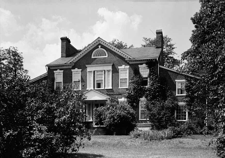
Sion Hill
Monument and historic site · National Register of Historic Places · 4.1 mi
Historic house in Maryland, United States

Sophia's Dairy
Monument and historic site · National Register of Historic Places · 4.4 mi
Building in Maryland, United States

Swansbury
Monument and historic site · National Register of Historic Places · 1.2 mi
Building in Maryland, United States


Winsted
Monument and historic site · National Register of Historic Places · 3.0 mi
Building in Aberdeen, Maryland, United States
Britannia
Monument and historic site · 2.7 mi
British Mark IV Female heavy tank

5 more on the map.
Parks, trails and playgrounds14





2 more on the map.
Restaurants and cafes56

Applebee's
Diner · American · 0.7 mi
991 Beards Hill Road, Aberdeen
Mo-Th,Su 11:30-23:00; Fr-Sa 11:30-24:00

Golden Corral
Restaurant · American, Buffet · 1.2 mi
706 South Philadelphia Boulevard, Aberdeen
Mo-Th 11:00-21:00; Fr-Su 07:30-21:00
IHOP
Restaurant · Breakfast, Pancake · 0.9 mi
980 Hospitality Way, Aberdeen
Mo-Th,Su 07:00-22:00; Fr,Sa 07:00-24:00
Johnny's Poki Bowl
Restaurant · Poke · 0.7 mi
939 Beards Hill Road, Aberdeen
Mo-Th 10:30-21:00; Fr-Sa 10:30-21:30; Su off
La Tolteca
Restaurant · Mexican · 0.9 mi
984 Hospitality Way, Aberdeen
Mo-Th 11:00-22:00; Fr 11:00-22:30; Sa 12:00-22:30; Su 12:00-21:00; PH off
Santini's Italian Cuisine
Restaurant · Italian, Pizza · 0.7 mi
951 Beards Hill Road, Aberdeen
Mo 11:00-21:00; Tu-Th,Su 11:00-22:00; Fr-Sa 11:00-23:00

Screaming Bean
Cafe · Coffee Shop · 1.5 mi
3700 Churchville Road, Aberdeen
Mo-Tu 06:00-14:00; We-Fr 06:00-17:00; Sa 07:00-17:00; Su 07:00-14:00
All American Steakhouse & Sports Theater
Restaurant · 1.4 mi
3720 Centerfield Drive, Aberdeen
11:30-22:30
Grumpy's Bar and Grille
Restaurant · 0.9 mi
820 West Bel Air Avenue, Aberdeen
Mo-Fr 11:00-21:00; Sa 12:00-21:00; Su off
Mamie's Cafe with Love
Cafe · 0.7 mi
939 Beards Hill Road, Aberdeen
Mo-Th,Su 11:00-21:00; Fr-Sa 11:00-22:00
44 more on the map.
History
Aberdeen was named after Aberdeen, Scotland, by immigrating Scots.
The James B. Baker House, Chestnut Ridge, Griffith House, Poplar Hill, Sophia's Dairy, and Swansbury are listed on the National Register of Historic Places.
From the History section of Aberdeen, Maryland on Wikipedia, under CC BY-SA 4.0.
Where to stay18
Churches and places of worship28
St. George's Parish Vestry House
Church · National Register of Historic Places · 3.3 mi
Seventh-day Adventist Church
Church · Seventh Day Adventist · 0.7 mi
16 North Philadelphia Boulevard, Aberdeen
Carsins Run Baptist Church
Church · Baptist · 2.3 mi
3524 Churchville Road, Aberdeen
Deeper Life Bible Church
Church · 0.8 mi
123 South Philadelphia Boulevard, Aberdeen
Shopping7
Gas and EV charging16
Schools, colleges and libraries23
Healthcare10
University of Maryland Urgent Care
Clinic and pharmacy · 1.4 mi
744 South Philadelphia Boulevard, Aberdeen
Key Point Health Services, Aberdeen Clinic
Clinic and pharmacy · 0.7 mi
135 North Parke Street, Aberdeen
Prompt Occupational Health care
Clinic and pharmacy · 0.8 mi
998 Hospitality Way, Aberdeen
Map of Aberdeen
191 places. The map loads OpenStreetMap tiles when you open it.
Climate by month
Monthly table
| Month | High | Low | Rain |
|---|---|---|---|
| Jan | 42°F | 25°F | 3.3 in |
| Feb | 44°F | 27°F | 2.8 in |
| Mar | 52°F | 33°F | 4.1 in |
| Apr | 65°F | 43°F | 3.5 in |
| May | 73°F | 53°F | 4.0 in |
| Jun | 82°F | 62°F | 4.3 in |
| Jul | 86°F | 68°F | 4.8 in |
| Aug | 84°F | 66°F | 4.2 in |
| Sep | 78°F | 59°F | 4.8 in |
| Oct | 67°F | 46°F | 4.2 in |
| Nov | 56°F | 37°F | 3.3 in |
| Dec | 46°F | 30°F | 3.9 in |
U.S. Climate Normals 1991-2020 for Aberdeen Phillips Fld (3 mi away), NOAA NCEI.
People and cost of living
American Community Survey 5-year estimates, 2020-2024, U.S. Census Bureau. Estimates have margins of error, larger for small towns.
Disaster history
Harford County has had 14 federal disaster declarations since 2000, most often for hurricanes.
- 2026-01-24: Severe Winter Storm (Winter Storm)
- 2020-03-26: Covid-19 Pandemic (Biological)
- 2020-03-13: Covid-19 (Biological)
- 2016-03-04: Severe Winter Storm And Snowstorm (Snowstorm)
- 2012-11-20: Hurricane Sandy (Hurricane)
- 2012-10-28: Hurricane Sandy (Hurricane)
OpenFEMA disaster declarations summaries.
Getting there and nearby towns
Phillips Army Air Field (APG) is the nearest airport with scheduled flights listed in OpenStreetMap, 3 miles away.
- Glasgow 24 mi east, about 38 min by car
- Newark 25 mi northeast, about 40 min by car
- Middletown 25 mi east, about 40 min by car
- Bear 27 mi east, about 44 min by car
- Brookside 27 mi northeast, about 43 min by car
- Baltimore 28 mi southwest, about 45 min by car
- Pike Creek Valley 29 mi northeast, about 47 min by car
- Hockessin 32 mi northeast, about 52 min by car
- Smyrna 34 mi southeast, about 54 min by car
- Wilmington 37 mi northeast, about 1 h by car
Drive times are estimates from straight-line distance, not routes.
Local news
Headlines from INDB, the NEMICO news database.
Reviews, tips and questions
Loading what members have shared...
Sources and licences
- NCES EDGE (Public domain): public schools
- NOAA NCEI U.S. Climate Normals 1991-2020 (Public domain): climate by month
- OpenFEMA (Public domain): disaster declarations
- OpenStreetMap contributors (ODbL 1.0): places, airports, map data
- U.S. Census Bureau (Public domain): population, income, housing, education, commute
- Wikidata (CC0 1.0): elevation, founding date, time zone, website, landmarks and historic places
- Wikimedia Commons (see each image): photos
- Wikipedia (CC BY-SA 4.0): overview and history text
Photo credits
- Aberdeen B&O Station, DanTD, CC BY-SA 3.0
- 2016-06-11 11 14 48 View north along Maryland State Route 462 (Paradise Road) at Maryland State Route 132 (Bel Air Avenue) in Aberdeen, Harford County, Maryland, Famartin, CC BY-SA 4.0
- 2019-05-21 15 06 33 View west along Maryland State Route 132 (Bel Air Avenue) just west of Maryland State Route 462 (Paradise Road) in Aberdeen, Harford County, Maryland, Famartin, CC BY-SA 4.0
- 2019-05-21 15 03 34 View south along Maryland State Route 462 (Paradise Road) just south of Maryland State Route 22 (Aberdeen Thruway) in Aberdeen, Harford County, Maryland, Famartin, CC BY-SA 4.0
- 2020-06-29 14 36 27 View east along Maryland State Route 22 (Churchville Road) just west of Maryland State Route 462 (Paradise Road) in Aberdeen, Harford County, Maryland, Famartin, CC BY-SA 4.0
- 2019-05-21 14 56 30 View east along Maryland State Route 22 (Aberdeen Thruway) just east of Middleton Road in Aberdeen, Harford County, Maryland, Famartin, CC BY-SA 4.0
- 2020-06-29 14 57 29 View north along Maryland State Route 462 (Paradise Road) at Maryland State Route 22 (Aberdeen Thruway) in Aberdeen, Harford County, Maryland, Famartin, CC BY-SA 4.0
- 2020-06-29 14 54 21 View west along Maryland State Route 22 (Churchville Road) just east of Maryland State Route 462 (Paradise Road) in Aberdeen, Harford County, Maryland, Famartin, CC BY-SA 4.0
- 2020-06-29 15 06 52 View east along Maryland State Route 132 (West Bel Air Avenue) at Bush Chapel Road in Aberdeen, Harford County, Maryland, Famartin, CC BY-SA 4.0
- 2016-06-11 11 12 43 View east along Maryland State Route 132 (Bel Air Avenue) near Bush Chapel Road in Aberdeen, Harford County, Maryland, Famartin, CC BY-SA 4.0
- Aberdeen Festival Park, Jeleva, CC BY-SA 4.0
- 2020-06-29 15 03 51 View east along Maryland State Route 132 (Beards Hill Road) at Maryland State Route 22 (Aberdeen Thruway) in Aberdeen, Harford County, Maryland, Famartin, CC BY-SA 4.0
- 2016-06-11 11 03 59 View west along Maryland State Route 132 (Bel Air Avenue) between Howard Street and Parke Street in Aberdeen, Harford County, Maryland, Famartin, CC BY-SA 4.0
- 2016-06-11 11 03 54 View west along Maryland State Route 132 (Bel Air Avenue) at Howard Street in Aberdeen, Harford County, Maryland, Famartin, CC BY-SA 4.0
- 2020-06-29 15 15 32 View west along Maryland State Route 132 (West Bel Air Avenue) at U.S. Route 40 (Philadelphia Boulevard) in Aberdeen, Harford County, Maryland, Famartin, CC BY-SA 4.0
- 2019-08-25 17 26 09 View east along U.S. Route 40 (Philadelphia Boulevard) at the exit for Maryland State Route 22 EAST (Aberdeen Proving Ground) in Aberdeen, Harford County, Maryland, Famartin, CC BY-SA 4.0
- 2019-08-14 08 47 38 View west along U.S. Route 40 (Philadelphia Boulevard) at the exit for Maryland State Route 22 EAST (Aberdeen Proving Ground) in Aberdeen, Harford County, Maryland, Famartin, CC BY-SA 4.0
- 2017-06-02 18 03 29 View west along Maryland State Route 740 (South Philadelphia Boulevard) at Custis Street and U.S. Route 40 (Pulaski Highway) in Aberdeen, Harford County, Maryland, Famartin, CC BY-SA 4.0
- Ideal Diner Aberdeen (49368286801), Mobilus In Mobili, CC BY-SA 2.0
- Amtrak 902 in Aberdeen, MD (6468562499), jpmueller99 from Shenandoah Valley of VA, USA, CC BY 2.0
- Aberdeen PCL signals Amtrak 2010, Caseyjonz, Public domain
- Aberdeen station (Maryland), 2025-07-06, User:ARLC-BTAP, CC0
- 2017-06-02 18 04 03 View west along Maryland State Route 740 (South Philadelphia Boulevard) at Market Street and U.S. Route 40 (Pulaski Highway) in Aberdeen, Harford County, Maryland, Famartin, CC BY-SA 4.0
- 2019-09-04 10 54 55 View west along U.S. Route 40 (Philadelphia Boulevard) from the overpass for Maryland State Route 22 (Aberdeen Thruway) in Aberdeen, Harford County, Maryland, Famartin, CC BY-SA 4.0
- 2019-09-04 10 56 18 View east along U.S. Route 40 (Philadelphia Boulevard) from the overpass for Maryland State Route 22 (Aberdeen Thruway) in Aberdeen, Harford County, Maryland, Famartin, CC BY-SA 4.0
- 2019-08-25 17 23 04 View east along U.S. Route 40 (Philadelphia Boulevard) at Plater Street in Aberdeen, Harford County, Maryland, Famartin, CC BY-SA 4.0
- GRIFFITH HOUSE, HARFORD COUNTY, MD, Jerrye & Roy Klotz, MD, CC BY-SA 4.0
- Winstead photo, RobertK. Taylor, CC BY-SA 3.0
- Poplar hill photo, Robert K. Taylor, CC BY-SA 3.0
- SWANSBURY, HARFORD COUNTY, MD, Jerrye & Roy Klotz, MD, CC BY-SA 4.0
- Sion Hill, E.H. Pickering, photographer for HABS, Public domain
- Sophia's Dairy HABS MD1, E.H. Pickering, HABS photographer, Public domain
- Chestnut ridge photo, Robert K. Taylor, CC BY-SA 3.0
- Baker House photo, Robert K. Taylor, CC BY-SA 3.0
- For Kurt 1994-2014 - panoramio, Иван Манилов, CC BY 3.0
- New Ideal 2017 (32607530357), Mobilus In Mobili, CC BY-SA 2.0
- New Ideal Diner Revisited 2019 (46826294764), Mobilus In Mobili, CC BY-SA 2.0
- Bargain - Flickr - Mobilus In Mobili, Mobilus In Mobili, CC BY-SA 2.0
- Acela Express Southbound (6468560979), jpmueller99 from Shenandoah Valley of VA, USA, CC BY 2.0
- 2020-06-29 15 22 31 View west along Maryland State Route 22 (Churchville Road) at the exit for Interstate 95 NORTH (New York) in Carsins, Harford County, Maryland, Famartin, CC BY-SA 4.0


Page built October 30, 2026. Spotted a mistake? Tell us or suggest a place.