


Why visit Albia
Townapedia lists 9 museums and landmarks, 4 parks and trails, 1 place to eat and 1 attraction in and around town.
Highlights include King Opera House, Albia Square and Central Commercial Historic District, Arvine and Elizabeth W. White House and Albia Golf and Leisure.
July is the warmest month, with average highs of 84°F; January lows average 13°F, and about 30 inches of snow fall in a normal year.
Weather in Albia
Forecast from the National Weather Service. Full forecast
About Albia
Albia is a city in and the county seat of Monroe County, in southern Iowa, United States. The population was 3,721 at the 2020 census. Albia is located at the junction of U.S. Route 34 and Iowa Highways 137 and 5. The city of Albia and the surrounding area was a past center for coal mining in Iowa, and is now known for its historic square, and collection of Victorian, Tudor, Gothic, and Italianate homes.
From the Wikipedia article Albia, Iowa (this version), under CC BY-SA 4.0.
Things to do1

Museums and landmarks9

Albia Square and Central Commercial Historic District
Monument and historic site · National Register of Historic Places
Historic district in Albia, Iowa
Arvine and Elizabeth W. White House
Monument and historic site · National Register of Historic Places
Historical residence located in Albia, Iowa, United States
Brick Gothic House
Monument and historic site · National Register of Historic Places · 2.4 mi
Historical residence located south of Albia in rural Monroe County, Iowa, United States
Dr. George A. Jenkins House
Monument and historic site · National Register of Historic Places · 0.5 mi
Historic house located at 223 South C Street in Albia, Iowa
Elbert-Bates House
Monument and historic site · National Register of Historic Places
Historic house in Iowa, United States
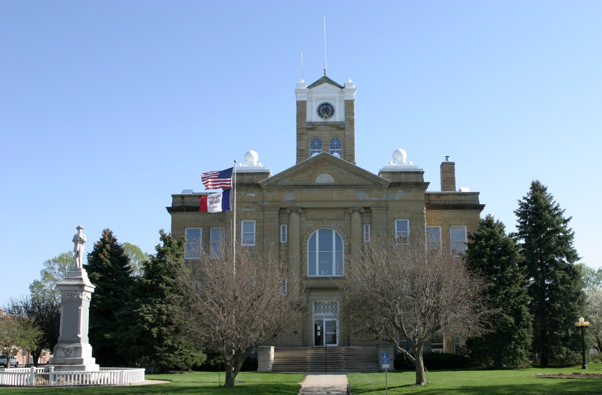
Monroe County Courthouse
Monument and historic site · National Register of Historic Places
Courthouse in Iowa, United States
Noble-Kendall House
Monument and historic site · National Register of Historic Places
Historical residence located in Albia, Iowa, United States
T.B. Perry House
Monument and historic site · National Register of Historic Places · 0.4 mi
Historic house in Iowa, United States

Parks, trails and playgrounds4




Restaurants and cafes1

History
Albia was incorporated as a town in 1856. The town was named after Albia, New York, the former home of an early settler.
On Feb. 14, 1893, there was a coal mine explosion in the Chicago and Iowa mine, about 2.5 miles west of Albia. This room and pillar mine had opened around 1877. By the time of the explosion, mining extended more than 1,000 yards from the hoisting shaft, and the mine employed 60 miners and 20 other men. One miner was killed outright and seven died later of their injuries, after a "shot" (gunpowder charge used to bring down the coal) ignited a dust explosion in the mine. This was one of only two major mine disasters in Iowa between 1888 and 1913.
In the early 20th century, the region around Albia was dotted with coal mining camps and company towns. Of these, Buxton, 9 miles north of Albia, is the most widely studied. It had a large Black population. Other former coal camps in the area include Hiteman, Bluff Creek, Lockman, Coalfield, Hocking, and Hynes.
From the History section of Albia, Iowa on Wikipedia, under CC BY-SA 4.0.
Churches and places of worship14
Kingdom of Jehovahs Witnesses
Church · Jehovahs Witness · 0.6 mi
633 North B Street, Albia
Shopping1
Schools, colleges and libraries13
Healthcare2
Map of Albia
45 places. The map loads OpenStreetMap tiles when you open it.
Climate by month
Monthly table
| Month | High | Low | Rain | Snow |
|---|---|---|---|---|
| Jan | 31°F | 13°F | 1.1 in | 7.4 in |
| Feb | 36°F | 17°F | 1.5 in | 8.4 in |
| Mar | 49°F | 28°F | 2.0 in | 3.9 in |
| Apr | 61°F | 39°F | 3.8 in | 1.1 in |
| May | 71°F | 50°F | 4.9 in | 0.0 in |
| Jun | 80°F | 61°F | 5.2 in | 0.0 in |
| Jul | 84°F | 65°F | 4.0 in | 0.0 in |
| Aug | 83°F | 62°F | 4.0 in | 0.0 in |
| Sep | 76°F | 54°F | 3.6 in | 0.0 in |
| Oct | 63°F | 42°F | 2.8 in | 0.4 in |
| Nov | 49°F | 30°F | 2.1 in | 1.9 in |
| Dec | 36°F | 19°F | 1.5 in | 6.9 in |
U.S. Climate Normals 1991-2020 for Albia 3 Nne Hcn (3 mi away), NOAA NCEI.
People and cost of living
American Community Survey 5-year estimates, 2020-2024, U.S. Census Bureau. Estimates have margins of error, larger for small towns.
Disaster history
Monroe County has had 11 federal disaster declarations since 2000, most often for severe storms.
- 2020-03-23: Covid-19 Pandemic (Biological)
- 2020-03-13: Covid-19 (Biological)
- 2019-03-23: Severe Storms And Flooding (Flood)
- 2015-07-31: Severe Storms, Tornadoes, Straight-Line Winds, And Flooding (Severe Storm)
- 2013-07-02: Severe Storms, Tornadoes, And Flooding (Severe Storm)
- 2013-05-31: Severe Storms, Straight-Line Winds, And Flooding (Flood)
OpenFEMA disaster declarations summaries.
Getting there and nearby towns
Ottumwa Regional Airport (OTM) is the nearest airport with scheduled flights listed in OpenStreetMap, 19 miles away.
- Eddyville 13 mi northeast, about 21 min by car
- Ottumwa 20 mi east, about 32 min by car
- Oskaloosa 20 mi northeast, about 33 min by car
- Centerville 21 mi south, about 34 min by car
- Knoxville 25 mi northwest, about 41 min by car
- Chariton 26 mi west, about 42 min by car
- Pella 27 mi north, about 43 min by car
- Bloomfield 28 mi southeast, about 45 min by car
- New Sharon 32 mi north, about 51 min by car
- Corydon 33 mi southwest, about 53 min by car
Drive times are estimates from straight-line distance, not routes.
Local news
Headlines from INDB, the NEMICO news database.
Reviews, tips and questions
Loading what members have shared...
Sources and licences
- NCES EDGE (Public domain): public schools
- NOAA NCEI U.S. Climate Normals 1991-2020 (Public domain): climate by month
- OpenFEMA (Public domain): disaster declarations
- OpenStreetMap contributors (ODbL 1.0): places, airports, map data
- U.S. Census Bureau (Public domain): population, income, housing, education, commute
- Wikidata (CC0 1.0): elevation, founding date, time zone, website, landmarks and historic places
- Wikimedia Commons (see each image): photos
- Wikipedia (CC BY-SA 4.0): overview and history text
Photo credits
- Monroe County, Iowa Courthouse, en:User:Cburnett, CC BY-SA 3.0
- 20160614 127 Town Square, Albia, Iowa, David Wilson, CC BY 2.0
- 20160614 127 Town Square, Albia, Iowa (cropped), David Wilson, CC BY 2.0
- 20160614 131 Albia, Iowa, David Wilson, CC BY 2.0
- 20160614 141 Albia, Iowa, David Wilson, CC BY 2.0
- 20160614 136 Albia, Iowa, David Wilson, CC BY 2.0
- The Arvine White House Albia, Iowa, Jim Roberts, CC BY-SA 4.0
- The Noble-Kendall House, Jim Roberts, CC BY-SA 4.0
- The T.B. Perry House, Jim Roberts, CC BY-SA 4.0
- The Bates Building, Jim Roberts, CC BY-SA 4.0
- The Elbert-Bates House, Jim Roberts, CC BY-SA 4.0
- The George A. Jenkins House, Jim Roberts, CC BY-SA 4.0
- Custom Bollards along Walkway, RuralResurrection, CC BY-SA 4.0
- Custom Bollards in the Welcome Home Soldier Memorial, RuralResurrection, CC BY-SA 4.0
- Row of Crosses in the Welcome Home Soldier Memorial, RuralResurrection, CC BY-SA 4.0
- Vietnam War Monument in Welcome Home Soldier Memorial, RuralResurrection, CC BY-SA 4.0
- Memorial Wall with Names of Veterans in Welcome Home Soldier Memorial, RuralResurrection, CC BY-SA 4.0
- ISS028-E-39364 - View of Earth, Earth Science and Remote Sensing Unit , Lyndon B. Johnson Space Center, Public domain
- ISS030-E-115532 - View of Earth, Earth Science and Remote Sensing Unit , Lyndon B. Johnson Space Center, Public domain
- ISS028-E-39363 - View of Earth, Earth Science and Remote Sensing Unit , Lyndon B. Johnson Space Center, Public domain
- ISS048-E-18726 - View of Earth, Earth Science and Remote Sensing Unit , Lyndon B. Johnson Space Center, Public domain


Page built October 30, 2026. Spotted a mistake? Tell us or suggest a place.