
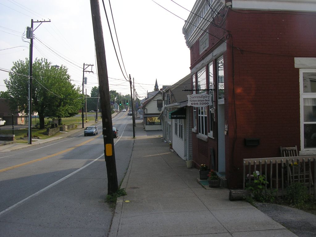


Alexandria, Kentucky
Alexandria is a city of 10,562 people in Campbell County, Kentucky, founded in 1793.
Why visit Alexandria
Townapedia lists 13 museums and landmarks, 3 parks and trails and 22 places to eat in and around town.
Highlights include Baumann House, Blau's Four Mile House and Alexandria Community Park.
July is the warmest month, with average highs of 87°F; January lows average 24°F.
Weather in Alexandria
Forecast from the National Weather Service. Full forecast
About Alexandria
Alexandria is a home rule-class city in Campbell County, Kentucky, in the United States. Along with Newport, it is one of the dual seats of the county. The population was 10,341 at the 2020 census.
From the Wikipedia article Alexandria, Kentucky (this version), under CC BY-SA 4.0.
Museums and landmarks13

Baumann House
Monument and historic site · National Register of Historic Places · 1.8 mi
Historic house in Kentucky, United States
Blau's Four Mile House
Monument and historic site · National Register of Historic Places · 2.3 mi
Historic house in Kentucky, United States
Blenk House
Monument and historic site · National Register of Historic Places · 2.1 mi
Historic house in Kentucky, United States
Camp Springs House
Monument and historic site · National Register of Historic Places · 2.9 mi
Historic property in Kentucky
Kort Grocery
Monument and historic site · National Register of Historic Places · 2.5 mi
Historic property in Camp Springs, Kentucky, U.S
Peter Barth Farm
Monument and historic site · National Register of Historic Places · 2.5 mi
Historic farm in Alexandria, Kentucky, USA
St. John's Lutheran Cemetery
Monument and historic site · National Register of Historic Places · 3.2 mi
Cemetery in Alexandria, Kentucky
St. Joseph Catholic Church and Cemetery
Monument and historic site · National Register of Historic Places · 2.2 mi
Historic church and cemetery in Campbell County, Kentucky, US
Walter House
Monument and historic site · National Register of Historic Places · 3.7 mi
Historic building in Melbourne, Kentucky, USA
Martz House
Monument and historic site · 1.8 mi
201 Four Mile Road, Camp Springs
Reitman House
Monument and historic site · 2.3 mi
Four Mile Road, Camp Springs

1 more on the map.
Parks, trails and playgrounds3

Restaurants and cafes22

Four Mile Pig
Restaurant · Barbecue · 0.4 mi
7962 Alexandria Pike, Alexandria
Mo-Sa 10:30-20:00; Su 10:30-19:00
Snappy Tomato Pizza
Restaurant · Pizza · 1.1 mi
8248 Alexandria Pike, Alexandria
Mo-Su 11:00-22:00; Fr,Sa 11:00-23:15

Alexandria Brewing Company
Brewery and winery · 0.4 mi
7926 Alexandria Pike, Alexandria
Tu-Fr 14:00-22:00; Sa 12:00-22:00; Su 12:00-20:00

Barrett's Pour House
Bar and pub · 2.3 mi
9406 Alexandria Pike, Alexandria
Mo-Su 00:00-02:00,12:00-24:00
Spare-Time Grill
Restaurant · Burger · 0.6 mi
7807 Alexandria Pike, Alexandria

10 more on the map.
Churches and places of worship13

Saint Mary of the Assumption Catholic Church
Church · Roman Catholic · 0.9 mi
8246 East Main Street, Alexandria
1 more on the map.
History
It is believed that the area that is now Alexandria was first settled by Frank Spilman and his family c. 1793. The Spilman family was from King George County, Virginia, and they may have named their settlement after Alexandria, Virginia. The family had begun developing and selling lots in the settlement by 1819, the year the first post office was established. On February 22, 1834, Alexandria was formally established by an act of the state assembly.
When the Kentucky General Assembly formed Kenton County from part of Campbell County in 1840, they moved Campbell's county seat from Newport to Alexandria, which was closer to the center of the redrawn county. The citizens of Alexandria quickly constructed a county courthouse but, because the majority of the county's population lived in Newport, the move was not a popular one and it took a court order and a visit from the sheriff to get the county clerk to move.
The city of Alexandria was formally incorporated by act of the state assembly in 1856.
From the History section of Alexandria, Kentucky on Wikipedia, under CC BY-SA 4.0.
Shopping6
Gas and EV charging3
Schools, colleges and libraries18
Campbell County Area Technology Center
School · 3.4 mi
909 Camel Crossing, Alexandria
Crossroads Elementary School
School · 3.0 mi
475 Crossroads Boulevard, Cold Spring
Donald E. Cline Elementary School
School · 4.4 mi
5586 E Alexandria Dr, Cold Spring
Healthcare2
Map of Alexandria
80 places. The map loads OpenStreetMap tiles when you open it.
Climate by month
Monthly table
| Month | High | Low | Rain |
|---|---|---|---|
| Jan | 41°F | 24°F | 2.9 in |
| Feb | 45°F | 26°F | 2.8 in |
| Mar | 55°F | 33°F | 3.9 in |
| Apr | 67°F | 42°F | 4.4 in |
| May | 75°F | 53°F | 4.7 in |
| Jun | 83°F | 61°F | 4.6 in |
| Jul | 87°F | 65°F | 4.4 in |
| Aug | 86°F | 64°F | 3.4 in |
| Sep | 80°F | 56°F | 3.1 in |
| Oct | 68°F | 44°F | 3.0 in |
| Nov | 55°F | 34°F | 2.9 in |
| Dec | 45°F | 28°F | 3.3 in |
U.S. Climate Normals 1991-2020 for Cincinnati Lunken Ap (10 mi away), NOAA NCEI.
People and cost of living
American Community Survey 5-year estimates, 2020-2024, U.S. Census Bureau. Estimates have margins of error, larger for small towns.
Disaster history
Campbell County has had 14 federal disaster declarations since 2000, most often for severe storms.
- 2026-01-24: Severe Winter Storm (Winter Storm)
- 2025-04-24: Severe Storms, Straight-Line Winds, Tornadoes, Flooding, Landslides, And Mudslides (Severe Storm)
- 2025-04-03: Severe Storms, Straight-Line Winds, Tornadoes, And Flooding (Severe Storm)
- 2025-02-16: Severe Storms, Straight-Line Winds, Flooding, And Landslides (Severe Storm)
- 2020-03-28: Covid-19 Pandemic (Biological)
- 2020-03-13: Covid-19 (Biological)
OpenFEMA disaster declarations summaries.
Getting there and nearby towns
Lunken Airport (LUK) is the nearest airport with scheduled flights listed in OpenStreetMap, 9 miles away.
- Forestville 7 mi north, about 12 min by car
- Amelia 10 mi northeast, about 15 min by car
- Cincinnati 14 mi northwest, about 22 min by car
- Norwood 14 mi north, about 22 min by car
- Reading 18 mi north, about 29 min by car
- Finneytown 19 mi north, about 30 min by car
- Bridgetown 19 mi northwest, about 30 min by car
- Monfort Heights 19 mi northwest, about 31 min by car
- Blue Ash 19 mi north, about 31 min by car
- Montgomery 20 mi north, about 32 min by car
Drive times are estimates from straight-line distance, not routes.
Local news
Headlines from INDB, the NEMICO news database.
Reviews, tips and questions
Loading what members have shared...
Sources and licences
- NCES EDGE (Public domain): public schools
- NOAA NCEI U.S. Climate Normals 1991-2020 (Public domain): climate by month
- OpenFEMA (Public domain): disaster declarations
- OpenStreetMap contributors (ODbL 1.0): places, airports, map data
- U.S. Census Bureau (Public domain): population, income, housing, education, commute
- Wikidata (CC0 1.0): elevation, founding date, time zone, website, landmarks and historic places
- Wikimedia Commons (see each image): photos
- Wikipedia (CC BY-SA 4.0): overview and history text
Photo credits
- Alexandria kentucky, W.marsh, CC BY-SA 3.0
- Old Campbell County High School (Campbell County Middle School), Alexandria, KY (50226411288), Warren LeMay from Covington, KY, United States, CC0
- Old Campbell County High School (Campbell County Middle School), Alexandria, KY (50227280062), Warren LeMay from Covington, KY, United States, CC0
- Old Campbell County High School (Campbell County Middle School), Alexandria, KY (50227054366), Warren LeMay from Covington, KY, United States, CC0
- Old Campbell County High School (Campbell County Middle School), Alexandria, KY (50227054166), Warren LeMay from Covington, KY, United States, CC0
- Old Campbell County High School (Campbell County Middle School), Alexandria, KY (50227057701), Warren LeMay from Covington, KY, United States, CC0
- Old Campbell County High School (Campbell County Middle School), Alexandria, KY (50227057531), Warren LeMay from Covington, KY, United States, CC0
- Cornerstone, Old Campbell County High School (Campbell County Middle School), Alexandria, KY (50227058136), Warren LeMay from Covington, KY, United States, CC0
- Old Campbell County High School (Campbell County Middle School), Alexandria, KY (50227282967), Warren LeMay from Covington, KY, United States, CC0
- Old Campbell County High School (Campbell County Middle School), Alexandria, KY (50227057826), Warren LeMay from Covington, KY, United States, CC0
- Old Campbell County High School (Campbell County Middle School), Alexandria, KY (50227283542), Warren LeMay from Covington, KY, United States, CC0
- Old Campbell County High School (Campbell County Middle School), Alexandria, KY (50227282092), Warren LeMay from Covington, KY, United States, CC0
- Old Campbell County High School (Campbell County Middle School), Alexandria, KY (50227057291), Warren LeMay from Covington, KY, United States, CC0
- Old Campbell County High School (Campbell County Middle School), Alexandria, KY (50227283692), Warren LeMay from Covington, KY, United States, CC0
- Old Campbell County High School (Campbell County Middle School), Alexandria, KY (50226411653), Warren LeMay from Covington, KY, United States, CC0
- Old Campbell County High School (Campbell County Middle School), Alexandria, KY (50227055446), Warren LeMay from Covington, KY, United States, CC0
- Old Campbell County High School (Campbell County Middle School), Alexandria, KY (50227054531), Warren LeMay from Covington, KY, United States, CC0
- Old Campbell County High School (Campbell County Middle School), Alexandria, KY (50227055786), Warren LeMay from Covington, KY, United States, CC0
- Old Campbell County High School (Campbell County Middle School), Alexandria, KY (50227280502), Warren LeMay from Covington, KY, United States, CC0
- Old Campbell County High School (Campbell County Middle School), Alexandria, KY (50227058486), Warren LeMay from Covington, KY, United States, CC0
- Old Campbell County High School (Campbell County Middle School), Alexandria, KY (50227283287), Warren LeMay from Covington, KY, United States, CC0
- Old Campbell County High School (Campbell County Middle School), Alexandria, KY (50227280917), Warren LeMay from Covington, KY, United States, CC0
- Old Campbell County High School (Campbell County Middle School), Alexandria, KY (50227279682), Warren LeMay from Covington, KY, United States, CC0
- Old Campbell County High School (Campbell County Middle School), Alexandria, KY (50227281057), Warren LeMay from Covington, KY, United States, CC0
- Old Campbell County High School (Campbell County Middle School), Alexandria, KY (50227281952), Warren LeMay from Covington, KY, United States, CC0
- Old Campbell County High School (Campbell County Middle School), Alexandria, KY (50226412668), Warren LeMay from Covington, KY, United States, CC0
- Old Campbell County High School (Campbell County Middle School), Alexandria, KY (50227281692), Warren LeMay from Covington, KY, United States, CC0
- Old Campbell County High School (Campbell County Middle School), Alexandria, KY (50227056566), Warren LeMay from Covington, KY, United States, CC0
- Old Campbell County High School (Campbell County Middle School), Alexandria, KY (50227058811), Warren LeMay from Covington, KY, United States, CC0
- Old Campbell County High School (Campbell County Middle School), Alexandria, KY (50227058906), Warren LeMay from Covington, KY, United States, CC0
- Washington Street, Alexandria, KY (50227293322), Warren LeMay from Covington, KY, United States, CC0
- Washington Street, Alexandria, KY (50227068066), Warren LeMay from Covington, KY, United States, CC0
- Washington Street, Alexandria, KY (50227293107), Warren LeMay from Covington, KY, United States, CC0
- Washington Street, Alexandria, KY (50227293017), Warren LeMay from Covington, KY, United States, CC0
- Washington Street, Alexandria, KY (50227292847), Warren LeMay from Covington, KY, United States, CC0
- Washington Street, Alexandria, KY (50227292682), Warren LeMay from Covington, KY, United States, CC0
- Washington Street, Alexandria, KY (50227067391), Warren LeMay from Covington, KY, United States, CC0
- Washington Street, Alexandria, KY (50227067251), Warren LeMay from Covington, KY, United States, CC0
- Washington Street, Alexandria, KY (50227067136), Warren LeMay from Covington, KY, United States, CC0
- Washington Street, Alexandria, KY (50227292107), Warren LeMay from Covington, KY, United States, CC0


Page built October 30, 2026. Spotted a mistake? Tell us or suggest a place.